
Pond
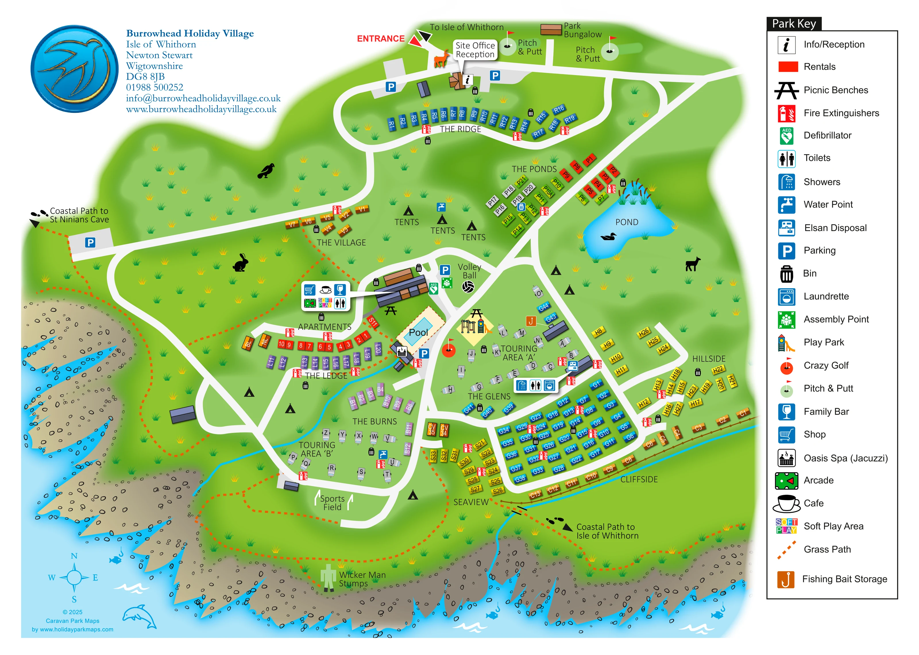
A blue, irregularly shaped pond with reeds and a decorative duck sits beside The Ponds accommodation group.
ILLUSTRATED PARK MAP · P052
Isle of Whithorn, Newton Stewart · United Kingdom
 Enlarge the map ↗
A SENSE OF THE PLACE
Burrowhead Holiday Village is based at Isle of Whithorn, Newton Stewart. This is a coastal park overlooking the Solway Firth towards the Isle of Man, welcoming families and pets. The park offers lodge, caravan, motorhome and tent holidays, plus holiday-home ownership.
Facilities include an outdoor swimming pool, indoor Jacuzzi and sauna, café, shop and family bar. Recreation includes pitch-and-putt, crazy golf, outdoor play and soft play.
LOOK CLOSER
A blue, irregularly shaped pond with reeds and a decorative duck sits beside The Ponds accommodation group.
The western and southern edges are drawn as jagged rocky shores meeting bright blue water.
Thin blue lines run through the lower park and towards the coast, including beside the Cliffside accommodation.
A labelled stump illustration marks a distinctive landmark beside the southern grass path.
A prominent speech-bubble label identifies the reception building immediately inside the entrance.
Red entrance lettering and directional triangles mark the northern approach, with a road continuation towards Isle of Whithorn.
Blue parking symbols identify spaces near reception, the central facilities, the pool and the western coastal-path approach.
A blue rectangular pool is labelled within a pale enclosure at the centre of the park.
A prominent speech-bubble label identifies the reception building immediately inside the entrance.
Red entrance lettering and directional triangles mark the northern approach, with a road continuation towards Isle of Whithorn.
Blue parking symbols identify spaces near reception, the central facilities, the pool and the western coastal-path approach.
A blue rectangular pool is labelled within a pale enclosure at the centre of the park.
The key's spa symbol is placed on a small building beside the pool.
A shopping-trolley symbol appears in the callout attached to the main central amenity building.
A cup symbol identifies the café within the central amenity-building callout.
A blue glass symbol identifies the family bar in the central facilities callout.
The arcade symbol is included in the main amenity-building callout.
A multicoloured Soft Play symbol is grouped with the central indoor amenities.
An illustrated climbing frame, swings and slide occupy a pale square beside Touring Area ‘A’ and the pool.
A red flagged-hole symbol marks crazy golf beside the pool and play park.
Two labelled golf symbols occupy the open strip near reception and the Park Bungalow.
A ball illustration and Volley Ball label identify an open space just north of the central pool and play facilities.
A labelled grassy sports field with goal-like marks lies below Touring Area ‘B’.
Black picnic-table symbols are shown near the main amenity building and outdoor play area.
Toilets are included in the central amenity callout. A separate grouped callout beside Touring Area ‘A’ identifies toilets and showers.
Laundrette symbols appear in The Ponds area and in the service callout beside Touring Area ‘A’.
Water-point symbols are distributed around camping and touring areas; an Elsan disposal symbol is shown beside Touring Area ‘A’.
Repeated black bin symbols mark service points throughout the accommodation neighbourhoods and central facilities.
Red extinguisher symbols are distributed along accommodation roads and around touring areas.
A green AED symbol is placed beside the central amenity buildings.
A green assembly-point symbol appears beside the volleyball area and central parking.
An orange hook symbol marks fishing bait storage near Touring Area ‘A’.
The key assigns solid red to rentals, used on the apartment row and selected accommodation blocks.
A blue, irregularly shaped pond with reeds and a decorative duck sits beside The Ponds accommodation group.
The western and southern edges are drawn as jagged rocky shores meeting bright blue water.
Thin blue lines run through the lower park and towards the coast, including beside the Cliffside accommodation.
Orange dashed paths cross open ground, connect central areas and follow the coastal perimeter.
A labelled arrow marks the westward coastal-path continuation towards St Ninians Cave.
A labelled coastal-path continuation is shown along the south-eastern edge, distinct from the road direction at the entrance.
A labelled stump illustration marks a distinctive landmark beside the southern grass path.
READING THE MAP
This illustrated map of Burrowhead Holiday Village places a busy holiday park within its distinctive coastal setting at Isle of Whithorn, near Newton Stewart. Bright blue water and a jagged rocky shoreline frame the western and southern edges, while green open spaces separate the accommodation neighbourhoods and recreation areas.
The plan brings together caravan-style holiday accommodation, apartments, two touring areas and tent-camping spaces. Named sections such as The Ridge, The Ponds, The Glens and Cliffside give visitors a practical way to recognise different parts of the park, supported by coloured unit blocks and individual references.
At the centre, the map shows the swimming pool, play park, crazy golf and a shared amenity building with a café, shop, family bar, arcade and soft play. Reception is clearly marked beside the entrance. A separate orange dashed path network introduces the wider headland experience, with coastal routes towards St Ninians Cave and Isle of Whithorn, plus the locally distinctive Wicker Man Stumps landmark.
The plan is organised around a northern entrance and reception point, from which broad white roads branch into a series of connected loops. The Ridge curves below reception, while The Ponds follows a diagonal road beside an illustrated pond. Farther south, denser accommodation groups occupy The Glens, Hillside, Seaview and Cliffside. Other smaller neighbourhoods sit around the central and western road network, with their names printed directly on the green ground.
Accommodation blocks use contrasting colours, dark outlines and white unit references. The apartments form a red row near the main facilities, and a Park Bungalow is labelled beside the entrance-side pitch-and-putt area. Pale grey caravan illustrations distinguish Touring Areas ‘A’ and ‘B’. Tent symbols identify open camping spaces without implying a fixed number of pitches.
The central recreation hub combines a clearly labelled pool, an illustrated outdoor play park, crazy golf, picnic benches and volleyball. A building callout groups the shop, café, family bar, arcade, soft play and toilets. Nearby symbols identify the Oasis Spa, defibrillator and assembly point. Touring services include toilets, showers, a laundrette, water points and Elsan disposal, with bins and fire-extinguisher symbols repeated across the wider plan. Fishing bait storage is also marked.
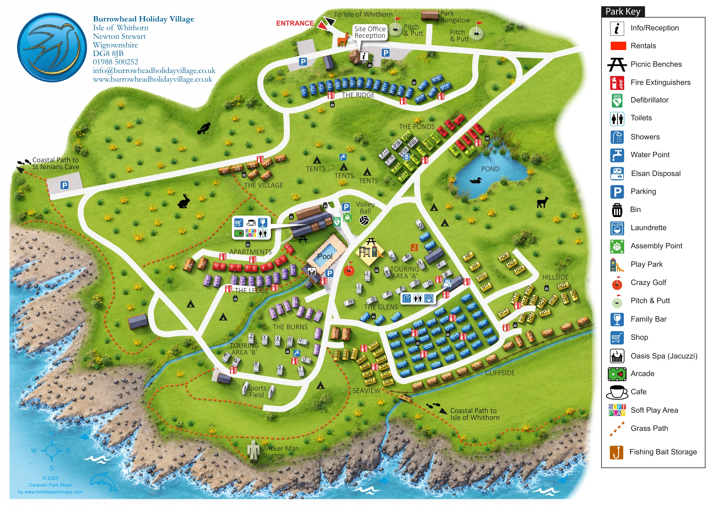
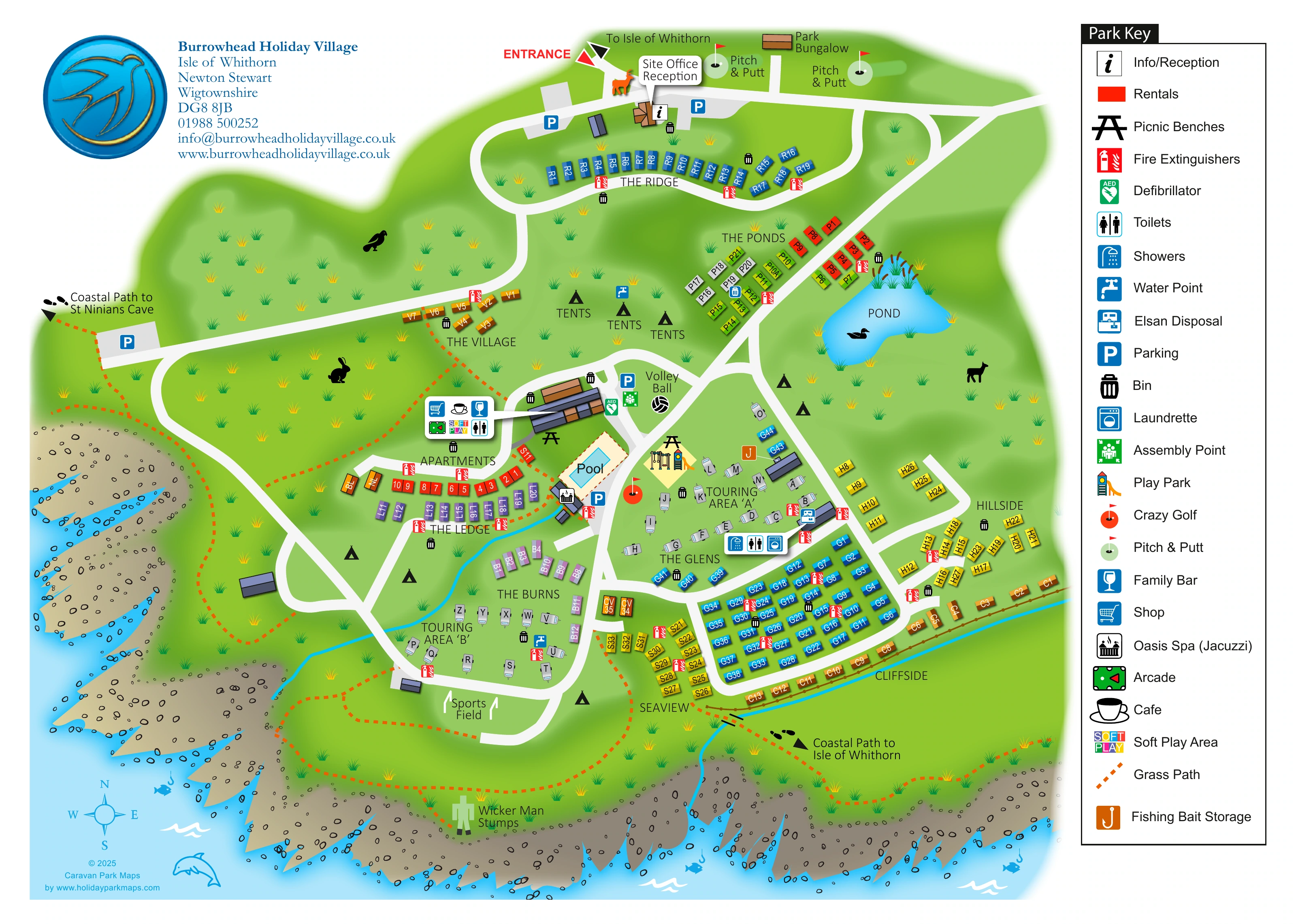
Orange dashed grass paths cross the open ground and trace the coast, passing the sports field and Wicker Man Stumps before continuing towards the named coastal destinations. A large right-hand key explains the symbols, while the upper-left identity block and lower-left compass complete the page. The accompanying enlargement shows overlapping detail from this same artwork, not a separate park section or additional site.
 Enlarge this map ↗
KEEP EXPLORING
Chosen for shared landscapes, accommodation or facilities.
 Explore the map ↗
United Kingdom
Trevornick’s colour-coded park map, with mixed accommodation, fishing ponds, golf and wooded trails.
 Explore the map ↗
United Kingdom
A colour-zoned coastal park map with touring areas, woodland trails, ponds and a leisure club.
 Explore the map ↗
United Kingdom
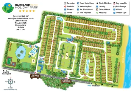
Illustrated Suffolk coastal park map with planted accommodation rows, central pitches, leisure facilities and beach directions.
Features may come from the sample artwork, its key or published park information. Approximate numbers describe the drawing and may cover only part of a park. They are intended to help you compare map examples. Current facilities and booking information should be checked with the park.
TAKE A CLOSER LOOK
View the illustrated map in detail or choose a file to download. These are sample maps; contact the park for current visitor information.



LET’S MAP YOUR PARK
For a map quotation, find your park and draw a rough boundary around it. The area you select helps us work out the design time and price.
Draw your park for a quote ↗Or talk to our map designers
01751 473136
 burrowhead_large.png