
Tree-lined boundaries and planted divisions
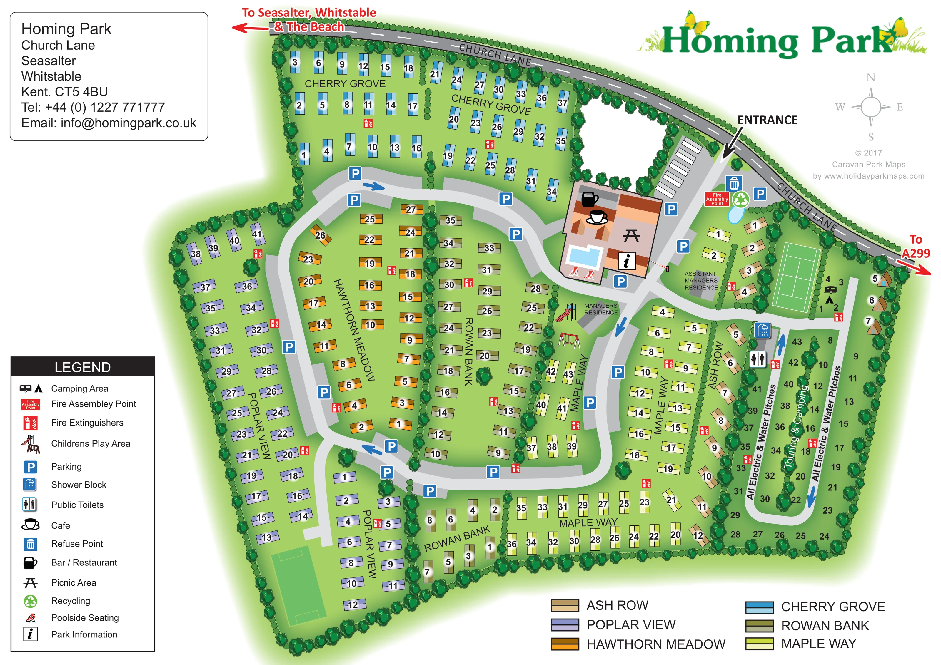
Dense illustrated trees enclose the park, follow Church Lane and divide several accommodation neighbourhoods.
ILLUSTRATED PARK MAP · P501
Homing Park, Church Lane, Seasalter, Whitstable, Kent · United Kingdom
 Enlarge the map ↗
A SENSE OF THE PLACE
Homing Park is a holiday park at Seasalter near Whitstable in Kent. It offers camping, camping pods and holiday homes, with a clubhouse among the shared facilities.
The site is part of an established family-run parks business. Its map gives visitors an overview of the accommodation areas and internal routes, helping them plan a stay on this stretch of the Kent coast.
LOOK CLOSER
Dense illustrated trees enclose the park, follow Church Lane and divide several accommodation neighbourhoods.
An information symbol marks the shared building complex beside the entrance road.
A cup-and-saucer symbol identifies a café within the entrance-side facilities complex.
The legend's bar / restaurant symbol is positioned on the shared facilities building.
A picnic-table symbol appears within the central facilities cluster.
A pale-blue rectangular pool is illustrated beside the café and bar / restaurant complex.
Two red-and-white deckchair illustrations mark poolside seating.
A slide and swing set mark a play area near the manager's residence, between the central holiday-home rows and Maple Way.
An information symbol marks the shared building complex beside the entrance road.
A cup-and-saucer symbol identifies a café within the entrance-side facilities complex.
The legend's bar / restaurant symbol is positioned on the shared facilities building.
A picnic-table symbol appears within the central facilities cluster.
A pale-blue rectangular pool is illustrated beside the café and bar / restaurant complex.
Two red-and-white deckchair illustrations mark poolside seating.
A slide and swing set mark a play area near the manager's residence, between the central holiday-home rows and Maple Way.
A green court with white tennis-style markings is drawn beside the north-eastern accommodation and touring area.
A green rectangular playing area with goal-area markings sits at the southern end of Poplar View; it has no written facility label.
Separate shower and toilet symbols identify a shared block between Ash Row and the touring and camping pitches.
Blue parking symbols are distributed along the internal roads, with a larger marked parking area beside the entrance.
Refuse and recycling symbols appear near the entrance-side parking and fire assembly point.
Red extinguisher symbols are distributed through the accommodation areas. A separate fire assembly point is marked near the entrance.
Two staff residences are labelled close to the main facilities and arrival area.
The touring and camping area carries the repeated label 'All Electric & Water Pitches'; individual service points are not separately plotted.
Dense illustrated trees enclose the park, follow Church Lane and divide several accommodation neighbourhoods.
A prominent black entrance arrow identifies access from Church Lane along the northern edge.
Broad grey roads connect the holiday-home neighbourhoods; a narrower loop serves touring and camping. Blue arrows indicate travel directions at selected points.
Red arrows on Church Lane point towards Seasalter, Whitstable and the beach in one direction, and the A299 in the other. These destinations are not depicted within the park.
READING THE MAP
This illustrated map of Homing Park brings together holiday homes, touring and camping on one clear, colour-coded plan. Set at Seasalter near Whitstable in Kent, the park is shown beneath the curving line of Church Lane, with bold arrows pointing towards the beach and the A299. A tree-lined boundary gives the grounds a distinct shape, while planted divisions help separate the accommodation neighbourhoods.
Six named areas organise the caravan-style holiday homes: Cherry Grove, Poplar View, Hawthorn Meadow, Rowan Bank, Maple Way and Ash Row. Each has its own colour, supported by numbered plots and a compact key. On the eastern side, a separate touring and camping loop is labelled for electric and water pitches, with washing facilities nearby.
The entrance leads towards a shared facilities cluster illustrated with café, bar / restaurant, information and picnic symbols, alongside a pool and poolside seating. Play equipment and marked sports areas add further landmarks. With its combination of practical symbols, bright accommodation colours and leafy illustration, this sample shows how a varied holiday park can be presented as a coherent visitor guide.
The plan uses a mainly overhead viewpoint, with Church Lane sweeping across the northern boundary and the entrance clearly marked towards the upper right. Arrival parking and the principal facilities building sit immediately inside this access point. The building is distinguished by peach and terracotta shapes carrying large café, bar / restaurant, picnic and information symbols. A pale-blue rectangular pool and red-and-white deckchairs make the leisure area recognisable without relying solely on text.
Broad grey roads curve through the holiday-home areas, connecting rows of coloured rectangular units. Cherry Grove occupies the northern section; Poplar View follows the western boundary and extends into the south-western corner. Hawthorn Meadow and Rowan Bank occupy much of the centre, while Maple Way wraps around the central and southern roads. Ash Row forms a narrower eastern group beside the touring area. Black plot numbers sit on white highlights, and the six accommodation colours are explained in a separate key along the bottom of the sheet.
The touring and camping section has an elongated road loop, numbered pitches and repeated electric-and-water wording. Shower and public toilet symbols mark a block beside Ash Row. Three pod-style huts appear along the outer boundary. Elsewhere, slide and swing illustrations identify the children's play area, a tennis-marked court lies towards the north-east, and a second marked sports pitch occupies the south-western corner.
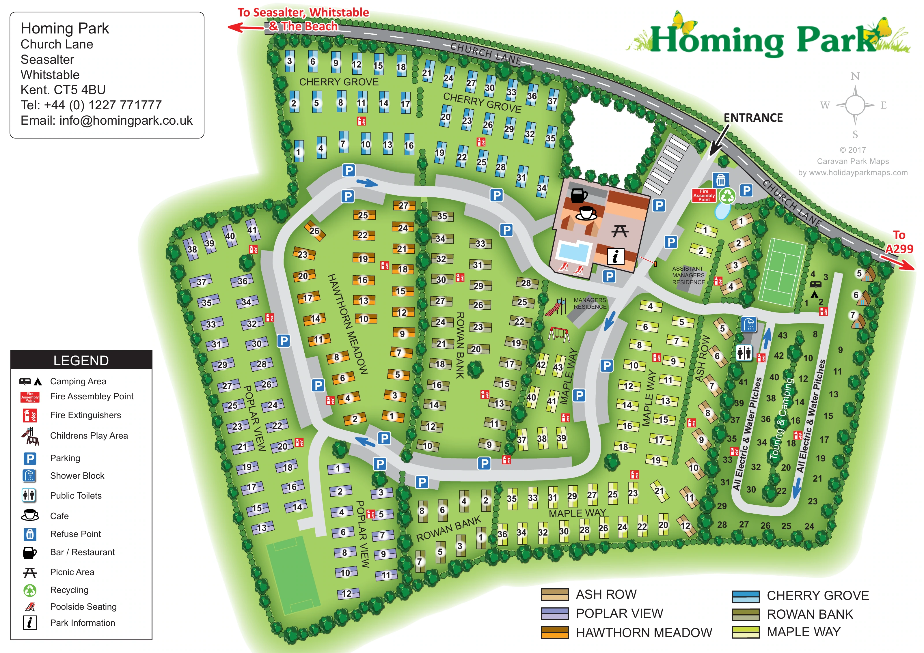
Trees outline the site and screen several rows. Parking and extinguisher symbols recur across the grounds, with waste, recycling and a fire assembly point near the entrance. A boxed contact panel, green butterfly-decorated title, compass and tall facility legend complete the single-page composition. The enlarged detail shows the same artwork, not a separate park section or alternative map.
KEEP EXPLORING
Chosen for shared landscapes, accommodation or facilities.
 Explore the map ↗
United Kingdom
A colour-zoned coastal park map with touring areas, woodland trails, ponds and a leisure club.
 Explore the map ↗
United Kingdom
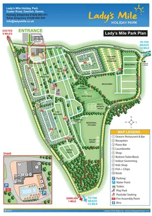
Portrait park plan with named fields, numbered accommodation, beach directions and an enlarged leisure-complex inset.
 Explore the map ↗
United Kingdom
Trevornick’s colour-coded park map, with mixed accommodation, fishing ponds, golf and wooded trails.
Features may come from the sample artwork, its key or published park information. Approximate numbers describe the drawing and may cover only part of a park. They are intended to help you compare map examples. Current facilities and booking information should be checked with the park.
TAKE A CLOSER LOOK
View the illustrated map in detail or choose a file to download. These are sample maps; contact the park for current visitor information.


LET’S MAP YOUR PARK
For a map quotation, find your park and draw a rough boundary around it. The area you select helps us work out the design time and price.
Draw your park for a quote ↗Or talk to our map designers
01751 473136
 homingparkmap_large.png