
Canal
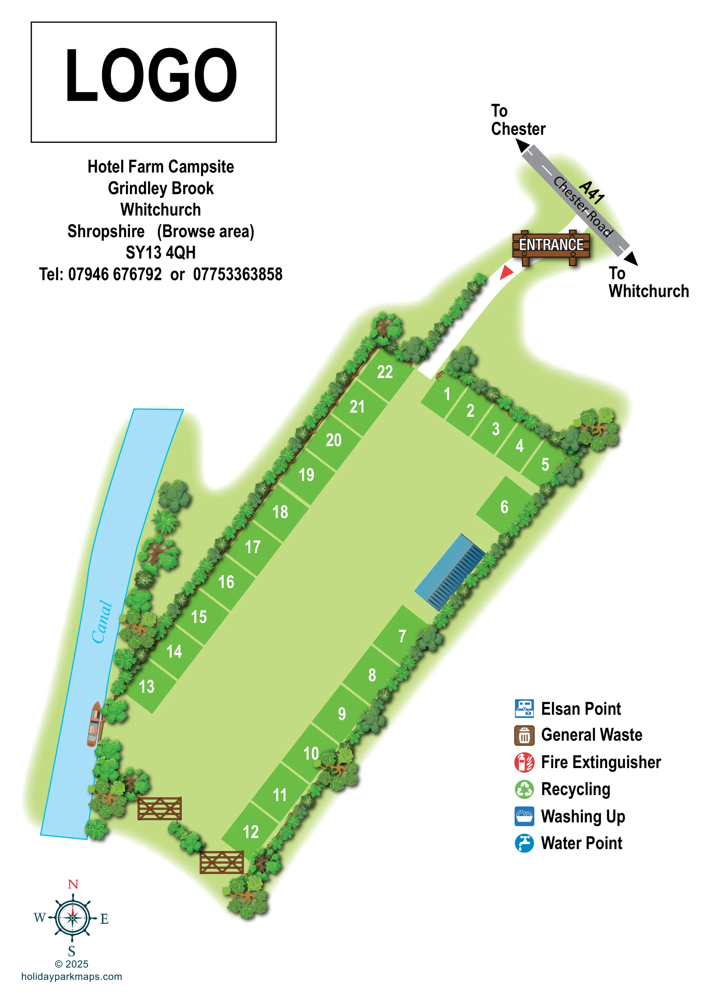
A labelled light-blue canal runs beside the western side of the campsite, separated from the pitches by a planted boundary.
ILLUSTRATED PARK MAP · P169
Hotel Farm Campsite, Grindley Brook, Whitchurch, Shropshire · United Kingdom
 Enlarge the map ↗
A SENSE OF THE PLACE
Hotel Farm is a Caravan and Motorhome Club Certificated Location at Grindley Brook near Whitchurch. This small site is reserved for club members bringing caravans or motorhomes.
The limited scale gives it a different character from a large holiday park. The map provides an overview of the site and access arrangements, helping touring visitors plan their arrival in this part of Shropshire.
LOOK CLOSER
A labelled light-blue canal runs beside the western side of the campsite, separated from the pitches by a planted boundary.
A small illustrated narrowboat adds character to the canal edge; it is a scenic detail rather than evidence of boat hire or a visitor mooring service.
Dense illustrated planting encloses the field, with larger tree clusters at corners and along the canal side. Timber fencing is visible beneath parts of the planting.
A broad pale-green interior separates the perimeter pitches; no internal road network or dedicated recreational use is labelled.
A prominent illustrated timber ENTRANCE sign marks the white access lane from Chester Road, with a red arrow pointing towards the campsite.
A short grey road segment at the top of the map has dashed white centre markings and directional arrows towards Chester and Whitchurch.
An elongated, unlabelled structure with a blue ridged roof sits along the eastern boundary between groups of pitches. Its function is not specified.
Two prominent timber gates are illustrated at the southern end of the field. Their destinations and visitor access arrangements are not labelled.
A prominent illustrated timber ENTRANCE sign marks the white access lane from Chester Road, with a red arrow pointing towards the campsite.
A short grey road segment at the top of the map has dashed white centre markings and directional arrows towards Chester and Whitchurch.
A labelled light-blue canal runs beside the western side of the campsite, separated from the pitches by a planted boundary.
A small illustrated narrowboat adds character to the canal edge; it is a scenic detail rather than evidence of boat hire or a visitor mooring service.
Dense illustrated planting encloses the field, with larger tree clusters at corners and along the canal side. Timber fencing is visible beneath parts of the planting.
A broad pale-green interior separates the perimeter pitches; no internal road network or dedicated recreational use is labelled.
An elongated, unlabelled structure with a blue ridged roof sits along the eastern boundary between groups of pitches. Its function is not specified.
Two prominent timber gates are illustrated at the southern end of the field. Their destinations and visitor access arrangements are not labelled.
A blue chemical-waste disposal pictogram is included in the legend; no corresponding position is visibly marked on the plan.
Separate brown general-waste and green recycling symbols appear in the legend, without visible placement on the field plan.
A red fire-extinguisher symbol is shown in the legend, but its location is not marked on the plan.
The legend includes a blue washing-up pictogram; it is not visibly attached to the illustrated building or another mapped location.
A blue tap symbol appears in the legend, without a visible water-point position on the plan.
READING THE MAP
This illustrated map presents Hotel Farm Campsite at Grindley Brook, near Whitchurch in Shropshire, as a compact touring field beside a canal. Its defining feature is the simple perimeter arrangement: numbered green pitch spaces surround a broad pale-green centre, with trees, shrubs and fencing forming the outer edges. The canal brings a clear sense of place, reinforced by a small narrowboat illustration along the bank.
Arrival information has a prominent role in the composition. A short section of the A41 Chester Road identifies the directions towards Chester and Whitchurch, while a white approach lane leads past a large timber-style entrance sign into the field. Large pitch numbers keep the accommodation layout easy to read without filling the plan with caravan illustrations.
The portrait page combines this straightforward site overview with an address block, compass and separate facility-symbol key. It is a useful sample for small touring sites seeking a map that explains their entrance and pitch arrangement while retaining the character of a planted, waterside setting.
The plan is arranged diagonally across a white portrait page, with the road approach at the upper right and the canal extending down the left-hand side. A grey strip labelled A41 Chester Road carries dashed centre markings and arrows towards Chester and Whitchurch. From this road, a white lane passes an illustrated timber ENTRANCE sign and a red directional arrow before opening into the campsite.
Roughly twenty pitch spaces are depicted as strong green rectangles with bold white numbers. They follow the western, northern and eastern boundaries rather than forming separate internal blocks. The pale-green centre remains largely open, so the pitch positions and overall field shape are immediately apparent. An elongated blue-roofed structure sits partway along the eastern side, breaking the pitch arrangement; no function is assigned to it by a label.
Trees and shrubs form a continuous illustrated enclosure, with timber fencing visible in places and larger tree groups punctuating the corners. Two timber gates appear at the lower end. Beside the western boundary, a light-blue canal with a cyan outline and italic label provides the main landscape landmark. A small narrowboat adds a recognisable canalside detail.
The lower-right legend lists Elsan point, general waste, fire extinguisher, recycling, washing up and water point using colour-coded pictograms. These entries remain in the key rather than being visibly positioned within the field. Above the map, a large logo panel and centred contact block balance the road information. A nautical-style compass, copyright line and designer website complete the lower-left margin.
KEEP EXPLORING
Chosen for shared landscapes, accommodation or facilities.
 Explore the map ↗
United Kingdom
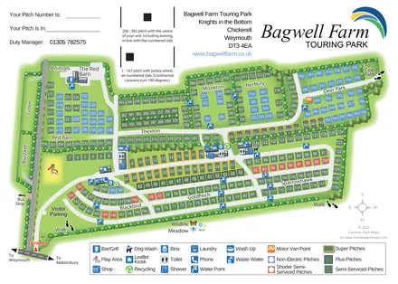
Illustrated Sanday aire map with a seasonal maze, café barn and motorhome service area.
 Explore the map ↗
United Kingdom
A colour-coded touring park plan with named pitch areas, service symbols and Coast Path links.
 Explore the map ↗
United Kingdom
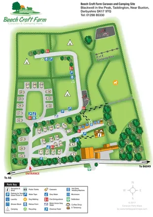
Illustrated touring and camping map with hedge-divided fields, age-labelled play areas and a detailed service key.
Features may come from the sample artwork, its key or published park information. Approximate numbers describe the drawing and may cover only part of a park. They are intended to help you compare map examples. Current facilities and booking information should be checked with the park.
This design-stage example includes a placeholder for the park logo.
LET’S MAP YOUR PARK
For a map quotation, find your park and draw a rough boundary around it. The area you select helps us work out the design time and price.
Draw your park for a quote ↗Or talk to our map designers
01751 473136