
Recreation area
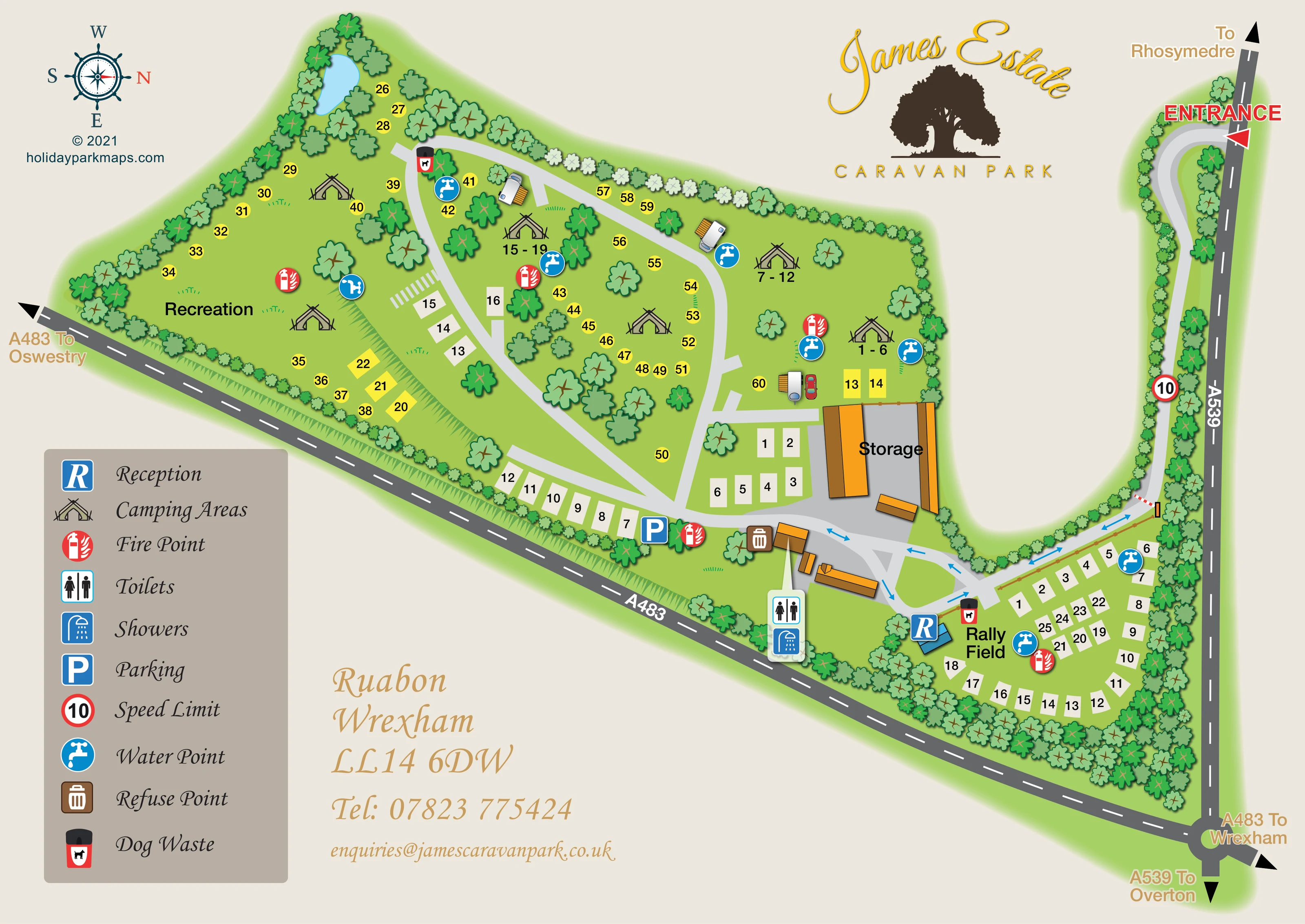
A broad grassy area on the left is labelled Recreation; no particular sports or play equipment is specified.
ILLUSTRATED PARK MAP · P177
Rhosymedre, Ruabon, Wrexham · United Kingdom
 Enlarge the map ↗
A SENSE OF THE PLACE
James Estate includes a residential park home development within the historic Wynnstay Estate grounds at Rhosymedre near Ruabon. The wider estate also offers camping and touring accommodation.
Serviced and non-electric camping pitches are advertised, while the residential homes form a distinct part of the site. Entrance controls and on-site wardens support the grounds, with the map helping explain the different areas.
LOOK CLOSER
A broad grassy area on the left is labelled Recreation; no particular sports or play equipment is specified.
A light-blue pond sits among trees at the upper-left tip of the illustrated grounds.
Dense rows of stylised trees and shrubs enclose the site, with larger scattered trees separating areas within the main grounds.
A blue reception marker identifies a small building beside the rally field and central arrival junction.
Paired toilet and shower symbols mark the service-building area near the lower edge of the main grounds.
A blue parking symbol appears beside the internal road and the row of rectangular positions along the A483 boundary.
Repeated blue tap symbols are distributed through the camping grounds and rally field.
Red extinguisher symbols identify fire points in the main grounds, near parking and within the rally field.
A blue reception marker identifies a small building beside the rally field and central arrival junction.
Paired toilet and shower symbols mark the service-building area near the lower edge of the main grounds.
A blue parking symbol appears beside the internal road and the row of rectangular positions along the A483 boundary.
Repeated blue tap symbols are distributed through the camping grounds and rally field.
Red extinguisher symbols identify fire points in the main grounds, near parking and within the rally field.
A brown bin symbol marks a refuse point beside the central service buildings.
Distinctive red-and-black dog-waste bin symbols appear beside the upper internal road and near reception.
A large orange-roofed building group and grey yard are labelled Storage beside the central road junction.
A separately labelled field occupies the lower-right wedge of the site, with numbered rectangular positions arranged around its edges and in short inner rows.
A broad grassy area on the left is labelled Recreation; no particular sports or play equipment is specified.
A light-blue pond sits among trees at the upper-left tip of the illustrated grounds.
Dense rows of stylised trees and shrubs enclose the site, with larger scattered trees separating areas within the main grounds.
A prominent entrance arrow marks access from the A539. A long curved drive leads to an illustrated barrier before the central junction.
Pale-grey roads connect the entrance, reception, storage and main grounds. Blue arrows indicate movement along the arrival route and around the central turning area.
A red-bordered sign displaying 10 is shown on the entrance drive and explained as Speed Limit in the legend.
The surrounding roads and roundabout are labelled, with directional references to Rhosymedre, Oswestry, Wrexham and Overton.
A short white-striped crossing is illustrated across an internal road in the left-central grounds.
The catalogue places James Estate within the historic Wynnstay Estate grounds at Rhosymedre near Ruabon.
READING THE MAP
This illustrated map of James Estate Caravan Park brings together camping grounds, numbered pitches and a separate rally field near Ruabon, Wrexham. Its distinctive shape follows the adjoining A483 and A539, with a long, curved entrance drive leading from the right-hand side of the page into the main site. Trees frame the grounds, while a small pond and a labelled recreation area give the plan a recognisable landscape character.
The artwork combines a simple overhead layout with lightly dimensional buildings and a few illustrated touring caravans. Yellow and cream pitch markers stand out against bright green grass, and blue service symbols make reception, parking, water points, toilets and showers easy to locate. Red symbols identify fire points, with separate designs for refuse and dog-waste bins.
A large legend, directional road labels and blue movement arrows support practical orientation. Above the plan, gold script lettering and a tree silhouette give the page a strong estate identity. This sample is particularly relevant to parks that need to explain several camping and pitch areas within one connected, landscaped site.
The plan is arranged diagonally across a landscape page, with the A483 forming the long lower boundary and the A539 running down the right. A roundabout and outward-pointing destination arrows establish the surrounding road context. The entrance is emphasised with a large red label and arrow at the upper right; from there, a pale-grey drive curves between planted boundaries towards an illustrated barrier and the central arrival junction.
Reception sits beside the rally field, close to the junction. Blue arrows show movement along the drive and around the central turning area. Nearby orange-roofed buildings form a service cluster, with toilet and shower symbols towards the lower boundary and a refuse point beside the road. A larger building group and yard are labelled Storage. Parking is marked further left, alongside a row of numbered rectangular positions.
The main grounds spread across the broader left-hand portion of the page. Curving roads divide grassy areas containing yellow numbered circles, short rows of rectangular markers and tent symbols identifying camping areas. Scattered trees break up these spaces, while dense planting traces the outside edge. The leftmost area is labelled Recreation, and a small pond occupies the upper-left tip. Repeated tap, fire-point and dog-waste symbols provide service references throughout the grounds.
The rally field forms a distinct lower-right section, with numbered rectangles around its perimeter and in short inner rows. A large ten-entry legend occupies the lower-left margin, balanced by gold-script location and contact details beneath the plan. The decorative compass makes the unusual right-facing north orientation explicit. The enlarged views show details of this same single-page artwork rather than additional site sections.
KEEP EXPLORING
Chosen for shared landscapes, accommodation or facilities.
 Explore the map ↗
United Kingdom
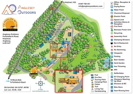
Illustrated camping and glamping map with an activity-centre inset and wildlife pond.
 Explore the map ↗
United Kingdom
Woodland camping, lodges, lakes and colour-coded bike trails at Avon Tyrrell Outdoor Centre.
 Explore the map ↗
United Kingdom
Woodland-framed Barnsoul map with mixed accommodation, shared facilities and paw-marked walking routes.
Features may come from the sample artwork, its key or published park information. Approximate numbers describe the drawing and may cover only part of a park. They are intended to help you compare map examples. Current facilities and booking information should be checked with the park.
TAKE A CLOSER LOOK
View the illustrated map in detail or choose a file to download. These are sample maps; contact the park for current visitor information.


LET’S MAP YOUR PARK
For a map quotation, find your park and draw a rough boundary around it. The area you select helps us work out the design time and price.
Draw your park for a quote ↗Or talk to our map designers
01751 473136