
South Meadow, North Meadow and East Meadow
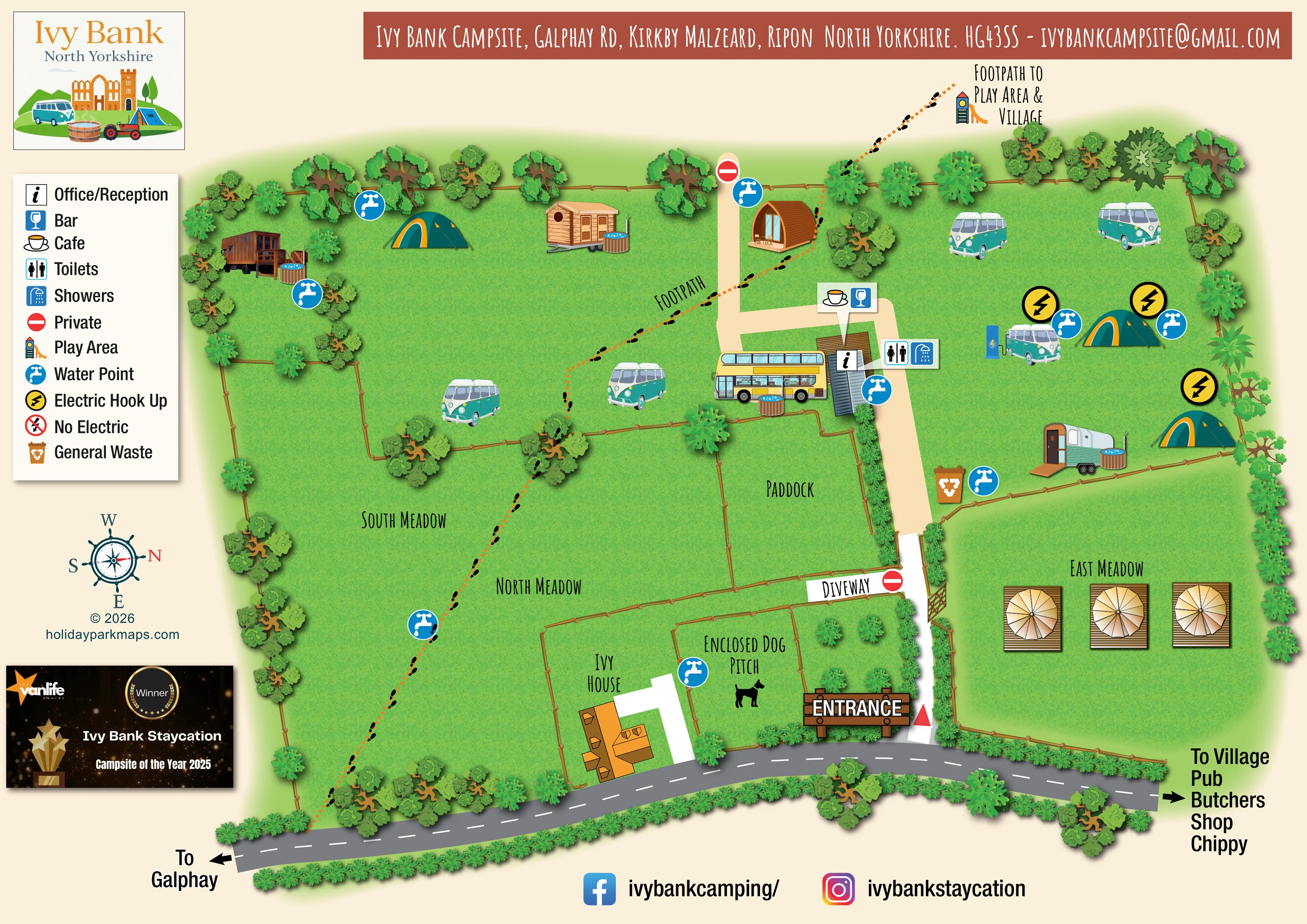
Three named grass areas provide the principal field-based orientation system.
ILLUSTRATED PARK MAP · P176
Ivy Bank Campsite, Galphay Rd, Kirkby Malzeard, Ripon North Yorkshire · United Kingdom
 Enlarge the map ↗
A SENSE OF THE PLACE
Ivy Bank Staycation offers camping, touring and unusual glamping accommodation near Kirkby Malzeard. Views towards Nidderdale and the wider Yorkshire countryside are part of the setting.
Grass and electric pitches cater for a range of vehicles and tents. A shower block and Café Ivy support stays, while glamping options include converted vehicles and other individual units. Dogs are welcomed under the site's lead rules.
LOOK CLOSER
Three named grass areas provide the principal field-based orientation system.
A fenced paddock lies beside the access lane, between the central hub and the entrance-side plots.
Illustrated trees and hedges enclose the site and roadside; brown post-and-rail fences divide the internal grass areas.
An information symbol marks the central building cluster beside the main access lane.
A cup symbol locates the café at the central hub, beside the illustrated yellow double-decker bus.
A wine-glass symbol shares the café callout at the central facilities hub.
Paired toilet and shower symbols identify facilities beside reception and the main lane.
Repeated blue tap symbols mark water points around the accommodation areas, facilities hub and enclosed dog pitch.
An information symbol marks the central building cluster beside the main access lane.
A cup symbol locates the café at the central hub, beside the illustrated yellow double-decker bus.
A wine-glass symbol shares the café callout at the central facilities hub.
Paired toilet and shower symbols identify facilities beside reception and the main lane.
Repeated blue tap symbols mark water points around the accommodation areas, facilities hub and enclosed dog pitch.
Yellow lightning symbols mark selected camping and campervan positions in the right-hand field; a blue connection pedestal is also illustrated.
A crossed-out lightning symbol appears in the key but is not clearly placed within the plan.
A brown bin symbol marks a waste point beside the main lane and the boundary above East Meadow.
A fenced plot labelled Enclosed Dog Pitch sits beside Ivy House and the entrance, with a dog silhouette and water-point symbol. It is labelled as a pitch, not a communal dog exercise area.
Timber-sided, water-filled tubs appear beside several unusual accommodation illustrations and the double-decker bus. They are visual details rather than separately named facilities.
Three named grass areas provide the principal field-based orientation system.
A fenced paddock lies beside the access lane, between the central hub and the entrance-side plots.
Illustrated trees and hedges enclose the site and roadside; brown post-and-rail fences divide the internal grass areas.
A timber entrance sign and red arrow identify access from the road along the lower edge. A pale lane continues towards the central facilities and branches across the upper part of the site.
Red no-entry-style symbols, defined as Private in the key, mark the upper lane end and the side driveway near Ivy House.
An orange dotted route with black footprints crosses the meadows diagonally and continues beyond the upper boundary towards the play area and village.
A play-equipment illustration accompanies the outward footpath label. The map presents the play area as a destination beyond the campsite boundary, not an on-site playground.
Road arrows point towards Galphay and towards the village pub, butchers, shop and chippy. These are local destinations rather than mapped campsite facilities.
A labelled house and separate driveway occupy a fenced plot beside the roadside. The map does not identify the house as bookable accommodation.
READING THE MAP
This illustrated map of Ivy Bank Campsite introduces a field-based camping and glamping site near Kirkby Malzeard in North Yorkshire. Rather than presenting a rigid grid of numbered pitches, it uses named meadows, fenced enclosures and distinctive accommodation drawings to explain the site’s character and organisation.
The entrance is clearly marked beside the roadside, with a pale access lane leading towards reception, toilets, showers and the café and bar hub. Teal campervans and tents sit within the green fields, while timber wagon-style units, a curved pod and a converted trailer give the accommodation illustrations an individual identity. In East Meadow, three bell-tent-like structures are arranged on square decks.
A dotted orange footpath, illustrated with black footprints, crosses the site towards the village and play area. Roadside arrows add directions to Galphay and village amenities. Trees, hedges and post-and-rail fences establish the rural setting, while the enclosed dog pitch provides a memorable entrance-side landmark. The cream background, terracotta header and prominent left-hand key bring the practical information together with Ivy Bank’s branding.
The plan places the roadside along the lower edge, with the campsite entrance towards the right of centre. A timber sign and red arrow mark the arrival point between East Meadow and the enclosed dog pitch. From here, the pale access lane runs into the site towards a compact facilities cluster, where symbols identify office/reception, café, bar, toilets and showers. A yellow double-decker bus and adjacent building drawings make this hub easy to recognise.
The fields are organised through fences and names rather than numbered pitches. South Meadow and North Meadow occupy much of the left and lower central plan, with the Paddock beside the lane. East Meadow contains a short row of three bell-tent-like structures on timber decks. Ivy House is drawn within its own roadside enclosure, alongside a separate driveway marked private. Another private marker appears at the upper end of the internal lane.
Across the upper fields, campervan and tent illustrations sit among individually drawn accommodation structures, including timber wagons, a curved-roof pod and a horse-trailer-style conversion. Several have small timber-sided tubs beside them. Blue tap symbols distribute water-point information around the site, yellow lightning symbols highlight selected electric camping positions, and a brown bin symbol locates general waste beside the lane.
The walking route is deliberately distinct from vehicle access: orange dots and black footprints trace a diagonal line through the meadows and beyond the boundary towards the village play area. External road arrows identify Galphay and village destinations. A left-hand key and rotated compass support orientation, while the logo, address banner, award panel and social details frame the single-page plan.
KEEP EXPLORING
Chosen for shared landscapes, accommodation or facilities.
 Explore the map ↗
United Kingdom
Woodland-framed Barnsoul map with mixed accommodation, shared facilities and paw-marked walking routes.
 Explore the map ↗
United Kingdom
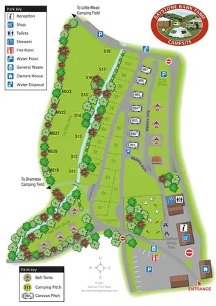
A stream-side farm campsite plan with car-free camping, caravan pitches and separate bell-tent areas.
 Explore the map ↗
United Kingdom
Woodland park map with mixed pitches, bell tents, lodges and a fishing lake.
Features may come from the sample artwork, its key or published park information. Approximate numbers describe the drawing and may cover only part of a park. They are intended to help you compare map examples. Current facilities and booking information should be checked with the park.
TAKE A CLOSER LOOK
View the illustrated map in detail or choose a file to download. These are sample maps; contact the park for current visitor information.

LET’S MAP YOUR PARK
For a map quotation, find your park and draw a rough boundary around it. The area you select helps us work out the design time and price.
Draw your park for a quote ↗Or talk to our map designers
01751 473136