
Beach
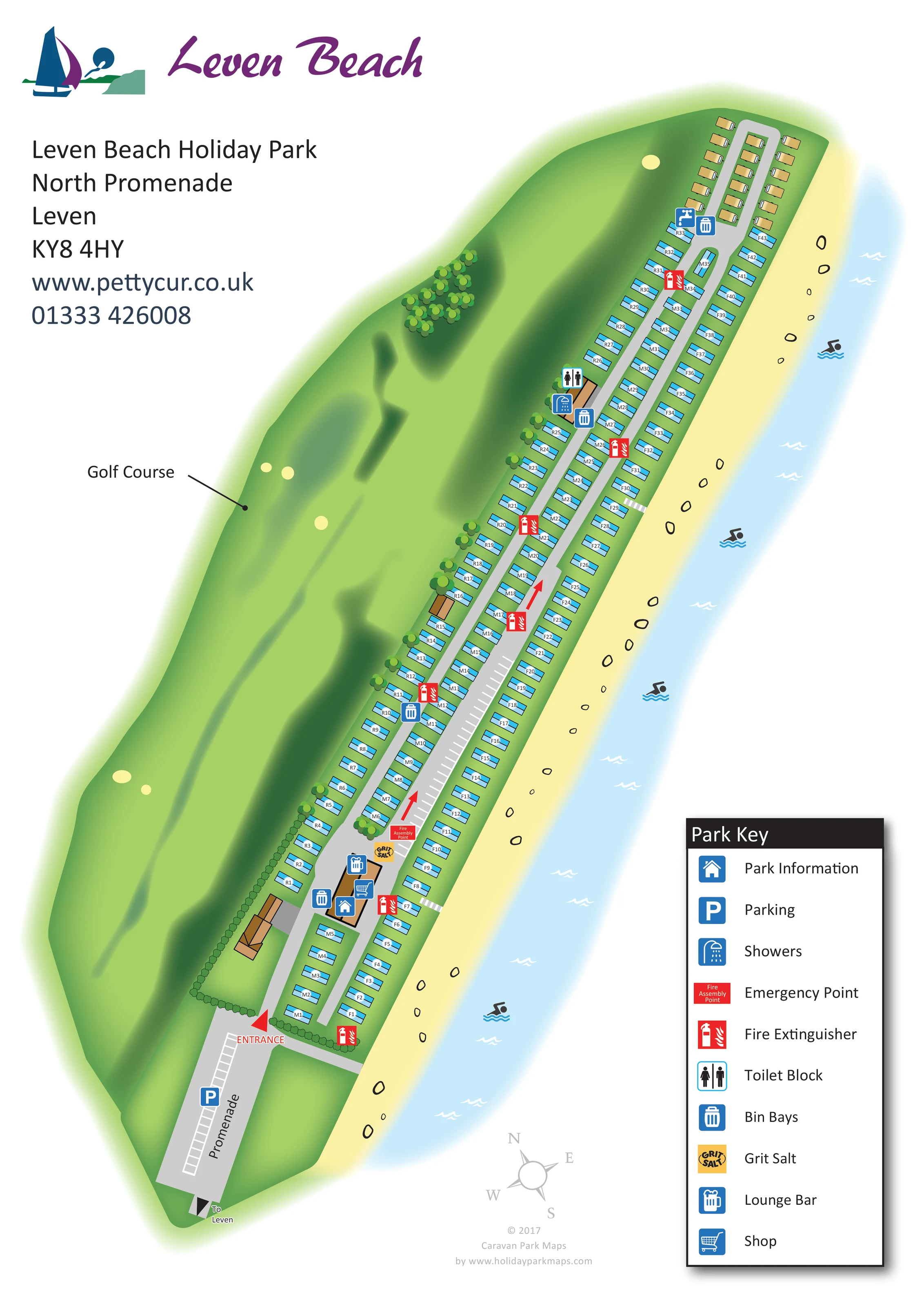
A continuous pale-yellow beach borders the full seaward side of the park, illustrated with scattered outlined stones.
ILLUSTRATED PARK MAP · P520
Leven Beach Holiday Park, North Promenade, Leven · United Kingdom
 Enlarge the map ↗
A SENSE OF THE PLACE
Leven Beach Holiday Park sits on Fife's south coast between Leven and Lundin Links. Direct access to Largo Bay's beach gives the family-owned park its seaside character.
The site offers touring and camping alongside its holiday park accommodation. A lounge bar with a beach-facing veranda provides a social space, with pool and darts among the indoor activities described by the operator.
LOOK CLOSER
A continuous pale-yellow beach borders the full seaward side of the park, illustrated with scattered outlined stones.
A pale-blue strip of sea follows the beach, with wave marks and repeated swimming pictograms providing seaside context rather than identifying a supervised swimming facility.
The large green landscape adjoining the inland boundary is labelled Golf Course and illustrated with shaded fairway-like forms and pale bunker shapes.
Tree clusters line sections of the inland accommodation edge, while hedges define parts of the entrance boundary.
A blue house symbol identifies park information at the main service building near the entrance.
A tankard symbol marks the lounge bar in the entrance-side service cluster.
A shopping-trolley symbol marks the shop at the same entrance-side building.
Toilet and shower symbols identify a service building farther along the accommodation rows on the golf-course side.
A blue house symbol identifies park information at the main service building near the entrance.
A tankard symbol marks the lounge bar in the entrance-side service cluster.
A shopping-trolley symbol marks the shop at the same entrance-side building.
Toilet and shower symbols identify a service building farther along the accommodation rows on the golf-course side.
Parking is marked on the promenade approach, with additional white bay markings along the internal road.
Repeated blue bin symbols mark collection points beside the entrance facilities and at intervals along the site.
A blue tap symbol appears near the far-end accommodation group, although it is not explained in the displayed key.
Red extinguisher symbols are distributed along the accommodation roads, including near the entrance.
A red Fire Assembly Point marker stands beside the lower internal parking bays. The key calls this symbol an Emergency Point.
A yellow grit-salt marker appears beside the assembly point near the entrance-side facilities.
A continuous pale-yellow beach borders the full seaward side of the park, illustrated with scattered outlined stones.
A pale-blue strip of sea follows the beach, with wave marks and repeated swimming pictograms providing seaside context rather than identifying a supervised swimming facility.
The large green landscape adjoining the inland boundary is labelled Golf Course and illustrated with shaded fairway-like forms and pale bunker shapes.
Tree clusters line sections of the inland accommodation edge, while hedges define parts of the entrance boundary.
The entrance is labelled at the lower end of the site, reached from the promenade. An outward arrow indicates the direction to Leven.
Two long grey roads serve the accommodation rows and connect around the far-end group. Red arrows indicate travel direction on the broader road.
Short white-striped links interrupt the seafront accommodation row at several points, visually connecting the internal route with the beach edge.
READING THE MAP
This map of Leven Beach Holiday Park presents an unusually long, narrow seaside site on Fife’s south coast. The accommodation stretches between an adjoining golf course and the beach, giving the artwork two strong landscape edges and an immediately recognisable coastal character. A pale-yellow ribbon of sand and light-blue water follows the full length of the park, while shaded greens describe the inland golf-course setting.
The plan is arranged diagonally on a portrait page, allowing the entrance, parallel roads and closely spaced caravan rows to remain readable without breaking the site into separate panels. Near the promenade entrance, symbols identify park information, the lounge bar and shop. Farther along the site, visitors can locate toilets, showers, bin bays and fire equipment through a consistent visual key.
Purple script branding and a sailing motif occupy the open upper-left corner, balanced by a substantial legend at the lower right. This sample is particularly relevant to coastal parks where a compact page must explain a long frontage, repeated accommodation rows and facilities spread along a linear route.
The illustrated plan follows the park from its promenade entrance at the lower end to a smaller accommodation group at the far end. Three main rows of blue caravan-shaped units run almost the full length of the site, each carrying a short reference label. Two grey internal roads separate the rows and connect around the tan-coloured units at the top. White parking-bay markings occupy part of the broader road, and red arrows provide a clear visual indication of travel direction.
The entrance-side service cluster carries symbols for park information, the lounge bar and shop. A yellow grit-salt marker and red Fire Assembly Point label sit nearby. Farther along the inland row, a separate building is marked with toilet and shower symbols. Bin bays and fire extinguisher points repeat at intervals, while a tap symbol appears towards the far end. Several short white-striped connections lead through the seafront row towards the beach.
Landscape is an integral part of the composition. The neighbouring golf course is shown as a broad green area with sweeping shadows, pale bunker-like shapes and a labelled leader line. Trees and hedges soften the inland accommodation boundary. On the opposite side, stones, wave marks and swimming pictograms distinguish the sandy beach and coastal water; these are contextual illustrations rather than a detailed coastal activity plan.
The single portrait artwork combines the complete site with its branding, contact block, compass and Park Key. Crisp outlines keep accommodation and facilities distinct, while soft gradients help the landscape recede. The result gives visitors both individual unit references and an easy understanding of the park’s position between shore and golf course.
KEEP EXPLORING
Chosen for shared landscapes, accommodation or facilities.
 Explore the map ↗
United Kingdom
Coastal park map with static-caravan rows, touring pitches, a camping field and two leisure clusters.
 Explore the map ↗
United Kingdom
Coastal park plan with colour-coded pitches, named neighbourhoods and a Morecambe Bay walking route.
 Explore the map ↗
United Kingdom
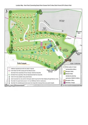
Illustrated touring-park plan with facilities, public footpaths and adjoining field-access details.
Features may come from the sample artwork, its key or published park information. Approximate numbers describe the drawing and may cover only part of a park. They are intended to help you compare map examples. Current facilities and booking information should be checked with the park.
LET’S MAP YOUR PARK
For a map quotation, find your park and draw a rough boundary around it. The area you select helps us work out the design time and price.
Draw your park for a quote ↗Or talk to our map designers
01751 473136