
River Severn
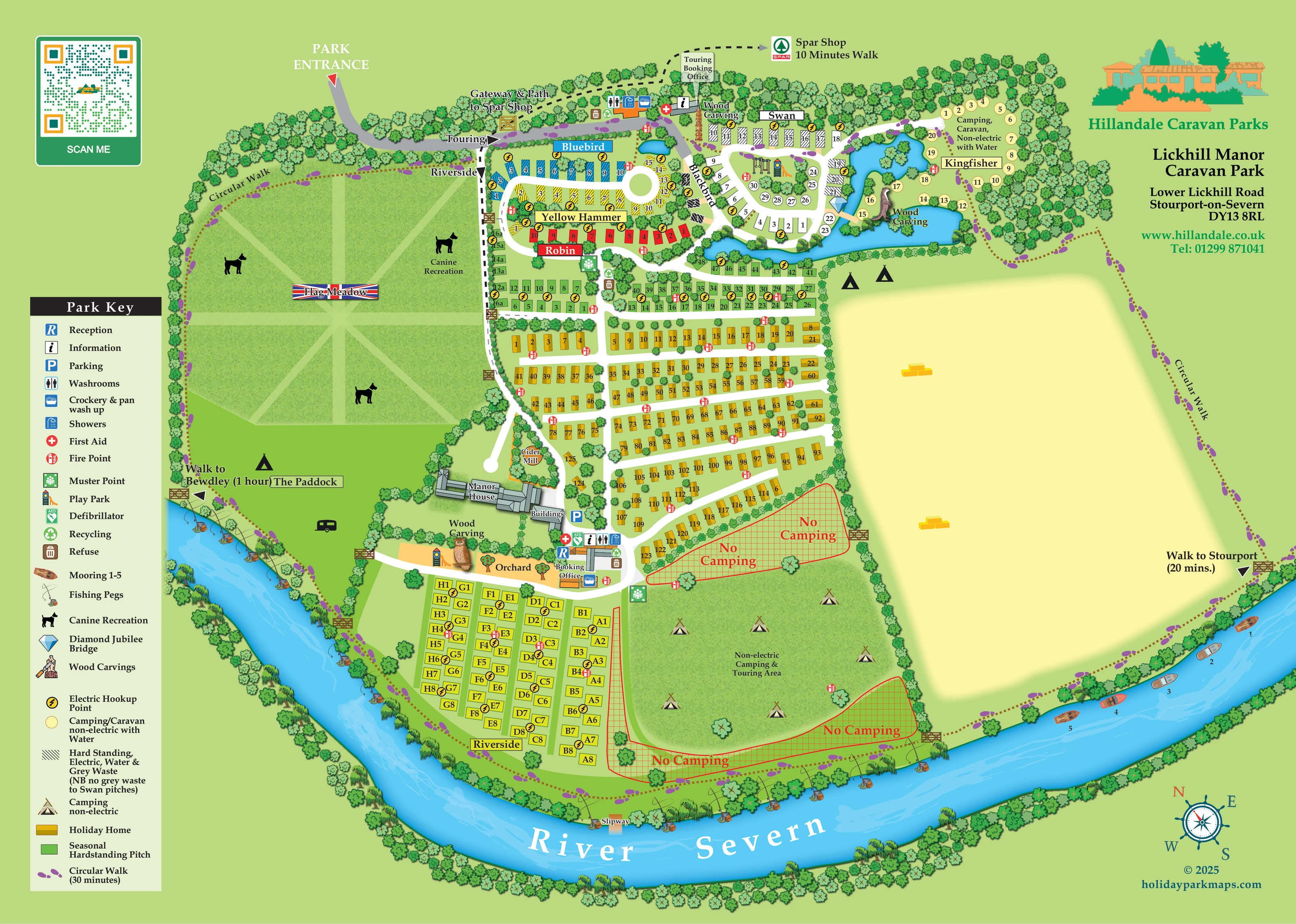
A broad blue river curves around the western and southern boundaries, giving the whole plan its distinctive horseshoe setting.
ILLUSTRATED PARK MAP · P187
Hillandale Caravan Parks, Lower Lickhill Road, Stourport-on-Severn · United Kingdom
 Enlarge the map ↗
A SENSE OF THE PLACE
Lickhill Manor Caravan Park surrounds a historic manor house beside the River Severn at Stourport. Tree-lined avenues and pastures form the setting for holiday homes, touring and camping.
Serviced pitch options and washroom facilities support stays. A riverside walk leads towards Stourport-on-Severn, while holiday home plots offer a choice between private gardens and lower-maintenance open settings.
LOOK CLOSER
A broad blue river curves around the western and southern boundaries, giving the whole plan its distinctive horseshoe setting.
Dense illustrated trees frame the park, separate accommodation blocks and surround broad grass fields, including a large pale-yellow eastern meadow.
The western meadow is named with a Union Flag banner and illustrated with a large Union Flag-like pattern of pale grass strips.
A labelled orchard with stylised fruit trees sits beside reception, a play area and an owl carving.
Blue ponds and a narrow watercourse thread through the northern accommodation areas. A blue diamond marker identifies the Diamond Jubilee Bridge beside Kingfisher.
Dog silhouettes and a canine recreation label identify the large western meadow area.
A long grey-roofed Manor House complex is drawn beside the central arrival facilities, with adjoining structures labelled Buildings.
A named landmark in a small tree-filled enclosure beside the central access road; its visitor function is not specified.
A broad blue river curves around the western and southern boundaries, giving the whole plan its distinctive horseshoe setting.
Dense illustrated trees frame the park, separate accommodation blocks and surround broad grass fields, including a large pale-yellow eastern meadow.
The western meadow is named with a Union Flag banner and illustrated with a large Union Flag-like pattern of pale grass strips.
Dog silhouettes and a canine recreation label identify the large western meadow area.
A long grey-roofed Manor House complex is drawn beside the central arrival facilities, with adjoining structures labelled Buildings.
A named landmark in a small tree-filled enclosure beside the central access road; its visitor function is not specified.
A labelled orchard with stylised fruit trees sits beside reception, a play area and an owl carving.
Blue ponds and a narrow watercourse thread through the northern accommodation areas. A blue diamond marker identifies the Diamond Jubilee Bridge beside Kingfisher.
Reception and a booking office are shown near the Manor House; a separate Touring Booking Office is marked near the northern entrance facilities.
A blue parking marker appears beside the Manor House and central service buildings.
Grouped symbols locate washrooms, showers and crockery and pan washing-up facilities at the northern and central service hubs.
Information symbols appear at the service hubs near the booking offices.
Colourful slide and climbing-frame illustrations mark play areas near the Orchard and within the northern loop.
An owl beside the Orchard, a tall carving near the Touring Booking Office and another carving beside Kingfisher are illustrated and labelled.
First-aid and defibrillator markers sit around the service hubs, with repeated fire points and several muster points distributed through the accommodation areas.
Recycling and refuse symbols are grouped at the main facility areas.
The key distinguishes electric hookups, non-electric camping/caravan pitches with water and hardstandings with electric, water and grey waste. It specifically notes that Swan pitches do not have grey waste.
Repeated fishing-rod illustrations mark pegs along the western and southern riverbank.
Five numbered boat illustrations identify moorings along the south-eastern riverbank.
A labelled slipway is shown on the southern riverbank beside the perimeter walking route.
The entrance approaches from the upper left and connects to a white road network serving touring areas, central facilities and holiday-home rows.
Purple footprints trace a perimeter route through woodland edges and along the river. The key labels it as a 30-minute circular walk.
Directional arrows label a walk to Bewdley as one hour and a walk to Stourport as 20 minutes; these are timings printed on the artwork.
A northern gateway and dashed off-site route point towards a Spar shop, labelled as a ten-minute walk rather than an on-site shop.
Red cross-hatched areas beside the open camping field and below the holiday-home rows are explicitly labelled No Camping.
READING THE MAP
The River Severn gives this illustrated map of Lickhill Manor Caravan Park its shape and character. Curving around the western and southern edges, the blue river frames a varied site of holiday homes, touring pitches, open camping fields and tree-lined meadows at Stourport-on-Severn. Rather than treating every area alike, the artwork gives each part of the park a clear visual identity: gold holiday homes, green seasonal hardstandings and contrasting bird-named visitor sections.
The map also makes room for the features that help guests recognise their surroundings. The Manor House, Cider Mill, Orchard and wood carvings appear alongside practical facilities such as reception, washrooms and play parks. Fishing pegs, moorings and a slipway connect the plan to its riverside setting, while purple footprints trace a circular walk around the grounds.
A substantial key, numbered pitches and clearly drawn roads support everyday navigation. Hillandale branding and contact details occupy the upper-right corner, leaving the central illustration to explain how the park’s accommodation, open spaces and riverside routes fit together.
The plan is arranged around a central accommodation spine, with the park entrance approaching from the upper left. At the northern end, curved roads serve Bluebird, Yellow Hammer, Robin, Blackbird, Swan and Kingfisher. Colour-filled pitches, hatched hardstandings and electric hookup symbols distinguish their layouts and service categories. Small ponds and a linking watercourse weave through this area, with the Diamond Jubilee Bridge marked beside Kingfisher.
Below these visitor sections, green seasonal hardstandings form compact rows. Gold holiday homes occupy the main central grid, separated by broad white lanes and scattered trees. The Manor House stands to the west of this grid, close to the Cider Mill, parking, reception and booking office. Nearby symbols identify washrooms, showers, washing-up facilities, information and safety points. The Orchard, a play area and a large illustrated owl carving add recognisable landmarks to this service hub.
Riverside uses a regular lettered pitch arrangement near the southern riverbank. Alongside it, an open field is labelled for non-electric camping and touring, with red cross-hatched no-camping zones around parts of its edge. The Paddock occupies another open area west of the Manor House. Farther north-west, Flag Meadow carries dog silhouettes and a pale Union Flag-like grass pattern.
The River Severn sweeps around the bottom of the composition, accompanied by fishing pegs, five numbered moorings and a slipway. Purple footprints follow the perimeter, with outward directions towards Bewdley and Stourport. A separate northern gateway points towards the Spar shop. The single-page artwork is supported by an overlapping enlargement of its key and western-central detail; this reveals the same map rather than an additional accommodation area.
KEEP EXPLORING
Chosen for shared landscapes, accommodation or facilities.
 Explore the map ↗
United Kingdom
A lakeside holiday-park and fishery map with numbered accommodation, fishing positions and clearly grouped visitor services.
 Explore the map ↗
United Kingdom
A woodland estate park map combining caravan loops, touring pitches, riverside paths and Bruce’s Cave landmarks.
 Explore the map ↗
United Kingdom
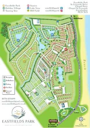
Six colour-coded neighbourhoods, lakeside layouts and coastal access on the Eastfields Park map.
Features may come from the sample artwork, its key or published park information. Approximate numbers describe the drawing and may cover only part of a park. They are intended to help you compare map examples. Current facilities and booking information should be checked with the park.
LET’S MAP YOUR PARK
For a map quotation, find your park and draw a rough boundary around it. The area you select helps us work out the design time and price.
Draw your park for a quote ↗Or talk to our map designers
01751 473136