
Lake 1
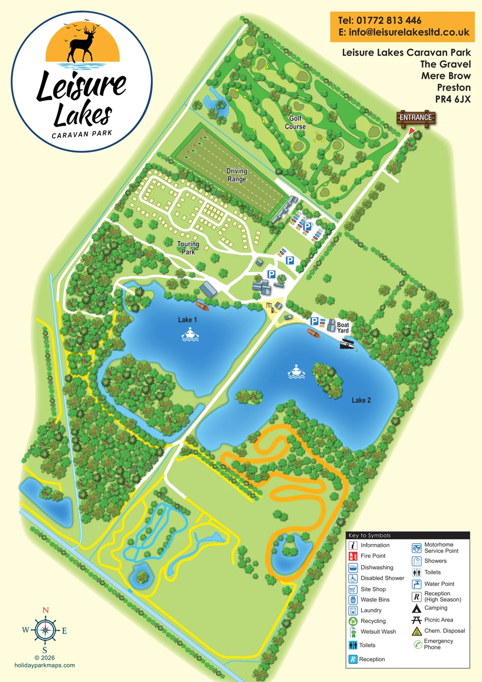
A large irregular blue lake with an inlet or channel curving around a tree-filled landform to the west and south. A small northern island-like feature is linked by a white crossing.
ILLUSTRATED PARK MAP · P186
Leisure Lakes Caravan Park, The Gravel, Mere Brow, Preston · United Kingdom
 Enlarge the map ↗
A SENSE OF THE PLACE
Leisure Lakes Caravan Park is located at Mere Brow near Southport. Serviced hardstanding and grass touring pitches sit within a larger countryside leisure site.
The wider complex includes fishing, golf, watersports and other independently operated activities, together with a pub and family attractions. The map helps visitors distinguish the caravan park's layout from the surrounding recreation areas.
LOOK CLOSER
A large irregular blue lake with an inlet or channel curving around a tree-filled landform to the west and south. A small northern island-like feature is linked by a white crossing.
A large irregular blue lake with illustrated tree-covered islands, a Boat Yard on its northern shore and a rowing pictogram.
Smaller blue ponds or water features appear within the golf area and across the southern grounds. None is named or assigned an activity.
Narrow cyan lines and wider pale-blue bands follow parts of the perimeter and connect with some water features. Their names and exact hydrological classification are not supplied.
Repeated shaded tree symbols create dense belts, islands, boundaries and scattered planting. They establish an illustrated leafy character but are not evidence of surveyed woodland extent, species or canopy cover.
Open green areas are divided by tree or hedge-like lines. The artwork does not identify them as camping, sports pitches or development land.
A broad orange serpentine course-like shape occupies the ground south of Lake 2. Its intended activity is not identified.
A substantial illustrated golf area with fairways, greens and bunker-like yellow shapes. The artwork does not state a hole count.
A substantial illustrated golf area with fairways, greens and bunker-like yellow shapes. The artwork does not state a hole count.
A rectangular driving range illustrated with flag targets, dashed lines and a building along its south-eastern end.
Parking is indicated by four blue P markers, with decorative car illustrations at several of the marked areas. The cars are not a reliable count of parking capacity.
An illustrated play area with a slide and frame or swing equipment. No age range or operating information is given.
A named boat yard with small buildings, adjacent parking and a nearby launch symbol.
A boat-on-trailer or slipway pictogram indicates a launch-related feature. Its practical use and availability are not stated.
Rowing pictograms and small boat illustrations associate the principal lakes with boating. They do not establish boat hire, permitted activities or supervision.
An information symbol is included in the key, but no corresponding location was identified on the main plan.
Reception is represented in the key by a white R on a cyan square. Its building is not identified on the plan.
A separate reception symbol is qualified as high season. This wording is an artwork statement, not current opening advice.
The key contains two entries both labelled Toilets, using different background treatments. Neither establishes a located toilet block or a count of blocks.
Showers are listed without a corresponding located symbol.
An accessible shower is represented by a wheelchair pictogram. The key uses the wording 'Disabled Shower'; no accessibility specification or location is supplied.
A dishwashing facility is listed in the key.
Laundry is listed, but the central buildings cannot be assigned this function from their appearance.
A site shop is listed in the key without a mapped location.
Waste bins are included in the key; individual bin positions are not shown.
Recycling is listed without a located collection point.
A wetsuit-washing facility is an unusual inclusion in the key, supporting the map's watersports context without establishing its location.
A motorhome service point is listed. This is not evidence of a separate motorhome accommodation zone or a motorhome pitch count.
Water points are represented in the key, but none can be individually located on the plan.
Chemical toilet disposal is listed without a mapped location.
Camping appears in the key, but no tent symbols, labelled camping field or defined tent pitches were identified elsewhere.
A picnic area is listed without a corresponding location on the main plan.
Fire points are included in the key, but the artwork does not provide usable located fire-point wayfinding.
An emergency phone is listed in the key. Its location and operational status are not established.
Fishing is described in the supplied research as part of the wider complex. The artwork does not allocate fishing to a particular lake.
The supplied research mentions a pub within the wider complex. None of the illustrated buildings is labelled as a pub.
The supplied research refers to family attractions and other independently operated activities without enough detail to assign them to the unlabelled southern features.
A large irregular blue lake with an inlet or channel curving around a tree-filled landform to the west and south. A small northern island-like feature is linked by a white crossing.
A large irregular blue lake with illustrated tree-covered islands, a Boat Yard on its northern shore and a rowing pictogram.
Smaller blue ponds or water features appear within the golf area and across the southern grounds. None is named or assigned an activity.
Narrow cyan lines and wider pale-blue bands follow parts of the perimeter and connect with some water features. Their names and exact hydrological classification are not supplied.
Repeated shaded tree symbols create dense belts, islands, boundaries and scattered planting. They establish an illustrated leafy character but are not evidence of surveyed woodland extent, species or canopy cover.
Open green areas are divided by tree or hedge-like lines. The artwork does not identify them as camping, sports pitches or development land.
A broad orange serpentine course-like shape occupies the ground south of Lake 2. Its intended activity is not identified.
READING THE MAP
This Leisure Lakes Caravan Park sample combines a touring area with a much wider leisure landscape at Mere Brow, near Southport. Lakes, a golf course and driving range are prominent parts of the illustrated plan, while the touring pitches form a distinct group connected to the wider site by internal roads.
The artwork brings together features that would be difficult to explain in a simple accommodation diagram. Visitors can see the relationship between the touring area, central buildings, parking, boat yard and lakeside recreation. White access roads provide a clear route through the green landscape and around the water.
For parks that sit within larger visitor attractions or activity centres, this is a useful example of showing both accommodation and the surrounding experience. It demonstrates how a site map can give a sense of scale and setting while keeping a specific touring area identifiable. The map’s lake shapes, golf features and generous green spaces also provide strong visual character for a gallery page.
This portrait map presents Leisure Lakes Caravan Park as part of an elongated leisure landscape, with the site arranged diagonally across a pale cream page. A large circular logo occupies the upper-left corner, combining handwritten-style lettering with a stag, sunset and water motif. An amber contact panel and bold address block sit at the upper-right, above a wooden entrance sign and red directional arrow.
The northern section is dominated by an illustrated golf course. Alternating green fairways, outlined greens, yellow bunker-like shapes and repeated tree symbols give it a recognisable sporting character. Immediately below, the driving range is drawn as a long rectangle with flag targets and dashed lines. The Touring Park lies to its south-west, where small cream, black-outlined rectangles follow a series of connected white road loops. These rectangles are not numbered, and the artwork does not distinguish pitch surfaces or occupied units.
The central road junction brings together parking symbols, blue-grey roofed buildings and a small illustrated play area. Lake 1 and Lake 2 occupy much of the middle of the page, separated by a broad white route. Blue gradients and bright shoreline outlines make the water a strong visual anchor, while rowing pictograms, illustrated boats and the labelled Boat Yard reinforce the leisure setting. Tree-filled islands and dense decorative planting add texture around the shores.
Further south, yellow routes, small ponds, blue looped features and a broad orange winding course extend through open green ground. These features are not named, so their intended activities cannot be established from the drawing. A nautical-style compass and designer copyright sit at bottom-left, balanced by a boxed, two-column facilities key at bottom-right. The key includes everyday camping services alongside a wetsuit wash and motorhome service point, although most corresponding symbols are not located on the main plan. The result is a distinctive illustrated overview whose principal zones read clearly, but whose detailed service wayfinding needs review.
KEEP EXPLORING
Chosen for shared landscapes, accommodation or facilities.
 Explore the map ↗
United Kingdom
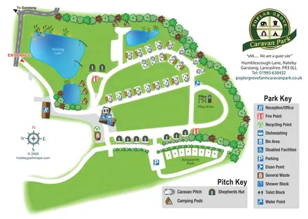
Illustrated touring and glamping park map with fishing lake, named huts and separate visitor keys.
 Explore the map ↗
United Kingdom
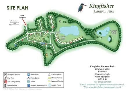
Tree-framed accommodation, lakeside homes and a woodland trail on Kingfisher Caravan Park's illustrated site plan.
 Explore the map ↗
United Kingdom
Woodland park map with mixed pitches, bell tents, lodges and a fishing lake.
Features may come from the sample artwork, its key or published park information. Approximate numbers describe the drawing and may cover only part of a park. They are intended to help you compare map examples. Current facilities and booking information should be checked with the park.
LET’S MAP YOUR PARK
For a map quotation, find your park and draw a rough boundary around it. The area you select helps us work out the design time and price.
Draw your park for a quote ↗Or talk to our map designers
01751 473136