
Wooded boundaries and planted divisions
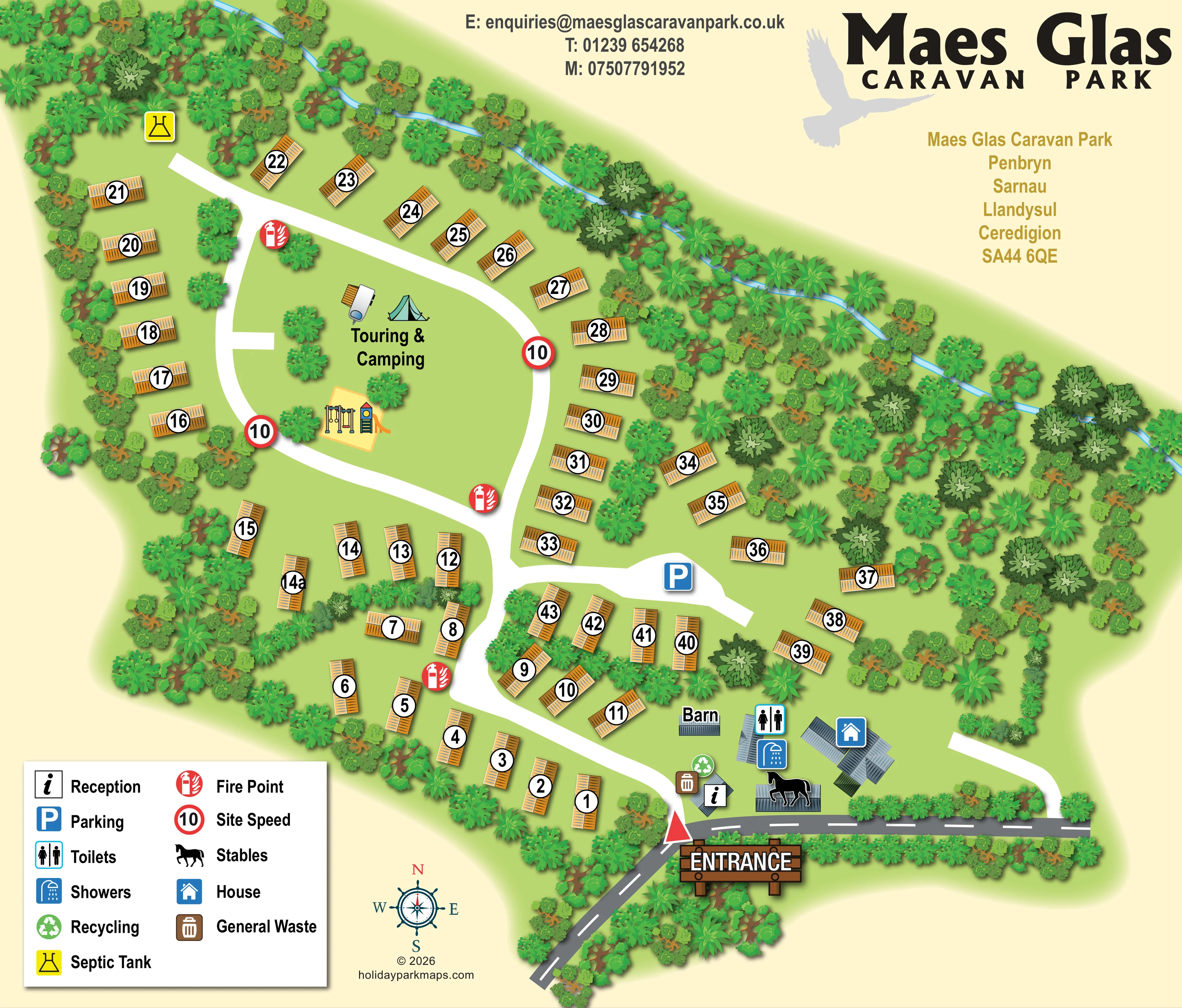
Dense illustrated trees wrap around much of the park, with additional planted strips separating caravan groups.
ILLUSTRATED PARK MAP · P203
Penbryn, Sarnau, Llandysul, Ceredigion · United Kingdom
 Enlarge the map ↗
A SENSE OF THE PLACE
Maes Glas Caravan Park is a small family-run holiday park near Penbryn in Ceredigion. The west Wales coast and Penbryn's beach are central to its location.
The map gives an overview of the caravan layout and routes around the park. It provides a useful starting point for understanding this coastal holiday base near Sarnau and Llandysul.
LOOK CLOSER
Dense illustrated trees wrap around much of the park, with additional planted strips separating caravan groups.
An unlabelled narrow blue watercourse runs through the trees along the northern and eastern edge.
An open green area enclosed by the road loop accommodates the named touring and camping area and illustrated playground.
Prominent wooden-style ENTRANCE sign and red triangular marker beside the southern road junction.
Broad white internal routes lead from the entrance, circle the central lawn and branch towards caravan groups and parking.
Information symbol on a small building immediately inside the entrance.
Blue P symbol marks a widened internal-road area east of the main loop.
Separate toilet and shower symbols identify the entrance-side amenity building.
Prominent wooden-style ENTRANCE sign and red triangular marker beside the southern road junction.
Broad white internal routes lead from the entrance, circle the central lawn and branch towards caravan groups and parking.
Information symbol on a small building immediately inside the entrance.
Blue P symbol marks a widened internal-road area east of the main loop.
Separate toilet and shower symbols identify the entrance-side amenity building.
Green recycling and brown general-waste symbols are grouped beside reception.
Repeated red extinguisher symbols appear at several points beside the internal roads.
Red-ringed 10 symbols appear on the central loop and are identified as Site Speed in the legend.
An illustrated swing frame, play tower and slide sit on a pale yellow pad within the central lawn.
A horse silhouette identifies a building beside the entrance-side amenities; no riding service is specified.
A blue house symbol marks the larger, multi-roof building east of the amenity block.
A small roofed structure north-west of the entrance facilities is labelled Barn; no accommodation use is stated.
Yellow symbol marks a septic tank near the north-western wooded edge.
Dense illustrated trees wrap around much of the park, with additional planted strips separating caravan groups.
An unlabelled narrow blue watercourse runs through the trees along the northern and eastern edge.
An open green area enclosed by the road loop accommodates the named touring and camping area and illustrated playground.
READING THE MAP
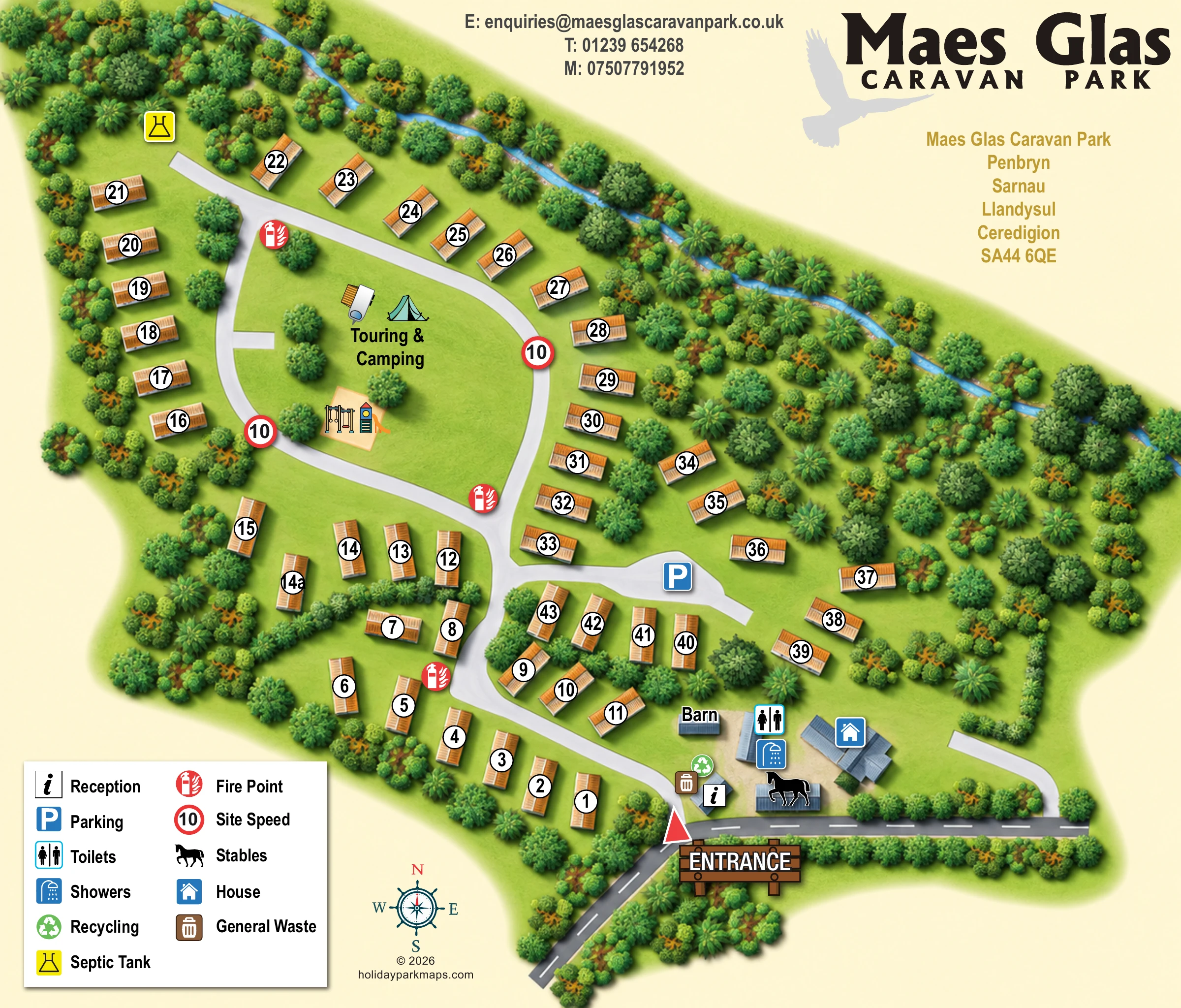
This illustrated map presents Maes Glas Caravan Park at Penbryn in Ceredigion as a compact, tree-framed holiday base near the west Wales coast. A broad white road loop gives the plan its organising shape, enclosing a green area labelled Touring & Camping while numbered caravan symbols follow the surrounding roads and wooded edges. Smaller accommodation groups sit closer to the entrance, separated by planted strips that help the layout read as distinct pockets rather than one continuous row.
The map combines practical arrival information with a recognisable picture of the park. Reception, toilets, showers, recycling and general waste are grouped near the southern entrance, alongside a house, stables and a labelled barn. A playground illustration provides another clear landmark within the central lawn. Dense green tree canopies and a narrow blue boundary watercourse establish the landscape character without obscuring the main routes.
On the page, a large Maes Glas wordmark and flying-bird silhouette balance the site illustration, while a boxed legend and compass support everyday visitor orientation.
The single-page plan is arranged around a southern entrance, marked by a timber-style sign and a red triangle beside the grey approach road. Immediately inside, a compact group of grey-roofed buildings carries symbols for reception, toilets, showers, stables and a house. Recycling and general waste are marked beside reception, and a nearby small structure is labelled Barn. These entrance-side landmarks establish a clear starting point before the internal routes extend into the accommodation.
White roads form a large loop around the central Touring & Camping lawn. A caravan and tent illustration identify the area's use without defining individual pitches. Towards the lower part of this lawn, a colourful playground drawing shows swings, a tower and slide on a pale yellow surface. Red fire-point symbols and red-ringed site-speed markers are positioned beside the roads.
Roughly 45 static caravan symbols occupy the surrounding park. They follow the western boundary, curve across the northern side and continue down the eastern edge of the loop. Further groups sit south of the loop and around an eastern parking branch. Each caravan carries a prominent circular number, while planted strips help distinguish neighbouring groups.
The landscape is unusually prominent: overlapping tree canopies enclose much of the site, and a thin blue watercourse follows the northern and eastern wooded margin. A yellow septic-tank symbol appears near the north-western edge. Outside the plan, the upper-right branding area contains the park name, bird silhouette and address. The lower-left legend explains the facility symbols, with a compass and designer credit nearby. The enlarged views show details of this same composition rather than separate map variants.
 Enlarge this map ↗
KEEP EXPLORING
Chosen for shared landscapes, accommodation or facilities.
 Explore the map ↗
United Kingdom
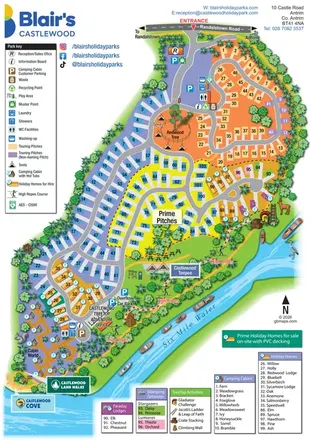
A colourful riverside park map combining touring pitches, holiday accommodation and treetop adventures.
 Explore the map ↗
United Kingdom
Woodland holiday homes, named camping fields and farm buildings on a colour-coded Nether Wasdale park map.
 Explore the map ↗
United Kingdom
Illustrated caravan park plan with woodland and riverside walks, fishing pools and wildlife panels.
Features may come from the sample artwork, its key or published park information. Approximate numbers describe the drawing and may cover only part of a park. They are intended to help you compare map examples. Current facilities and booking information should be checked with the park.
LET’S MAP YOUR PARK
For a map quotation, find your park and draw a rough boundary around it. The area you select helps us work out the design time and price.
Draw your park for a quote ↗Or talk to our map designers
01751 473136