
Tree-lined boundaries and pitch compartments
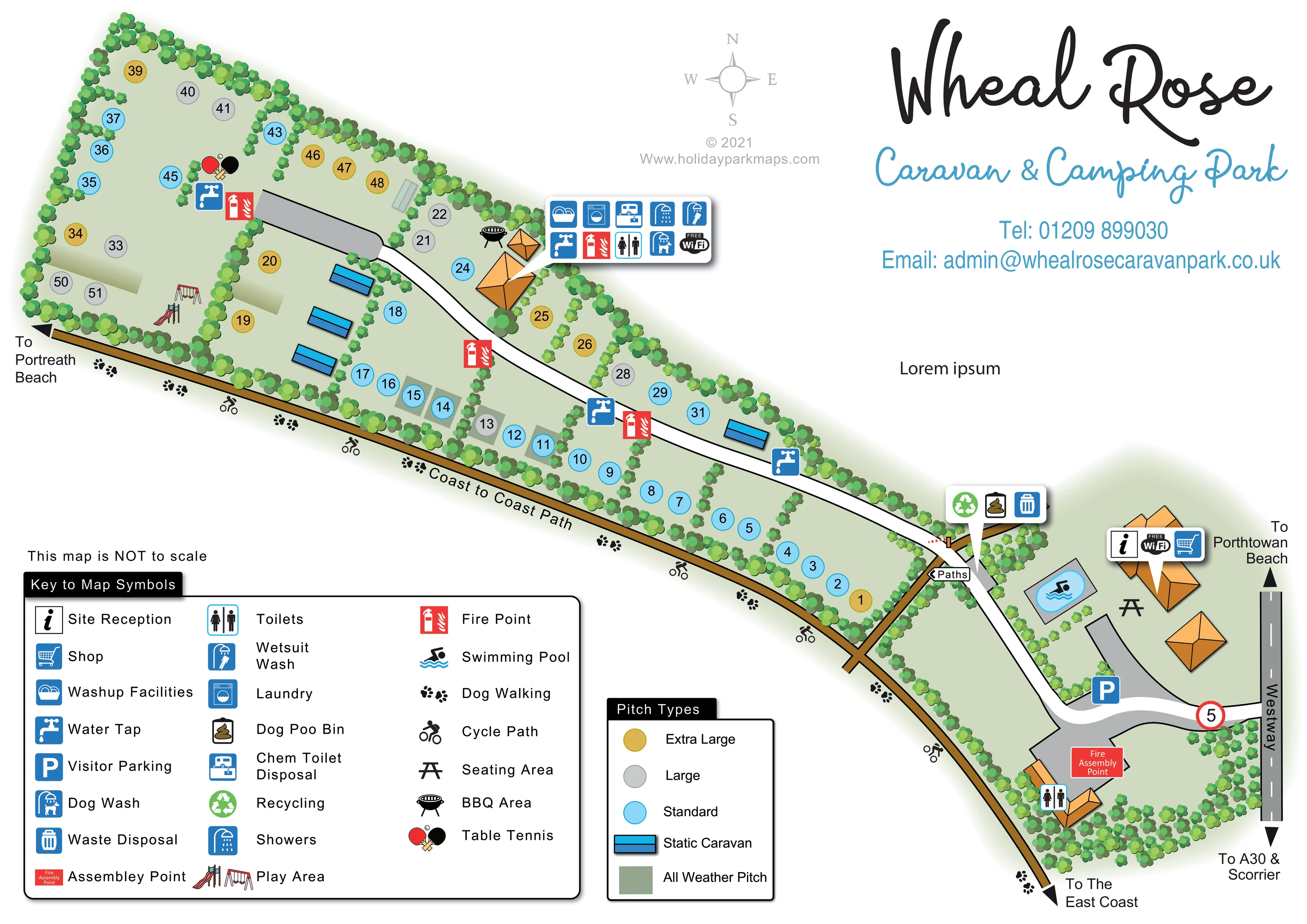
Dense rows of stylised trees enclose the site and divide its long grassy strip into smaller pitch groups.
ILLUSTRATED PARK MAP · P643
Wheal Rose, Scorrier, Redruth, Cornwall · United Kingdom
 Enlarge the map ↗
A SENSE OF THE PLACE
This map records Wheal Rose Caravan and Camping Park at Scorrier near Redruth in Cornwall. The archived visitor listing describes a family-run site in a small valley with access to the coast-to-coast walking and cycling route.
The artwork remains an example of campsite mapping, showing the layout of pitches and visitor facilities. It is presented as a historical map example, as the available directory record no longer describes the site as accepting camping stays.
LOOK CLOSER
Dense rows of stylised trees enclose the site and divide its long grassy strip into smaller pitch groups.
An information and shopping callout identifies the orange-roofed building near the entrance and swimming pool.
Free Wi-Fi badges appear in the reception and main service-building callouts; these do not establish a coverage area.
A blue parking marker sits beside the entrance drive and reception-side buildings.
A small blue pool within a grey surround is illustrated beside reception.
The central service-building callout includes toilets and showers. A separate toilet marker appears by the entrance-side building; the central callout also contains an accessible-toilet pictogram.
Both facilities are identified in the callout attached to the orange-roofed service buildings beside the middle of the pitch area.
A dedicated wetsuit-wash symbol appears in the central facilities callout.
An information and shopping callout identifies the orange-roofed building near the entrance and swimming pool.
Free Wi-Fi badges appear in the reception and main service-building callouts; these do not establish a coverage area.
A blue parking marker sits beside the entrance drive and reception-side buildings.
A small blue pool within a grey surround is illustrated beside reception.
The central service-building callout includes toilets and showers. A separate toilet marker appears by the entrance-side building; the central callout also contains an accessible-toilet pictogram.
Both facilities are identified in the callout attached to the orange-roofed service buildings beside the middle of the pitch area.
A dedicated wetsuit-wash symbol appears in the central facilities callout.
A dog-wash symbol is included in the central facilities callout.
Chemical toilet disposal is identified at the central service area.
Blue tap markers are distributed along the pitch area, including the far end and positions beside the main lane.
A grouped callout near the entrance-side path junction identifies recycling, general waste disposal and a dog waste bin.
Red fire-point symbols recur through the pitch area. A labelled fire assembly point is shown near the entrance-side toilet building.
A slide and swings mark a play area in the broad, far-left section of the park.
A bat-and-ball illustration marks table tennis near the far end of the internal lane.
A barbecue illustration sits beside the central service buildings.
A picnic-table symbol identifies seating between the pool and reception-side buildings.
A labelled ochre route follows the long lower boundary. Bicycle and paw-print symbols identify cycling and dog walking, with arrows towards Portreath Beach and the east coast.
An ochre path branches from the boundary route towards the entrance-side lane and is labelled 'Paths'.
Westway runs down the right-hand side, with directional arrows towards Porthtowan Beach and the A30 and Scorrier. A curved drive connects it to the park.
Dense rows of stylised trees enclose the site and divide its long grassy strip into smaller pitch groups.
The archived visitor listing describes a family-run site in a small valley near Scorrier.
READING THE MAP
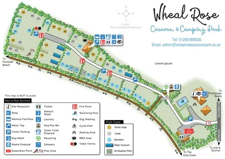
This illustrated map of Wheal Rose Caravan & Camping Park presents a small Cornish campsite as a long, tree-lined strip beside the Coast to Coast Path. Located at Scorrier near Redruth, the park is shown with numbered touring and camping pitches, a handful of static caravans and a compact arrival area reached from Westway. The diagonal composition makes the relationship between the entrance, accommodation and neighbouring walking and cycling route especially clear.
Colour-coded pitch markers distinguish standard, large and extra-large spaces, while shaded rectangles identify all-weather pitches. Visitor facilities range from reception, a shop and swimming pool near the entrance to a central service area with showers, laundry, wash-up facilities and specialist wash points for dogs and wetsuits. A play area, table tennis and barbecue symbol add useful recreational landmarks.
Presented as a historical mapping example, the artwork combines practical campsite information with a distinctive graphic identity: orange-roofed buildings, layered green planting, blue service icons and a generous handwritten-style title. It is a useful sample for parks needing to explain varied pitches and facilities within an elongated site.
The plan runs diagonally across the page, widening towards the upper-left and narrowing into an entrance area at the lower-right. Westway forms the right-hand approach, with arrows towards Porthtowan Beach and the A30 and Scorrier. A curved grey arrival drive leads past visitor parking, reception-side buildings and the swimming pool before becoming the white internal lane through the accommodation area.
Numbered pitches sit in small groups on either side of this lane. Blue, grey and gold circles identify standard, large and extra-large pitches, while muted green rectangular backgrounds distinguish all-weather surfaces. Blue static-caravan illustrations are concentrated around the middle-left, with another beside the lane farther towards the entrance. Rows of clustered tree symbols enclose the boundary and separate pitch compartments, giving structure to the otherwise simple grassy plan.
The central orange-roofed service buildings have a grouped callout for wash-up facilities, laundry, chemical toilet disposal, showers, toilets, dog wash, wetsuit wash, water and Wi-Fi. Elsewhere, repeated tap and fire-point symbols identify distributed services. Recycling, waste disposal and a dog waste bin share a callout near the path junction. The entrance area includes seating and a labelled fire assembly point, while the wider far end contains a play area and table tennis; a barbecue is shown near the central buildings.
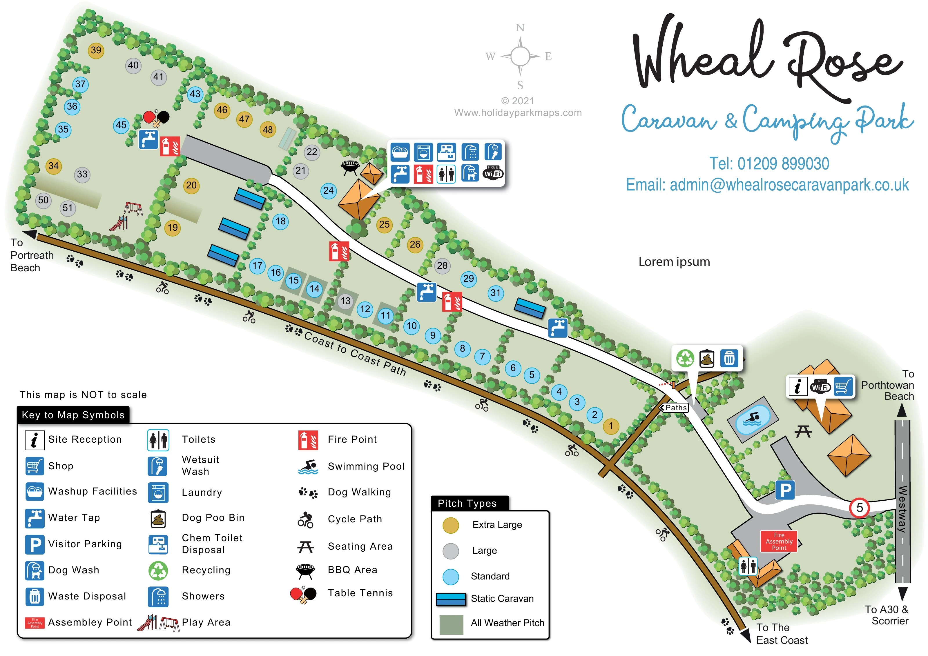
The ochre Coast to Coast Path follows the lower edge, accompanied by cycling and dog-walking symbols and outward destination arrows. A short connecting path links it towards the park lane. Large facility and pitch-type keys occupy the bottom-left, balancing the script title and contact block above the entrance. The accompanying enlarged image shows the same artwork’s legend in greater detail, rather than a separate park section.
KEEP EXPLORING
Chosen for shared landscapes, accommodation or facilities.
 Explore the map ↗
United Kingdom
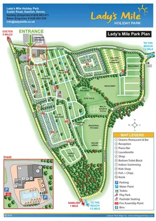
Portrait park plan with named fields, numbered accommodation, beach directions and an enlarged leisure-complex inset.
 Explore the map ↗
United Kingdom
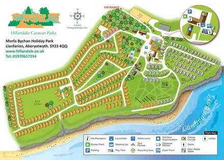
Coastal park plan with mixed accommodation, bird-themed pitch areas and an enlarged facilities inset.
 Explore the map ↗
United Kingdom
Trevornick’s colour-coded park map, with mixed accommodation, fishing ponds, golf and wooded trails.
Features may come from the sample artwork, its key or published park information. Approximate numbers describe the drawing and may cover only part of a park. They are intended to help you compare map examples. Current facilities and booking information should be checked with the park.
TAKE A CLOSER LOOK
View the illustrated map in detail or choose a file to download. These are sample maps; contact the park for current visitor information.


LET’S MAP YOUR PARK
For a map quotation, find your park and draw a rough boundary around it. The area you select helps us work out the design time and price.
Draw your park for a quote ↗Or talk to our map designers
01751 473136
 whealrose_large.png