
Beach and sea
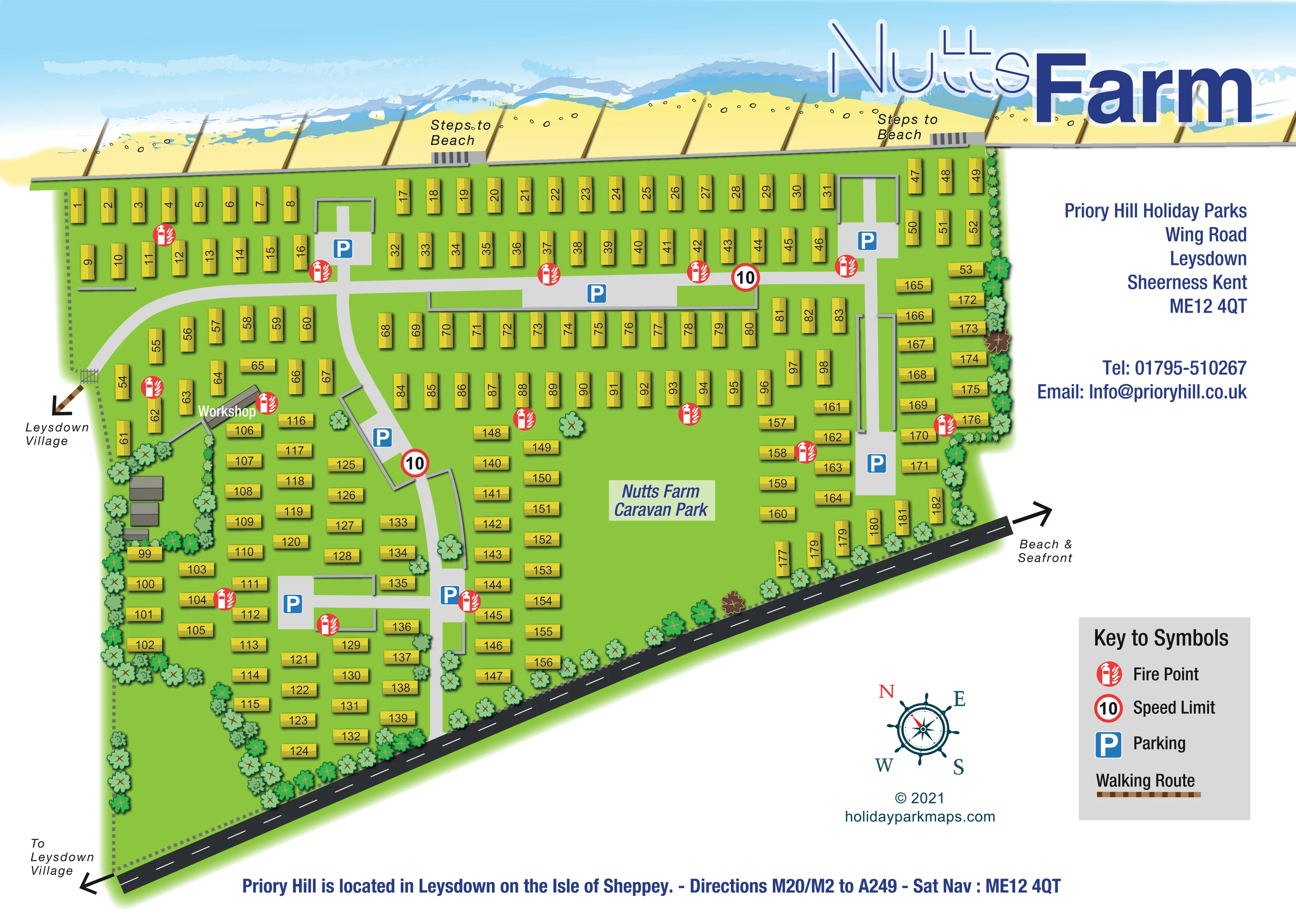
A continuous sandy shoreline and blue sea with white surf occupy the upper edge, establishing the park's coastal setting.
ILLUSTRATED PARK MAP · P553
Wing Road, Leysdown, Kent · United Kingdom
 Enlarge the map ↗
A SENSE OF THE PLACE
Nutts Farm is part of a pair of family-run coastal holiday parks at Leysdown on the Isle of Sheppey. Touring provision complements the neighbouring parks' holiday home ownership.
The seafront and Leysdown's coastal park are close to the touring area. The map provides an overview of Nutts Farm's layout, helping visitors distinguish it from the adjoining Priory Hill site.
LOOK CLOSER
A continuous sandy shoreline and blue sea with white surf occupy the upper edge, establishing the park's coastal setting.
Repeated brown structures cross the sand towards the sea, giving the shoreline a recognisable groyne pattern.
Stylised trees and shrubs line much of the perimeter, surround the workshop-side buildings and punctuate the accommodation areas.
Two labelled sets of steps interrupt the grey boundary along the beach-facing edge.
Blue P symbols identify parking in several grey courts and widened sections of the internal road network.
Red circular extinguisher symbols are distributed throughout the accommodation groups and explained in the key.
Two red-ringed signs marked 10 appear on internal roads; the legend identifies the symbol as Speed Limit.
A grey building labelled Workshop sits towards the left of the plan, beside a planted enclosure containing other unlabelled buildings.
A continuous sandy shoreline and blue sea with white surf occupy the upper edge, establishing the park's coastal setting.
Two labelled sets of steps interrupt the grey boundary along the beach-facing edge.
Repeated brown structures cross the sand towards the sea, giving the shoreline a recognisable groyne pattern.
Blue P symbols identify parking in several grey courts and widened sections of the internal road network.
Red circular extinguisher symbols are distributed throughout the accommodation groups and explained in the key.
Two red-ringed signs marked 10 appear on internal roads; the legend identifies the symbol as Speed Limit.
A grey building labelled Workshop sits towards the left of the plan, beside a planted enclosure containing other unlabelled buildings.
A short brown patterned walking-route arrow leads from a gate on the left boundary towards Leysdown Village.
The dark diagonal road along the lower boundary has directional arrows to Leysdown Village at the left and Beach & Seafront at the right.
Light-grey branching roads connect the accommodation rows and parking courts, with two branches visibly meeting the lower boundary road.
Stylised trees and shrubs line much of the perimeter, surround the workshop-side buildings and punctuate the accommodation areas.
READING THE MAP
This map of Nutts Farm Caravan Park in Leysdown, on Kent's Isle of Sheppey, combines a numbered accommodation plan with a strongly illustrated seaside setting. A band of pale sand, beach groynes and blue-and-white surf stretches across the top of the page, making the coastal relationship immediately apparent. Two labelled sets of beach steps connect that shoreline with the park below.
The accommodation is drawn as yellow caravan-style units on bright green ground. Regular rows near the beach give way to shorter, staggered groups around the branching internal roads. Parking areas, fire points and the workshop provide useful landmarks, while arrows point towards Leysdown Village and the beach and seafront.
The page also accommodates Priory Hill Holiday Parks contact information, a compact symbol key and a nautical compass without placing them over the accommodation plan. For a designer's gallery, this is a useful example of a medium-sized coastal caravan map: detailed enough to help visitors locate individual units, but with a simple graphic hierarchy that keeps routes, destinations and the seaside character easy to recognise.
The single-page artwork shows Nutts Farm as an irregular wedge between a beach-facing boundary at the top and a diagonal external road below. Roughly 180 yellow caravan-style units occupy the green site, each carrying a black number. The upper half uses long, parallel rows, while the lower half breaks into shorter columns and rotated groups that follow the roads and tapering boundaries.
A light-grey cross-site road links the accommodation near the beach. Curving and straight branches extend towards the lower road, with parking courts set into several parts of the plan. Blue P symbols make these courts easy to pick out. Red fire-point symbols recur across the site, and two red-ringed signs marked 10 are explained by the speed-limit entry in the key. Towards the left, the labelled workshop and a small group of grey buildings sit within a planted enclosure.
The coastal strip is more illustrative than the accommodation plan. Layered waves, white surf, pebble marks and brown groynes give the beach a distinctive appearance. Two labelled stairways break the grey shoreline boundary. A gate and short brown walking-route arrow on the left point towards Leysdown Village; arrows at the ends of the dark lower road indicate the village in one direction and the beach and seafront in the other.
Trees and shrubs frame the perimeter and soften selected spaces between units. The right-hand white area contains contact branding, a grey symbol panel and a nautical compass. The oversized Nutts Farm title sits over the sea illustration, while regional directions run along the bottom. The enlarged views show overlapping portions of this same plan, rather than separate park sections or additional map variants.
KEEP EXPLORING
Chosen for shared landscapes, accommodation or facilities.
 Explore the map ↗
United Kingdom
Coastal park map with static-caravan rows, touring pitches, a camping field and two leisure clusters.
 Explore the map ↗
United Kingdom
Coastal park plan with colour-coded pitches, named neighbourhoods and a Morecambe Bay walking route.
 Explore the map ↗
United Kingdom
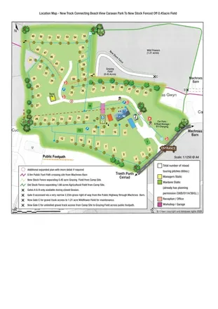
Illustrated touring-park plan with facilities, public footpaths and adjoining field-access details.
Features may come from the sample artwork, its key or published park information. Approximate numbers describe the drawing and may cover only part of a park. They are intended to help you compare map examples. Current facilities and booking information should be checked with the park.
LET’S MAP YOUR PARK
For a map quotation, find your park and draw a rough boundary around it. The area you select helps us work out the design time and price.
Draw your park for a quote ↗Or talk to our map designers
01751 473136