
Tree-lined boundaries and planted divisions
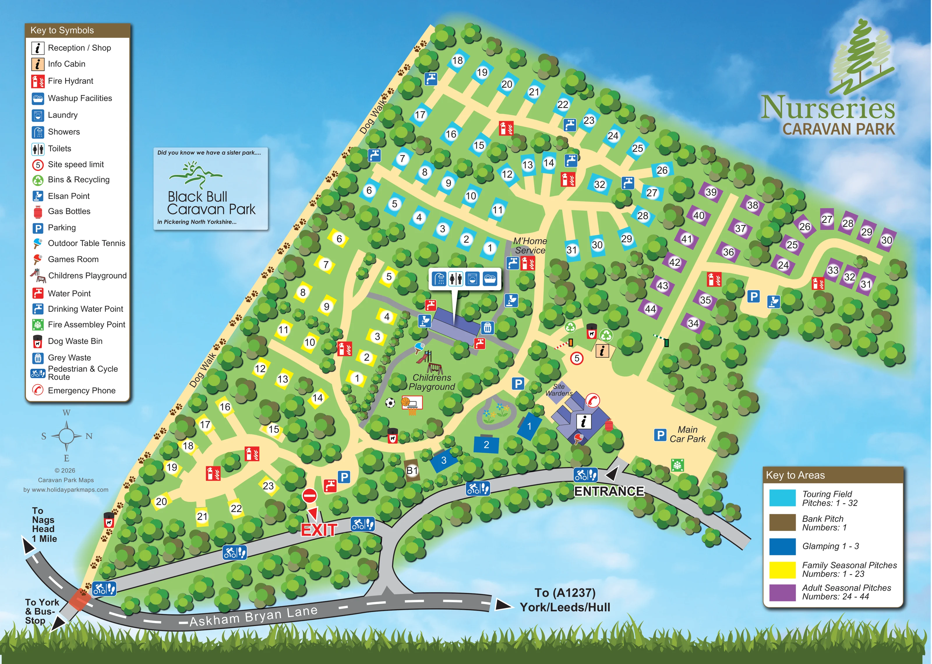
Dense stylised trees frame the park and separate pitch groups, with smaller hedge-like planting around individual areas.
ILLUSTRATED PARK MAP · P231
Askham Bryan Lane, Askham Bryan, York, North Yorkshire · United Kingdom
 Enlarge the map ↗
A SENSE OF THE PLACE
Nurseries Caravan Park is a family-run touring and glamping site near Askham Bryan and York. Short-stay and seasonal touring pitches sit alongside pods and converted horsebox accommodation.
Electric touring connections and a games room provide on-site conveniences. The countryside setting offers a quieter base close to York, and the map helps visitors compare the different accommodation areas.
LOOK CLOSER
Dense stylised trees frame the park and separate pitch groups, with smaller hedge-like planting around individual areas.
A small oval planted feature with coloured flowers sits between the glamping group, playground and reception.
An information symbol identifies the main purple-roofed building beside the entrance and main car park.
A peach information-cabin symbol is positioned at the central arrival junction.
The site wardens label appears beside the small buildings immediately above reception.
A grouped symbol panel identifies these facilities at the central purple-roofed service building between the seasonal and touring areas.
A labelled motorhome service area lies beside the central touring-field approach, with nearby service symbols.
Disposal symbols appear around the central facilities and motorhome service area.
An information symbol identifies the main purple-roofed building beside the entrance and main car park.
A peach information-cabin symbol is positioned at the central arrival junction.
The site wardens label appears beside the small buildings immediately above reception.
A grouped symbol panel identifies these facilities at the central purple-roofed service building between the seasonal and touring areas.
A labelled motorhome service area lies beside the central touring-field approach, with nearby service symbols.
Disposal symbols appear around the central facilities and motorhome service area.
Red water-point and blue drinking-water symbols are distributed across the pitch sections and service areas.
Green recycling symbols mark collection points near the central arrival area.
A red gas-bottle symbol appears beside the reception building.
The main car park occupies the entrance-side clearing, with further blue parking symbols near facilities and within the pitch sections.
A central green recreation area contains illustrated play equipment, a football and a basketball hoop.
A table-tennis symbol appears beside the playground and central facilities.
The games-room paddle symbol is placed on the reception-side building.
A pale path marked with repeated pawprints follows the long left-hand boundary, with Dog Walk labels and dog-waste bins.
Repeated blue walking-and-cycling symbols identify the frontage route between the road-side connection, exit and entrance.
Large arrows distinguish the entrance near reception from the exit farther left along the frontage route.
Road arrows point towards York and a bus stop, the Nags Head, and the A1237 for York, Leeds and Hull.
Dense stylised trees frame the park and separate pitch groups, with smaller hedge-like planting around individual areas.
A small oval planted feature with coloured flowers sits between the glamping group, playground and reception.
Red symbols keyed as fire hydrants appear throughout the accommodation areas; a green assembly-point symbol is shown beside the main car park.
A red telephone symbol is placed beside the reception and wardens' building group.
A circular 5 speed-limit symbol appears at the central arrival junction.
A separate promotional panel names a sister park in Pickering, North Yorkshire; it does not depict facilities at Nurseries.
READING THE MAP
This illustrated map of Nurseries Caravan Park near Askham Bryan, York, brings touring, seasonal and glamping accommodation together in one colour-coded plan. A tree-lined footprint sits against a clouded blue background, with cream internal lanes connecting the accommodation areas to a central cluster of visitor facilities. Cyan touring pitches occupy the upper section, yellow family seasonal pitches run down the left, and purple adult seasonal pitches extend into the right-hand wing. Three dark-blue glamping positions sit close to reception and the arrival garden.
The map gives particular attention to everyday navigation. Separate entrance and exit labels connect the site to Askham Bryan Lane, while parking, the facilities block, motorhome servicing and the children's playground are easy to locate. A pawprint-marked dog walk follows the boundary, and walking-and-cycling symbols identify the frontage route. Two distinct keys explain the service symbols and accommodation colours, making this a useful example of a park map designed to distinguish different pitch uses without losing the overall shape of the site.
The single-page artwork presents the park as a branching green footprint, framed by dense clusters of stylised trees. Its upper wedge contains the cyan touring field, where numbered pitch rectangles follow a network of cream lanes. The yellow family seasonal section occupies the left-hand side, with curved lanes and smaller planted divisions. A purple adult seasonal section stretches across the right-hand wing. Near the lower centre, three dark-blue glamping positions and a brown bank-pitch marker sit close to reception and a small ornamental garden.
Arrival is explained along the bottom of the plan. Askham Bryan Lane is drawn as a grey road with dashed white markings, with arrows towards York, a bus stop, the Nags Head and the A1237. A separate frontage route links the clearly labelled entrance and exit. Blue walking-and-cycling symbols repeat along this route, while the long left boundary carries a pawprint dog walk.
The central service building is identified by a grouped panel for showers, toilets, laundry and washing-up facilities. Nearby are motorhome servicing, disposal points and water facilities. Reception, the shop, games room, information cabin, wardens and main car park form the arrival-side cluster. The playground is shown with play equipment and ball-game illustrations, with outdoor table tennis alongside. Water, fire, parking and waste symbols are distributed through the plan.
The upper-left symbol key and lower-right area key keep facilities separate from accommodation categories. Park branding fills the upper-right space, and a smaller panel promotes the sister park in Pickering. The accompanying enlargements show portions of this same artwork, including frontage directions and the area key, rather than additional park sections.
KEEP EXPLORING
Chosen for shared landscapes, accommodation or facilities.
 Explore the map ↗
United Kingdom
Woodland-framed Barnsoul map with mixed accommodation, shared facilities and paw-marked walking routes.
 Explore the map ↗
United Kingdom
Riverside park map with named pitch fields, illustrated huts and a paw-print dog walk.
 Explore the map ↗
United Kingdom
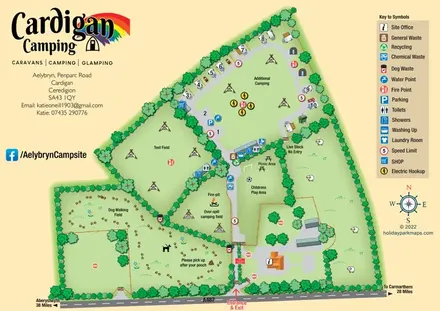
Illustrated farm-campsite map with mixed accommodation, named camping fields and a dedicated dog-walking area.
Features may come from the sample artwork, its key or published park information. Approximate numbers describe the drawing and may cover only part of a park. They are intended to help you compare map examples. Current facilities and booking information should be checked with the park.
TAKE A CLOSER LOOK
View the illustrated map in detail or choose a file to download. These are sample maps; contact the park for current visitor information.

LET’S MAP YOUR PARK
For a map quotation, find your park and draw a rough boundary around it. The area you select helps us work out the design time and price.
Draw your park for a quote ↗Or talk to our map designers
01751 473136
 nurseries_Page_2.png