
Dog walking area
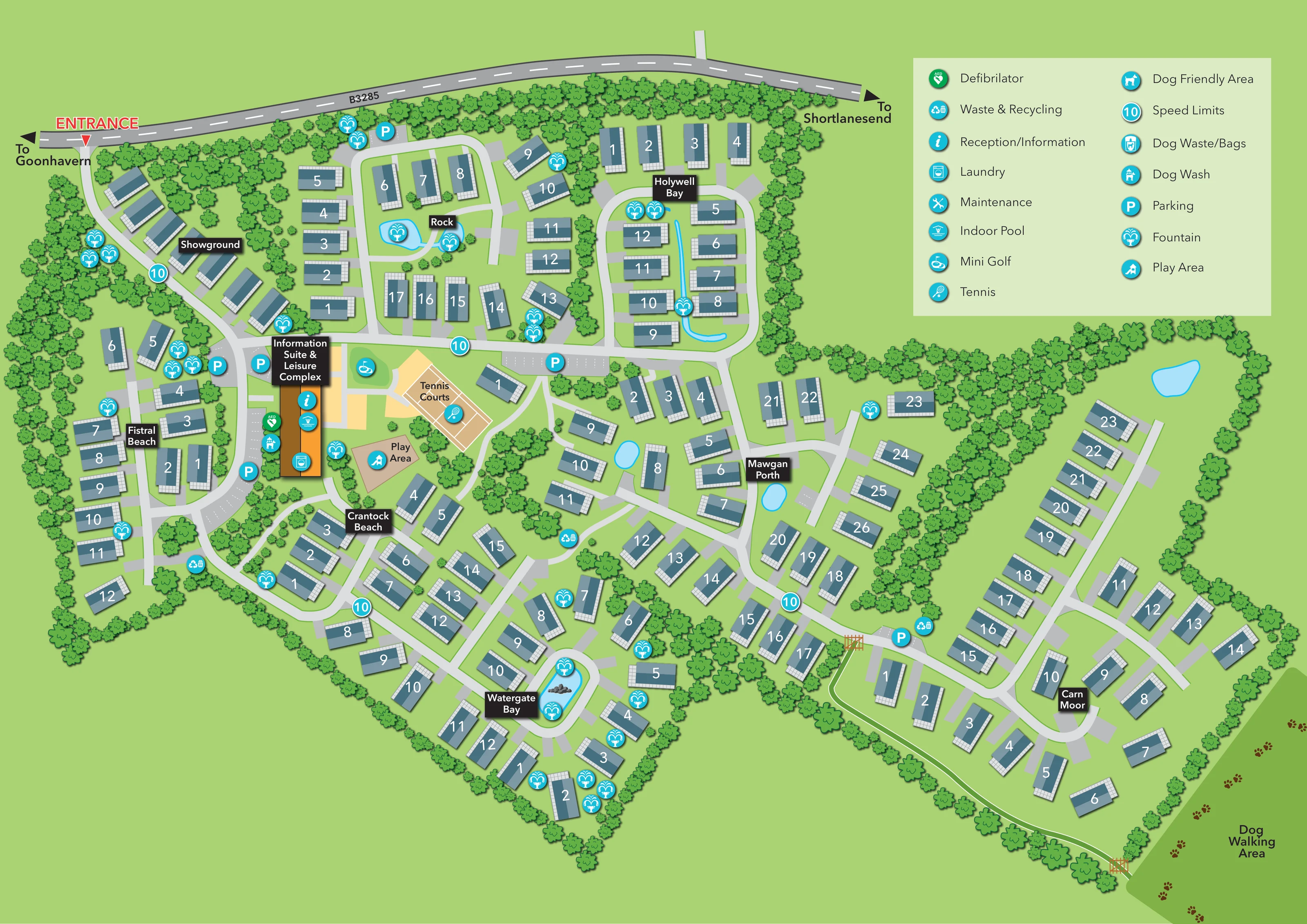
Separate green area outside the lower-right accommodation boundary, labelled Dog Walking Area and illustrated with brown paw prints.
ILLUSTRATED PARK MAP · P561
Goonhavern, Cornwall · United Kingdom
 Enlarge the map ↗
A SENSE OF THE PLACE
Oyster Bay Coastal & Country Retreat is based at Goonhavern, Cornwall. The operator places Perranporth Beach about three miles away. This is an owners-only holiday-home park advertising a 12-month season.
Tennis, putting, children's play and instructed coastal activities are advertised; availability or charges can vary. Facilities include an indoor pool, steam room and owners' lounge with Wi-Fi. On-site dog walking and a dog wash station are listed.
LOOK CLOSER
Separate green area outside the lower-right accommodation boundary, labelled Dog Walking Area and illustrated with brown paw prints.
Numerous fountain markers accompany landscaped areas. Blue water shapes include a pond at Rock, a narrow curved feature at Holywell Bay and a rock-centred pool within the Watergate Bay road loop.
Dense stylised tree belts define the perimeter and divide the accommodation into distinct neighbourhoods, with smaller trees scattered around homes and facilities.
Prominent orange-and-brown building near the western arrival junction, carrying reception/information, indoor pool and laundry symbols.
Pool symbol positioned on the Information Suite & Leisure Complex.
Laundry symbol placed towards the lower end of the leisure building.
Green AED marker beside the leisure complex, visually distinct from the turquoise facility symbols.
Labelled tan court area with white court markings immediately east of the leisure complex.
Prominent orange-and-brown building near the western arrival junction, carrying reception/information, indoor pool and laundry symbols.
Pool symbol positioned on the Information Suite & Leisure Complex.
Laundry symbol placed towards the lower end of the leisure building.
Green AED marker beside the leisure complex, visually distinct from the turquoise facility symbols.
Labelled tan court area with white court markings immediately east of the leisure complex.
Golf symbol on a small green area between the leisure complex and tennis courts.
Labelled tan play area below the tennis courts, close to the Crantock Beach section.
A row of unnumbered holiday-home illustrations follows the entrance road before the main facilities.
Repeated P markers identify parking beside the leisure complex and at several points along the internal roads; some bays have dashed white divisions.
Grouped waste/recycling symbols appear at several road junctions across the accommodation sections.
Dog-wash symbol beside the western side of the leisure complex.
Dog waste/bag symbols are distributed among the accommodation roads, including the western and southern sections.
Separate green area outside the lower-right accommodation boundary, labelled Dog Walking Area and illustrated with brown paw prints.
A narrow white-edged route follows the lower boundary of Carn Moor, with illustrated gates at its connection to the internal road and at the dog walking area.
Numerous fountain markers accompany landscaped areas. Blue water shapes include a pond at Rock, a narrow curved feature at Holywell Bay and a rock-centred pool within the Watergate Bay road loop.
Dense stylised tree belts define the perimeter and divide the accommodation into distinct neighbourhoods, with smaller trees scattered around homes and facilities.
Red ENTRANCE label and triangular pointer mark access from the road across the top of the plan. Direction arrows point towards Goonhavern and Shortlanesend.
Circular markers showing 10 appear along the internal road network; the legend identifies them as speed limits.
Listed in the legend, without a clearly identifiable corresponding location on the plan.
A dog symbol is included in the key. The separately labelled dog walking area is mapped, but a distinct placement of this particular symbol is not apparent.
READING THE MAP
This illustrated map presents Oyster Bay Coastal & Country Retreat at Goonhavern, Cornwall, as a collection of holiday-home neighbourhoods linked by curving roads and generous planted boundaries. Rather than treating the park as a uniform grid, the design gives each area a recognisable identity through names such as Rock, Holywell Bay, Watergate Bay and Carn Moor, supported by clear white numbers on the homes.
The arrival sequence is particularly easy to follow. A red entrance marker leads from the B3285 past the showground towards the orange Information Suite & Leisure Complex. Nearby tennis courts, mini golf and a children's play area form a compact leisure cluster, while parking and practical service symbols are distributed around the wider plan.
Trees, fountains and pale-blue water features give the map its country-retreat character. At the lower-right edge, a paw-print dog walking area and a separate boundary path add a useful layer of outdoor wayfinding. A large two-column key keeps the many facility symbols understandable without filling the roads with lengthy labels.
The single-page artwork uses an overhead view, with the B3285 running across the upper edge and arrows indicating Goonhavern and Shortlanesend. Entry is marked at the upper left, where an access road passes a line of showground homes before reaching the main facilities. From here, a pale-grey road spine runs eastwards and branches into loops and short streets serving the different accommodation areas.
Rock and Holywell Bay occupy the upper part of the plan. Fistral Beach sits along the western edge, with Crantock Beach and Watergate Bay extending downwards. Mawgan Porth occupies the central-right area, while Carn Moor forms the broad eastern neighbourhood. Each section is identified by a black label with white lettering. The homes share a slate-blue roof treatment, pale gridded edging and short grey aprons, with large white numbers remaining prominent against the darker roofs.
The Information Suite & Leisure Complex is drawn in orange and brown, with symbols for reception, the indoor pool and laundry. A green defibrillator marker and a dog-wash marker sit beside it. Tennis courts, mini golf and the labelled play area are grouped immediately to the east. Parking, waste and recycling, dog waste/bag points and circular speed markers are shown at intervals around the roads.
Dense tree belts separate the sections and frame the perimeter. Water features include a pond at Rock, a slender curved feature through Holywell Bay and a pool with rocks inside the Watergate Bay loop. Beyond Carn Moor, a white-edged boundary path with illustrated gates leads towards the labelled dog walking area. The upper-right legend explains the pictograms; maintenance and Dog Friendly Area also appear as key entries.
KEEP EXPLORING
Chosen for shared landscapes, accommodation or facilities.
 Explore the map ↗
United Kingdom
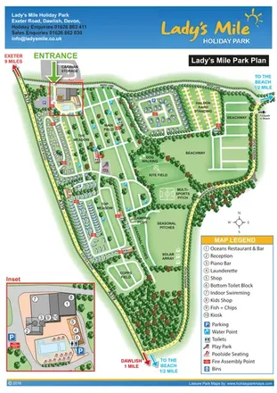
Portrait park plan with named fields, numbered accommodation, beach directions and an enlarged leisure-complex inset.
 Explore the map ↗
United Kingdom
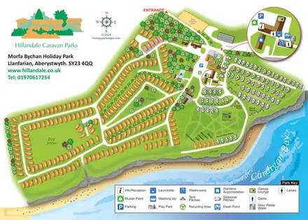
Coastal park plan with mixed accommodation, bird-themed pitch areas and an enlarged facilities inset.
 Explore the map ↗
United Kingdom
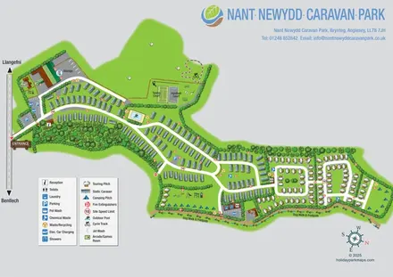
Illustrated Anglesey park map with static caravans, touring loops, camping, sports courts and a perimeter dog walk.
Features may come from the sample artwork, its key or published park information. Approximate numbers describe the drawing and may cover only part of a park. They are intended to help you compare map examples. Current facilities and booking information should be checked with the park.
LET’S MAP YOUR PARK
For a map quotation, find your park and draw a rough boundary around it. The area you select helps us work out the design time and price.
Draw your park for a quote ↗Or talk to our map designers
01751 473136