
Marina
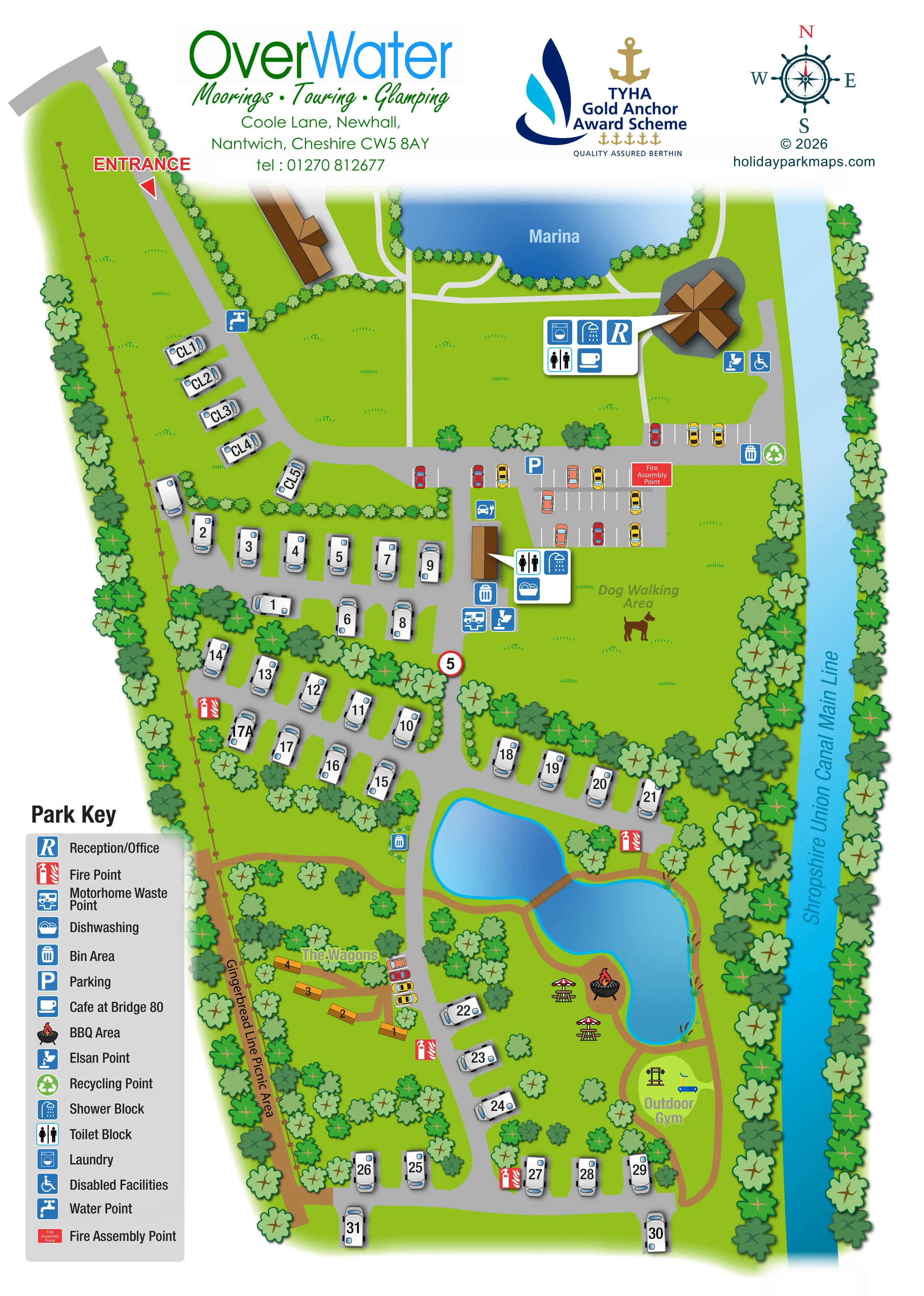
A blue water area labelled ‘Marina’ forms the northern backdrop; individual boats, pontoons and berths are not detailed.
ILLUSTRATED PARK MAP · P237
Coole Lane, Newhall, Nantwich, Cheshire · United Kingdom
 Enlarge the map ↗
A SENSE OF THE PLACE
Overwater Marina combines boating with touring and glamping near Audlem on the Shropshire Union Canal. A club Certificated Location operates alongside a separate serviced touring park.
Glamping wagons offer an alternative stay, with hot tubs on selected options. Privately owned lodges are also advertised for holiday letting. The map helps distinguish the marina, touring spaces and fixed accommodation within the wider site.
LOOK CLOSER
A blue water area labelled ‘Marina’ forms the northern backdrop; individual boats, pontoons and berths are not detailed.
The named canal runs down the eastern edge as a straight blue strip bordered by trees.
Two irregular blue ponds occupy the lower centre, with reeds on the larger southern pond and a small bridge between the waterside paths.
Dense tree belts frame the canal and western boundary; smaller trees and hedges separate pitch groups, buildings and glamping paths.
Located by a multi-wing brown-roofed building between the marina and canal, identified through a facility callout.
The café symbol appears in the reception-building callout; its name is provided in the park key.
Toilet and shower symbols are grouped in callouts for the main reception building and a smaller block beside the touring area.
Laundry is included in the main reception-building facility callout.
Located by a multi-wing brown-roofed building between the marina and canal, identified through a facility callout.
The café symbol appears in the reception-building callout; its name is provided in the park key.
Toilet and shower symbols are grouped in callouts for the main reception building and a smaller block beside the touring area.
Laundry is included in the main reception-building facility callout.
Dishwashing facilities are marked at the smaller touring-area service block.
A wheelchair symbol beside the main building is identified as ‘Disabled Facilities’ in the key.
A water point is marked on the entrance approach. Elsan symbols occur beside the main building and touring service block, with a motorhome waste point at the latter.
Bin symbols are distributed around the plan, with recycling marked beside the northern parking area.
Marked parking bays occupy the central arrival area and the space below the main building; a smaller parking row adjoins The Wagons.
A blue car-and-plug symbol is positioned beside the central parking and touring service block, although it is not explained in the key.
Red fire-point symbols are distributed through the accommodation areas. A labelled fire assembly point sits beside the central parking.
A broad lawn east of the touring service block is labelled ‘Dog Walking Area’ and illustrated with a dog silhouette.
A barbecue illustration and parasol-topped picnic tables sit beside the southern pond.
A named picnic area follows the western boundary beside The Wagons and the southern touring pitches.
A labelled exercise area with equipment illustrations lies south of the ponds, beside the looping footpath.
A blue water area labelled ‘Marina’ forms the northern backdrop; individual boats, pontoons and berths are not detailed.
The named canal runs down the eastern edge as a straight blue strip bordered by trees.
Two irregular blue ponds occupy the lower centre, with reeds on the larger southern pond and a small bridge between the waterside paths.
Dense tree belts frame the canal and western boundary; smaller trees and hedges separate pitch groups, buildings and glamping paths.
A red entrance label and triangular marker identify the north-western approach. Grey roads branch towards parking and continue through successive touring groups.
Brown paths link the western picnic area, wagon cluster, ponds, barbecue area and outdoor gym; a short bridge connects paths between the ponds.
A ship’s-wheel-style compass in the upper-right corner provides north, east, south and west orientation.
READING THE MAP
This illustrated map of Overwater Marina brings together a canal-side touring site, a small glamping enclave and waterside recreation in one portrait-format plan. Set at Newhall near Nantwich in Cheshire, the site is presented between the marina at the top of the artwork and the Shropshire Union Canal running along its eastern edge.
The map shows roughly 40 touring pitches and glamping units in total, with a separately labelled CL group near the entrance and The Wagons tucked into trees farther south. Grey roads make the vehicle layout easy to follow, while brown paths connect the picnic area, two ponds, a footbridge, a barbecue spot and an outdoor gym.
A prominent entrance marker leads visitors towards parking and the main service buildings. Reception, the café, washrooms and practical touring facilities are identified through pictograms and building callouts rather than lengthy labels across the plan. Bright green lawns, layered tree belts and blue water give the artwork a strong landscape identity, while the large park key provides a clear reference for everyday visitor needs.
The plan follows an elongated north–south layout, with the entrance approaching from the upper left and the canal forming a continuous landmark on the right. A small group of CL-labelled touring pitches sits beside the entrance road before it reaches the central parking and service area. Below this, numbered caravan illustrations line short branches and bends in the grey internal road, with planted divisions separating the accommodation into manageable groups.
The main reception building stands near the marina and canal. Its white callout groups reception, café, laundry, toilet and shower symbols. A second, smaller building beside the touring pitches carries a separate callout for toilets, showers and dishwashing. Water, Elsan and motorhome waste points appear elsewhere around the arrival and service areas. Parking, bins, recycling, fire points and a fire assembly point are also marked, alongside a car-and-plug symbol near the central parking.
The lower half changes emphasis from arrival facilities to landscape and recreation. Two blue ponds sit within a network of brown paths, with a small footbridge linking the paths between them. Picnic tables and a barbecue illustration occupy the southern waterside space, and a labelled outdoor gym lies just below. The Wagons form a four-unit glamping cluster west of the ponds, reached by individual path branches from nearby parking. The Gingerbread Line Picnic Area follows the western boundary, while a large dog walking lawn occupies the upper canal-side portion.
The single portrait artwork uses a large branded header and a lower-left legend. Its enlarged detail views show the same plan rather than separate accommodation areas. Oversized pitch labels, grouped facility callouts and distinct road, path and water colours keep the varied site readable without losing its landscaped character.
KEEP EXPLORING
Chosen for shared landscapes, accommodation or facilities.
 Explore the map ↗
United Kingdom
Woodland-framed Barnsoul map with mixed accommodation, shared facilities and paw-marked walking routes.
 Explore the map ↗
United Kingdom
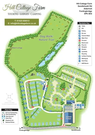
Portrait park map with mixed touring pitches, seasonal rows, ponds and an extensive dog walk.
 Explore the map ↗
United Kingdom
A woodland estate park map combining caravan loops, touring pitches, riverside paths and Bruce’s Cave landmarks.
Features may come from the sample artwork, its key or published park information. Approximate numbers describe the drawing and may cover only part of a park. They are intended to help you compare map examples. Current facilities and booking information should be checked with the park.
TAKE A CLOSER LOOK
View the illustrated map in detail or choose a file to download. These are sample maps; contact the park for current visitor information.


LET’S MAP YOUR PARK
For a map quotation, find your park and draw a rough boundary around it. The area you select helps us work out the design time and price.
Draw your park for a quote ↗Or talk to our map designers
01751 473136
 marinamap_large.png