
Tree belts and hedged plot groups
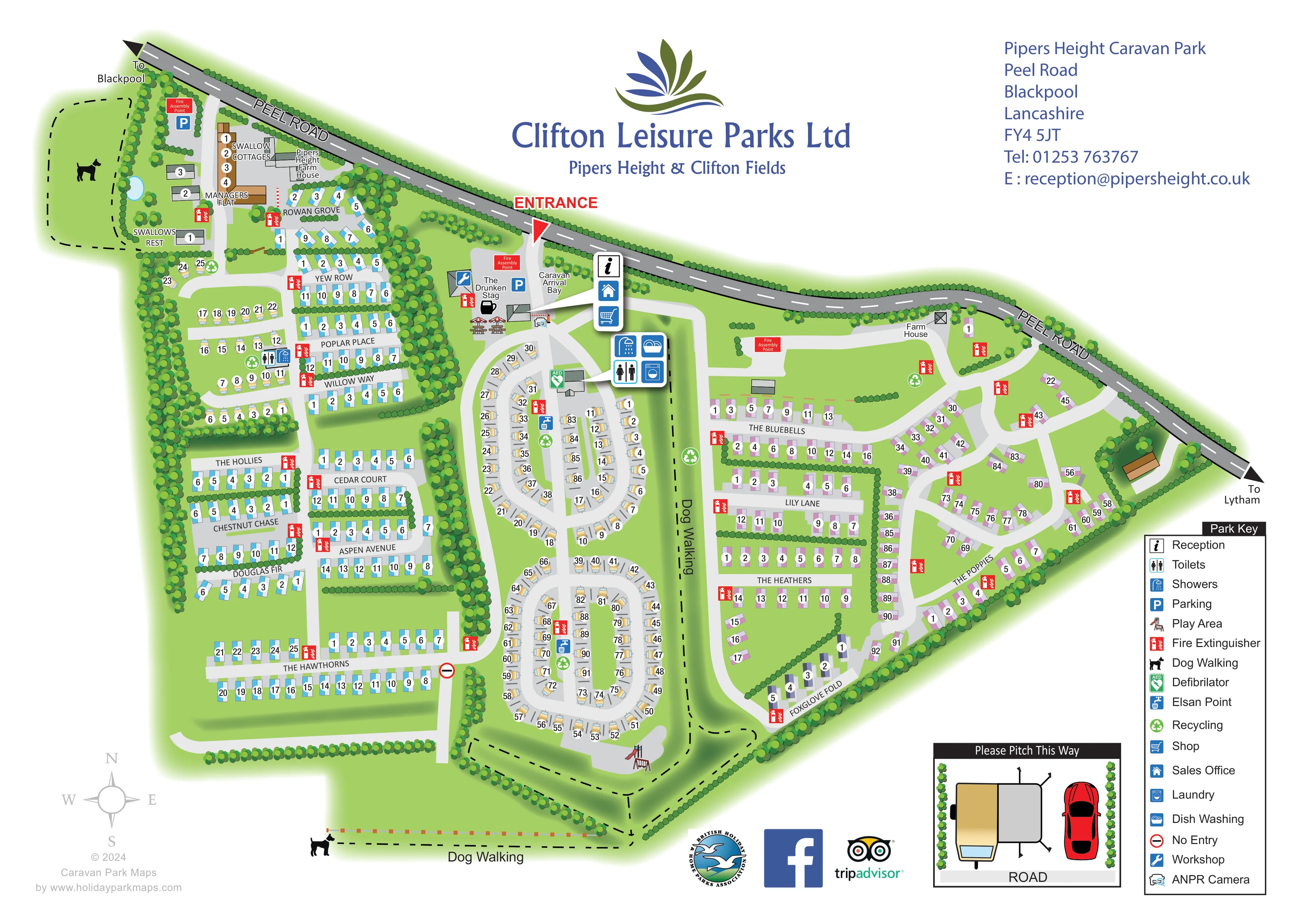
Continuous hedges and rounded tree canopies define the perimeter, separate accommodation rows and frame the touring section.
ILLUSTRATED PARK MAP · P259
Pipers Height Caravan Park, Peel Road, Blackpool, Lancashire · United Kingdom
 Enlarge the map ↗
A SENSE OF THE PLACE
Pipers Height welcomes touring caravans and motorhomes between Blackpool and Lytham St Annes. Nightly and seasonal pitches provide a base for exploring the Fylde Coast.
Serviced pitches have water, electricity and grey-water drainage. A heated amenities block, laundry, shop, Wi-Fi and children's play area support stays, with the map helping visitors locate the touring sections and shared facilities.
LOOK CLOSER
Continuous hedges and rounded tree canopies define the perimeter, separate accommodation rows and frame the touring section.
Broad green strips surround the roads and plots, particularly beside the dog-walking routes and southern boundary.
A small pond-like blue shape appears beside the north-western dog-walking area; it is not named.
A large three-symbol callout locates the reception, sales office and shop cluster close to the entrance.
A four-symbol callout identifies the shared amenities building near the northern end of the touring section. A further toilet and shower symbol pair appears in the western accommodation area.
A named venue beside the entrance is accompanied by a cup symbol and illustrated outdoor picnic tables with parasols.
Illustrated play equipment stands at the southern end of the central touring loops, also shown on the focused variant.
Blue parking symbols appear beside The Drunken Stag and near the north-western boundary.
A large three-symbol callout locates the reception, sales office and shop cluster close to the entrance.
A four-symbol callout identifies the shared amenities building near the northern end of the touring section. A further toilet and shower symbol pair appears in the western accommodation area.
A named venue beside the entrance is accompanied by a cup symbol and illustrated outdoor picnic tables with parasols.
Illustrated play equipment stands at the southern end of the central touring loops, also shown on the focused variant.
Blue parking symbols appear beside The Drunken Stag and near the north-western boundary.
Blue disposal-point symbols are placed within both central touring loops.
Green recycling symbols are distributed through the touring and outer accommodation sections.
Repeated red extinguisher symbols mark locations across the accommodation roads and entrance facilities.
Red labelled assembly-point boxes appear near The Drunken Stag, the north-western parking area and the northern part of the eastern section.
A green AED symbol marks the building beside the touring-area amenities cluster.
A blue spanner symbol identifies a small building beside The Drunken Stag.
The entrance approach includes an illustrated barrier and an ANPR camera symbol.
A labelled arrival bay sits immediately inside the Peel Road entrance.
Peel Road runs across the upper edge of the full plan, with arrows towards Blackpool and Lytham and a prominent red entrance marker.
Light-grey roads connect straight named accommodation lanes, branching eastern roads and two rounded touring loops.
A red-ringed no-entry symbol appears at the eastern end of The Hawthorns on the full plan.
Black dashed routes follow the central and southern green margins, with a separate enclosed dog-walking area at the north-western edge. Dog silhouettes and labels reinforce their purpose.
Continuous hedges and rounded tree canopies define the perimeter, separate accommodation rows and frame the touring section.
Broad green strips surround the roads and plots, particularly beside the dog-walking routes and southern boundary.
A small pond-like blue shape appears beside the north-western dog-walking area; it is not named.
These building labels provide landmarks around the northern boundary. Their labels do not establish public access or guest use.
A boxed 'Please Pitch This Way' diagram shows a caravan and car in relation to the road, making the illustrated arrangement easier to understand.
Published park information describes water, electricity and grey-water drainage at serviced pitches. These individual connections are not mapped.
Published park information describes a heated amenities block and Wi-Fi; heating and wireless coverage are not illustrated.
READING THE MAP
This illustrated map of Pipers Height Caravan Park in Blackpool brings a substantial caravan site into one readable plan. Set below Peel Road, the park is organised into named accommodation lanes on either side of a central touring area. Pale-blue and lilac plot symbols distinguish the outer sections, while small cream-and-gold caravan illustrations make the touring loops immediately recognisable.
The arrival sequence is a strong feature of the design. A red entrance marker leads visitors towards the caravan arrival bay, The Drunken Stag and the reception, shop and sales-office facilities. Larger symbol panels identify these services and the nearby amenities building without crowding the smaller plot labels. Tree belts, hedges and broad green margins explain how the different areas relate to one another, with dashed dog-walking routes following parts of the boundary.
The artwork also includes a separate touring-area version. By concentrating on the two rounded pitch loops and their shared facilities, this companion layout offers a simpler view for visitors who do not need the full park plan. Both versions retain a facility key and a practical caravan-and-car pitching diagram.
The full-park plan follows the irregular Peel Road frontage, with arrows towards Blackpool and Lytham at opposite ends. The main entrance lies near the centre of this frontage, beside a labelled caravan arrival bay, an illustrated barrier and an ANPR camera symbol. The Drunken Stag, outdoor parasol tables, parking and a workshop form a distinctive landmark cluster immediately inside the park.
Accommodation is arranged in three broad areas. To the west, compact parallel rows sit along tree-lined lanes such as Yew Row, Willow Way, Cedar Court, Chestnut Chase and The Hawthorns. To the east, The Bluebells, Lily Lane and The Heathers lead into more loosely curved roads around The Poppies. Between them, touring caravans occupy two adjoining rounded loops, with pitches on both the outer curves and inner rows. White circular plot numbers stand out against the different accommodation colours.
Shared facilities are communicated through both local symbols and larger callouts. Reception, the sales office and shop are grouped near the entrance; toilets, showers, laundry and dish washing are grouped at the amenities building. Elsan and recycling points appear within the touring loops, while fire extinguisher symbols recur across the wider plan. An AED marker and labelled fire assembly points add further useful landmarks. Play equipment is illustrated at the southern end of the touring area.
Dashed dog-walking routes follow green margins beside and below the touring section, with another dog-walking area at the north-western edge. The second artboard enlarges the central touring layout and arrival facilities, omitting the outer accommodation lanes. Its repeated key, compass, destination arrows and 'Please Pitch This Way' inset allow this focused version to work independently.
KEEP EXPLORING
Chosen for shared landscapes, accommodation or facilities.
 Explore the map ↗
United Kingdom
Coastal park map with static-caravan rows, touring pitches, a camping field and two leisure clusters.
 Explore the map ↗
United Kingdom
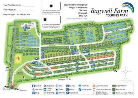
A colour-coded touring park plan with named pitch areas, service symbols and Coast Path links.
 Explore the map ↗
United Kingdom
Coastal park plan with colour-coded pitches, named neighbourhoods and a Morecambe Bay walking route.
Features may come from the sample artwork, its key or published park information. Approximate numbers describe the drawing and may cover only part of a park. They are intended to help you compare map examples. Current facilities and booking information should be checked with the park.
TAKE A CLOSER LOOK
View the illustrated map in detail or choose a file to download. These are sample maps; contact the park for current visitor information.

LET’S MAP YOUR PARK
For a map quotation, find your park and draw a rough boundary around it. The area you select helps us work out the design time and price.
Draw your park for a quote ↗Or talk to our map designers
01751 473136
 pipersheighting_Page_2.png