
River Rawthey
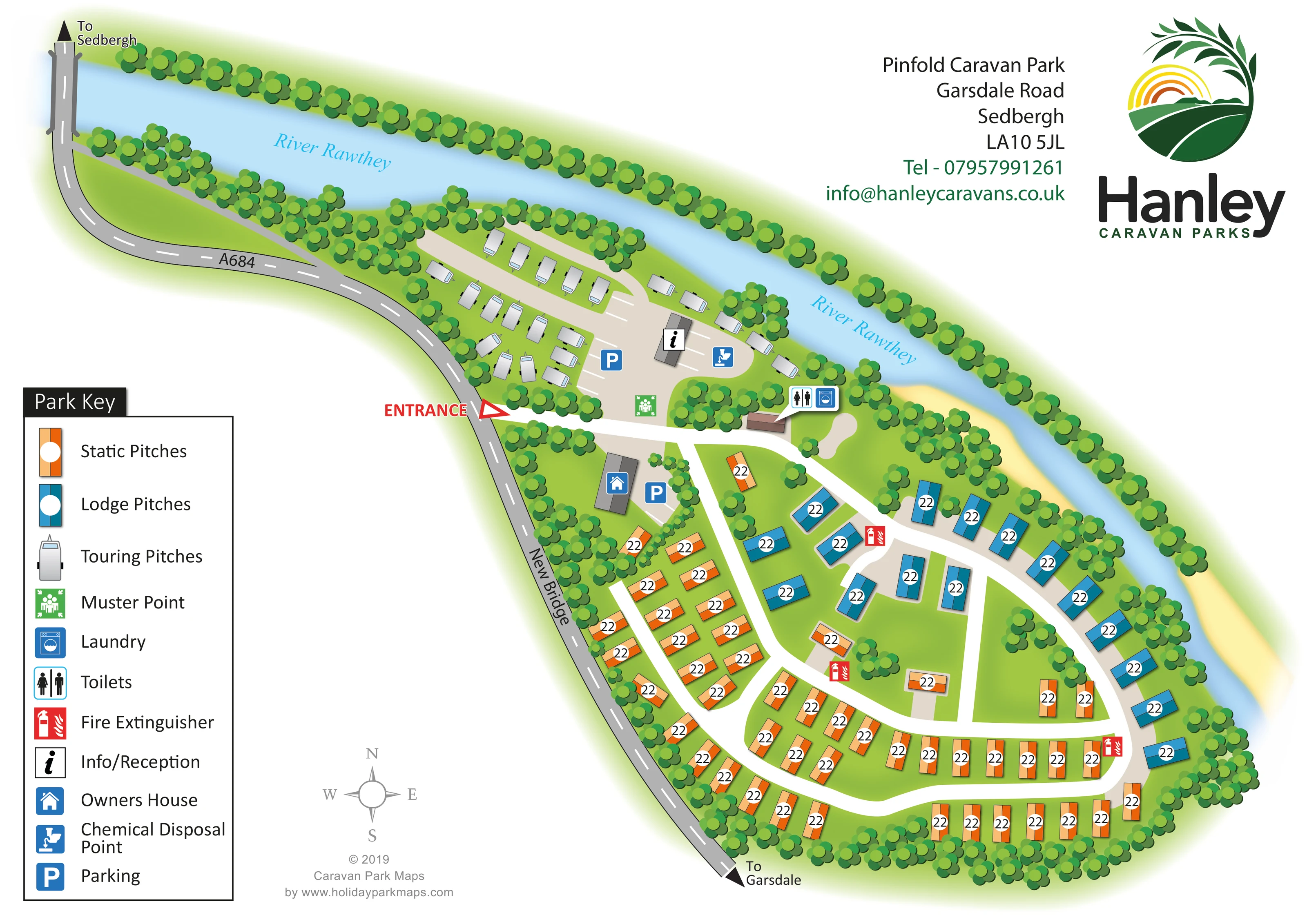
A broad blue river curves along the northern and eastern boundaries, with its name printed twice along the water.
ILLUSTRATED PARK MAP · P571
Pinfold Caravan Park, Garsdale Road, Sedbergh · United Kingdom
 Enlarge the map ↗
A SENSE OF THE PLACE
Pinfold Caravan Park is located near Sedbergh, with views over the town and surrounding Yorkshire Dales countryside. Static caravans and lodges for ownership sit alongside touring and motorhome provision.
The valley-floor setting lies near the River Rawthey, with Sedbergh's shops and restaurants within walking distance. The map provides an overview of the different accommodation areas and internal routes.
LOOK CLOSER
A broad blue river curves along the northern and eastern boundaries, with its name printed twice along the water.
Dense illustrated tree belts frame the river and roadside edges; smaller clusters divide accommodation groups and surround buildings.
A pale yellow strip follows part of the outer river bend. It is an unlabelled landscape treatment, not an identified beach or visitor facility.
The grey public road borders the western side, crosses the river at the upper left and carries directional arrows towards Sedbergh and Garsdale.
A bold red ENTRANCE label and outlined arrow mark the access from the public road into the central junction.
White routes branch from the entrance into the touring area and a connected series of curved roads serving the static and lodge pitches.
A black information symbol marks a building within the touring-area forecourt.
Blue P symbols identify parking by reception and beside the owner's house; white bay markings help distinguish the parking areas.
A broad blue river curves along the northern and eastern boundaries, with its name printed twice along the water.
Dense illustrated tree belts frame the river and roadside edges; smaller clusters divide accommodation groups and surround buildings.
A pale yellow strip follows part of the outer river bend. It is an unlabelled landscape treatment, not an identified beach or visitor facility.
The grey public road borders the western side, crosses the river at the upper left and carries directional arrows towards Sedbergh and Garsdale.
A bold red ENTRANCE label and outlined arrow mark the access from the public road into the central junction.
White routes branch from the entrance into the touring area and a connected series of curved roads serving the static and lodge pitches.
A black information symbol marks a building within the touring-area forecourt.
Blue P symbols identify parking by reception and beside the owner's house; white bay markings help distinguish the parking areas.
Adjacent toilet and washing-machine symbols mark a small building near the junction between the touring and fixed-accommodation areas.
A blue disposal symbol is placed near reception and the touring-area parking.
A blue house symbol identifies the grey-roofed building immediately south of the entrance, beside a marked parking area.
A green assembly symbol marks a location just inside the entrance, on the touring side of the access road.
Red extinguisher symbols are distributed beside internal roads through the static and lodge accommodation area.
READING THE MAP
This illustrated map of Pinfold Caravan Park in Sedbergh makes a riverside layout easy to understand at a glance. The River Rawthey curves around the top and right of the plan, while the A684 and the road labelled New Bridge define the opposite edge. Between them, tree-lined accommodation areas are connected by a clear network of white internal roads.
The design separates three accommodation types visually: orange symbols for static pitches, blue for lodge pitches and small grey caravan illustrations for touring pitches. The touring area sits close to reception and the entrance, while the static and lodge areas spread through the broader southern part of the park. Toilets, laundry, parking and a chemical disposal point are identified with compact pictograms.
A large Park Key anchors the lower-left corner, balanced by Hanley Caravan Parks branding and the park's address at the upper right. With its curved site boundary, planted divisions and distinct accommodation zones, this sample is particularly relevant to parks needing to explain a mixed layout without losing the character of their setting.
The plan follows the shape of a narrow riverside site that widens towards its southern end. The River Rawthey runs diagonally across the upper page before bending down the eastern edge. On the west, the grey public road crosses the river and curves past the park, with arrows indicating Sedbergh in one direction and Garsdale in the other. The red entrance label provides a strong focal point midway along this roadside boundary.
Inside the entrance, the layout divides into two main accommodation areas. To the north, grey touring-caravan illustrations surround a beige forecourt containing reception, marked parking bays and a chemical disposal symbol. A green muster-point icon is positioned near the access junction. Toilets and laundry are marked together beside a small building between the touring area and the routes leading further into the park. The owner's house and another parking area sit immediately south of the entrance.
The lower part of the plan uses orange static-pitch symbols and blue lodge-pitch symbols. Static pitches form curved rows along the western and southern routes, with smaller groups towards the centre. Lodges largely follow the eastern river bend, with additional pitches beside central branches. Red fire-extinguisher icons punctuate the internal road network. Tree belts enclose the boundary and create divisions between pitch groups, while smaller planted clusters soften junctions and building surrounds.
The single landscape-format artwork combines the site plan, a substantial symbol key, compass, address block and Hanley logo. The accompanying enlargement shows the same key and entrance detail, rather than a separate park section. Its two-tone accommodation symbols, white roads and repeated tree forms give the plan a consistent visual language.
KEEP EXPLORING
Chosen for shared landscapes, accommodation or facilities.
 Explore the map ↗
United Kingdom
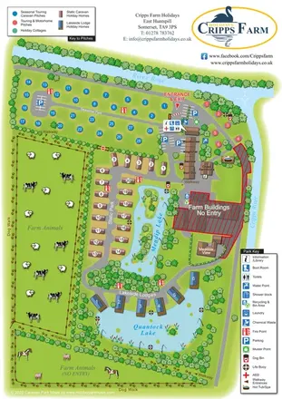
Illustrated farm holiday park plan combining riverside pitches, lakeside accommodation, animal fields and paw-print walking routes, with separate accommodation and facilities keys.
 Explore the map ↗
United Kingdom
Woodland park map with mixed pitches, bell tents, lodges and a fishing lake.
 Explore the map ↗
United Kingdom
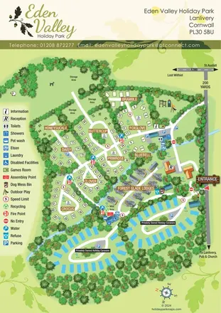
A tree-lined Cornwall park map with flower-named pitches, Forest Glade Lodges and two private-caravan loops.
Features may come from the sample artwork, its key or published park information. Approximate numbers describe the drawing and may cover only part of a park. They are intended to help you compare map examples. Current facilities and booking information should be checked with the park.
LET’S MAP YOUR PARK
For a map quotation, find your park and draw a rough boundary around it. The area you select helps us work out the design time and price.
Draw your park for a quote ↗Or talk to our map designers
01751 473136