
Enchanted Forest
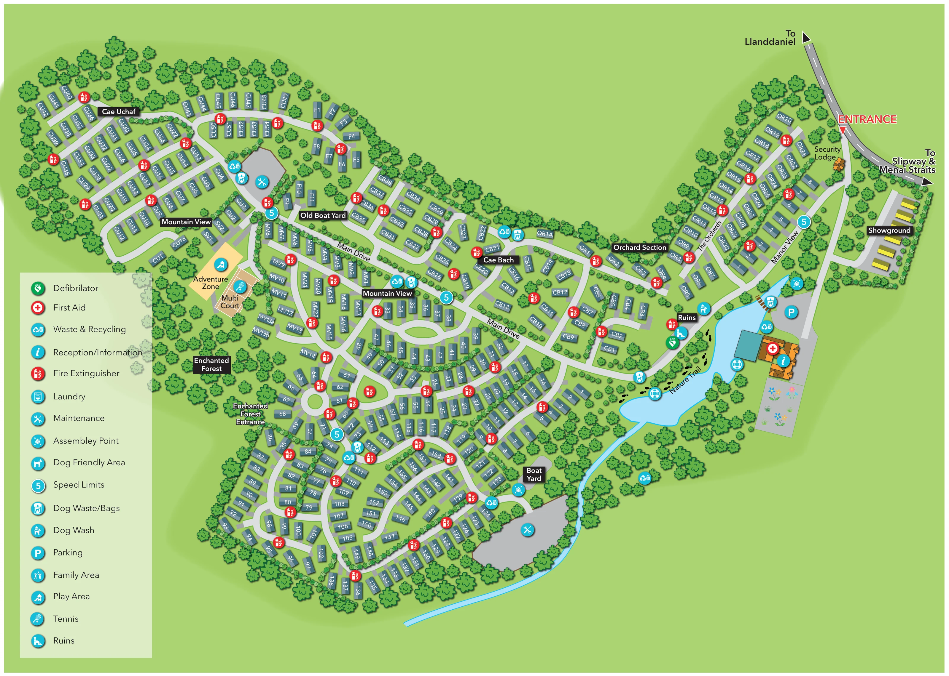
A substantial wooded area occupies the western side of the central accommodation layout, with a separately labelled forest entrance.
ILLUSTRATED PARK MAP · P572
Llanedwen, Llanfairpwllgwyngyll, Ynys Môn · United Kingdom
 Enlarge the map ↗
A SENSE OF THE PLACE
Plas Coch Country and Leisure Retreat is located at Llanedwen on Anglesey. Its holiday park setting combines accommodation with substantial indoor leisure facilities.
Published park information describes a swimming pool, hydrotherapy facilities, spa rooms, gym and places to eat. The map gives an overview of the accommodation layout and the location of shared facilities within the retreat.
LOOK CLOSER
A substantial wooded area occupies the western side of the central accommodation layout, with a separately labelled forest entrance.
An irregular light-blue pond beside the main buildings narrows into a winding watercourse along the lower boundary.
A labelled ruins marker sits beside the road near Cae Bach and the head of the Nature Trail.
A prominent red ENTRANCE label and triangular marker identify arrival from the external road at the upper right.
A small orange-roofed building is labelled beside the entrance.
The information symbol is placed on the large orange-roofed building complex beside the water and arrival-side parking.
A grey parking area with a turquoise P symbol sits between the arrival road and the main building complex.
A yellow play-area footprint beside Mountain View is labelled Adventure Zone and carries the play-area symbol.
A prominent red ENTRANCE label and triangular marker identify arrival from the external road at the upper right.
A small orange-roofed building is labelled beside the entrance.
The information symbol is placed on the large orange-roofed building complex beside the water and arrival-side parking.
A grey parking area with a turquoise P symbol sits between the arrival road and the main building complex.
A yellow play-area footprint beside Mountain View is labelled Adventure Zone and carries the play-area symbol.
A tan court with white playing lines sits next to the Adventure Zone; the tennis symbol links it to the legend.
A substantial wooded area occupies the western side of the central accommodation layout, with a separately labelled forest entrance.
Black footprint marks trace a named walking route along the accommodation-side edge of the water.
An irregular light-blue pond beside the main buildings narrows into a winding watercourse along the lower boundary.
A short brown bridge crosses the narrow upper end of the water near parking and the main buildings.
A labelled ruins marker sits beside the road near Cae Bach and the head of the Nature Trail.
Boat Yard is labelled near a lower service area. Old Boat Yard names a separate upper-central part of the plan containing accommodation symbols.
A separate roadside strip at the upper right contains yellow rectangular display blocks and a Showground label.
The family-area symbol is positioned near the upper end of the water beside Manor View.
A dog-wash symbol is mapped beside the ruins and the arrival-side road.
Repeated turquoise dog-waste symbols identify points across the accommodation neighbourhoods and near the main facilities.
Grouped waste-and-recycling symbols appear at several shared points throughout the layout.
Crossed-tool symbols mark grey service compounds in the upper-left accommodation area and beside the lower watercourse.
First aid is marked at the main building complex; a green AED symbol is placed near the ruins.
Red extinguisher markers are distributed throughout the accommodation areas, with turquoise assembly-point symbols near shared spaces.
White lifebuoy pictograms in turquoise circles appear beside the pond. They are not explained in the visible legend.
Circular turquoise markers carrying the numeral 5 are placed along internal roads.
Arrowheads on the external road indicate Llanddaniel in one direction and the slipway and Menai Straits in the other; these destinations are outside the illustrated park layout.
Laundry is included in the key, but no corresponding location is clearly identifiable on the plan.
A dog-friendly-area symbol is included in the legend; a specific matching area is not clearly located in the artwork.
Published park information describes a swimming pool, hydrotherapy facilities, spa rooms, a gym and places to eat. These are wider park context rather than individually labelled facilities on this map.
READING THE MAP
This illustrated map of Plas Coch Country & Leisure Retreat brings together a large holiday-home layout, wooded surroundings and shared visitor facilities on one landscape page. Set at Llanedwen on Anglesey, the retreat is presented as a series of connected neighbourhoods rather than a uniform grid. Cae Uchaf, Cae Bach, Mountain View and the Orchard Section each have their own shape within the wider road network.
The entrance is easy to pick out at the upper right, beside the security lodge and the road carrying directions towards Llanddaniel and the Menai Straits. From there, the plan follows Manor View and Main Drive into the accommodation areas, with reception and parking grouped beside an irregular pond.
The artwork also gives outdoor attractions a clear place in the visitor experience. An Adventure Zone and Multi Court sit near the Enchanted Forest, while a footprint-marked Nature Trail follows the water’s edge. Blue-grey holiday homes, orange-roofed shared buildings and turquoise facility symbols provide a consistent visual language for navigating a substantial, landscaped retreat.
The single-page plan shows an irregular estate organised around a diagonal Main Drive and a series of curving local roads. Its upper-right arm contains the Orchard Section, The Orchards route and Manor View, leading from the marked entrance towards the main building complex. A separate Showground appears beside the external road, using yellow blocks to distinguish it from the blue-grey accommodation elsewhere.
Across the upper-left area, Cae Uchaf forms several short rows within a substantial tree belt. Old Boat Yard and Cae Bach occupy the connecting central band, while Mountain View sits near the Adventure Zone and Multi Court. The southern accommodation area is more densely arranged, with homes following loops, rounded turning spaces and green islands. Individual white identifiers remain the most detailed level of navigation beneath the larger section labels.
Landscape is integral to the composition. Repeated tree and shrub symbols outline the neighbourhoods and form the Enchanted Forest on the western side. Near reception, a pale-blue pond narrows into a watercourse that curves around the lower edge of the park. Black footprints mark the Nature Trail along its bank, and a small bridge crosses the upper end near parking.
The map locates reception and information, first aid, a defibrillator, a dog wash, family and play areas, maintenance compounds and assembly points. Repeated symbols group waste and recycling points, dog-waste facilities and fire extinguishers across the estate. The tall lower-left legend explains the pictograms, including tennis at the Multi Court. Black-backed area labels, road-aligned lettering and a red entrance marker give the busy plan several distinct levels of wayfinding.
KEEP EXPLORING
Chosen for shared landscapes, accommodation or facilities.
 Explore the map ↗
United Kingdom
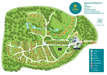
A woodland holiday-park plan with numbered homes, tree-named roads, walking loops and a distinctive entrance totem pole.
 Explore the map ↗
United Kingdom
Illustrated lakeside park plan with numbered holiday units, leisure buildings and a looping Woodland Walk.
 Explore the map ↗
United Kingdom
A lakeside holiday-park and fishery map with numbered accommodation, fishing positions and clearly grouped visitor services.
Features may come from the sample artwork, its key or published park information. Approximate numbers describe the drawing and may cover only part of a park. They are intended to help you compare map examples. Current facilities and booking information should be checked with the park.
LET’S MAP YOUR PARK
For a map quotation, find your park and draw a rough boundary around it. The area you select helps us work out the design time and price.
Draw your park for a quote ↗Or talk to our map designers
01751 473136