
Red Wharf Bay shoreline
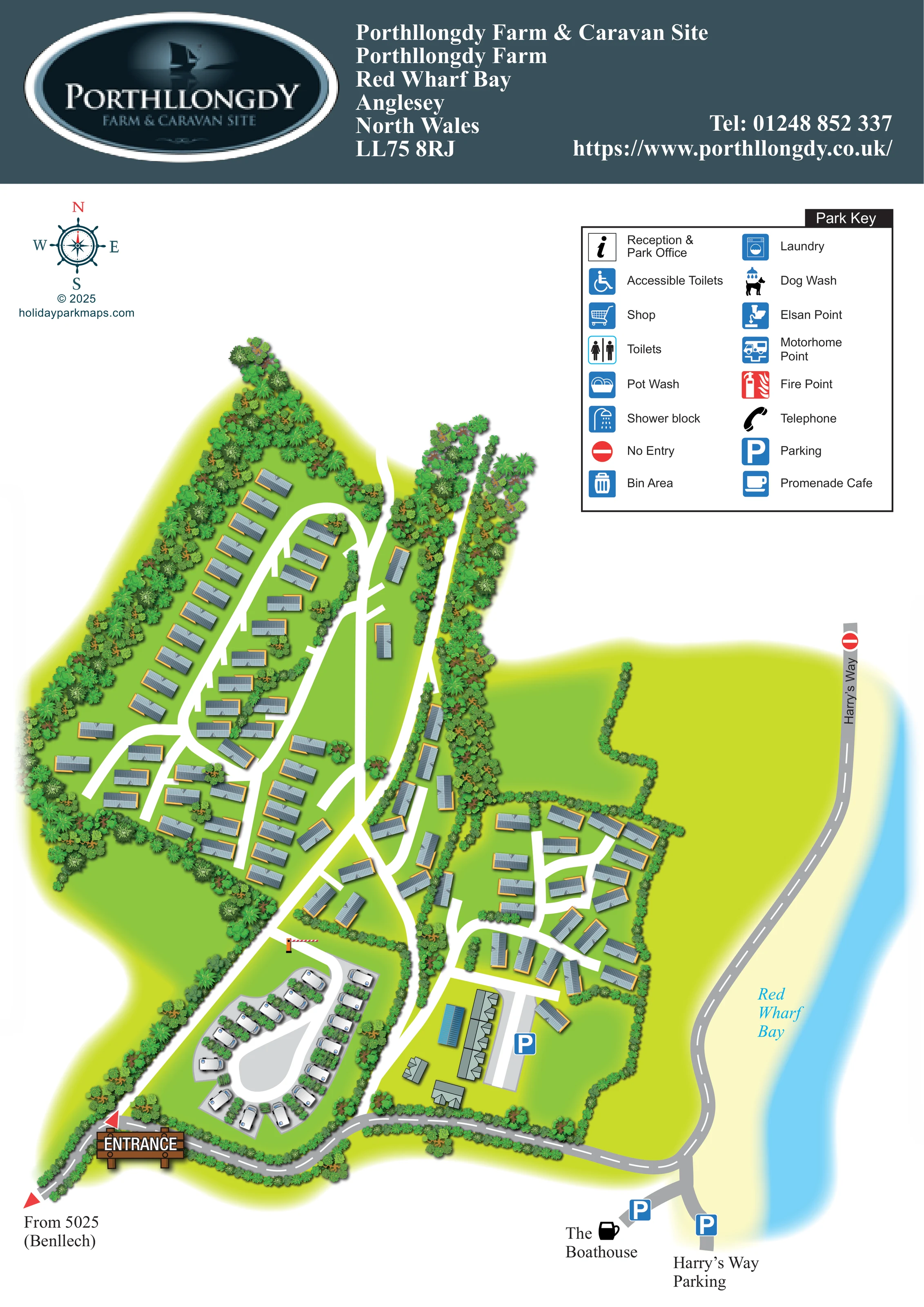
A labelled blue band of water and pale sandy margin runs along the right-hand side, establishing the park's coastal relationship.
ILLUSTRATED PARK MAP · P263
Porthllongdy Farm, Red Wharf Bay, Anglesey, North Wales · United Kingdom
 Enlarge the map ↗
A SENSE OF THE PLACE
Porthllongdy Farm and Caravan Park overlooks Red Wharf Bay on Anglesey. It offers lodge and caravan ownership, cottage and caravan rentals, and seasonal touring pitches.
Coastal views and the parkland setting are central to its appeal. The map explains the relationship between the different accommodation areas and internal routes, supporting visitors planning a holiday or repeated seasonal stays.
LOOK CLOSER
A labelled blue band of water and pale sandy margin runs along the right-hand side, establishing the park's coastal relationship.
Dense illustrated trees enclose the western accommodation areas, line the central corridor and divide the touring pitches; finer hedges frame the eastern group.
Broad unoccupied green spaces appear west of the central accommodation and between the eastern units and the shore road.
A timber-style ENTRANCE sign and red arrows identify the lower-left arrival, with the approach labelled 'From 5025 (Benllech)'.
White routes connect the entrance area to elongated western loops, a central north–south corridor and a smaller eastern accommodation network.
A red-and-white barrier is drawn at the northern connection to the touring area; no operating arrangements are stated.
A grey road follows the bay on the east side, with a no-entry symbol at its upper end and a named parking area at the lower end.
Blue parking symbols identify a long parking strip beside the lower building cluster and two parking locations near The Boathouse and Harry's Way.
A labelled blue band of water and pale sandy margin runs along the right-hand side, establishing the park's coastal relationship.
Dense illustrated trees enclose the western accommodation areas, line the central corridor and divide the touring pitches; finer hedges frame the eastern group.
Broad unoccupied green spaces appear west of the central accommodation and between the eastern units and the shore road.
A timber-style ENTRANCE sign and red arrows identify the lower-left arrival, with the approach labelled 'From 5025 (Benllech)'.
White routes connect the entrance area to elongated western loops, a central north–south corridor and a smaller eastern accommodation network.
A red-and-white barrier is drawn at the northern connection to the touring area; no operating arrangements are stated.
A grey road follows the bay on the east side, with a no-entry symbol at its upper end and a named parking area at the lower end.
Blue parking symbols identify a long parking strip beside the lower building cluster and two parking locations near The Boathouse and Harry's Way.
The Boathouse is named beside the lower waterfront junction and accompanied by a black cup symbol.
Several larger grey-roofed buildings and a narrow blue-roofed structure sit beside the internal parking strip. Their individual uses are not labelled.
Listed in the Park Key with an information symbol; a corresponding location is not clearly marked on the plan.
A shopping-trolley symbol appears in the key, without a clearly identifiable mapped position.
All three are listed separately in the key. Their symbols do not establish specific building locations on the visible plan.
Dishwashing and laundry symbols appear in the key, but their positions are not clearly shown.
A distinctive dog-under-a-shower icon is included in the key, without a clearly mapped location.
Both servicing facilities are named in the key; this does not identify their positions or establish separate motorhome accommodation.
Waste, fire and telephone symbols appear in the key without clearly visible placements in the accommodation areas.
Named in the key with a blue cup symbol. The artwork does not clearly position this entry or explicitly equate it with The Boathouse.
READING THE MAP
This illustrated map presents Porthllongdy Farm & Caravan Site beside Red Wharf Bay on Anglesey, North Wales. Its portrait composition places the coastal setting alongside the accommodation layout, with a pale shore and blue water running down the right-hand side. Tree-lined groups of fixed holiday units occupy most of the park, while a separate touring-caravan loop sits close to the entrance.
The map gives particular attention to how these areas connect. White internal lanes stand out against bright green grounds, and the grey approach road links the arrival point with the waterfront and Harry's Way. Parking symbols, a prominent entrance sign and the named Boathouse provide useful reference points without covering the accommodation illustration in labels.
A large two-column Park Key, nautical compass and dark teal identity banner complete the page. This is a useful sample for coastal parks that need to explain several accommodation areas within one coherent illustration, while retaining the landscape character that makes the setting recognisable.
The plan is organised around an arrival from the lower-left corner, marked by red arrows and a timber-style entrance sign. The approach is labelled from 5025, Benllech, and continues as a grey road around the lower edge towards the bay. Beyond the entrance, white internal routes branch into the park's main accommodation areas.
The largest group stretches up the left side in long, staggered rows. Narrower groups follow a central tree-lined corridor, while a compact eastern cluster uses shorter branching lanes. Fixed units are represented by grey ribbed roofs with ochre edging and shadows. Their repeated forms communicate the scale and arrangement of the park, rather than identifying individual plots. Near the entrance, white touring caravans sit around a grey loop with planted pitch divisions and a red-and-white barrier at its upper connection.
Several larger buildings occupy the lower central-right area beside a long parking strip. Further parking symbols appear by the waterfront, where The Boathouse and Harry's Way Parking are named. Harry's Way curves north along the shore, ending visually at a no-entry symbol. Red Wharf Bay is shown as blue water beyond a pale sandy margin, with open green space between the coast road and accommodation.
The upper-right key lists reception, shop, washrooms, laundry, dog wash, touring-service points and other facilities. Most of these symbols appear only in the key, rather than at identifiable locations within the plan. A compass balances the key on the opposite side. The additional detail image enlarges this same key and coastal area; it is not a separate map or accommodation section.
KEEP EXPLORING
Chosen for shared landscapes, accommodation or facilities.
 Explore the map ↗
United Kingdom
A colour-zoned coastal park map with touring areas, woodland trails, ponds and a leisure club.
 Explore the map ↗
United Kingdom
Trevornick’s colour-coded park map, with mixed accommodation, fishing ponds, golf and wooded trails.
 Explore the map ↗
United Kingdom
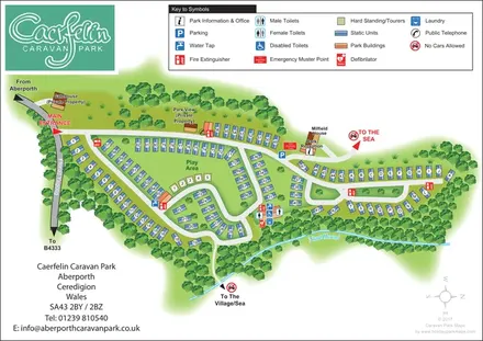
Woodland-framed caravan park plan with numbered and lettered units, a central play area and routes towards Aberporth’s village and sea.
Features may come from the sample artwork, its key or published park information. Approximate numbers describe the drawing and may cover only part of a park. They are intended to help you compare map examples. Current facilities and booking information should be checked with the park.
LET’S MAP YOUR PARK
For a map quotation, find your park and draw a rough boundary around it. The area you select helps us work out the design time and price.
Draw your park for a quote ↗Or talk to our map designers
01751 473136