
Rumbling Burn
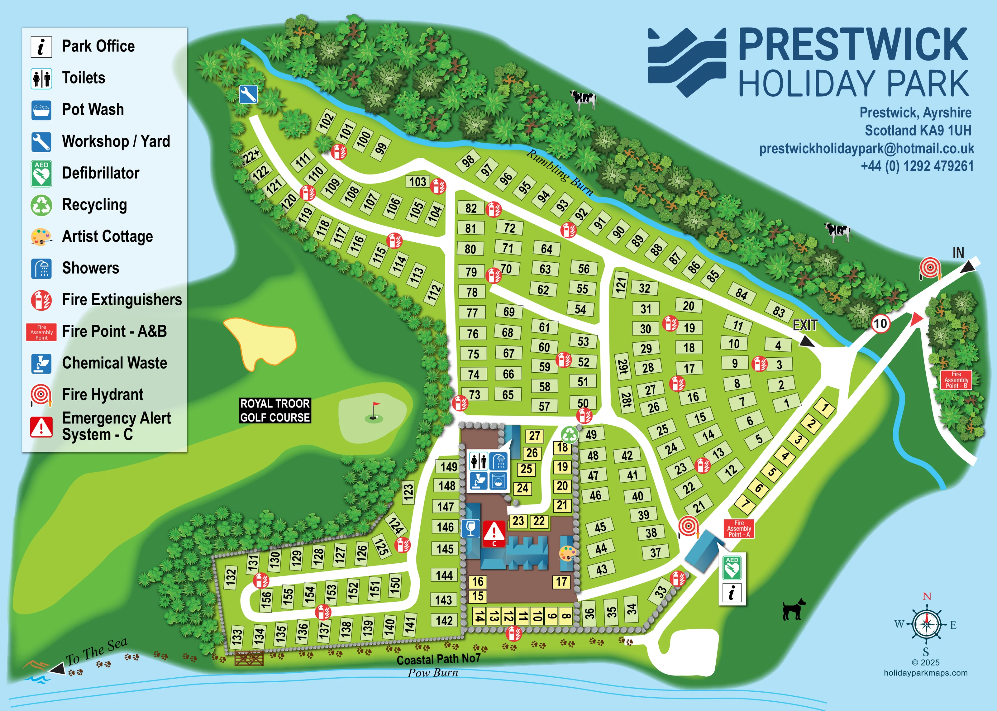
A bright-blue watercourse follows the wooded northern boundary and curves south beside the eastern approach.
ILLUSTRATED PARK MAP · P265
Prestwick, Ayrshire, Scotland · United Kingdom
 Enlarge the map ↗
A SENSE OF THE PLACE
Prestwick Holiday Park offers a coastal base in Ayrshire, with self-catering apartments housed in a period mansion. Each apartment provides cooking, dining and lounge space.
The on-site pub and restaurant adds food, drinks and entertainment, with indoor and outdoor seating. The map gives an overview of the holiday park grounds and the relationship between accommodation and shared facilities.
LOOK CLOSER
A bright-blue watercourse follows the wooded northern boundary and curves south beside the eastern approach.
Named along the lower edge of the artwork, immediately beyond the coastal path.
Dense illustrated trees frame the northern boundary and separate the accommodation from the neighbouring golf landscape.
The western landscape is labelled 'ROYAL TROOR GOLF COURSE' and illustrated with a fairway, putting green, flag and bunker. It is outside the accommodation layout, not presented as a park-owned facility.
An information symbol identifies the office beside a small blue-roofed building on the south-eastern internal approach.
Toilet and shower symbols are grouped at the northern end of the central building compound.
A chemical waste symbol appears with the central amenity-block symbols.
A washing-machine pictogram appears in the central amenity cluster, although it is not separately named in the legend.
An information symbol identifies the office beside a small blue-roofed building on the south-eastern internal approach.
Toilet and shower symbols are grouped at the northern end of the central building compound.
A chemical waste symbol appears with the central amenity-block symbols.
A washing-machine pictogram appears in the central amenity cluster, although it is not separately named in the legend.
Listed in the legend; a separate matching pot-wash location is not clearly identifiable on the plan.
A spanner symbol marks the far north-western end of the internal road system.
A green recycling symbol is positioned beside the road at the northern edge of the central compound.
A palette symbol identifies a small building along the eastern side of the central compound. Its use as bookable accommodation is not established.
A drinks-glass symbol marks a building on the western side of the central compound.
Park information describes an on-site pub and restaurant with entertainment and indoor and outdoor seating.
An AED symbol is placed beside the park-office marker.
Red extinguisher symbols are distributed throughout the accommodation areas. Hydrant symbols appear near the entrance and beside the office approach.
Assembly point A is labelled near the office approach; point B is labelled beside the eastern access road.
A red warning symbol marked C appears within the central building compound.
A bright-blue watercourse follows the wooded northern boundary and curves south beside the eastern approach.
Named along the lower edge of the artwork, immediately beyond the coastal path.
Dense illustrated trees frame the northern boundary and separate the accommodation from the neighbouring golf landscape.
The western landscape is labelled 'ROYAL TROOR GOLF COURSE' and illustrated with a fairway, putting green, flag and bunker. It is outside the accommodation layout, not presented as a park-owned facility.
A labelled route runs along the southern boundary beside Pow Burn, with paw-print decoration and a gate illustrated near the south-western accommodation area.
A 'To The Sea' arrow points towards the lower-left edge of the artwork.
IN and EXIT labels and directional arrows distinguish movements at the eastern approach, where the road crosses the burn.
READING THE MAP
This illustrated map of Prestwick Holiday Park places a busy accommodation layout within a distinctive Ayrshire coastal setting. Numbered positions follow a network of white roads, while tree belts, two named burns and neighbouring golf scenery give the plan a clear sense of place. Along the lower edge, Coastal Path No7 and an arrow towards the sea connect the park grounds with the surrounding landscape.
The artwork combines practical site information with a more expressive treatment of its boundaries and shared buildings. Pale-green and yellow accommodation markers keep the numbered areas visually organised, while blue-roofed buildings form a recognisable central hub. A large pictogram legend explains visitor facilities and emergency equipment, with the park office and defibrillator marked beside the south-eastern approach.
Prominent Prestwick Holiday Park branding occupies the upper-right corner, balancing the legend on the left. This sample is particularly relevant to parks that need to show many numbered locations without losing the character of their setting, or that want accommodation, shared facilities and nearby walking routes to work together on one visitor-facing plan.
The plan shows an irregular park footprint reached from the eastern side, where IN and EXIT arrows distinguish the approach around a crossing of Rumbling Burn. Broad white roads branch through the accommodation areas, forming long boundary runs, smaller internal blocks and a rounded loop in the south-west. Bold black numbers sit within pale-green and yellow rectangles; the colours distinguish groups visually, although the legend does not assign them accommodation types.
Towards the lower centre, blue-roofed buildings occupy a brown compound edged with illustrated stones. Toilet, shower, chemical-waste and washing-machine symbols are grouped at its northern end. A glass symbol marks the bar, a palette identifies Artist Cottage, and recycling is indicated beside the adjoining road. The park office and AED are shown by a separate small building on the south-eastern route. A workshop or yard marker sits at the far north-western end of the road network. Pot wash is included in the legend.
Red extinguisher symbols recur across the accommodation layout, supported by hydrant markers, labelled assembly points A and B, and an emergency alert symbol marked C at the central buildings. These symbols make operational information part of the main plan rather than a separate diagram.
The surrounding landscape is equally prominent. Rumbling Burn follows the wooded northern edge before curving down the east. A neighbouring golf course fills the western margin with a fairway, bunker and flagged green. Coastal Path No7 follows the southern boundary beside Pow Burn, with paw-print decoration, an illustrated gate and a direction arrow towards the sea. A nautical compass completes the single landscape-format composition.
KEEP EXPLORING
Chosen for shared landscapes, accommodation or facilities.
 Explore the map ↗
United Kingdom
Illustrated coastal campsite plan with named fields, electric pitch colours, beach routes and the Afon Hen.
 Explore the map ↗
United Kingdom
A colour-zoned coastal park map with touring areas, woodland trails, ponds and a leisure club.
 Explore the map ↗
United Kingdom
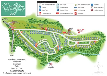
Woodland-framed caravan park plan with numbered and lettered units, a central play area and routes towards Aberporth’s village and sea.
Features may come from the sample artwork, its key or published park information. Approximate numbers describe the drawing and may cover only part of a park. They are intended to help you compare map examples. Current facilities and booking information should be checked with the park.
LET’S MAP YOUR PARK
For a map quotation, find your park and draw a rough boundary around it. The area you select helps us work out the design time and price.
Draw your park for a quote ↗Or talk to our map designers
01751 473136