
Woodland and tree-rich grounds
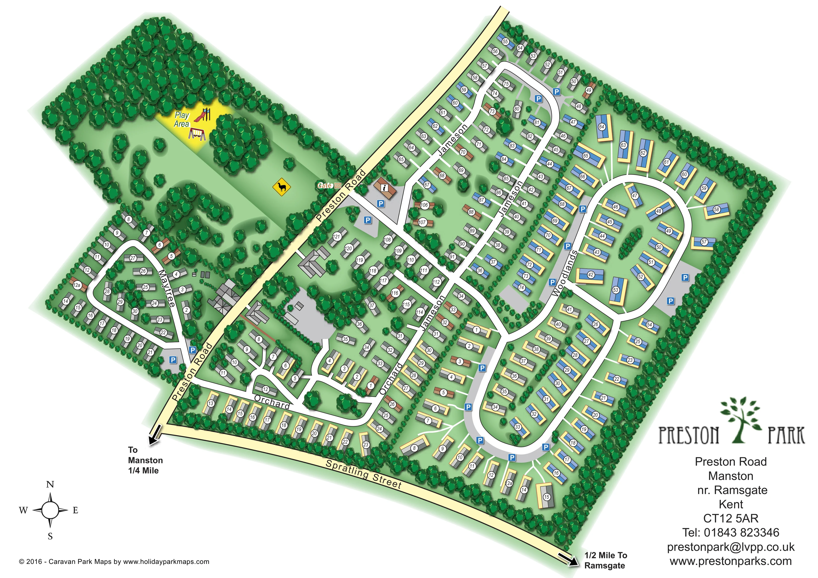
A substantial wooded area occupies the upper-left part of the plan, with dense tree cover, scattered trees and open grassy clearings.
ILLUSTRATED PARK MAP · P576
Preston Road, Manston, near Ramsgate, Kent · United Kingdom
 Enlarge the map ↗
A SENSE OF THE PLACE
Preston Park is a holiday home site near Manston and Ramsgate in Kent. Its countryside setting includes private woodland and picnic spaces beside the park.
Coastal beaches and local amenities provide options for excursions. The map shows the arrangement of holiday homes and access routes, helping owners and visitors understand this quieter site.
LOOK CLOSER
A substantial wooded area occupies the upper-left part of the plan, with dense tree cover, scattered trees and open grassy clearings.
Continuous tree belts enclose much of the park, while smaller trees and hedged divisions structure the accommodation groups.
Broad green spaces separate the wooded canopy, play area and Maytree accommodation. An unlabelled horse-silhouette marker appears in one clearing.
A labelled yellow clearing within the woodland-side grounds, illustrated with a slide and swings.
A brown-roofed building carrying an information 'i' symbol stands beside Preston Road at an entrance to the main accommodation area.
Blue 'P' symbols mark grey parking spaces beside the information building, at Maytree and around the Jameson and Woodlands roads.
A labelled gate is shown on the edge of the woodland-side grounds, opposite the information-marked building.
Names placed directly along internal roads distinguish the compact western loop, southern branches, central accommodation and larger eastern loops.
A labelled yellow clearing within the woodland-side grounds, illustrated with a slide and swings.
A brown-roofed building carrying an information 'i' symbol stands beside Preston Road at an entrance to the main accommodation area.
Blue 'P' symbols mark grey parking spaces beside the information building, at Maytree and around the Jameson and Woodlands roads.
A substantial wooded area occupies the upper-left part of the plan, with dense tree cover, scattered trees and open grassy clearings.
Continuous tree belts enclose much of the park, while smaller trees and hedged divisions structure the accommodation groups.
Broad green spaces separate the wooded canopy, play area and Maytree accommodation. An unlabelled horse-silhouette marker appears in one clearing.
A labelled gate is shown on the edge of the woodland-side grounds, opposite the information-marked building.
Names placed directly along internal roads distinguish the compact western loop, southern branches, central accommodation and larger eastern loops.
Preston Road runs diagonally between park sections; Spratling Street follows the lower edge of the main accommodation area.
Large black arrows at the outer road ends provide local destination references.
The park context describes picnic spaces associated with its private woodland; these are not individually labelled on the artwork.
READING THE MAP
This illustrated map of Preston Park near Manston and Ramsgate in Kent brings together a substantial holiday-home layout and the wooded grounds beside it. Preston Road runs diagonally through the composition, separating the compact Maytree section and woodland from the larger network of homes to the right. Named roads, numbered units and clearly marked parking give the artwork a practical role for owners and visitors, while the surrounding trees communicate the park's countryside character.
The plan uses a mainly overhead view, softened by shaded tree canopies and simple roof illustrations. White internal roads stand out against green lawns, and pale cream distinguishes the neighbouring public roads. A bright yellow play-area clearing, complete with swings and a slide, provides a memorable landmark within the woodland-side grounds.
Rather than relying on a large facilities key, the design places information directly where it is needed: parking symbols beside the roads, an information icon on a building near Preston Road, and a gate label at the woodland edge. The result is a useful sample for holiday-home parks needing to explain several connected sections without losing their landscape identity.
The Preston Park plan is arranged diagonally across a landscape page, with Preston Road passing between two contrasting parts of the site. On the left, Maytree forms a compact loop of numbered homes below a broad area of woodland and open grass. A labelled play area sits in a yellow clearing among the trees, and a gate marks access at the Preston Road edge.
The larger accommodation network lies to the right. Jameson provides the central road structure, with homes in rows, small clusters and planted islands. Orchard runs through the lower part of the plan, combining short branches with a long line of homes near Spratling Street. Woodlands is particularly recognisable through its two rounded loops, where homes turn with the road geometry and occupy both outer edges and central spaces. Tree belts frame the perimeter, while smaller planted divisions separate groups within the park.
An information-marked building beside Preston Road and nearby grey parking areas create a useful arrival reference. Further blue parking symbols appear throughout the accommodation sections. White oval numbers identify individual homes, and large black road names follow the internal routes. The homes have grey, blue or brown roofs; many also have pale-yellow surrounds. These visual variations are not accompanied by a colour key.
Outside the plan, destination arrows point towards Manston and Ramsgate, a compass rose sits at lower left, and the Preston Park tree logo heads the address and contact panel at lower right. The two artwork files present the same composition, rather than separate park sections or alternative walking-map views.
KEEP EXPLORING
Chosen for shared landscapes, accommodation or facilities.
 Explore the map ↗
United Kingdom
Woodland-framed Barnsoul map with mixed accommodation, shared facilities and paw-marked walking routes.
 Explore the map ↗
United Kingdom
A wooded, streamside park map with a linked farm, café, touring and cottage area.
 Explore the map ↗
United Kingdom
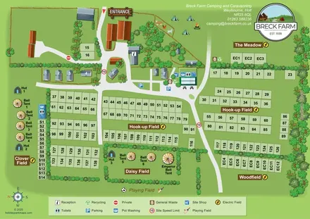
A field-based farm campsite map with numbered pitches, bell tents, huts and a wooded boundary.
Features may come from the sample artwork, its key or published park information. Approximate numbers describe the drawing and may cover only part of a park. They are intended to help you compare map examples. Current facilities and booking information should be checked with the park.
TAKE A CLOSER LOOK
View the illustrated map in detail or choose a file to download. These are sample maps; contact the park for current visitor information.


LET’S MAP YOUR PARK
For a map quotation, find your park and draw a rough boundary around it. The area you select helps us work out the design time and price.
Draw your park for a quote ↗Or talk to our map designers
01751 473136