
Tree and shrub boundaries
Continuous stylised planting outlines much of the irregular site boundary, with larger trees and clusters around the entrance and central bend.
ILLUSTRATED PARK MAP · P588
Saint Oswalds Park, Main Street, Dunham-on-Trent, Newark · United Kingdom
 Enlarge the map ↗
A SENSE OF THE PLACE
Saint Oswalds Park is a residential park home site in Nottinghamshire. Council-hosted park rules identify the accommodation as permanent residential homes.
The map is included as an example of residential estate mapping. It records the arrangement of homes and access routes, without presenting the site as a holiday destination or assigning an unconfirmed current operator.
LOOK CLOSER
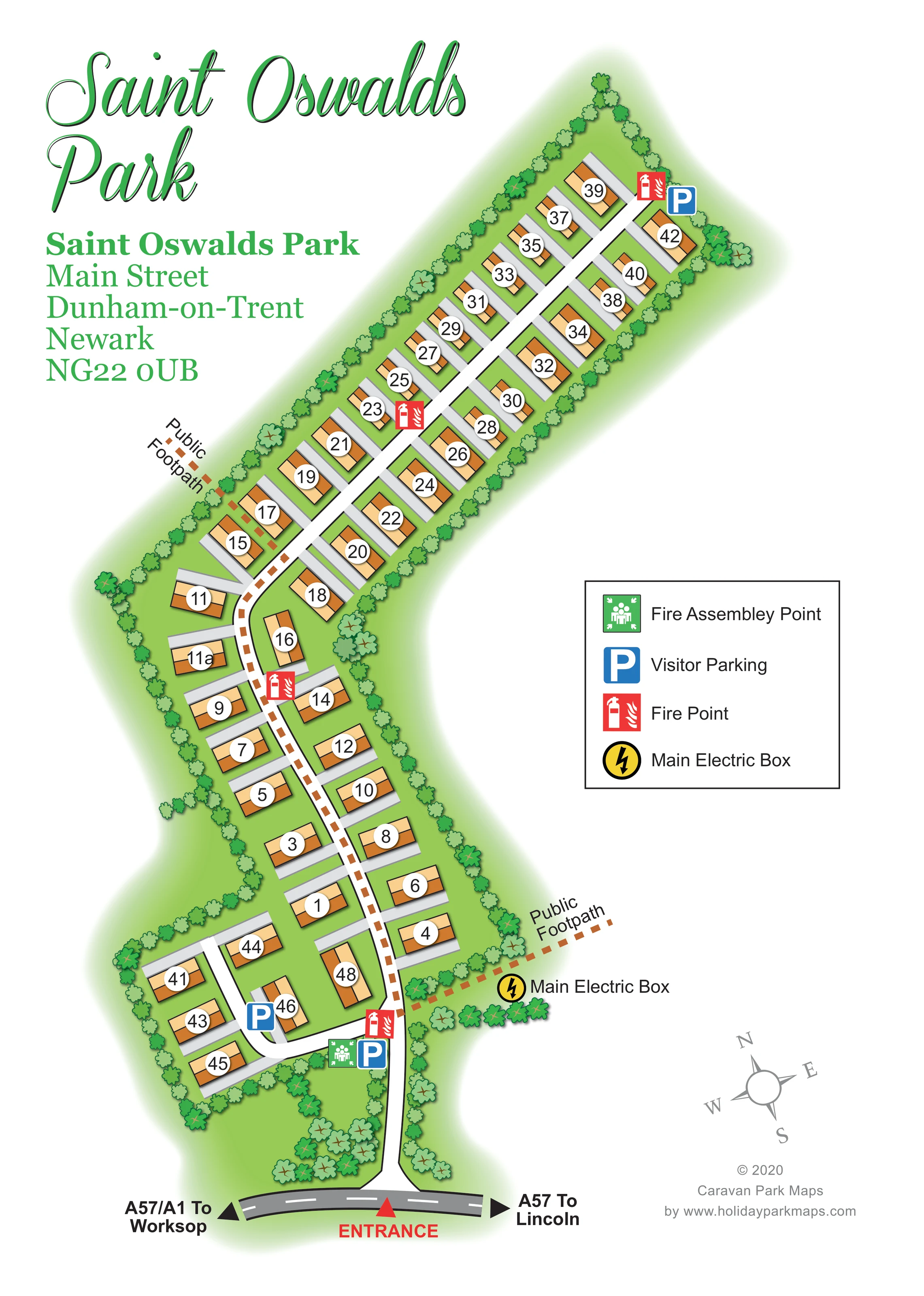
Continuous stylised planting outlines much of the irregular site boundary, with larger trees and clusters around the entrance and central bend.
Light-green ground separates the homes and roads, with broader unlabelled green pockets beside the lower section and entrance.
Blue parking symbols identify locations around the entrance-side branch and at the far end of the main internal road.
Repeated red fire-point symbols are distributed along the main access road, including the entrance-side junction and terminal end.
A green assembly-point symbol appears beside visitor parking near the entrance-side road junction.
A yellow electrical symbol and explicit label identify the main electric box near the lower-right boundary and public footpath.
A rust-brown dashed route enters through the lower-right boundary, follows part of the internal road and leaves through the left boundary near the central bend.
The entrance is highlighted by a red triangle and uppercase label at the bottom of the plan, connecting the external road to the internal spine.
Blue parking symbols identify locations around the entrance-side branch and at the far end of the main internal road.
Repeated red fire-point symbols are distributed along the main access road, including the entrance-side junction and terminal end.
A green assembly-point symbol appears beside visitor parking near the entrance-side road junction.
A yellow electrical symbol and explicit label identify the main electric box near the lower-right boundary and public footpath.
A rust-brown dashed route enters through the lower-right boundary, follows part of the internal road and leaves through the left boundary near the central bend.
The entrance is highlighted by a red triangle and uppercase label at the bottom of the plan, connecting the external road to the internal spine.
The external road has arrows labelled A57/A1 to Worksop and A57 to Lincoln.
One main road curves through the lower homes before straightening along the elongated upper section; a short branch serves the smaller entrance-side group.
Continuous stylised planting outlines much of the irregular site boundary, with larger trees and clusters around the entrance and central bend.
Light-green ground separates the homes and roads, with broader unlabelled green pockets beside the lower section and entrance.
READING THE MAP
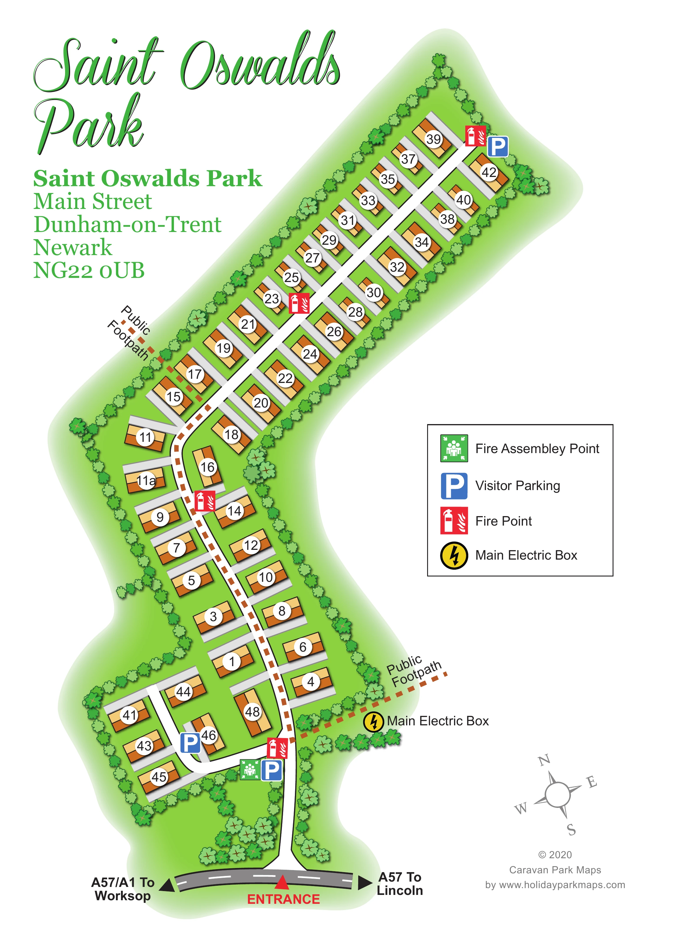
This illustrated map of Saint Oswalds Park presents a residential park home estate in Dunham-on-Trent, Nottinghamshire. Its long, narrow layout is arranged diagonally across a portrait page, making room for a prominent park name, full address and a clearly separated symbol key. Approximately 45 homes are shown along a main access road and a smaller branch near the entrance.
The map concentrates on everyday orientation rather than holiday attractions. Large numbered circles identify individual homes, while blue parking markers and contrasting safety symbols highlight useful shared locations. A public footpath is drawn as a brown dashed line, showing how it passes through the site and follows part of the internal road. At the bottom, a red entrance marker and directions towards Worksop and Lincoln connect the estate plan to its wider road setting.
Two-tone roof illustrations, grey access strips and a planted green boundary give the plan visual character without obscuring its practical purpose. It is a useful sample for residential estates needing a straightforward, illustrated guide to homes, access and shared infrastructure.
The single portrait plan follows Saint Oswalds Park from its entrance at the bottom of the page to the far end of a long diagonal residential section. The external road is drawn in grey with dashed white markings, direction arrows towards Worksop and Lincoln, and a red entrance triangle. From here, a white internal road runs into the estate, passes a short side branch and bends between the lower homes before continuing as a straight spine through the upper rows.
Most homes sit on either side of this road. Their rectangular cream-and-orange roof symbols rotate to follow the changing alignment, and white circular badges carry the home numbers. Light-grey strips beside the buildings distinguish access or hardstanding areas from the surrounding green ground. A smaller cluster sits around the entrance-side branch, where visitor parking is also marked.
The public footpath is particularly prominent: thick brown dashes enter through the lower-right boundary, continue along part of the main road and turn out through the left boundary near the central bend. Repeated red fire-point icons appear along the route through the estate. Blue visitor-parking markers are shown near the lower junction and at the far end, while a green fire assembly symbol sits near the entrance-side parking. The main electric box is labelled beside the lower-right boundary.
Stylised shrubs and trees frame the site, with larger planting clusters near the entrance and broader green pockets beside the lower section. The large green title and address occupy the upper-left white space. A four-entry boxed legend, grey compass and designer credit complete the right-hand side, keeping explanatory material separate from the numbered homes.
KEEP EXPLORING
Chosen for shared landscapes, accommodation or facilities.
 Explore the map ↗
United Kingdom
Illustrated Sanday aire map with a seasonal maze, café barn and motorhome service area.
 Explore the map ↗
United Kingdom
Illustrated coastal campsite plan with named fields, electric pitch colours, beach routes and the Afon Hen.
 Explore the map ↗
United Kingdom
A woodland touring-park map with colour-coded pitches, a stream and footprint-marked walks.
Features may come from the sample artwork, its key or published park information. Approximate numbers describe the drawing and may cover only part of a park. They are intended to help you compare map examples. Current facilities and booking information should be checked with the park.
TAKE A CLOSER LOOK
View the illustrated map in detail or choose a file to download. These are sample maps; contact the park for current visitor information.


LET’S MAP YOUR PARK
For a map quotation, find your park and draw a rough boundary around it. The area you select helps us work out the design time and price.
Draw your park for a quote ↗Or talk to our map designers
01751 473136
 dunhamparka_large.png