
Beach and coastal frontage
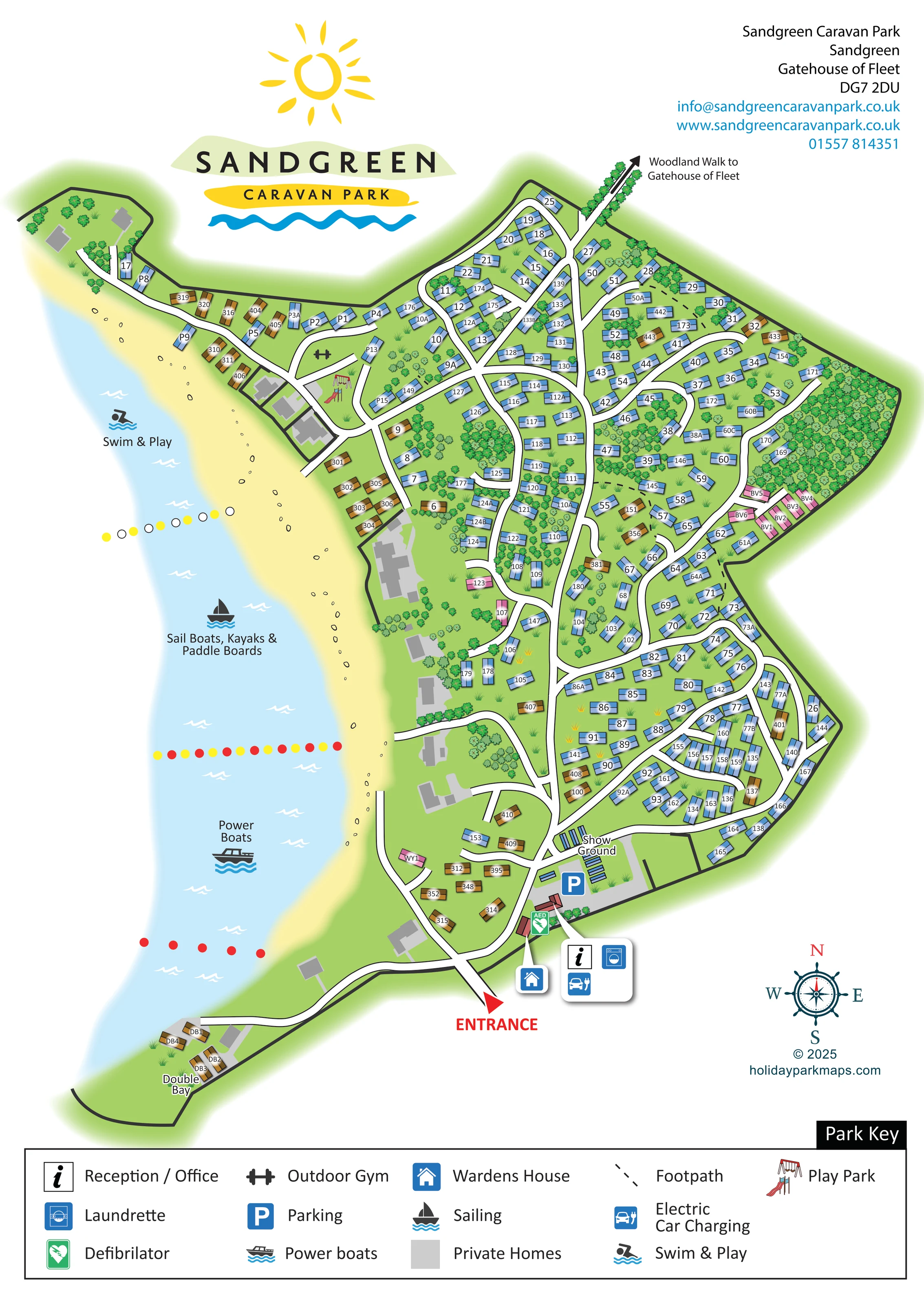
A long pale-yellow beach curves along the western edge of the park beside light-blue water, with small outlined stones along the shore.
ILLUSTRATED PARK MAP · P284
Sandgreen, Gatehouse of Fleet · United Kingdom
 Enlarge the map ↗
A SENSE OF THE PLACE
Sandgreen Caravan Park is located near Gatehouse of Fleet in Dumfries and Galloway. Holiday home and lodge ownership is set close to the sea and a private beach.
Boating is part of the park's character, with storage and designated water-use areas shown on the park plan. Laundry, an outdoor gym and a bike track add facilities on land, and the map brings these different spaces together.
LOOK CLOSER
A long pale-yellow beach curves along the western edge of the park beside light-blue water, with small outlined stones along the shore.
Dense tree symbols occupy the eastern boundary and several internal pockets, with scattered trees and grass tufts between accommodation.
A named waterfront extension at the south-western tip is reached by a long road spur and contains a small group of ochre accommodation symbols.
An information-symbol callout identifies the reception / office building in the entrance-side service cluster.
The washing-machine symbol shares the entrance-side facility callout with reception and electric car charging.
A blue car-and-plug symbol identifies charging in the entrance-side service area.
A green AED marker appears beside the entrance-side buildings.
A separate house-symbol callout points to a building close to the entrance.
An information-symbol callout identifies the reception / office building in the entrance-side service cluster.
The washing-machine symbol shares the entrance-side facility callout with reception and electric car charging.
A blue car-and-plug symbol identifies charging in the entrance-side service area.
A green AED marker appears beside the entrance-side buildings.
A separate house-symbol callout points to a building close to the entrance.
A large blue P marks the grey-surfaced area beside the show ground and entrance facilities.
The labelled show ground lies immediately north of the parking area, with rows of narrow blue display symbols.
A dumbbell symbol marks a green space near the northern waterfront road junction.
Illustrated swings and a slide identify a play area beside the outdoor gym, within a curved road loop.
The northern part of the shoreline water is labelled Swim & Play and marked with a swimming pictogram.
The central water area is explicitly labelled for sail boats, kayaks and paddle boards.
The southern water area carries a power-boat label and pictogram. Coloured marker lines separate the illustrated water-use areas.
A long pale-yellow beach curves along the western edge of the park beside light-blue water, with small outlined stones along the shore.
Dense tree symbols occupy the eastern boundary and several internal pockets, with scattered trees and grass tufts between accommodation.
A tree-lined route leaves the northern boundary beneath a directional arrow labelled Woodland Walk to Gatehouse of Fleet.
Short dashed black links cross accommodation areas, supplementing the white road network.
A red entrance arrow at the southern edge leads into a branching network of curving roads, loops and shoreline spurs.
A named waterfront extension at the south-western tip is reached by a long road spur and contains a small group of ochre accommodation symbols.
Grey building footprints, identified as private homes in the key, appear mainly along the coastal side and are visually separate from numbered holiday accommodation.
Published park context mentions boat storage; the visible artwork does not provide an explicit boat-storage label.
A bike track is mentioned in the park context but is not explicitly identified on this artwork.
READING THE MAP
Sandgreen Caravan Park's illustrated map brings a wooded coastal holiday-home park near Gatehouse of Fleet into one clear portrait-format plan. The beach runs along the left-hand side of the artwork, while numbered accommodation follows a network of winding roads through green spaces and pockets of trees. The result is a map in which the shoreline is as important to orientation as the road layout.
Its most distinctive feature is the treatment of the water itself. Separate labels identify Swim & Play, sail boats, kayaks and paddle boards, and power boats, with coloured marker lines dividing the illustrated areas. On land, the map picks out the outdoor gym, play park and entrance-side facilities, including reception, the launderette, parking and electric car charging.
A large sun-and-wave Sandgreen logo, nautical compass and full-width key give the page a recognisable coastal character. This sample is particularly relevant to holiday-home parks that need to explain a substantial accommodation layout alongside beach access, woodland routes and waterside activities.
The plan is arranged around a long western shoreline, with the main entrance at the bottom and a woodland walking route leaving the top towards Gatehouse of Fleet. White roads with dark outlines form a central spine, branching loops and short spurs. Numbered holiday-home symbols sit at varied angles along these routes, with tree clusters and open green pockets breaking up the rows. Short dashed footpaths provide additional links through the accommodation areas.
Blue roof symbols make up most of the accommodation, interspersed with ochre and pink groups. Grey footprints represent private homes, a distinction explained in the key. At the south-western tip, a road follows the coast to the small, separately labelled Double Bay group. Near the main entrance, the show ground and parking area form a recognisable arrival landmark. Pointer callouts identify reception, the launderette, electric car charging and the warden's house, with a green AED marker beside the buildings.
Further north, swings and a slide mark the play park, and a dumbbell symbol identifies the neighbouring outdoor gym. Along the beach, pale sand, small stone outlines and white wave marks establish the coastal setting. Large water-activity labels and pictograms distinguish swimming and play from sailing and paddling, and from power boating; coloured marker lines cross the water between these areas.
The single portrait artwork is completed by a prominent park logo, upper-right contact block, nautical compass and broad Park Key along the bottom. Its combination of direct unit numbering, uncluttered roads and enlarged facility callouts keeps the practical information readable without losing the park's wooded, waterside character.
KEEP EXPLORING
Chosen for shared landscapes, accommodation or facilities.
 Explore the map ↗
United Kingdom
A colour-zoned coastal park map with touring areas, woodland trails, ponds and a leisure club.
 Explore the map ↗
United Kingdom
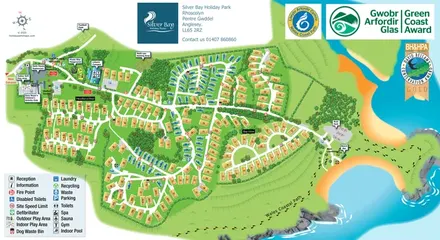
Illustrated Anglesey holiday-park map with numbered homes, family facilities and a footprint-marked coastal path.
 Explore the map ↗
United Kingdom
Trevornick’s colour-coded park map, with mixed accommodation, fishing ponds, golf and wooded trails.
Features may come from the sample artwork, its key or published park information. Approximate numbers describe the drawing and may cover only part of a park. They are intended to help you compare map examples. Current facilities and booking information should be checked with the park.
TAKE A CLOSER LOOK
View the illustrated map in detail or choose a file to download. These are sample maps; contact the park for current visitor information.


LET’S MAP YOUR PARK
For a map quotation, find your park and draw a rough boundary around it. The area you select helps us work out the design time and price.
Draw your park for a quote ↗Or talk to our map designers
01751 473136