
Beach, sea and grassy cliff edge
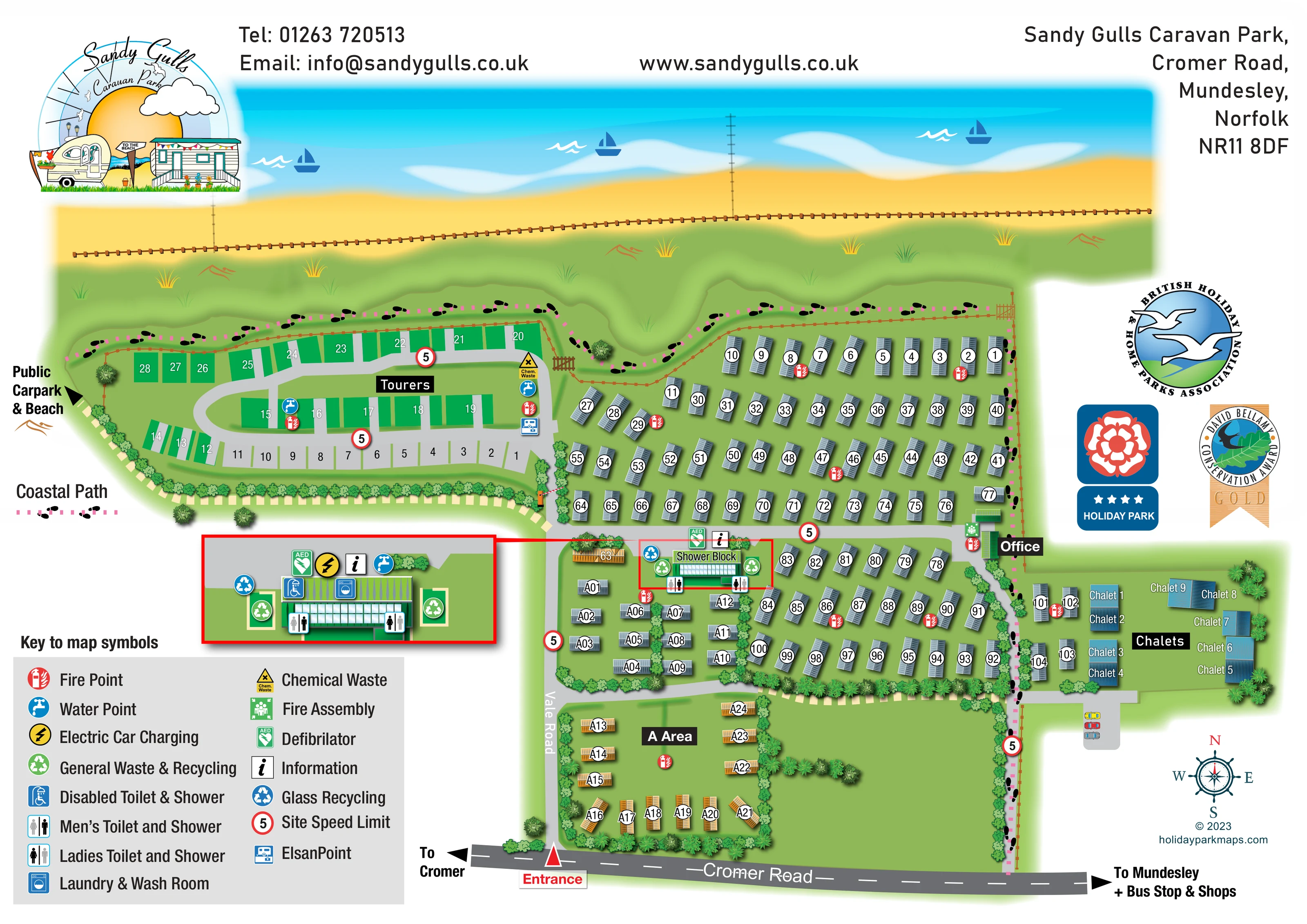
The park plan places a broad sandy beach and turquoise sea beyond a fenced, undulating green coastal margin. The walking map labels Mundesley Beach along its diagonal shoreline.
ILLUSTRATED PARK MAP · P286
Cromer Road, Mundesley, Norfolk · United Kingdom
 Enlarge the map ↗
A SENSE OF THE PLACE
Sandy Gulls Caravan Park is based at Cromer Road, Mundesley, Norfolk. The touring area is on the clifftop with sea views and beach access. The park offers holiday-caravan ownership and an adults-only touring area. Pitch choices include hardstanding and grass options with electricity and television connections.
The map brings the site layout and its access routes together in one view, providing a reference for understanding the arrangement of the grounds.
LOOK CLOSER
The park plan places a broad sandy beach and turquoise sea beyond a fenced, undulating green coastal margin. The walking map labels Mundesley Beach along its diagonal shoreline.
Dense illustrated planting defines accommodation boundaries, with open green space inside the A Area and beside the southern entrance-side plots.
A pale green golf-course area and flag symbol appear inland on the walking map.
A pink dotted line with repeated black footprints follows the coastal boundary and continues down the eastern side towards Cromer Road.
A red entrance marker connects Cromer Road to Vale Road and the internal lanes. Directional arrows indicate Cromer and Mundesley, with the latter also referencing a bus stop and shops.
A western-edge arrow identifies the direction to a public car park and beach; it is not depicted as an on-site park facility.
The office label appears beside the eastern internal lane, near the junction between the main caravan rows and chalet area.
A central shower block is repeated in a red-bordered enlargement. Symbols identify men's and ladies' toilets and showers, together with a disabled toilet and shower.
The park plan places a broad sandy beach and turquoise sea beyond a fenced, undulating green coastal margin. The walking map labels Mundesley Beach along its diagonal shoreline.
A pink dotted line with repeated black footprints follows the coastal boundary and continues down the eastern side towards Cromer Road.
A red entrance marker connects Cromer Road to Vale Road and the internal lanes. Directional arrows indicate Cromer and Mundesley, with the latter also referencing a bus stop and shops.
A western-edge arrow identifies the direction to a public car park and beach; it is not depicted as an on-site park facility.
The office label appears beside the eastern internal lane, near the junction between the main caravan rows and chalet area.
A central shower block is repeated in a red-bordered enlargement. Symbols identify men's and ladies' toilets and showers, together with a disabled toilet and shower.
The laundry and wash-room symbol appears in the enlarged shower-block detail.
A yellow charging symbol is positioned in the shower-block enlargement.
Blue tap symbols identify water points in the touring area and at the shower-block service hub.
Green general-waste/recycling symbols and blue glass-recycling symbols are grouped around the shower block and shown in its enlargement.
Distinct chemical-waste and Elsan symbols appear at the eastern end of the touring area.
Repeated red fire-point symbols are distributed through the touring, caravan and chalet-side parts of the plan.
A green assembly symbol is shown near the office-side lane.
AED and information symbols are attached to the shower-block hub and repeated in the enlarged detail.
Red-ringed 5 symbols appear at several internal road locations and are explained in the key.
Dense illustrated planting defines accommodation boundaries, with open green space inside the A Area and beside the southern entrance-side plots.
A grey spur with three illustrated cars sits below the chalet group.
The separate village map locates tourist information, public toilets, car parking, bus stops, a post office, pharmacy, library and petrol station/garage. These are off-site amenities.
Premier, Tesco and SPAR logos mark shop locations on the Mundesley map, rather than shops within the holiday park.
The village map marks Mundesley Museum near Beach Road, a church beside Cromer Road and a Methodist church closer to the village centre.
Gold Park is labelled in the village, with a mapped symbol for games, an outdoor gym and a skate park. It is not an on-site recreation facility.
A pale green golf-course area and flag symbol appear inland on the walking map.
The inset headed Best routes into Sandy Gulls shows the wider road network around Cromer and North Walsham, using red arrows to highlight approaches to the park.
READING THE MAP
These two maps show Sandy Gulls Caravan Park and its surroundings at Mundesley on the Norfolk coast. The main illustrated plan brings together the clifftop setting, accommodation areas and practical visitor facilities, while the companion walking map places the park within the village and wider road network.
On the park sheet, a turquoise sea and golden beach form a strong coastal backdrop. Touring pitches occupy a curved western loop, static caravans are arranged in rows and planted sections, and a small chalet group sits to the east. A pink dotted coastal path, reinforced with footprint symbols, provides a recognisable walking route around the edge of the grounds.
The design also gives everyday wayfinding its own clear hierarchy. A red entrance marker, numbered accommodation symbols and bold area labels sit alongside a detailed facility key and an enlarged shower-block illustration. The second sheet shifts attention to local streets, beach-side landmarks, shops, bus stops and village services. Together, the pair illustrates how a holiday-park map collection can support both finding a place on site and exploring the surrounding destination.
The main park plan is organised between Cromer Road along the bottom of the sheet and the beach and sea across the top. The entrance is picked out in red where Vale Road enters the grounds. Pale grey lanes branch towards the caravan rows, the A Area and the western touring loop, while directional arrows point towards Cromer, Mundesley and a public car park and beach.
Accommodation is represented with individual roof illustrations rather than undifferentiated blocks. Most caravans have blue-grey roofs and white number discs; ochre roofs give part of the A Area a different visual character. The touring section uses green and grey rectangular pitches, and the eastern chalets have larger blue roofs and their own labels. Illustrated hedges and trees divide the groups and frame open lawns.
A central shower block acts as the main service hub. Its red-bordered enlargement makes the toilets, showers, laundry, water, recycling, information, defibrillator and electric-car-charging symbols easier to distinguish. Chemical-waste and Elsan points are shown beside the touring pitches, with fire points distributed elsewhere and a fire assembly marker near the office-side lane. The coastal path is traced with pink dashes and black footprints, separate from the vehicle roads.
The companion walking map replaces the detailed park layout with a labelled location marker on Cromer Road. Named streets and peach building footprints lead into Mundesley, where symbols locate the museum, public toilets, parking, churches, library, pharmacy, shops and bus stops. Gold Park and the inland golf course add recreational landmarks. A large inset headed Best routes into Sandy Gulls shows regional approaches through the Cromer and North Walsham area, using red arrows over a simplified road map.
KEEP EXPLORING
Chosen for shared landscapes, accommodation or facilities.
 Explore the map ↗
United Kingdom
Coastal park map with static-caravan rows, touring pitches, a camping field and two leisure clusters.
 Explore the map ↗
United Kingdom
Coastal park plan with colour-coded pitches, named neighbourhoods and a Morecambe Bay walking route.
 Explore the map ↗
United Kingdom
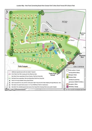
Illustrated touring-park plan with facilities, public footpaths and adjoining field-access details.
Features may come from the sample artwork, its key or published park information. Approximate numbers describe the drawing and may cover only part of a park. They are intended to help you compare map examples. Current facilities and booking information should be checked with the park.
LET’S MAP YOUR PARK
For a map quotation, find your park and draw a rough boundary around it. The area you select helps us work out the design time and price.
Draw your park for a quote ↗Or talk to our map designers
01751 473136