
Sandy Beach
A named sandy shoreline stretches across the upper edge of the plan beside the accommodation.
ILLUSTRATED PARK MAP · P591
Sandy Beach Estates, Sandy Beach, Llanfwrog, Anglesey · United Kingdom
 Enlarge the map ↗
A SENSE OF THE PLACE
Sandy Beach Leisure Park is a family-run coastal park at Llanfwrog on Anglesey. It sits directly beside the beach and has a private slipway for launching boats.
Owner-occupied static caravans and seasonal touring form its main offering, with a lodge also advertised for rent. Short-stay touring and tents are not accepted. The map helps owners and visitors navigate the accommodation and beach-access areas.
LOOK CLOSER
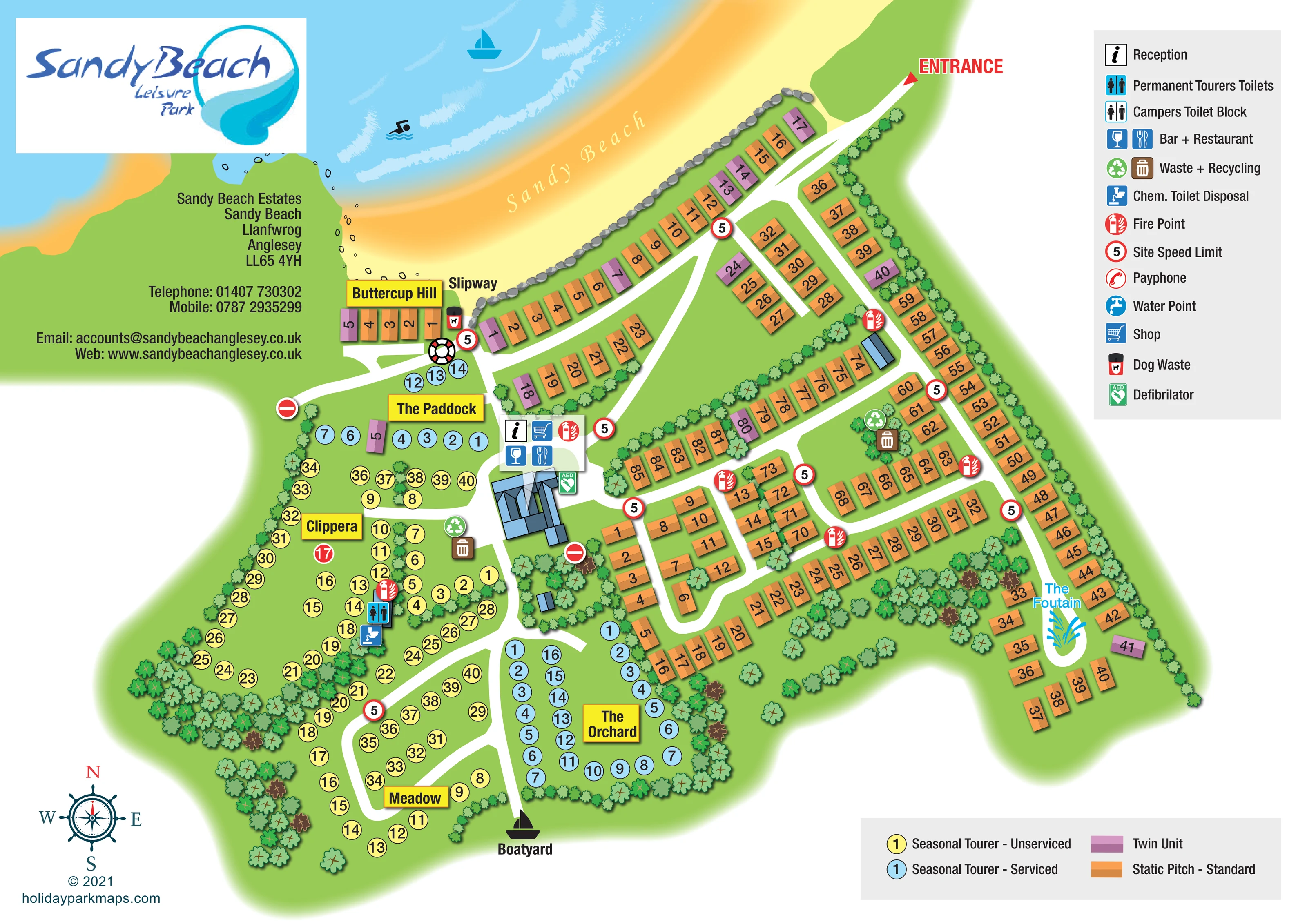
A named sandy shoreline stretches across the upper edge of the plan beside the accommodation.
Blue sea with white wave marks, a sailing-boat illustration and a swimmer pictogram establishes the coastal setting; the illustrations do not identify park-run activities.
A blue fountain illustration forms a landmark inside a small turning loop at the south-eastern end of the static accommodation roads.
Repeated tree and shrub illustrations enclose touring areas, divide static rows and create substantial planted pockets towards the south.
A continuous illustrated line of grey rocks separates the beach from much of the seafront static accommodation.
Labelled beach access beside Buttercup Hill and the western end of the seafront accommodation row.
A boatyard label and boat silhouette sit at the southern end of the road between Meadow and The Orchard.
A conspicuous red arrow marks arrival from the upper-right edge onto the internal road network.
A named sandy shoreline stretches across the upper edge of the plan beside the accommodation.
Blue sea with white wave marks, a sailing-boat illustration and a swimmer pictogram establishes the coastal setting; the illustrations do not identify park-run activities.
Labelled beach access beside Buttercup Hill and the western end of the seafront accommodation row.
A boatyard label and boat silhouette sit at the southern end of the road between Meadow and The Orchard.
A conspicuous red arrow marks arrival from the upper-right edge onto the internal road network.
An information symbol identifies reception at the central blue-roofed building complex.
A shopping-trolley symbol is grouped with reception and hospitality symbols at the central facilities.
Wine-glass and cutlery icons identify the bar and restaurant at the central building complex.
The blue toilet symbol is positioned within Clippera beside the chemical toilet disposal point.
A disposal symbol marks a service point in the western seasonal touring area.
Paired waste and recycling symbols appear near the central facilities and within the eastern static accommodation area.
Repeated red fire-point symbols are distributed through the static and touring areas.
A green AED symbol is placed beside the central facilities building.
A dog-waste bin symbol is shown beside the slipway.
A blue fountain illustration forms a landmark inside a small turning loop at the south-eastern end of the static accommodation roads.
Repeated tree and shrub illustrations enclose touring areas, divide static rows and create substantial planted pockets towards the south.
A continuous illustrated line of grey rocks separates the beach from much of the seafront static accommodation.
Red-ringed speed-limit symbols displaying 5 recur beside the roads, with no-entry symbols at selected branches.
An illustrated lifebuoy appears at the road junction beside the slipway.
A separate campers' toilet-block symbol is included in the key; its position is not clearly identifiable on the plan.
The facility key includes a water-point symbol, without a clearly identifiable mapped location.
A payphone symbol appears in the key, without a clearly identifiable mapped location.
READING THE MAP
This illustrated map of Sandy Beach Estates at Llanfwrog, Anglesey, brings the shoreline into the heart of the page. A sweeping band of sand and blue sea runs above the accommodation, immediately explaining the park's coastal character. The entrance is picked out in red at the upper right, while white internal roads connect the seafront pitches, central facilities and more sheltered touring areas further inland.
The design handles two quite different accommodation patterns. Orange static pitches and purple twin units sit in orderly roadside rows, whereas seasonal touring pitches appear as yellow or blue numbered circles within named green areas. Bright yellow signs identify Buttercup Hill, The Paddock, Clippera, Meadow and The Orchard, giving visitors useful destinations beyond individual pitch numbers.
Reception, the shop, bar and restaurant are grouped around a recognisable blue-roofed building. The slipway, boatyard and fountain add distinctive local landmarks. Separate facility and accommodation keys keep the practical information organised, making this a useful sample for coastal parks combining static accommodation, seasonal touring and boating access.
The single landscape-format plan shows the park from above, with lightly shaded accommodation blocks and illustrated landscape details. Sandy Beach curves across the top of the artwork, edged by blue water, white wave strokes and a line of grey shoreline rocks. A red entrance arrow marks the approach from the upper right. From there, a broad white road follows the coastal accommodation before dividing into the site's internal network.
Most static accommodation occupies the eastern half of the plan. Orange standard pitches and occasional purple twin units form long perimeter rows, shorter parallel groups and compact road loops. At the south-eastern end, a blue fountain illustration sits inside a small turning loop. Trees and planted strips break up the rows and provide a clear visual boundary around the site.
The western and southern sections use a different graphic language: numbered circles distinguish yellow unserviced seasonal touring pitches from blue serviced ones. The Paddock, Clippera, Meadow and The Orchard are marked by yellow nameplates, with Buttercup Hill beside the slipway. Curving access roads and tree belts give these areas a less regimented appearance than the static rows.
A central blue-roofed building is accompanied by reception, shop, bar and restaurant symbols, with an AED marker alongside. Toilets for permanent tourers and chemical toilet disposal are marked in Clippera. Fire points and waste and recycling stations appear at selected locations across the plan. A dog-waste point and lifebuoy sit near the slipway, while the boatyard is labelled at the southern road end. Two grey legend panels explain facilities and accommodation, and a nautical compass completes the page.
KEEP EXPLORING
Chosen for shared landscapes, accommodation or facilities.
 Explore the map ↗
United Kingdom
A colour-zoned coastal park map with touring areas, woodland trails, ponds and a leisure club.
 Explore the map ↗
United Kingdom
Colour-coded accommodation, central leisure facilities and coastal paths on an illustrated headland park map.
 Explore the map ↗
United Kingdom
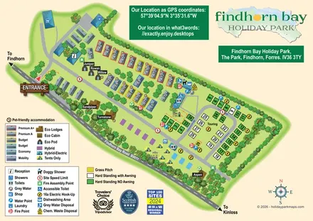
Illustrated mixed-accommodation park plan with colour-coded caravans, named eco units and a touring loop.
Features may come from the sample artwork, its key or published park information. Approximate numbers describe the drawing and may cover only part of a park. They are intended to help you compare map examples. Current facilities and booking information should be checked with the park.
LET’S MAP YOUR PARK
For a map quotation, find your park and draw a rough boundary around it. The area you select helps us work out the design time and price.
Draw your park for a quote ↗Or talk to our map designers
01751 473136