
Recreation field
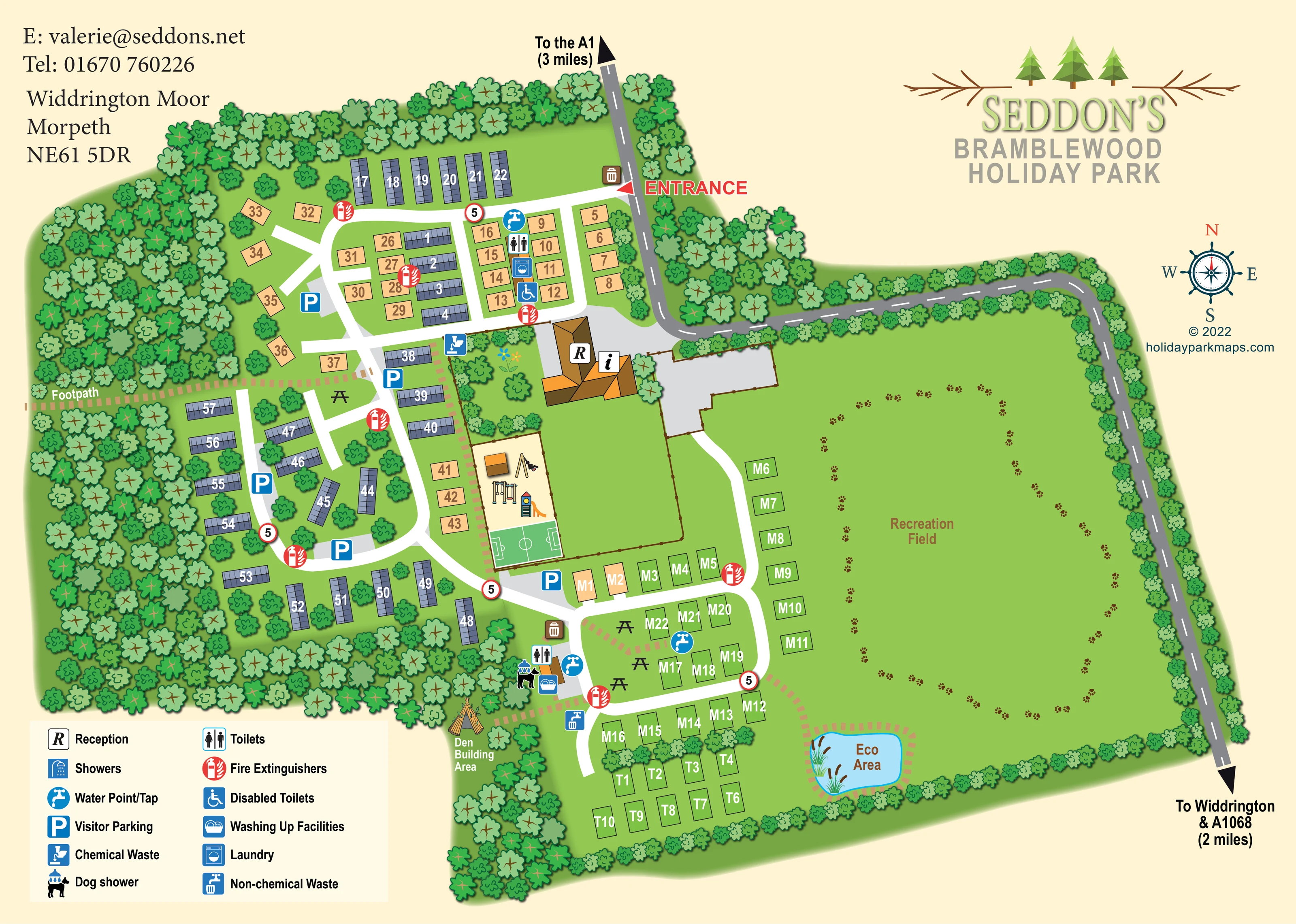
A large open field occupies most of the eastern half of the park. A loop of brown paw-print motifs is drawn across it.
ILLUSTRATED PARK MAP · P292
Widdrington Moor, Morpeth, Northumberland · United Kingdom
 Enlarge the map ↗
A SENSE OF THE PLACE
Seddons Bramblewood Holiday Park is based at Widdrington Moor, Morpeth, Northumberland. The operator describes a woodland setting at Widdrington Moor. The operator website lists static-caravan hire and seasonal touring pitches.
Published facilities include washrooms, an accessible wet room, laundry and dog-walking space.
LOOK CLOSER
A large open field occupies most of the eastern half of the park. A loop of brown paw-print motifs is drawn across it.
The south-eastern Eco Area is illustrated as a blue pond with reeds and a dashed path around its edge.
Dense overlapping tree canopies surround the western accommodation area, with smaller trees and hedges edging the eastern field and roadside.
A prominent ochre-roofed building near the entrance junction carries an R reception marker and an information symbol.
Blue P symbols mark several parking locations distributed through the accommodation area and beside the central play facilities.
Toilet symbols identify facility clusters in the northern accommodation group and beside the southern pitches.
A wheelchair symbol marks the northern facilities cluster; the legend labels this ‘Disabled Toilets’.
A washing-machine symbol identifies laundry facilities in the northern service cluster.
A prominent ochre-roofed building near the entrance junction carries an R reception marker and an information symbol.
Blue P symbols mark several parking locations distributed through the accommodation area and beside the central play facilities.
Toilet symbols identify facility clusters in the northern accommodation group and beside the southern pitches.
A wheelchair symbol marks the northern facilities cluster; the legend labels this ‘Disabled Toilets’.
A washing-machine symbol identifies laundry facilities in the northern service cluster.
A dishes symbol marks washing-up facilities beside the southern toilet building.
Showers are included in the legend, but a separate matching shower location is not clearly identifiable on the plan.
A distinctive dog-under-a-shower illustration marks a dog shower beside the southern facilities.
Blue circular tap symbols appear at the northern service cluster and in the southern pitch area.
Chemical waste and non-chemical waste symbols mark separate service points; brown bin symbols appear near the entrance and southern facilities.
Repeated red extinguisher symbols provide readily recognisable service landmarks along the internal routes.
A fenced central play enclosure contains illustrated swings, climbing equipment and a slide.
A green rectangular playing area with white football markings adjoins the children’s play equipment.
Black picnic-table silhouettes appear on grass near the western accommodation and southern pitch groups.
A large open field occupies most of the eastern half of the park. A loop of brown paw-print motifs is drawn across it.
The south-eastern Eco Area is illustrated as a blue pond with reeds and a dashed path around its edge.
A labelled woodland activity area beside the southern facilities is represented by an illustrated stick den, not an accommodation tent.
Dense overlapping tree canopies surround the western accommodation area, with smaller trees and hedges edging the eastern field and roadside.
Tan dashed paths cross the western woodland and continue past the play area, southern facilities and Eco Area. The western route is explicitly labelled ‘Footpath’.
A red entrance arrow marks access from the grey boundary road. Directional labels point towards the A1 and towards Widdrington and the A1068.
Broad white lanes form loops and short branches between accommodation groups. Red-ringed signs displaying 5 recur along these lanes.
Operator information lists an accessible wet room; the map itself identifies accessible toilets without separately naming the wet room.
Operator information lists dog-walking space. The artwork includes paw prints in the recreation field but does not explicitly label a dedicated dog-walking route.
READING THE MAP
This illustrated map of Seddons Bramblewood Holiday Park presents a woodland holiday setting at Widdrington Moor, near Morpeth in Northumberland. Dense green tree canopies frame the accommodation on the left, while a broad recreation field gives the right-hand side a deliberately open character. Between them, reception, play facilities and branching internal lanes establish the main landmarks visitors need when finding their way around.
The design combines recognisable caravan roofs with simple numbered pitch shapes, keeping accommodation locations readable without drawing every space in the same way. Blue service symbols identify practical facilities, and red markers make the entrance and fire-extinguisher points stand out against the grass. A two-column key explains the symbols in a clear panel at the lower left.
Several details give this particular map its identity: a dog-shower illustration, a woodland Den Building Area, a reed-fringed Eco Area and paw prints looping across the recreation field. Together with the tree-themed park branding and warm cream page background, these features make the plan both a visitor guide and a visual introduction to the park’s outdoor spaces.
The map is arranged as a single landscape-format plan, with the entrance near the top and the surrounding road bending along the northern and eastern boundaries. Directional arrows connect the artwork to the A1, Widdrington and the A1068. Just inside the park, a large ochre-roofed reception building carries reception and information markers beside a grey arrival area.
White internal lanes lead west into the main accommodation section, where roofed caravan illustrations and tan numbered rectangles sit in short rows and branching groups. Trees fill the spaces between units and form a particularly dense belt along the western edge. Further south, M- and T-prefixed rectangular spaces occupy more open groups beside the recreation field and southern boundary. Their prefixes are visible, although the key does not define their accommodation categories.
The central activity enclosure contains illustrated swings, climbing equipment and a slide, with a small football-marked area directly below. Nearby parking symbols and picnic-table silhouettes help establish useful meeting points. Practical facilities are concentrated in northern and southern clusters, with mapped toilets, accessible toilets, laundry, washing-up facilities, taps and waste-disposal points. The southern cluster also has a distinctive dog-shower symbol. Fire-extinguisher markers recur beside the lanes; showers appear in the legend rather than at a clearly identifiable separate location.
The eastern recreation field is drawn as uninterrupted grass with a loop of paw-print motifs. At its southern edge, the labelled Eco Area appears as a blue, reed-fringed pond. Tan dashed footpaths link woodland, accommodation and outdoor activity spaces, including the named Den Building Area. Contact details, woodland-themed branding, a compass and the lower-left symbol key complete the page. The enlarged quadrant views show details of this same plan rather than separate park sections or additional designs.
KEEP EXPLORING
Chosen for shared landscapes, accommodation or facilities.
 Explore the map ↗
United Kingdom
Woodland-framed Barnsoul map with mixed accommodation, shared facilities and paw-marked walking routes.
 Explore the map ↗
United Kingdom
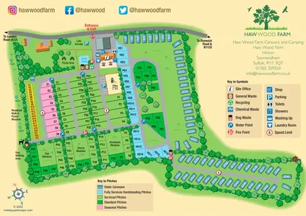
Colour-coded pitches, a leafy facilities hub and a long static-caravan wing at Haw Wood Farm, Suffolk.
 Explore the map ↗
United Kingdom
A woodland estate park map combining caravan loops, touring pitches, riverside paths and Bruce’s Cave landmarks.
Features may come from the sample artwork, its key or published park information. Approximate numbers describe the drawing and may cover only part of a park. They are intended to help you compare map examples. Current facilities and booking information should be checked with the park.
LET’S MAP YOUR PARK
For a map quotation, find your park and draw a rough boundary around it. The area you select helps us work out the design time and price.
Draw your park for a quote ↗Or talk to our map designers
01751 473136