
Wild meadow dog walking area
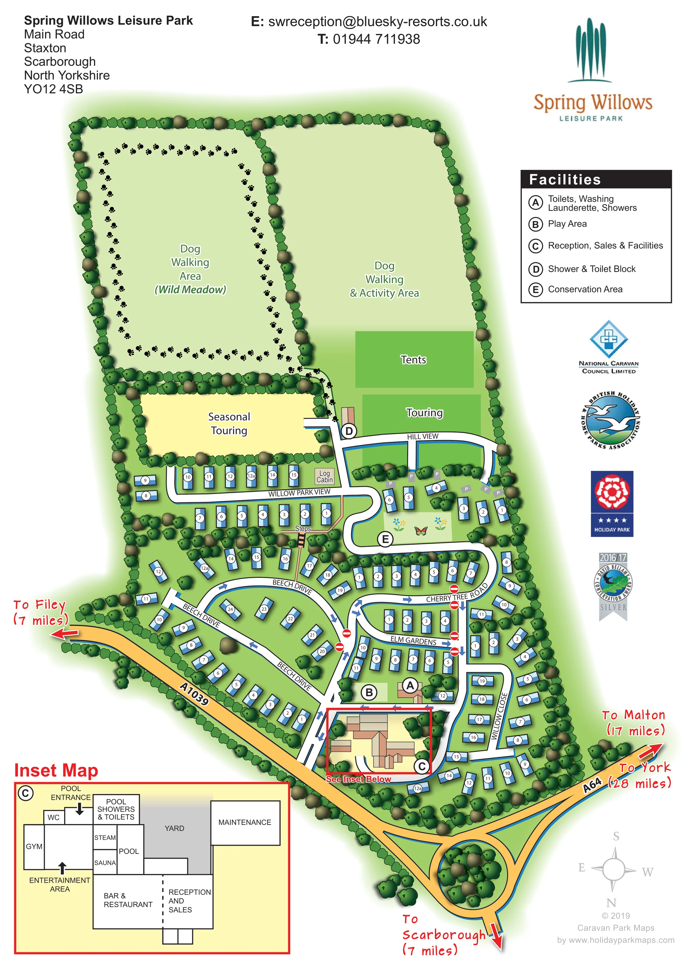
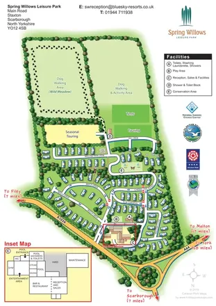
A large tree-enclosed field is labelled 'Dog Walking Area (Wild Meadow)', with a loop of paw prints indicating a walking circuit.
ILLUSTRATED PARK MAP · P600
Main Road, Staxton, Scarborough · United Kingdom
 Enlarge the map ↗
A SENSE OF THE PLACE
Spring Willows Leisure Park is based at Main Road, Staxton, Scarborough. The park is centred around a natural spring near the Yorkshire Wolds. Tourers, tents and motorhomes can use electric or non-electric pitches.
The park provides washrooms, accessible facilities, laundry, a bar/restaurant and an indoor pool and spa.
LOOK CLOSER
A large tree-enclosed field is labelled 'Dog Walking Area (Wild Meadow)', with a loop of paw prints indicating a walking circuit.
A second large field is labelled for dog walking and activities and contains the designated tent and touring areas.
Facility E identifies a small green space inside a road bend, illustrated with flowers and a butterfly.
Dense illustrated planting encloses the fields, divides accommodation groups and follows the external roads.
Facility C marks the main building complex near the entrance; reception and sales are separately labelled in its enlarged inset.
A large section of the main facilities inset is labelled 'Bar & Restaurant'.
The facilities inset identifies the pool and a separate pool entrance.
Adjacent rooms beside the pool are labelled 'Sauna' and 'Steam'.
Facility C marks the main building complex near the entrance; reception and sales are separately labelled in its enlarged inset.
A large section of the main facilities inset is labelled 'Bar & Restaurant'.
The facilities inset identifies the pool and a separate pool entrance.
Adjacent rooms beside the pool are labelled 'Sauna' and 'Steam'.
A gym is labelled on the left side of the facilities inset.
An arrow in the facilities inset identifies the entertainment area beside the gym.
Mapped facility A provides toilets, washing, a launderette and showers; D marks a shower and toilet block by the touring fields. Pool showers, toilets and a WC also appear in the inset.
Facility B marks a pale-green play area near the washroom building and main facilities complex.
A large tree-enclosed field is labelled 'Dog Walking Area (Wild Meadow)', with a loop of paw prints indicating a walking circuit.
A second large field is labelled for dog walking and activities and contains the designated tent and touring areas.
Facility E identifies a small green space inside a road bend, illustrated with flowers and a butterfly.
Dense illustrated planting encloses the fields, divides accommodation groups and follows the external roads.
Hill View, Willow Park View, Beech Drive, Cherry Tree Road, Elm Gardens and Willow Close organise the accommodation.
Blue arrows and red no-entry symbols distinguish travel directions on several internal road sections.
A narrow peach-coloured path links Willow Park View and Beech Drive, with steps explicitly marked.
Grey spaces bearing a white P sit beside the small accommodation group above the conservation area.
The plan includes the adjoining roads and roundabout, with directional annotations towards Filey, Scarborough, Malton and York.
The facilities inset distinguishes a grey yard and a maintenance building from visitor spaces.
The park information describes a setting centred around a natural spring near the Yorkshire Wolds; the spring is not explicitly located in this artwork.
Accessible facilities are mentioned in the park information but are not separately identified on the map.
READING THE MAP
This illustrated map of Spring Willows Leisure Park at Staxton, near Scarborough, brings together holiday-home streets, touring fields and generous outdoor recreation spaces on one portrait page. Tree-lined boundaries give the plan a strong green framework, while the contrast between compact accommodation rows and open fields makes the park’s different areas easy to recognise.
The map shows numbered caravan-style holiday homes along named roads, a log cabin beside Willow Park View, and separate areas for touring, seasonal touring and tents. Two substantial dog walking spaces are prominent, including a wild meadow with a paw-print circuit. A smaller conservation area is picked out with flowers and a butterfly.
Visitor facilities are handled at two scales. Lettered markers locate the principal amenities across the park, while an enlarged inset explains the reception and leisure complex, including its bar and restaurant, pool, gym, sauna and steam room. The adjoining A1039, A64 and roundabout provide arrival context without requiring a separate location diagram.
The main plan divides naturally into two contrasting sections. In the lower part of the page, blue-and-white accommodation symbols follow a network of curved roads and short connecting streets. Beech Drive forms a broad loop, Cherry Tree Road curves around another group, and Elm Gardens and Willow Close organise smaller rows. Willow Park View runs across the transition to the larger fields. Circular number badges identify individual positions, while road names sit directly on the white carriageways.
Above this denser accommodation area, the map shows a pale-yellow seasonal touring field and green areas labelled Touring and Tents. Hill View provides access to the touring section, with shower and toilet facility D nearby. The largest outdoor spaces are the tree-enclosed wild meadow and the neighbouring dog walking and activity area. Paw prints create a clear circuit around the meadow and continue towards its access point. A narrow pedestrian route between Willow Park View and Beech Drive includes labelled steps.
Facilities A and B locate the washing, laundry, shower and toilet building and the nearby play area. Conservation area E occupies a small green pocket within a road bend. Parking symbols appear beside the adjacent accommodation group.
The main facilities complex, marked C, is enclosed by a red callout frame. Its matching lower-left inset uses a simple floor-plan treatment to distinguish reception and sales, the bar and restaurant, entertainment area, gym, pool, sauna, steam room, WC and pool washrooms. The yard and maintenance building are also labelled. Yellow public roads and the illustrated roundabout frame the approach, with red destination arrows outside the park. The right-hand column contains the facilities key and badges, while a grey compass indicates that north is towards the bottom of the page.
KEEP EXPLORING
Chosen for shared landscapes, accommodation or facilities.
 Explore the map ↗
United Kingdom
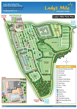
Colour-coded accommodation, central leisure facilities and coastal paths on an illustrated headland park map.
 Explore the map ↗
United Kingdom
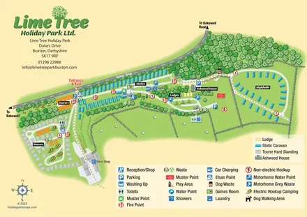
Portrait park plan with named fields, numbered accommodation, beach directions and an enlarged leisure-complex inset.
 Explore the map ↗
United Kingdom
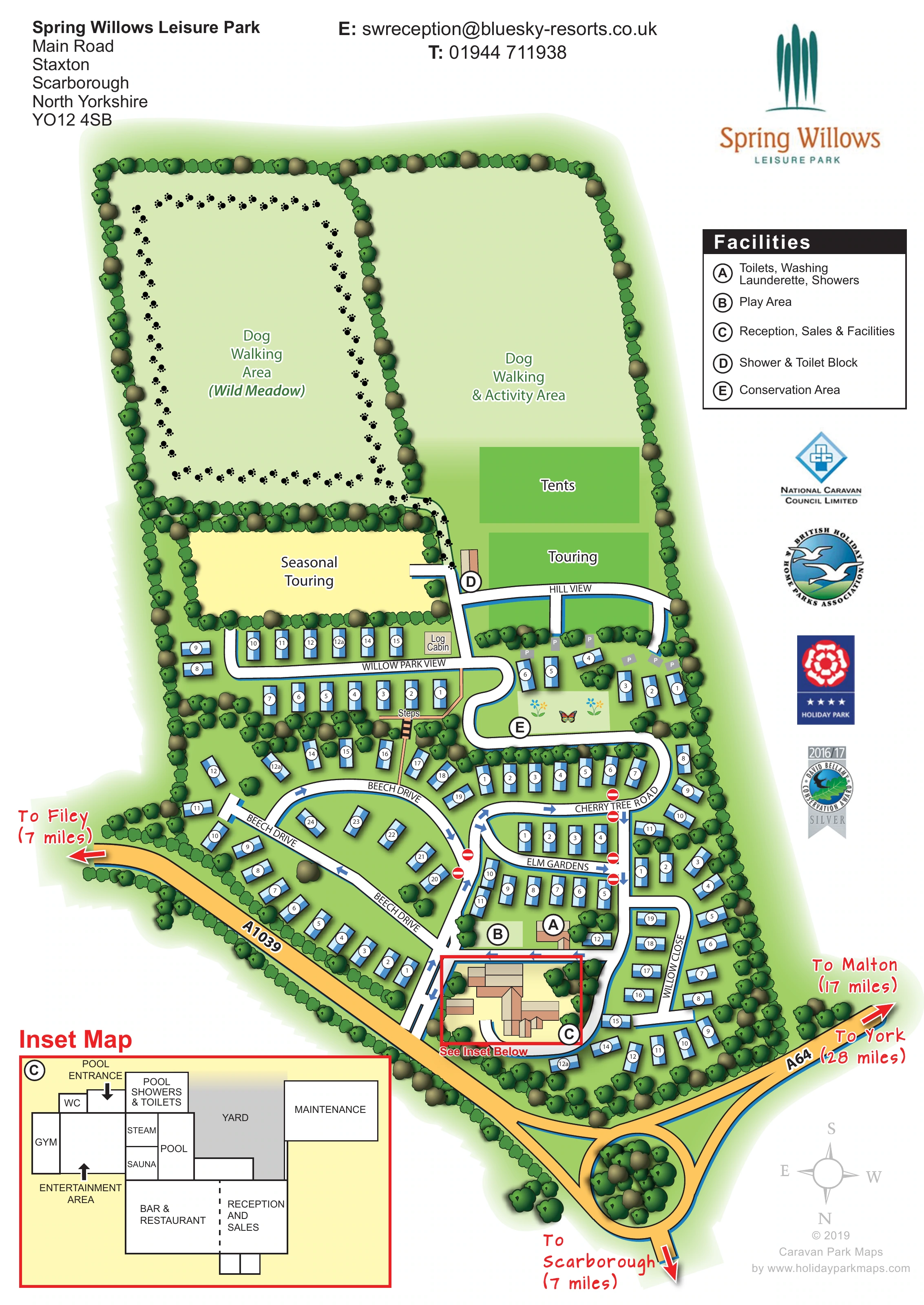
Mixed-accommodation park map with woodland, public footpaths and clearly differentiated service symbols.
Features may come from the sample artwork, its key or published park information. Approximate numbers describe the drawing and may cover only part of a park. They are intended to help you compare map examples. Current facilities and booking information should be checked with the park.
TAKE A CLOSER LOOK
View the illustrated map in detail or choose a file to download. These are sample maps; contact the park for current visitor information.


LET’S MAP YOUR PARK
For a map quotation, find your park and draw a rough boundary around it. The area you select helps us work out the design time and price.
Draw your park for a quote ↗Or talk to our map designers
01751 473136
 springwillowsparkmaprotated_large.png
 springwillowsparkmap_large.png
 springwillowsparkmaprotated.png