
Six named fishery waters
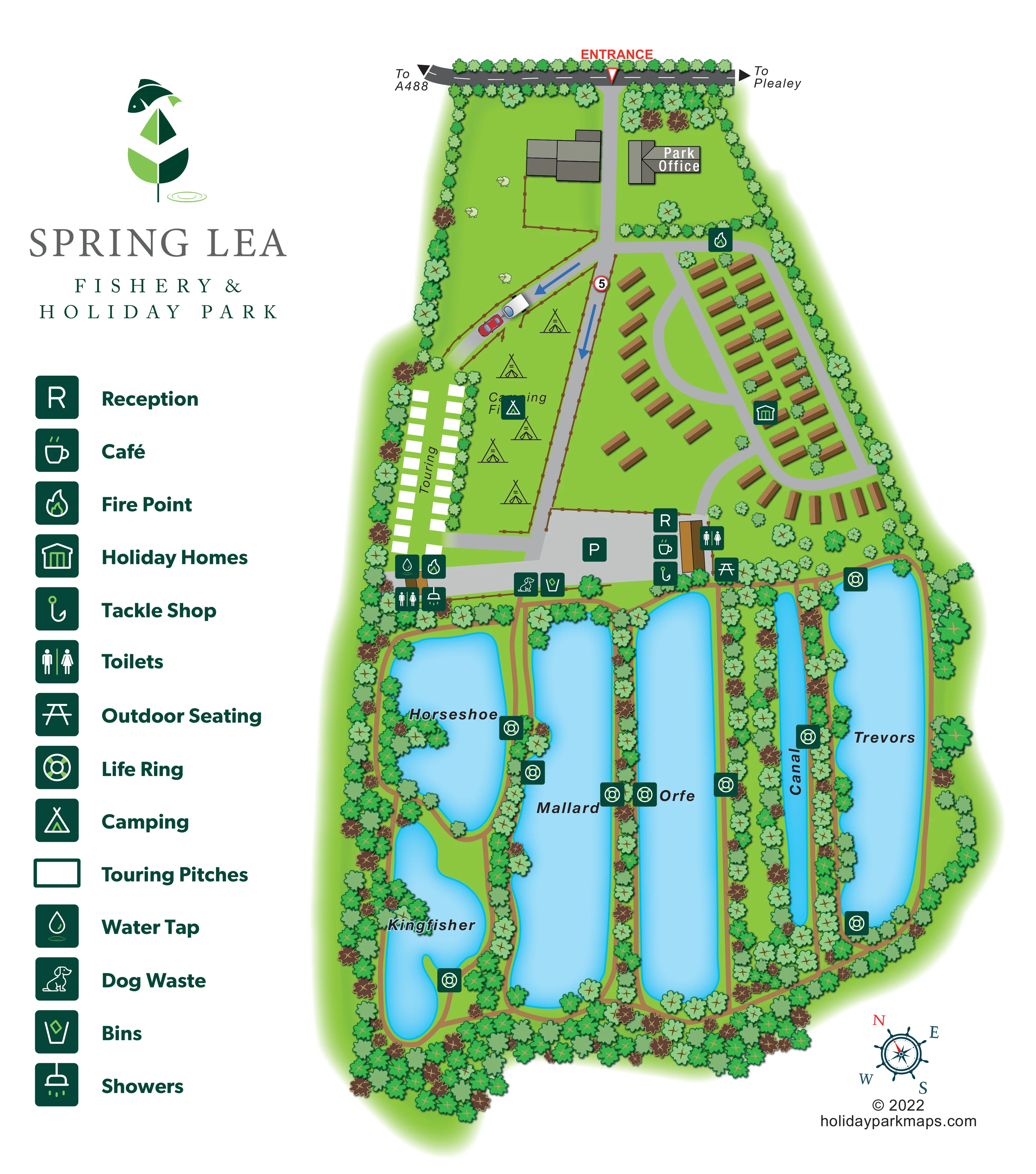
Horseshoe, Kingfisher, Mallard, Orfe, Canal and Trevors occupy the lower part of the plan. Their contrasting shapes and clearly placed names provide the principal landscape landmarks.
ILLUSTRATED PARK MAP · P310
Plealey Road, Lea Cross, Shrewsbury, Shropshire · United Kingdom
 Enlarge the map ↗
A SENSE OF THE PLACE
Spring Lea Holiday Park and Fishery is a rural holiday lodge park at Lea Cross near Shrewsbury. Fishing lakes form a central part of its setting in the Shropshire countryside.
Waterside lodges are offered for holiday home ownership, with decking connecting the accommodation to its outdoor surroundings. The map highlights the relationship between the lodge areas, lakes and park routes.
LOOK CLOSER
Horseshoe, Kingfisher, Mallard, Orfe, Canal and Trevors occupy the lower part of the plan. Their contrasting shapes and clearly placed names provide the principal landscape landmarks.
Dense illustrated trees frame the park, separate the lakes and soften the edges of the accommodation areas.
A green enclosure with small sheep illustrations lies to the left of the entrance drive, adding rural context without being labelled as a visitor facility.
Brown paths follow the lake margins, pass between the long parallel waters and connect across their upper and lower ends.
A red entrance label and triangular pointer identify the turn from the road at the top of the plan.
The road above the entrance has outward arrows labelled To A488 on the left and To Plealey on the right.
Grey roads lead from the entrance to the camping and touring areas, central parking and curving holiday-home loops. Blue arrows mark travel direction on two approach lanes.
A directly labelled grey-roofed building stands just inside the entrance, separate from the reception facilities farther down the park.
Horseshoe, Kingfisher, Mallard, Orfe, Canal and Trevors occupy the lower part of the plan. Their contrasting shapes and clearly placed names provide the principal landscape landmarks.
Brown paths follow the lake margins, pass between the long parallel waters and connect across their upper and lower ends.
Dense illustrated trees frame the park, separate the lakes and soften the edges of the accommodation areas.
A red entrance label and triangular pointer identify the turn from the road at the top of the plan.
The road above the entrance has outward arrows labelled To A488 on the left and To Plealey on the right.
Grey roads lead from the entrance to the camping and touring areas, central parking and curving holiday-home loops. Blue arrows mark travel direction on two approach lanes.
A directly labelled grey-roofed building stands just inside the entrance, separate from the reception facilities farther down the park.
An R symbol locates reception beside the central parking area, at the transition between accommodation and the lakes.
A cup symbol marks the café in the central service cluster beside reception.
A fishing-hook symbol places the tackle shop beside the reception and café building, close to the lake paths.
A P marker identifies a broad grey parking area between the camping field and the lakeside service building.
Toilet symbols appear beside the touring area and the central service building; a shower symbol is shown at the touring-side facilities.
A picnic-table symbol marks outdoor seating beside the central service building and the head of the lake paths.
A water-drop symbol marks a tap near the lower end of the touring pitches.
Fire-point symbols are placed near the touring facilities and at the upper edge of the holiday-home area.
Repeated life-ring symbols identify mapped locations around the named waters and along the paths between them.
Bin and dog-waste symbols sit beside the central access area, near the route into the lake-path network.
A green enclosure with small sheep illustrations lies to the left of the entrance drive, adding rural context without being labelled as a visitor facility.
READING THE MAP
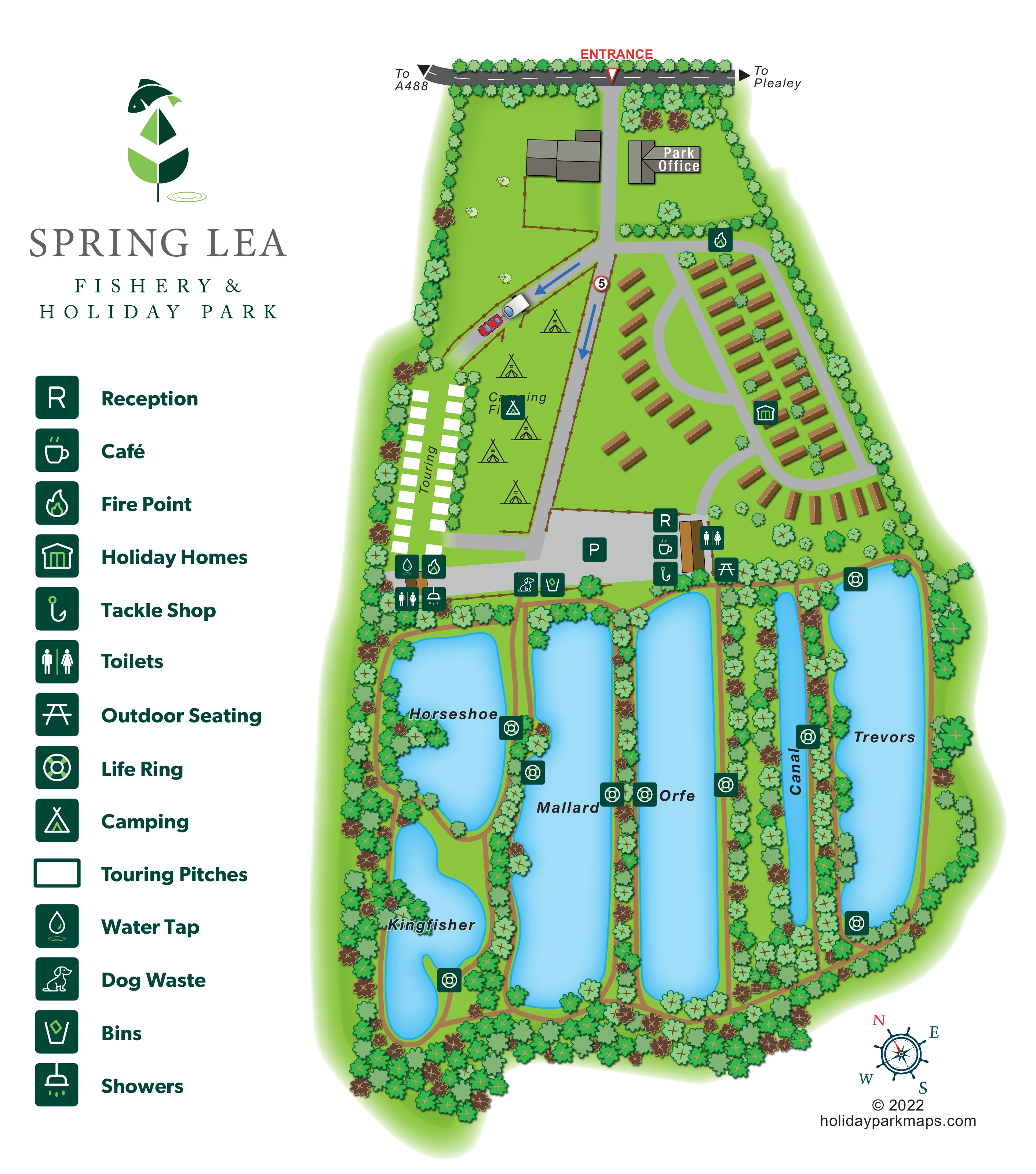
Fishing lakes shape this illustrated map of Spring Lea Fishery & Holiday Park at Lea Cross, near Shrewsbury in Shropshire. Six named waters occupy much of the plan, with tree-lined paths threading between them and around their banks. Above the lakes, the map brings together holiday homes, touring pitches and an open camping field in clearly differentiated areas.
The arrival sequence is easy to follow: a red entrance marker leads from the roadside to the park office, then onwards to the accommodation roads and a central parking and service area. Reception, the café and tackle shop are grouped beside the routes into the fishery, making their relationship to both staying guests and lake visitors immediately apparent.
The design uses bright green grounds, pale-blue water and a large dark-green pictogram legend. Brown holiday-home illustrations and white touring-pitch rectangles remain distinct from the more organic lake shapes. This sample is particularly relevant to parks where fishing waters are a defining attraction and the map needs to explain accommodation, visitor facilities and lakeside routes together.
The portrait artwork places Spring Lea’s fish-and-leaf logo, park name and facility legend down the left, leaving the main illustrated plan to fill the right-hand side and lower page. The entrance sits at the top beneath a roadside strip carrying directions towards the A488 and Plealey. A grey drive passes the labelled park office and branches into the accommodation areas. Blue arrows mark direction on the camping-side approach lanes, where a small car and caravan illustration adds context.
Two rows of white touring-pitch rectangles follow the left boundary. Immediately alongside them, a fenced Camping Field contains outline tent illustrations. Brown holiday homes occupy the opposite side of the park, arranged in staggered rows around curving grey roads, with a fan-like group following the lower bend.
A broad parking area lies between these accommodation zones and the lakes. Reception, café and tackle-shop symbols identify the adjoining service building, with toilets and outdoor seating close by. Additional toilets, showers, a water tap and a fire point are shown at the touring end; another fire point appears above the holiday homes. Bin and dog-waste markers sit near the central route.
Below this hub, Horseshoe and Kingfisher have irregular outlines, while Mallard, Orfe, Canal and Trevors form a series of elongated waters. Brown paths connect their banks, and dense illustrated trees separate the lakes and enclose the park. Life-ring markers remain conspicuous against the blue water and green planting. A decorative compass rose completes the lower-right corner. The composition is a single integrated park plan, rather than separate accommodation and fishing maps.
KEEP EXPLORING
Chosen for shared landscapes, accommodation or facilities.
 Explore the map ↗
United Kingdom
Ashby Park map with seven fishing lakes, colour-coded accommodation and illustrated wooded shorelines.
 Explore the map ↗
United Kingdom
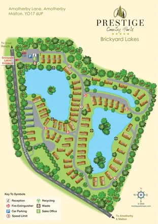
Brickyard Lakes map with lakeside holiday homes, wooded islands and clearly marked arrival facilities.
 Explore the map ↗
United Kingdom
Colour-coded accommodation, lakeside facilities and woodland routes at Burton Constable Holiday Park & Arboretum.
Features may come from the sample artwork, its key or published park information. Approximate numbers describe the drawing and may cover only part of a park. They are intended to help you compare map examples. Current facilities and booking information should be checked with the park.
TAKE A CLOSER LOOK
View the illustrated map in detail or choose a file to download. These are sample maps; contact the park for current visitor information.


LET’S MAP YOUR PARK
For a map quotation, find your park and draw a rough boundary around it. The area you select helps us work out the design time and price.
Draw your park for a quote ↗Or talk to our map designers
01751 473136
 springleasalop_large.png