
Tree-lined boundaries and planted divisions
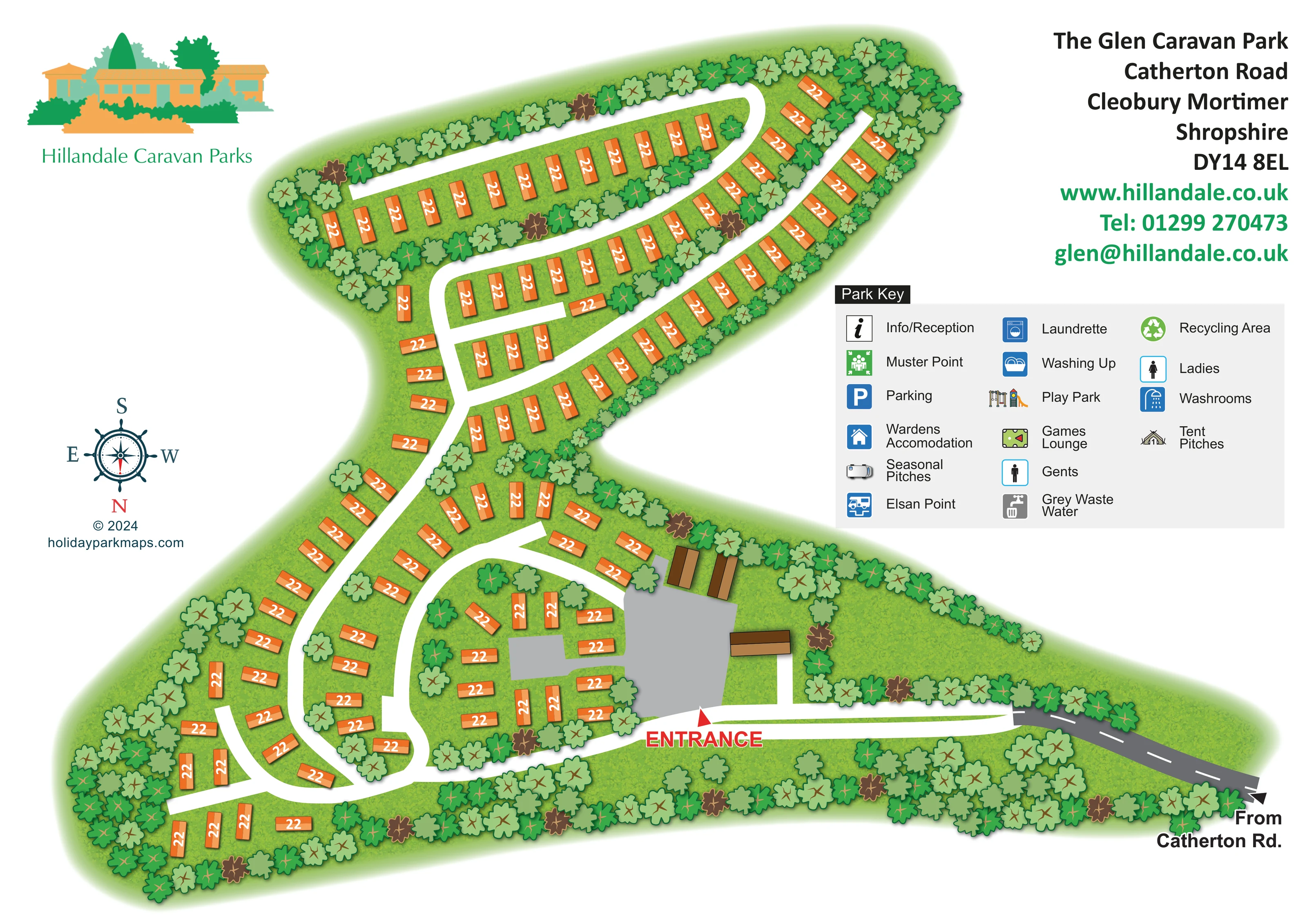
Dense illustrated trees enclose most of the park and divide several accommodation rows, with smaller groups scattered between plots.
ILLUSTRATED PARK MAP · P331
The Glen Caravan Park, Catherton Road, Cleobury Mortimer, Shropshire · United Kingdom
 Enlarge the map ↗
A SENSE OF THE PLACE
The Glen Caravan Park is a holiday home park near Cleobury Mortimer in Shropshire. Terraced pitches are designed to make the most of views across the surrounding countryside.
Landscaped plots and private decking provide outdoor space for owners. The operator describes a calm setting particularly suited to couples, with visiting relatives also welcomed; nearby fishing and golf offer activities beyond the park.
LOOK CLOSER
Dense illustrated trees enclose most of the park and divide several accommodation rows, with smaller groups scattered between plots.
Textured green ground surrounds the accommodation, including a relatively open tree-edged area beside the approach road.
A grey external road labelled 'From Catherton Rd.' joins a white approach route; a red arrow and ENTRANCE label mark arrival beside the central forecourt.
White roads form a lower loop, a long connecting spine and sweeping parallel branches serving the upper accommodation rows.
Three brown-roofed building forms stand around a sizeable grey forecourt near the entrance. Their individual uses are not labelled.
Dense illustrated trees enclose most of the park and divide several accommodation rows, with smaller groups scattered between plots.
Textured green ground surrounds the accommodation, including a relatively open tree-edged area beside the approach road.
A grey external road labelled 'From Catherton Rd.' joins a white approach route; a red arrow and ENTRANCE label mark arrival beside the central forecourt.
White roads form a lower loop, a long connecting spine and sweeping parallel branches serving the upper accommodation rows.
Three brown-roofed building forms stand around a sizeable grey forecourt near the entrance. Their individual uses are not labelled.
Named in the key with an information symbol; no corresponding position is identifiable on the plan.
A blue P symbol appears in the key. The grey forecourt is visible, but it is not explicitly marked as parking.
Included in the key with a blue house symbol, without an identifiable placement.
A washing-machine symbol and label appear in the key only.
Listed in the key with a dishwashing symbol; location is not marked.
Separate ladies, gents and shower-style washroom symbols appear in the key, without identifiable locations.
Both waste-disposal services are named in the key. No separate fresh-water point is explicitly identified.
Shown as a green recycling emblem in the key only.
A small illustrated play-equipment symbol appears in the key, but no play area is identifiable on the main plan.
Represented by a pool-table icon in the key only.
A green assembly-point symbol appears in the key without an identifiable mapped position.
READING THE MAP
This illustrated map presents The Glen Caravan Park near Cleobury Mortimer in Shropshire as a tree-lined holiday-home site with a distinctive network of curving roads. Orange accommodation blocks stand out against textured green grounds, while belts of illustrated trees trace the boundary and divide the longer rows of plots. The result makes the park's overall shape and arrangement easy to understand at a glance.
Arrival is a prominent part of the composition. The approach from Catherton Road leads towards a red entrance marker and a central group of buildings beside a grey forecourt. From here, white internal roads connect the lower clusters of holiday homes with the sweeping rows in the upper part of the plan.
Hillandale Caravan Parks branding, a substantial park key and a decorative compass complete the landscape-format page. This sample is particularly relevant to holiday-home parks seeking an illustrated overview that communicates landscaped surroundings and road-led plot organisation without relying on an aerial photograph.
The plan is organised around an irregular, elongated green footprint, enclosed almost continuously by illustrated trees. In the upper part of the artwork, accommodation follows several long, gently curving rows. White roads run between these rows, with planted strips reinforcing their separation. A connecting road narrows through the middle of the site before opening into the more varied layout below.
The lower section combines perimeter plots, smaller internal clusters and a broad looping route. Near the entrance, three brown-roofed building forms stand around a large grey hardstanding area. Additional accommodation sits close to this central space, while an open green area extends towards the approach on the right. The buildings are visually distinct from the orange holiday-home blocks, although their individual functions are not labelled.
Catherton Road is indicated by a dark-grey approach with dashed white markings and an arrow at the page edge. This changes to a white route leading into the park. A red arrow and large ENTRANCE label make the arrival point conspicuous. The compass is unusual in placing north towards the bottom of the page.
The three-column key names reception, parking, wardens' accommodation, laundry and washing-up facilities, toilets and washrooms, recycling, waste disposal, a play park, games lounge and muster point. Seasonal and tent pitches are also included. These entries explain the symbol vocabulary, but their corresponding locations are not identifiable in the main drawing.
The accompanying enlarged view provides a closer look at this key and the approach area; it is a detail of the same artwork, not a separate map or additional accommodation section.
KEEP EXPLORING
Chosen for shared landscapes, accommodation or facilities.
 Explore the map ↗
United Kingdom
Coastal park map with static-caravan rows, touring pitches, a camping field and two leisure clusters.
 Explore the map ↗
United Kingdom
A wooded Allerton park plan with colour-coded neighbourhoods, touring pitches and a central facilities hub.
 Explore the map ↗
United Kingdom
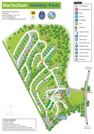
A wooded, mixed-accommodation park plan with winding lanes, a pool, camping areas and a clear facility key.
Features may come from the sample artwork, its key or published park information. Approximate numbers describe the drawing and may cover only part of a park. They are intended to help you compare map examples. Current facilities and booking information should be checked with the park.
LET’S MAP YOUR PARK
For a map quotation, find your park and draw a rough boundary around it. The area you select helps us work out the design time and price.
Draw your park for a quote ↗Or talk to our map designers
01751 473136