
Tree and hedge boundaries
Continuous stylised hedges enclose much of the site, reinforced by mature-tree symbols and several internal tree clusters.
ILLUSTRATED PARK MAP · P619
The Grange Touring Park, Yarmouth Road, Ormesby, Great Yarmouth, Norfolk · United Kingdom
 Enlarge the map ↗
A SENSE OF THE PLACE
The Grange Touring Park is a family touring and camping site at Ormesby near Great Yarmouth. Level pitches, mature trees and surfaced access roads form its layout.
Electric pitches and hardstanding options support touring stays. The adjacent Grange pub offers food and children's play equipment, while the Norfolk coast and Broads provide options for exploring beyond the campsite.
LOOK CLOSER
Continuous stylised hedges enclose much of the site, reinforced by mature-tree symbols and several internal tree clusters.
A tan office building with the information symbol stands beside the central arrival junction.
A separate small building beside the site office is labelled Warden Office.
A prominent grey building is named beside the northern pitch area, with parking and a playground nearby.
Two pale-green play areas contain illustrated swings and slides: one near the public house and one beside the amenities building.
A ball game area is labelled near the eastern entrance approach; its precise extent is not outlined.
Toilet and shower symbols identify the amenities building on the western side of the central junction.
The wheelchair symbol at the amenities building corresponds to the legend entry for disabled toilets and showers.
A tan office building with the information symbol stands beside the central arrival junction.
A separate small building beside the site office is labelled Warden Office.
A prominent grey building is named beside the northern pitch area, with parking and a playground nearby.
Two pale-green play areas contain illustrated swings and slides: one near the public house and one beside the amenities building.
A ball game area is labelled near the eastern entrance approach; its precise extent is not outlined.
Toilet and shower symbols identify the amenities building on the western side of the central junction.
The wheelchair symbol at the amenities building corresponds to the legend entry for disabled toilets and showers.
A washing-machine symbol marks the launderette within the amenities cluster.
A dishwashing symbol is positioned at the amenities building.
Coral tap symbols are distributed through the northern loop, arrival area and southern pitch rows.
A motorhome waste symbol appears immediately south of the amenities building.
An Elsan disposal symbol is shown beside the amenities and western playground cluster.
A bin symbol marks a tree-screened position within the upper part of the southern pitch area.
Black dog silhouettes mark dog waste points near internal roads and the northern boundary.
Parking symbols identify spaces near the public house and on the central arrival spur.
Continuous stylised hedges enclose much of the site, reinforced by mature-tree symbols and several internal tree clusters.
Pale-grey roads connect the entrance, central facilities, smaller northern loop and larger southern circuit.
The road along the eastern boundary is labelled Caister By Pass, with arrows towards Hemsby and Great Yarmouth.
A discreet compass in the left margin establishes north towards the top of the page.
READING THE MAP
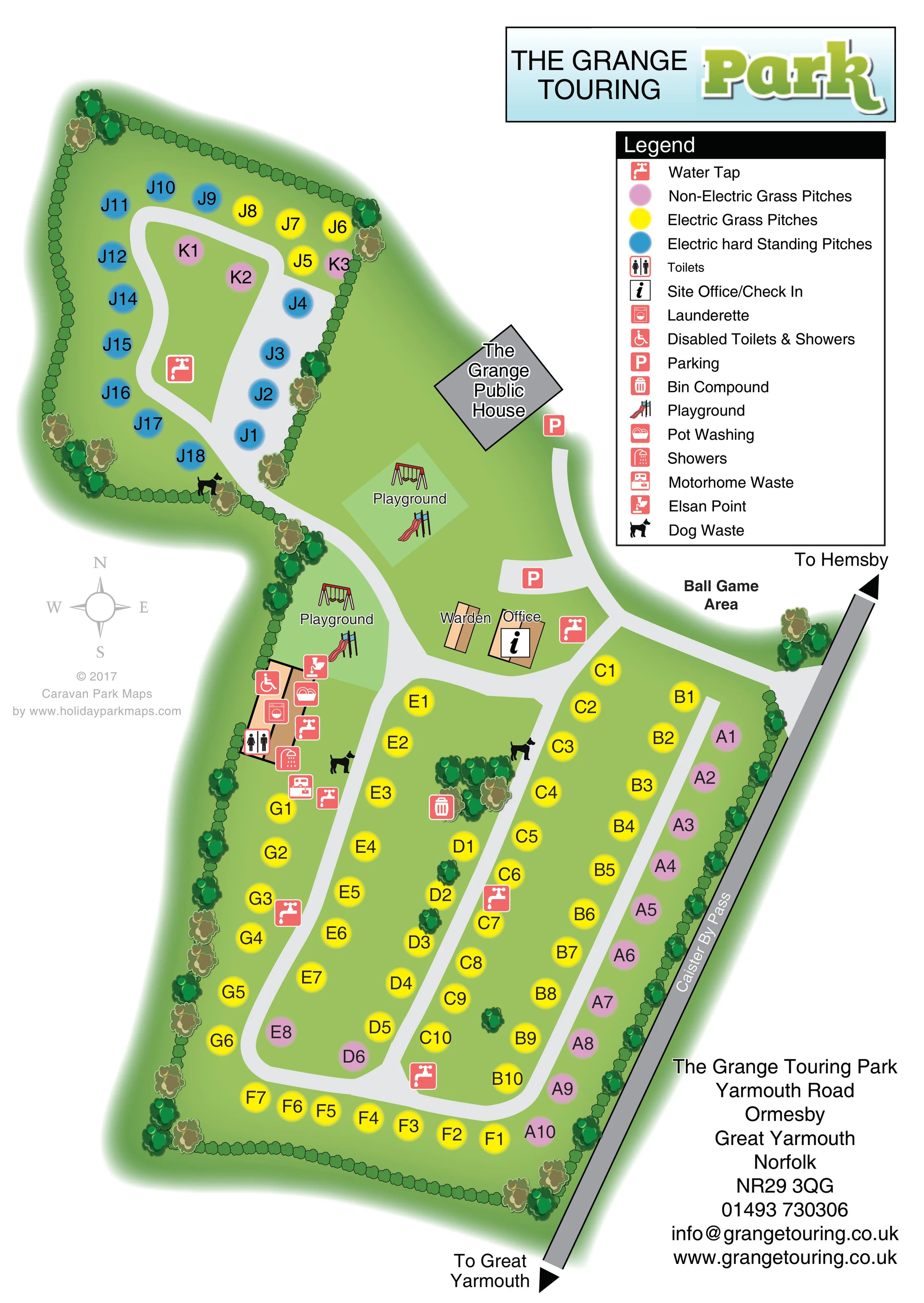
This map of The Grange Touring Park in Ormesby, near Great Yarmouth, presents a tree-lined touring site through a clear overhead plan. Its most useful feature is the distinction between three pitch types: yellow for electric grass, pink for non-electric grass and blue for electric hardstanding. Letter-and-number references sit directly inside the coloured markers, helping visitors connect their pitch allocation with the layout.
The artwork brings together a smaller northern loop and a larger southern pitch area around a central arrival zone. The site office, warden office and amenities building provide recognisable landmarks, while The Grange Public House occupies a prominent position beside the northern section. Two illustrated playgrounds and a labelled ball game area add useful family-oriented detail.
Hedged boundaries, rounded tree symbols and softly shaded green ground give the plan a landscaped character without obscuring its practical information. A large right-hand legend explains the service symbols, and the roadside arrows towards Hemsby and Great Yarmouth place the entrance in its local travel context.
The portrait artwork uses an overhead plan with north towards the top of the page. The park has an elongated, irregular outline, with the mapped Caister By Pass running diagonally along its eastern edge. An entrance road branches west into the site and reaches a central junction beside the site office and warden office. Nearby parking and a separate spur towards The Grange Public House help distinguish the arrival area from the pitch roads.
To the north-west, a compact looping road serves a mixed group of pitches, with blue electric hardstanding markers particularly prominent. The southern section is larger, with long pitch rows arranged around a broad circuit and internal access lanes. Yellow electric grass markers dominate this area, while pink non-electric grass markers form a noticeable row beside the eastern boundary and appear in smaller groups elsewhere. Each pitch carries an alphanumeric reference.
The amenities building lies west of the central junction. Its symbols identify toilets, showers, disabled toilets and showers, a launderette and pot washing. Elsan and motorhome waste points are shown nearby. Water taps appear throughout the accommodation areas, with a bin compound among an internal tree cluster and dog waste symbols beside selected routes.
Two pale-green playground areas contain illustrated swings and slides: one near the public house and another beside the amenities. A ball game area is named near the entrance approach. Hedges and varied tree canopies frame the site, while a restrained compass occupies the left margin. The title, comprehensive legend and contact block sit to the right. The accompanying enlarged view simply makes this legend and part of the entrance area easier to read.
KEEP EXPLORING
Chosen for shared landscapes, accommodation or facilities.
 Explore the map ↗
United Kingdom
Coastal park map with static-caravan rows, touring pitches, a camping field and two leisure clusters.
 Explore the map ↗
United Kingdom
A wooded Allerton park plan with colour-coded neighbourhoods, touring pitches and a central facilities hub.
 Explore the map ↗
United Kingdom
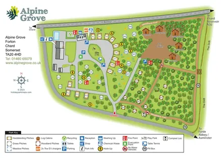
Colour-coded pitches, named log cabins and a woodland trail at Alpine Grove, Somerset.
Features may come from the sample artwork, its key or published park information. Approximate numbers describe the drawing and may cover only part of a park. They are intended to help you compare map examples. Current facilities and booking information should be checked with the park.
LET’S MAP YOUR PARK
For a map quotation, find your park and draw a rough boundary around it. The area you select helps us work out the design time and price.
Draw your park for a quote ↗Or talk to our map designers
01751 473136