
Loch Linnhe
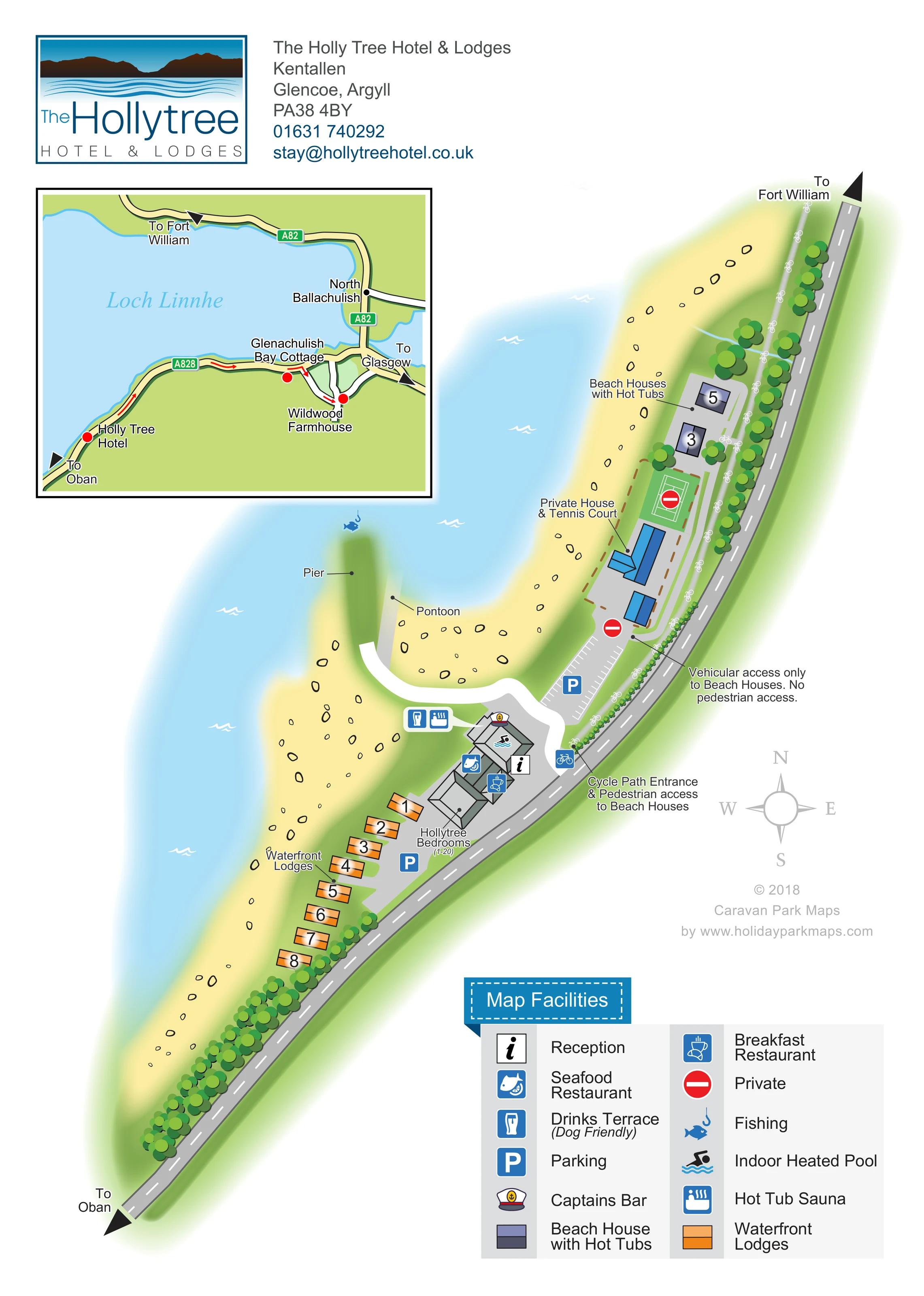
The loch forms the waterside edge of the main plan and is explicitly named in the regional inset.
ILLUSTRATED PARK MAP · P621
The Holly Tree Hotel & Lodges, Kentallen, Glencoe, Argyll · United Kingdom
 Enlarge the map ↗
A SENSE OF THE PLACE
The Holly Tree Hotel and its neighbouring lodges occupy a waterside location at Kentallen on Loch Linnhe. Views across the loch towards the Morvern hills define the setting near Glencoe.
The hotel offers sea-view rooms, a seafood restaurant, bar, indoor pool and hot tub spa. Adjacent lodges and beach houses provide self-catering alternatives, including accommodation with private hot tubs and dog-friendly choices.
LOOK CLOSER
The loch forms the waterside edge of the main plan and is explicitly named in the regional inset.
A broad pale-yellow shore, scattered with outlined stones, follows the loch around the accommodation and pier.
Repeated rounded tree canopies line the roadside and separate properties. A thin blue watercourse crosses the northern grounds towards the shore.
An information-style reception symbol is positioned at the main hotel building and identified in the key.
A fish-and-lemon pictogram marks the restaurant within the hotel complex.
A cup-and-croissant symbol identifies the breakfast restaurant at the hotel.
A distinctive captain's hat symbol marks the bar in the main building.
A drinks symbol beside the loch-facing hotel area denotes the terrace; the legend describes this terrace as dog friendly.
An information-style reception symbol is positioned at the main hotel building and identified in the key.
A fish-and-lemon pictogram marks the restaurant within the hotel complex.
A cup-and-croissant symbol identifies the breakfast restaurant at the hotel.
A distinctive captain's hat symbol marks the bar in the main building.
A drinks symbol beside the loch-facing hotel area denotes the terrace; the legend describes this terrace as dog friendly.
A swimmer symbol is placed over the northern part of the hotel building.
The key's combined 'Hot Tub Sauna' symbol is mapped beside the drinks terrace, with a callout towards the hotel.
A leader-line label identifies the northern beach houses as accommodation with hot tubs; individual tubs are not separately illustrated.
Blue parking symbols identify parking beside the hotel and lodges, and a marked-bay car park north of the main building.
A fish-and-hook symbol appears in the loch near the end of the pier.
Separate leader lines identify the projecting pier and the narrow pontoon alongside it.
The loch forms the waterside edge of the main plan and is explicitly named in the regional inset.
A broad pale-yellow shore, scattered with outlined stones, follows the loch around the accommodation and pier.
Repeated rounded tree canopies line the roadside and separate properties. A thin blue watercourse crosses the northern grounds towards the shore.
A labelled cycle-path entrance beside the hotel leads to a route parallel to the road, marked with repeated bicycle symbols and identified as pedestrian access to the beach houses.
A northern road connection is specifically labelled as vehicular access only to the beach houses, distinct from the pedestrian route.
A blue-roofed house and green tennis court occupy a dashed-boundary enclosure between the hotel and beach houses. Both the label and red private symbols distinguish this from guest facilities.
The inset shows the A828 and A82, North Ballachulish, directions towards Oban, Fort William and Glasgow, and markers for the hotel, Glenachulish Bay Cottage and Wildwood Farmhouse.
READING THE MAP
This map of The Holly Tree Hotel & Lodges presents a compact waterside destination at Kentallen, near Glencoe, with Loch Linnhe shaping the entire layout. Rather than arranging accommodation within a conventional park grid, the artwork follows a narrow strip between the shore and the road. The hotel sits at the centre, with orange waterfront lodges extending south and a separate pair of beach houses with hot tubs to the north.
The portrait page combines an illustrated site plan with a regional road locator, helping visitors understand both the immediate grounds and the approach from Oban, Fort William or Glasgow. Reception, restaurants, the bar, pool and terrace are gathered around the hotel, while the pier, pontoon and fishing symbol emphasise the waterside setting.
A particularly useful feature is the distinction between vehicle access and the cycle-path entrance used for pedestrian access to the beach houses. Colour-coded buildings, clear private-area markers and a substantial facility key make this a relevant sample for small hotel-and-lodge estates with several accommodation groups and different arrival routes.
The main plan runs diagonally across the portrait page, following the curved shoreline from the Oban direction at the lower left towards Fort William at the upper right. Pale-blue water occupies the loch side, with white wave marks and a yellow shore scattered with outlined rocks. Rounded green tree canopies reinforce the road edge and provide visual separation around the northern properties.
At the centre, joined grey roof shapes represent the hotel. Symbols locate reception, the seafood and breakfast restaurants, Captains Bar and the indoor heated pool. A paired callout identifies the drinks terrace and the facility labelled 'Hot Tub Sauna'. The terrace's dog-friendly designation appears in the legend. Hotel bedrooms are identified by a separate annotation, and parking is shown beside the building and in a marked-bay area further north.
A short row of orange, numbered waterfront lodges sits south of the hotel. The northern beach houses use contrasting slate-purple roofs and a label identifying their hot tubs. Between these groups, a blue-roofed private house and green tennis court sit within a dashed boundary, reinforced by red private symbols.
The route network receives unusually explicit treatment. A bicycle-marked path parallels the main road, with a labelled entrance near the hotel for pedestrian access to the beach houses. Their vehicle entrance is separately annotated. A broad white approach curves towards the pier and its adjacent pontoon, with fishing marked nearby.
The framed regional inset shows Loch Linnhe, the A828 and A82, North Ballachulish and three property markers. It complements the site plan rather than repeating its accommodation. The upper branding block, right-hand compass and lower-right facility key complete the single-page composition.
KEEP EXPLORING
Chosen for shared landscapes, accommodation or facilities.
 Explore the map ↗
United Kingdom
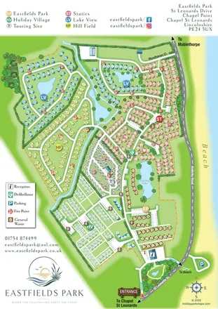
Six colour-coded neighbourhoods, lakeside layouts and coastal access on the Eastfields Park map.
 Explore the map ↗
United Kingdom
Illustrated lakeside park plan with numbered holiday units, leisure buildings and a looping Woodland Walk.
 Explore the map ↗
United Kingdom
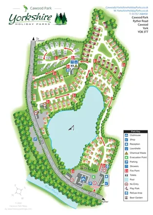
A lake-centred Cawood Park map with touring pitches, tree-lined holiday homes and clear entrance facilities.
Features may come from the sample artwork, its key or published park information. Approximate numbers describe the drawing and may cover only part of a park. They are intended to help you compare map examples. Current facilities and booking information should be checked with the park.
TAKE A CLOSER LOOK
View the illustrated map in detail or choose a file to download. These are sample maps; contact the park for current visitor information.


LET’S MAP YOUR PARK
For a map quotation, find your park and draw a rough boundary around it. The area you select helps us work out the design time and price.
Draw your park for a quote ↗Or talk to our map designers
01751 473136