
Tree-lined boundaries and internal planting
Repeated illustrated trees frame the perimeter, separate accommodation groups and line parts of the internal roads.
ILLUSTRATED PARK MAP · P631
Ugthorpe Lodge Caravan Park, Guisbrough Road, Whitby, North Yorkshire · United Kingdom
 Enlarge the map ↗
A SENSE OF THE PLACE
Ugthorpe Lodge Caravan Park is a family-friendly holiday home and touring park near Whitby. Its location by the A171 provides access to the North York Moors, Esk Valley and Yorkshire coast.
Seasonal touring pitches are offered, and pets are welcomed. The map shows the arrangement of the holiday accommodation, while nearby coastal villages and moorland routes provide options for days out.
LOOK CLOSER
Repeated illustrated trees frame the perimeter, separate accommodation groups and line parts of the internal roads.
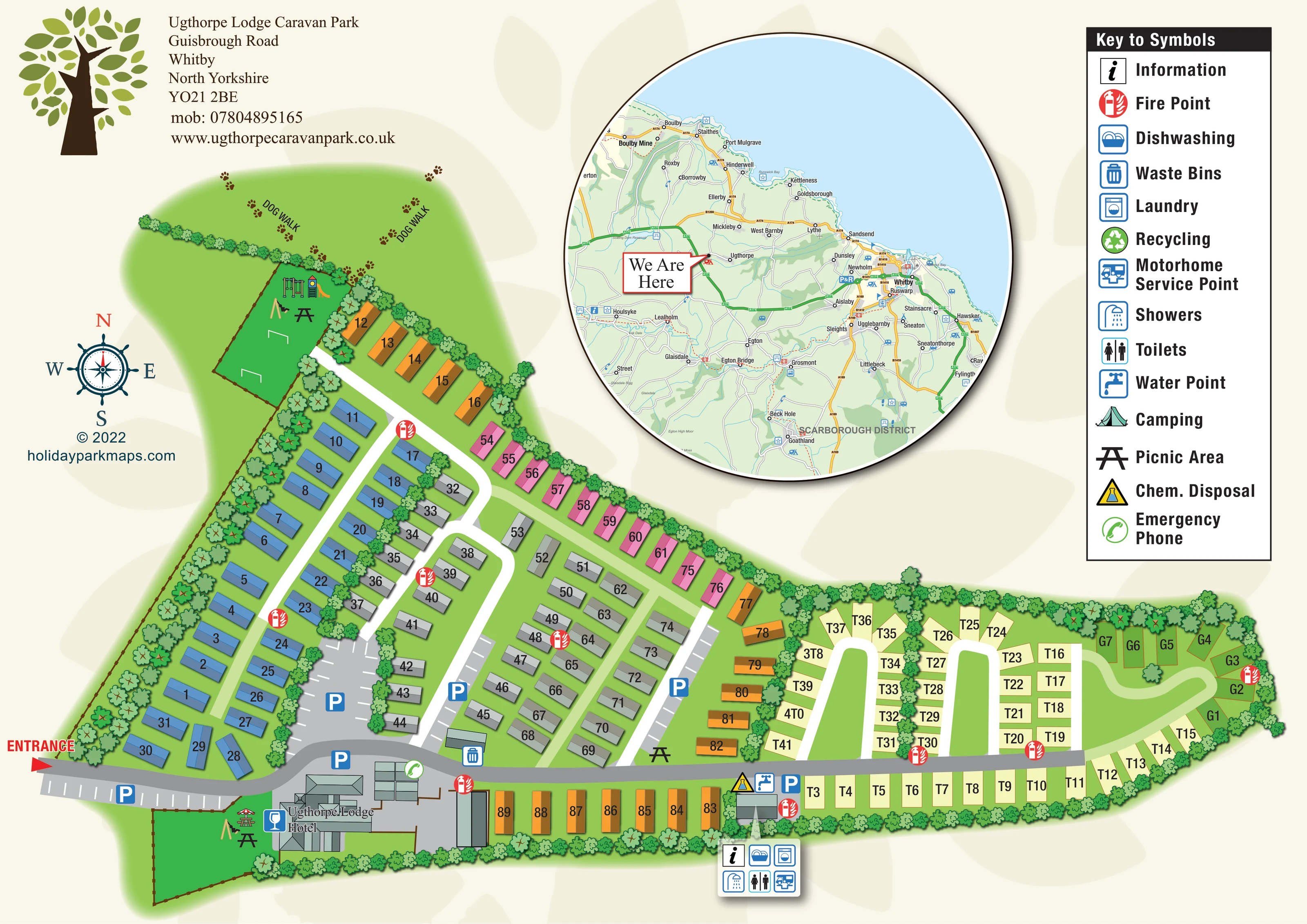
A red ENTRANCE label and arrow mark arrival at the lower-left edge, feeding into the grey main drive.
Blue P symbols identify parking beside the entrance, hotel, central caravan rows and touring service area; several bays have white stall markings.
A labelled, multi-roof building complex stands beside the entrance drive, with a drinks-glass symbol alongside it.
Two fenced green recreation spaces contain illustrated play equipment: one at the upper-left end and another beside the hotel.
Picnic-table symbols appear in both recreation spaces and beside the eastern edge of the main caravan section.
DOG WALK labels and trails of paw prints identify the green area beyond the upper-left tree boundary.
An information symbol is included in the facility callout attached to the building at the transition into the touring area.
A red ENTRANCE label and arrow mark arrival at the lower-left edge, feeding into the grey main drive.
Blue P symbols identify parking beside the entrance, hotel, central caravan rows and touring service area; several bays have white stall markings.
A labelled, multi-roof building complex stands beside the entrance drive, with a drinks-glass symbol alongside it.
Two fenced green recreation spaces contain illustrated play equipment: one at the upper-left end and another beside the hotel.
Picnic-table symbols appear in both recreation spaces and beside the eastern edge of the main caravan section.
DOG WALK labels and trails of paw prints identify the green area beyond the upper-left tree boundary.
An information symbol is included in the facility callout attached to the building at the transition into the touring area.
A grouped callout beside the touring-area service building identifies toilets, showers, dishwashing and laundry.
The motorhome service symbol appears in the touring-area facility callout.
A blue tap and yellow chemical-disposal triangle are positioned beside the touring-area service building and main drive.
A waste-bin symbol is shown near the main drive, east of the hotel.
Recycling is included in the key, but a corresponding location is not clearly identifiable on the site plan.
Red circular fire-point symbols are distributed through the caravan rows, touring loops and eastern end.
A green telephone symbol is placed beside the hotel-side building and parking area.
Repeated illustrated trees frame the perimeter, separate accommodation groups and line parts of the internal roads.
A large circular regional map marks the park with a 'We Are Here' pointer and shows Whitby, coastal villages, the River Esk, moorland and connecting roads.
READING THE MAP
This illustrated map of Ugthorpe Lodge Caravan Park combines a detailed site plan with a large regional location map, placing the park within the landscape around Whitby and the North Yorkshire coast. The accommodation stretches across a tree-lined site, with colourful rows of holiday caravans giving way to a separate touring area at the eastern end.
Arrival is clearly marked beside Ugthorpe Lodge Hotel, where the main drive begins its route through the park. Parking areas, numbered accommodation, touring loops and a compact service hub are shown alongside everyday visitor facilities. Two illustrated play spaces, picnic-table symbols and a paw-print dog walk add useful recreational landmarks without overwhelming the plan.
The page has a distinctive cream-and-green presentation, with a leafy tree motif, a nautical-style compass and a tall symbol key. Its circular inset shows the relationship between the park, Whitby, nearby coastal villages and the moorland inland. Together, these elements make this a useful example of a holiday-park map that supports both finding a pitch and understanding the surrounding area.
The main site plan occupies the lower and left-hand portions of the page, following an elongated footprint from the entrance to the far eastern touring plots. A red arrow marks arrival at the lower-left corner. From here, a grey spine road passes the labelled Ugthorpe Lodge Hotel and continues along the lower edge of the accommodation, linking parking areas and the touring service building.
The western and central sections contain rows of rectangular holiday caravans. Blue, grey, pink and orange groups are separated by white access lanes, planted strips and parking bays. Black numbers are placed directly on the roof illustrations. At the eastern end, cream T-prefixed touring pitches follow a series of white loops, with a smaller group of green G-prefixed plots around the outer curve.
Recreation spaces sit beside the hotel and above the western caravan rows. Both contain illustrated play equipment and picnic tables; another picnic symbol appears near the central-to-eastern transition. Beyond the upper tree boundary, DOG WALK labels and paw prints mark an open green area. Repeated trees give the perimeter a strong visual edge while also dividing internal accommodation groups.
A callout attached to the touring service building groups information, dishwashing, laundry, showers, toilets and motorhome servicing. Water and chemical-disposal symbols sit nearby. Fire points are distributed across the site, with waste bins and an emergency phone also marked. The key additionally includes recycling and camping symbols, without clearly locating these on the plan.
Above the site, a circular regional inset locates the park among Whitby, coastal settlements and the Esk Valley. The second supplied view enlarges this inset and the key; it is detail from the same artwork, not a separate park section.
KEEP EXPLORING
Chosen for shared landscapes, accommodation or facilities.
 Explore the map ↗
United Kingdom
Coastal park plan with colour-coded pitches, named neighbourhoods and a Morecambe Bay walking route.
 Explore the map ↗
United Kingdom
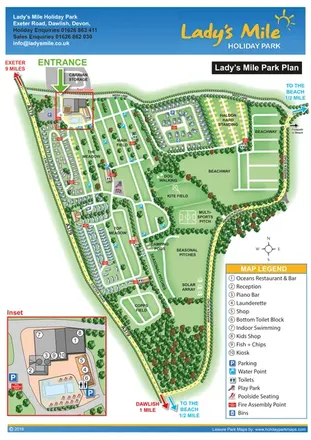
Portrait park plan with named fields, numbered accommodation, beach directions and an enlarged leisure-complex inset.
 Explore the map ↗
United Kingdom
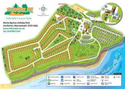
Coastal park plan with mixed accommodation, bird-themed pitch areas and an enlarged facilities inset.
Features may come from the sample artwork, its key or published park information. Approximate numbers describe the drawing and may cover only part of a park. They are intended to help you compare map examples. Current facilities and booking information should be checked with the park.
LET’S MAP YOUR PARK
For a map quotation, find your park and draw a rough boundary around it. The area you select helps us work out the design time and price.
Draw your park for a quote ↗Or talk to our map designers
01751 473136