
Recreation area
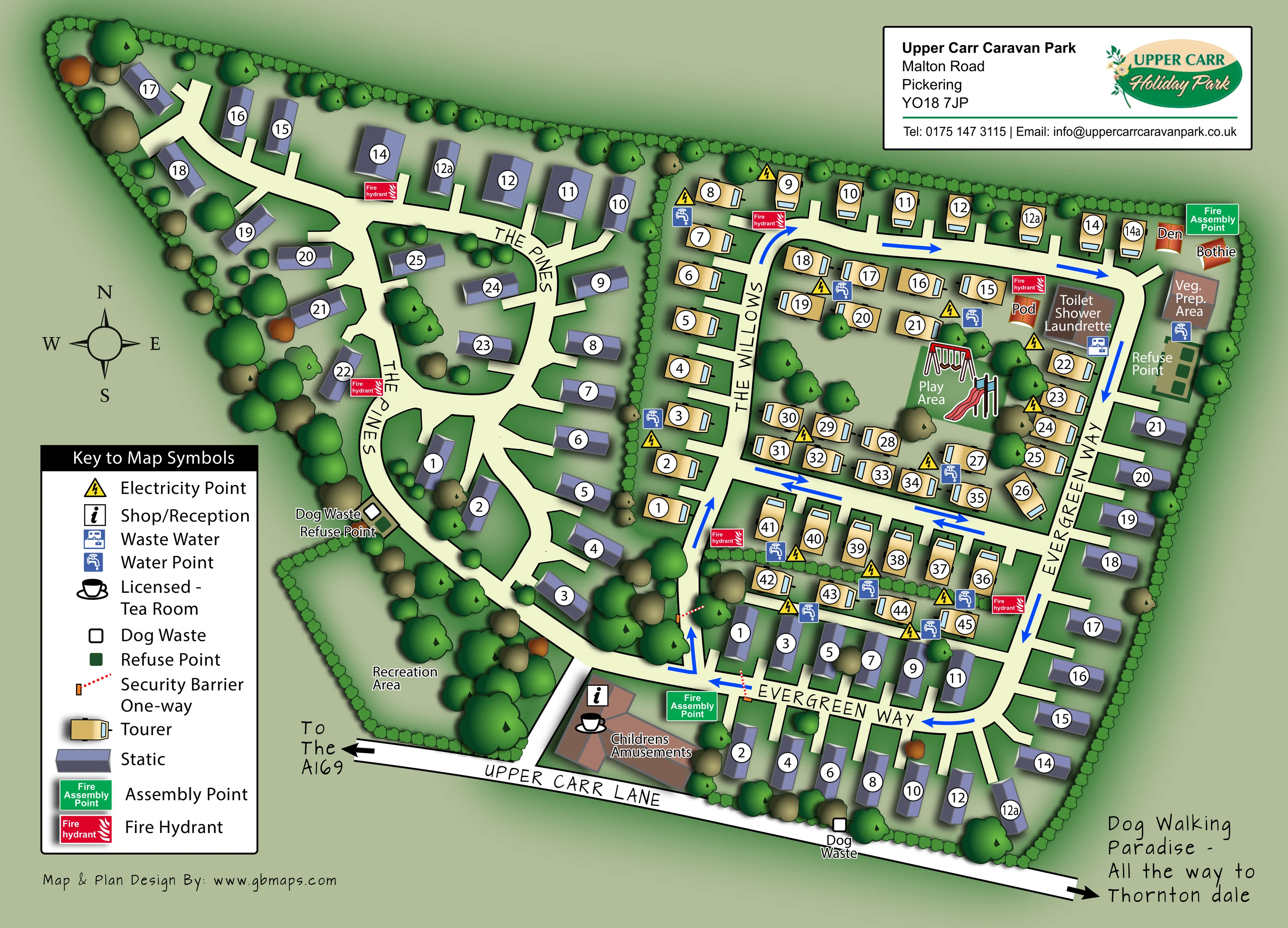
An enclosed grassy area with trees occupies the south-western corner, beside the entrance approach.
ILLUSTRATED PARK MAP · P632
Upper Carr Lane, Pickering, North Yorkshire · United Kingdom
 Enlarge the map ↗
A SENSE OF THE PLACE
Upper Carr Holiday Park is based at Upper Carr Lane, Pickering, North Yorkshire. Flower of May lists Upper Carr as an ownership-only holiday park near Pickering.
A free Wi-Fi browsing service is offered, with paid upgrades. Park-specific facilities include barrier-controlled entry, a children's play area and a launderette. The operator describes five acres of rural parkland on the edge of the North York Moors.
LOOK CLOSER
An enclosed grassy area with trees occupies the south-western corner, beside the entrance approach.
Continuous hedging encloses much of the park, while dense trees frame The Pines, separate the western and eastern sections and soften the touring grid.
The information symbol identifies shop/reception in the entrance-side building beside Upper Carr Lane.
A cup symbol on the entrance-side building corresponds to the licensed tea room in the key.
Labelled within the entrance-side building complex.
A central green space in the touring section contains illustrated swings and a slide.
A shared building near the north-eastern side of the touring area is labelled with all three functions.
A separate building near the upper-right boundary is labelled Veg. Prep. Area.
The information symbol identifies shop/reception in the entrance-side building beside Upper Carr Lane.
A cup symbol on the entrance-side building corresponds to the licensed tea room in the key.
Labelled within the entrance-side building complex.
A central green space in the touring section contains illustrated swings and a slide.
A shared building near the north-eastern side of the touring area is labelled with all three functions.
A separate building near the upper-right boundary is labelled Veg. Prep. Area.
Three small structures are individually labelled near the northern service area. Their use is not explained, so they are not classified as accommodation.
Yellow lightning-bolt triangles mark service points around the touring pitches.
Blue tap symbols are distributed through the touring section, with a waste-water symbol beside the toilet, shower and launderette block.
Refuse points appear beside the western recreation area and eastern service buildings; dog-waste points are marked on the western side and beside Upper Carr Lane.
Red fire-hydrant markers are spread across both accommodation sections. Green assembly-point signs appear near the entrance and the upper-right corner.
An enclosed grassy area with trees occupies the south-western corner, beside the entrance approach.
Continuous hedging encloses much of the park, while dense trees frame The Pines, separate the western and eastern sections and soften the touring grid.
Red dotted barrier symbols mark internal access points close to the entrance junction.
Blue arrows show circulation through The Willows and Evergreen Way, including links around the central touring rows.
Named internal roads distinguish the winding western layout from the more regular eastern accommodation areas.
Upper Carr Lane runs along the lower edge of the plan, with a leftward arrow labelled To the A169.
A rightward roadside arrow accompanies the wording Dog Walking Paradise – All the way to Thornton dale. It is a directional reference rather than a plotted walking trail.
READING THE MAP
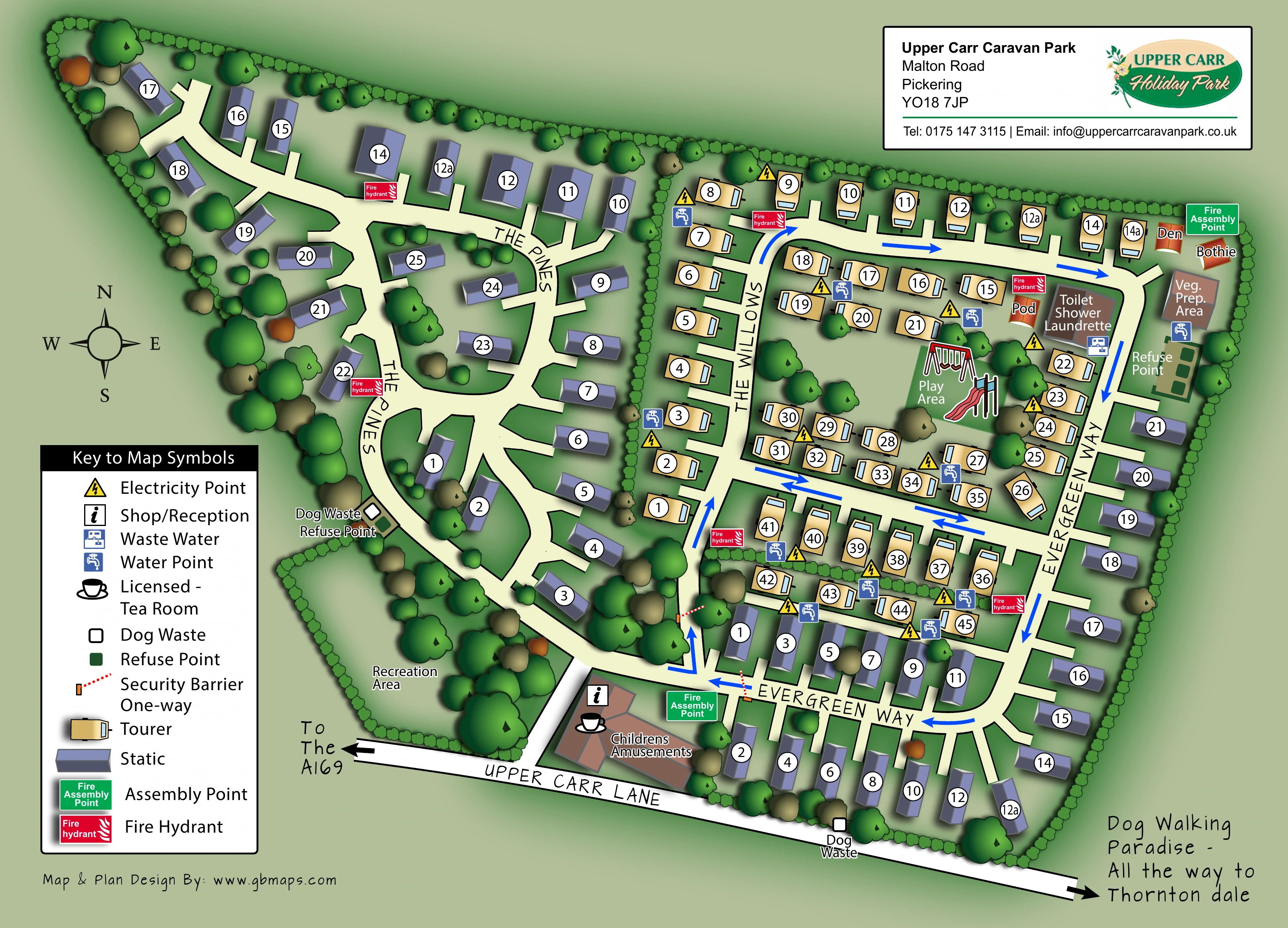
This illustrated map of Upper Carr Holiday Park in Pickering brings together a wooded caravan layout, a central touring area and a clearly marked network of visitor facilities. The artwork is titled Upper Carr Caravan Park and uses contrasting caravan symbols to distinguish static units from touring pitches, making the accommodation pattern easy to understand at a glance.
The western half follows the curving roads of The Pines, with caravans set among generous clusters of trees. To the east, The Willows and Evergreen Way organise straighter rows around a playground and shared service buildings. Upper Carr Lane anchors the bottom of the plan, with the entrance-side reception building, a direction towards the A169 and a separate annotation pointing towards dog walking in the Thornton dale direction.
The design combines practical navigation with an illustrated parkland character. Numbered circles, blue one-way arrows and a substantial facilities key carry the operational information, while shaded trees, colourful accommodation symbols and a compact branded panel give the page its distinctive appearance.
The plan is arranged as two connected neighbourhoods within a hedge-lined boundary. On the left, The Pines winds through static caravans placed at varied angles, with short road branches and planted islands breaking up the layout. A separate recreation area occupies the lower-left corner. On the right, touring pitches form more regular rows along The Willows and around a central green space, with further static caravans following Evergreen Way along the southern and eastern edges.
Arrival is shown from Upper Carr Lane beside a terracotta-coloured building marked with shop/reception and licensed tea-room symbols, together with a children's amusements label. Barrier symbols sit close to the entrance junction. Blue arrows then explain the eastern one-way circulation, including the cross-links between touring rows.
The illustrated playground contains swings and a slide. Nearby, a building is labelled Toilet, Shower and Laundrette, while a separate vegetable preparation area stands towards the upper-right boundary. Small structures named Pod, Den and Bothie add local detail without an indicated accommodation function. Electricity, water and waste-water symbols support the touring layout; refuse points, dog-waste points, hydrants and assembly signs are also mapped.
The large lower-left key explains these symbols and the two caravan styles. A compass rose and the named roads provide orientation, while the upper-right identity panel keeps branding and contact information clear of the main plan. Trees are individually shaded and varied in colour, lending depth to an otherwise overhead drawing. The accompanying detail view enlarges the legend and south-western corner of this same artwork; it is not a separate park section or additional map.
KEEP EXPLORING
Chosen for shared landscapes, accommodation or facilities.
 Explore the map ↗
United Kingdom
Coastal park map with static-caravan rows, touring pitches, a camping field and two leisure clusters.
 Explore the map ↗
United Kingdom
A wooded Allerton park plan with colour-coded neighbourhoods, touring pitches and a central facilities hub.
 Explore the map ↗
United Kingdom
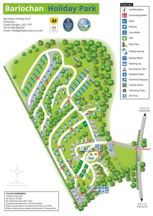
A wooded, mixed-accommodation park plan with winding lanes, a pool, camping areas and a clear facility key.
Features may come from the sample artwork, its key or published park information. Approximate numbers describe the drawing and may cover only part of a park. They are intended to help you compare map examples. Current facilities and booking information should be checked with the park.
TAKE A CLOSER LOOK
View the illustrated map in detail or choose a file to download. These are sample maps; contact the park for current visitor information.


LET’S MAP YOUR PARK
For a map quotation, find your park and draw a rough boundary around it. The area you select helps us work out the design time and price.
Draw your park for a quote ↗Or talk to our map designers
01751 473136
 caravanparksample_large.png