
Two ponds
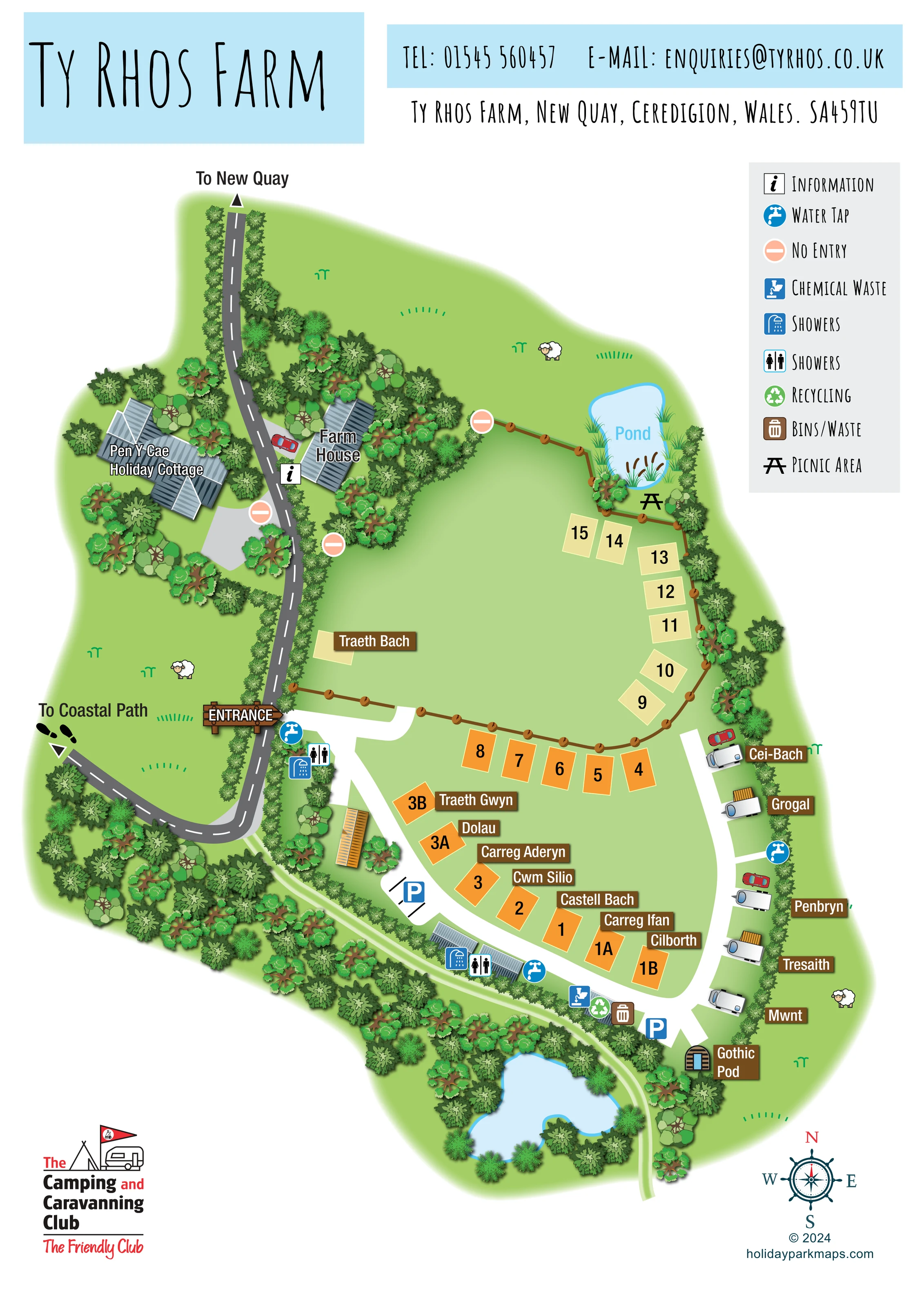
A small labelled pond with reeds occupies the north-east corner; a larger unlabelled water feature lies among trees along the southern edge.
ILLUSTRATED PARK MAP · P351
Ty Rhos Farm, New Quay, Ceredigion · United Kingdom
 Enlarge the map ↗
A SENSE OF THE PLACE
Ty Rhos Farm is based at New Quay, Ceredigion. This is a small family-run Camping and Caravanning Club Certificated Site about a mile outside New Quay. Caravans, motorhomes and tents are accepted; a Gothic glamping pod is also offered. The level, mainly grass site has hardstanding pitches and views across the countryside towards the sea.
Shower blocks, washing-up facilities, fresh-water points and a chemical disposal point are provided.
LOOK CLOSER
A small labelled pond with reeds occupies the north-east corner; a larger unlabelled water feature lies among trees along the southern edge.
Layered tree symbols surround the cottage and farmhouse, flank the approach and form a substantial southern boundary belt.
Broad green areas surround the pitches. Small sheep and grass illustrations reinforce the rural farm character without marking accommodation capacity.
An information symbol is placed beside the farmhouse on the approach lane.
Shower and male/female pictograms appear near the entrance and alongside the southern service buildings. Both pictogram types are labelled 'Showers' in the legend.
Blue tap symbols mark water points near the entrance, along the eastern pitch row and beside the southern facilities.
A chemical waste symbol appears in the southern service cluster beside the internal lane.
Recycling and bins/waste symbols are grouped with the southern service facilities.
An information symbol is placed beside the farmhouse on the approach lane.
Shower and male/female pictograms appear near the entrance and alongside the southern service buildings. Both pictogram types are labelled 'Showers' in the legend.
Blue tap symbols mark water points near the entrance, along the eastern pitch row and beside the southern facilities.
A chemical waste symbol appears in the southern service cluster beside the internal lane.
Recycling and bins/waste symbols are grouped with the southern service facilities.
A picnic-table symbol sits beside the smaller, labelled northern pond.
Blue P symbols identify parking beside the south-western internal lane and near the Gothic Pod end of the site.
The labelled farmhouse stands within a densely planted area east of the approach road.
A small labelled pond with reeds occupies the north-east corner; a larger unlabelled water feature lies among trees along the southern edge.
Layered tree symbols surround the cottage and farmhouse, flank the approach and form a substantial southern boundary belt.
Broad green areas surround the pitches. Small sheep and grass illustrations reinforce the rural farm character without marking accommodation capacity.
A timber-style ENTRANCE sign marks the turn east from the grey approach lane into the white internal campsite route.
The northern end of the approach road carries an arrow and 'To New Quay' label.
A western branch is labelled 'To Coastal Path', with an arrow and footprint graphics. The coastal path itself is not drawn.
White lanes curve around the central pitches and serve the eastern caravan row; a narrow pale-green route follows the southern tree belt and larger pond.
Peach no-entry symbols distinguish selected branches near the farmhouse, cottage and northern fenced area.
Washing-up facilities are mentioned in the park information, but are not separately identified on the map.
READING THE MAP
This illustrated map of Ty Rhos Farm presents a small rural campsite near New Quay in Ceredigion, Wales. Rather than treating the site as a uniform grid, the design follows its curving lanes, open grass areas and planted boundaries. The farmhouse and Pen Y Cae Holiday Cottage establish the arrival setting, while two ponds and a distinctly drawn Gothic Pod give visitors memorable landmarks within the plan.
Numbered pitch blocks are combined with individual Welsh place names on brown plaques. A separate row of caravan illustrations follows the eastern edge, and a timber-style entrance sign makes the turn into the campsite easy to spot. Blue facility symbols identify water and shower points, with waste services and parking grouped around the southern lane. Arrows towards New Quay and the coastal path connect the campsite to its surroundings without expanding the artwork into a wider area map.
The portrait page balances practical visitor information with a recognisably farm-based character: leafy borders, reeds, sheep illustrations and soft green edges sit beneath a clear title, contact strip and compact facility key.
The plan is arranged around a grey approach road running down the western side from the 'To New Quay' arrow. It passes between Pen Y Cae Holiday Cottage and the farmhouse, both illustrated with segmented slate-grey roofs and surrounded by layered trees. An information marker sits beside the farmhouse. Lower down, the approach bends west towards the coastal-path direction, while a large timber entrance sign points into the campsite's contrasting white lanes.
Inside the site, numbered orange pitches curve around the central grass area. Pale-yellow pitch blocks continue along the north-eastern boundary towards a small pond, where reeds, cattails and a picnic-table symbol create a distinctive corner. Brown post-and-rail fencing helps describe the edges of this northern area. The pitch colours are visually distinct, although their meaning is not explained in the key.
An eastern lane serves a row of caravan illustrations labelled with names including Cei-Bach, Grogal, Penbryn, Tresaith and Mwnt. At its southern end, the Gothic Pod is represented by a small arched timber frontage. The southern circuit also contains parking markers, roofed service buildings, water points, shower and sanitary pictograms, chemical waste disposal, recycling and bins. A narrow green route follows the planted southern edge beside a second, larger pond.
The map's white margins accommodate a pale-blue title and contact banner, a grey-backed symbol key, the Camping and Caravanning Club logo and a nautical compass rose. Bold pitch numbers and white-on-brown name plaques remain distinct from the more decorative landscape illustration. Together, these elements make a compact campsite legible without stripping away its farm buildings, greenery or individual accommodation character.
KEEP EXPLORING
Chosen for shared landscapes, accommodation or facilities.
 Explore the map ↗
United Kingdom
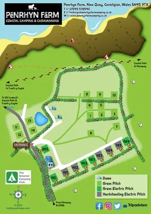
A colour-zoned coastal park map with touring areas, woodland trails, ponds and a leisure club.
 Explore the map ↗
United Kingdom
A colourful coastal farm campsite map with electric pitches, geodesic domes and footprint-marked walking routes.
 Explore the map ↗
United Kingdom
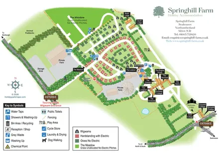
Mixed-accommodation farm map with separate entrances, touring loops, wigwams, cottages and an open camping meadow.
Features may come from the sample artwork, its key or published park information. Approximate numbers describe the drawing and may cover only part of a park. They are intended to help you compare map examples. Current facilities and booking information should be checked with the park.
LET’S MAP YOUR PARK
For a map quotation, find your park and draw a rough boundary around it. The area you select helps us work out the design time and price.
Draw your park for a quote ↗Or talk to our map designers
01751 473136