
Dog Walk & Recreation field
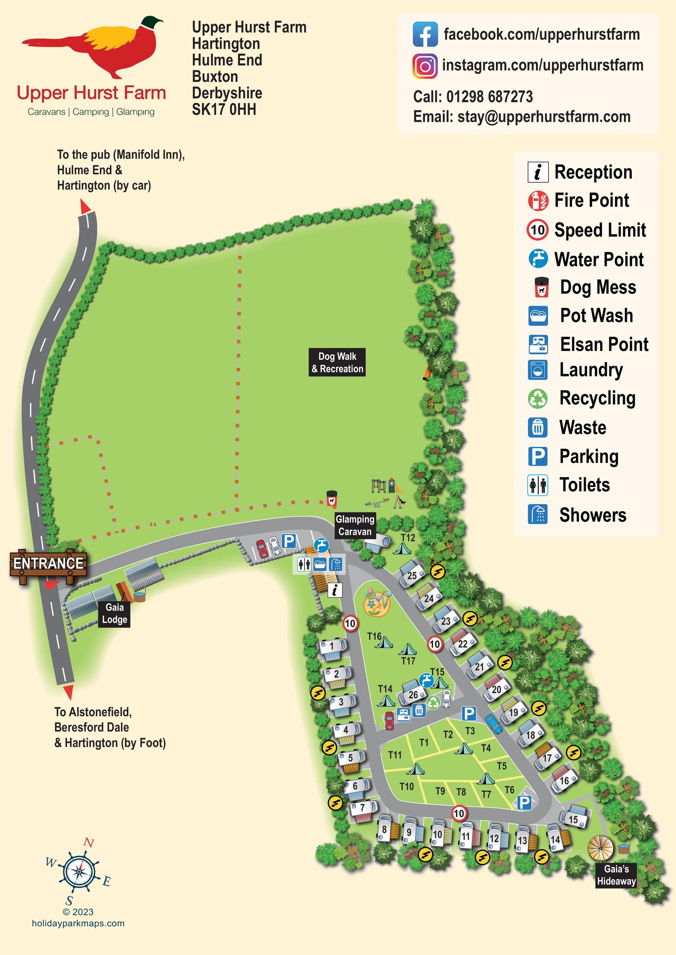
A large, enclosed grassy field occupies the upper portion of the plan and is explicitly labelled for dog walking and recreation.
ILLUSTRATED PARK MAP · P353
Upper Hurst Farm, Hartington, Hulme End, Buxton, Derbyshire · United Kingdom
 Enlarge the map ↗
A SENSE OF THE PLACE
Upper Hurst Farm offers camping, glamping and a holiday cottage near Hartington in the Peak District. Panoramic countryside views and access to the Manifold Valley and surrounding dales shape the setting.
Serviced touring pitches and tent pitches are supported by heated washrooms, an accessible wet room, laundry and washing-up facilities. Dog-friendly stays are available, with walking and cycling forming part of the area's appeal.
LOOK CLOSER
A large, enclosed grassy field occupies the upper portion of the plan and is explicitly labelled for dog walking and recreation.
Hedges edge the roadside and upper field; dense illustrated tree belts surround much of the accommodation area. Fence lines divide the open field, and stone walls frame parts of the arrival area.
An information symbol marks reception at the entrance end of the touring and camping area, alongside the main amenity building.
Toilet and shower symbols are grouped on the reception-side amenity building.
A washing-up symbol appears with the toilets and showers at the main building.
Blue tap symbols identify water points by the amenity building and near the central service junction.
A chemical-toilet disposal symbol is placed at the service area between the central camping spaces.
Waste and recycling symbols are grouped beside the central service junction.
An information symbol marks reception at the entrance end of the touring and camping area, alongside the main amenity building.
Toilet and shower symbols are grouped on the reception-side amenity building.
A washing-up symbol appears with the toilets and showers at the main building.
Blue tap symbols identify water points by the amenity building and near the central service junction.
A chemical-toilet disposal symbol is placed at the service area between the central camping spaces.
Waste and recycling symbols are grouped beside the central service junction.
Blue parking symbols identify the arrival-side bays and parking spaces within the accommodation loop.
A dog waste bin symbol is shown at the boundary between the recreation field and the accommodation entrance.
Swings, a slide/climbing structure and a seesaw are illustrated near the lower edge of the recreation field.
A large, enclosed grassy field occupies the upper portion of the plan and is explicitly labelled for dog walking and recreation.
Hedges edge the roadside and upper field; dense illustrated tree belts surround much of the accommodation area. Fence lines divide the open field, and stone walls frame parts of the arrival area.
Round timber-sided, blue-filled tubs are illustrated beside Gaia Lodge and Gaia’s Hideaway; neither is separately labelled in the key.
A prominent timber-style ENTRANCE sign marks the turn from the road on the left into the internal access lane.
A grey access lane leads past reception into a rounded triangular loop, with a cross-connection separating the central camping areas.
An arrow at the upper end of the roadside strip gives these destinations explicitly as a route by car; the pub is not depicted as an on-site facility.
An arrow at the lower end of the roadside strip names these destinations as a route by foot.
Repeated red-ringed 10 symbols appear along the internal roads and are explained as speed-limit symbols in the key.
Laundry appears in the key, but a corresponding location is not clearly identifiable in the plan.
A fire-point symbol is included in the key, without a clearly identifiable matching placement on the plan.
READING THE MAP
This illustrated map of Upper Hurst Farm brings together a compact touring and camping area and a much larger dog-walking and recreation field. Set near Hartington and Hulme End in Derbyshire’s Peak District, the park is presented as a green, tree-framed site with a straightforward arrival route and several individually named places to stay.
The map shows touring pitches around a rounded triangular road loop, with tent pitches on the lawns inside it. Reception, washrooms and arrival parking sit at the head of the accommodation area, while Gaia Lodge, the Glamping Caravan and Gaia’s Hideaway receive their own clear labels. Play equipment is illustrated beside the recreation field, giving visitors another recognisable landmark.
A cream background, bright green grass and shaded trees create a countryside character without obscuring the practical information. The pheasant logo anchors the page, and a large symbol key explains the main visitor facilities. Separate arrows towards local destinations distinguish travel by car from travel on foot, making the design useful both for settling into the park and understanding its immediate surroundings.
The portrait plan is organised around two contrasting spaces: an expansive enclosed recreation field in the upper half and a compact accommodation area tapering towards the lower-right corner. A road runs down the left edge, where a large timber-style entrance sign marks the turn into the park. The internal lane follows the field boundary before reaching arrival parking, reception and the main washroom building.
Beyond reception, the road forms a rounded triangular loop. Numbered touring pitches occupy most of its outer edge, illustrated with white caravans and brightly striped awnings. Inside the loop, pale yellow divisions mark a central group of tent pitches, while additional T-labelled spaces sit on the grass closer to reception. A cross-road provides a useful break between the camping areas and carries symbols for waste, recycling and the Elsan point. Water taps and several parking markers add practical reference points.
The named accommodation is visually distinct. Gaia Lodge sits within the entrance-side building group, the Glamping Caravan lies beside the upper end of the pitch area, and Gaia’s Hideaway is tucked into the planted lower-right corner. Round outdoor tubs are drawn beside the lodge and hideaway. Swings, a slide and a seesaw identify the play area at the recreation field’s lower edge.
Dense tree illustrations frame the touring pitches, with hedges, fence lines and stone walls distinguishing other boundaries. The right-hand key explains reception, washrooms, water, disposal and parking symbols, alongside laundry and fire-point entries. A compass rose sits below the plan. The heading and contact panel remain separate from the map, while roadside arrows label routes towards local villages, Beresford Dale and the Manifold Inn.
KEEP EXPLORING
Chosen for shared landscapes, accommodation or facilities.
 Explore the map ↗
United Kingdom
Woodland-framed Barnsoul map with mixed accommodation, shared facilities and paw-marked walking routes.
 Explore the map ↗
United Kingdom
Illustrated farm campsite map with touring pitches, pods, camping fields and a riverside dog-walk route.
 Explore the map ↗
United Kingdom
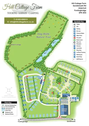
Portrait park map with mixed touring pitches, seasonal rows, ponds and an extensive dog walk.
Features may come from the sample artwork, its key or published park information. Approximate numbers describe the drawing and may cover only part of a park. They are intended to help you compare map examples. Current facilities and booking information should be checked with the park.
LET’S MAP YOUR PARK
For a map quotation, find your park and draw a rough boundary around it. The area you select helps us work out the design time and price.
Draw your park for a quote ↗Or talk to our map designers
01751 473136