
Boundary trees and shrubs
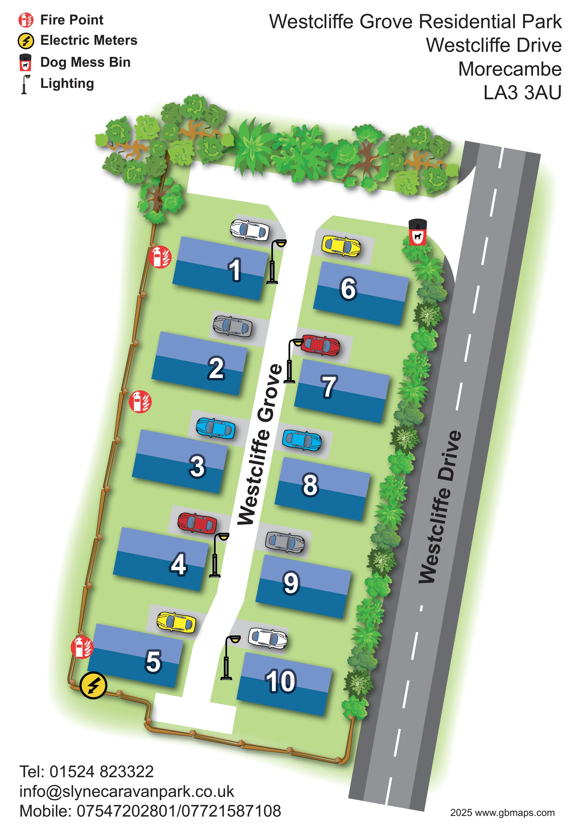
Large illustrated trees frame the upper boundary, while a narrow, continuous strip of mixed shrubs separates the homes from Westcliffe Drive.
ILLUSTRATED PARK MAP · P360
Westcliffe Grove Residential Park, Westcliffe Drive, Morecambe · United Kingdom
 Enlarge the map ↗
A SENSE OF THE PLACE
Westcliffe Grove is a residential park home estate in Morecambe, Lancashire. The artwork records the layout of the estate at Westcliffe Drive.
This example belongs to the residential park map collection. It illustrates the organisation of homes and access routes, with the location providing context for the design rather than a description of bookable holiday accommodation.
LOOK CLOSER
Large illustrated trees frame the upper boundary, while a narrow, continuous strip of mixed shrubs separates the homes from Westcliffe Drive.
Pale-green ground surrounds the homes. An ochre-brown post-and-rail-style fence follows the left and lower edges and a short section of the lower-right boundary.
Repeated red fire-point symbols along the left-hand boundary, explained by the upper-left legend.
A yellow lightning-bolt symbol marks the electric meters near the lower-left boundary.
A red-and-black dog mess bin symbol appears beside the planting near the upper-right access junction.
Black lamp-post illustrations with yellow lights are distributed beside the central estate lane.
Individual light-grey parking pads beside the homes contain illustrated cars in several colours.
The named external road runs down the right side of the plan, shown in grey with a dashed white centre line.
Repeated red fire-point symbols along the left-hand boundary, explained by the upper-left legend.
A yellow lightning-bolt symbol marks the electric meters near the lower-left boundary.
A red-and-black dog mess bin symbol appears beside the planting near the upper-right access junction.
Black lamp-post illustrations with yellow lights are distributed beside the central estate lane.
Individual light-grey parking pads beside the homes contain illustrated cars in several colours.
The named external road runs down the right side of the plan, shown in grey with a dashed white centre line.
A white lane connects to Westcliffe Drive at the upper end, runs between the two rows of homes and finishes in a widened terminal area at the bottom.
Large illustrated trees frame the upper boundary, while a narrow, continuous strip of mixed shrubs separates the homes from Westcliffe Drive.
Pale-green ground surrounds the homes. An ochre-brown post-and-rail-style fence follows the left and lower edges and a short section of the lower-right boundary.
READING THE MAP
This illustrated map of Westcliffe Grove Residential Park presents a small park-home estate on Westcliffe Drive in Morecambe, Lancashire. Rather than showing holiday pitches or leisure zones, it concentrates on the everyday geography of a residential site: homes, parking, access and a handful of useful service points.
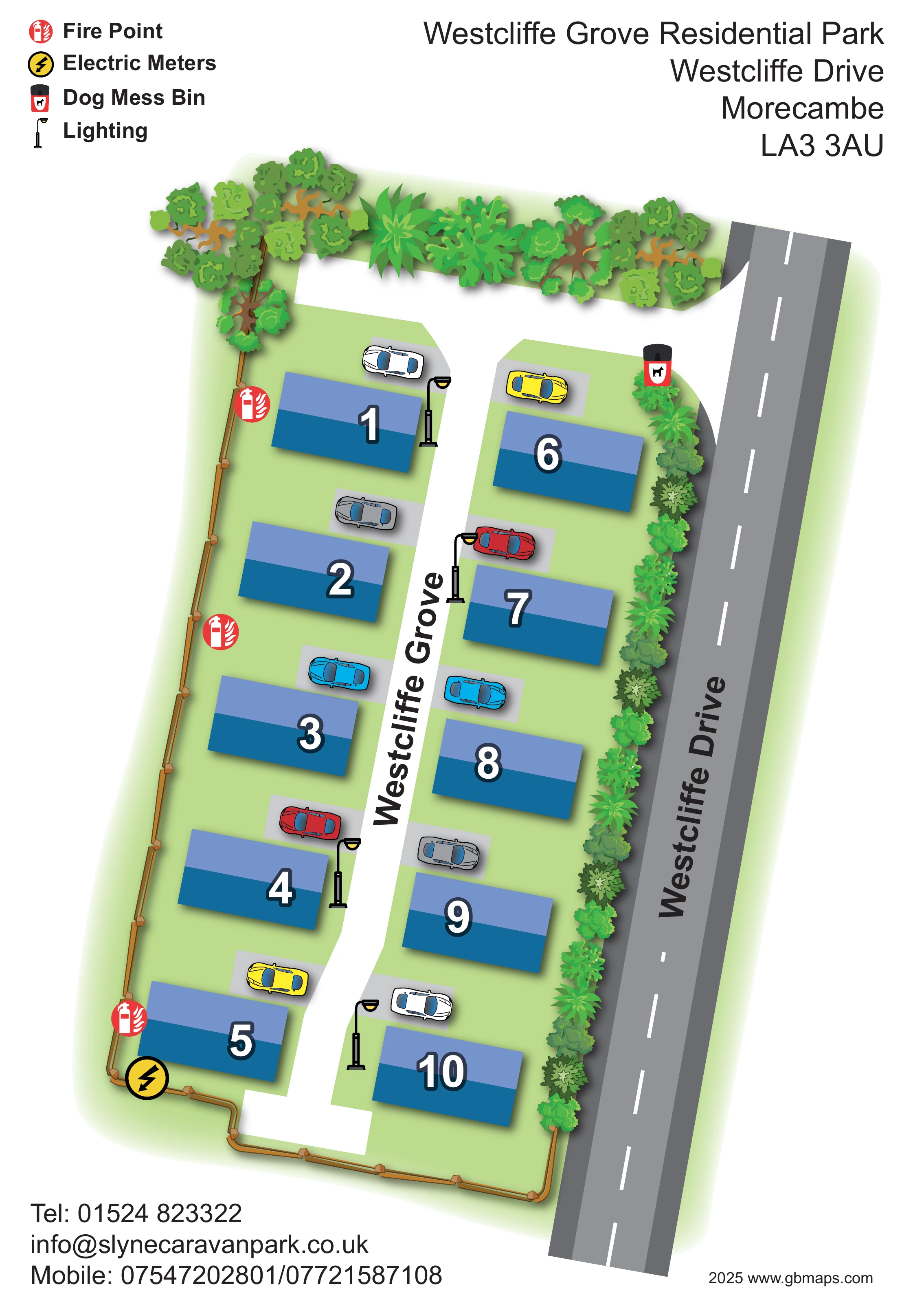
Approximately ten homes are arranged in two short rows either side of a central lane. Large white numbers stand out against two-tone blue building symbols, while grey parking pads and colourful overhead car illustrations show how each home relates to the road. Westcliffe Drive forms a strong reference along the right edge, separated from the estate by a continuous band of shrubs.
The portrait composition leaves room for a clear service legend, a prominent park name and address, and a contact block beneath the plan. Trees, grass and perimeter fencing give the estate a recognisable setting without obscuring the simple layout. It is a useful sample for residential park operators seeking a compact illustrated plan that prioritises finding a home and understanding the surrounding access and services.
The map uses a near-overhead view of an elongated estate, set at a slight angle on a white portrait page. Westcliffe Drive runs along the right-hand side as a broad grey road with white centre-line dashes. At the upper end, a white access connection leads into Westcliffe Grove, the named internal lane that passes between the two rows of homes. A short branch extends across the top of the estate, while the central lane finishes in a widened area beside the lower boundary.
The homes share a consistent visual treatment: rectangular blue forms with a lighter upper section, a darker lower section and soft shadows. Oversized white numbers with dark outlines make the individual homes the strongest wayfinding elements. Light-grey parking pads sit beside the buildings, each illustrated with a car. Black lamp-post symbols are positioned at intervals along the lane.
A brown fence follows the left and lower perimeter. Red fire-point markers appear along the left boundary, and a yellow electric-meter symbol sits near the lower-left corner. A dog mess bin is marked close to the upper access junction, beside the roadside planting. These services are explained in a four-item legend at the top left.
Landscape illustration supplies much of the map’s character. Large, varied tree canopies frame the upper edge, while closely spaced shrubs form a green buffer between the right-hand homes and Westcliffe Drive. The title and address occupy the upper-right margin; contact details and a small designer credit sit below the plan. The artwork is a single estate map without a separate inset or walking-route panel.
KEEP EXPLORING
Chosen for shared landscapes, accommodation or facilities.
 Explore the map ↗
United Kingdom
Illustrated Sanday aire map with a seasonal maze, café barn and motorhome service area.
 Explore the map ↗
United Kingdom
Illustrated coastal campsite plan with named fields, electric pitch colours, beach routes and the Afon Hen.
 Explore the map ↗
United Kingdom
A woodland touring-park map with colour-coded pitches, a stream and footprint-marked walks.
Features may come from the sample artwork, its key or published park information. Approximate numbers describe the drawing and may cover only part of a park. They are intended to help you compare map examples. Current facilities and booking information should be checked with the park.
TAKE A CLOSER LOOK
View the illustrated map in detail or choose a file to download. These are sample maps; contact the park for current visitor information.


LET’S MAP YOUR PARK
For a map quotation, find your park and draw a rough boundary around it. The area you select helps us work out the design time and price.
Draw your park for a quote ↗Or talk to our map designers
01751 473136
 westcliffe_large.png