
Fishing Lakes 1, 2 and 3
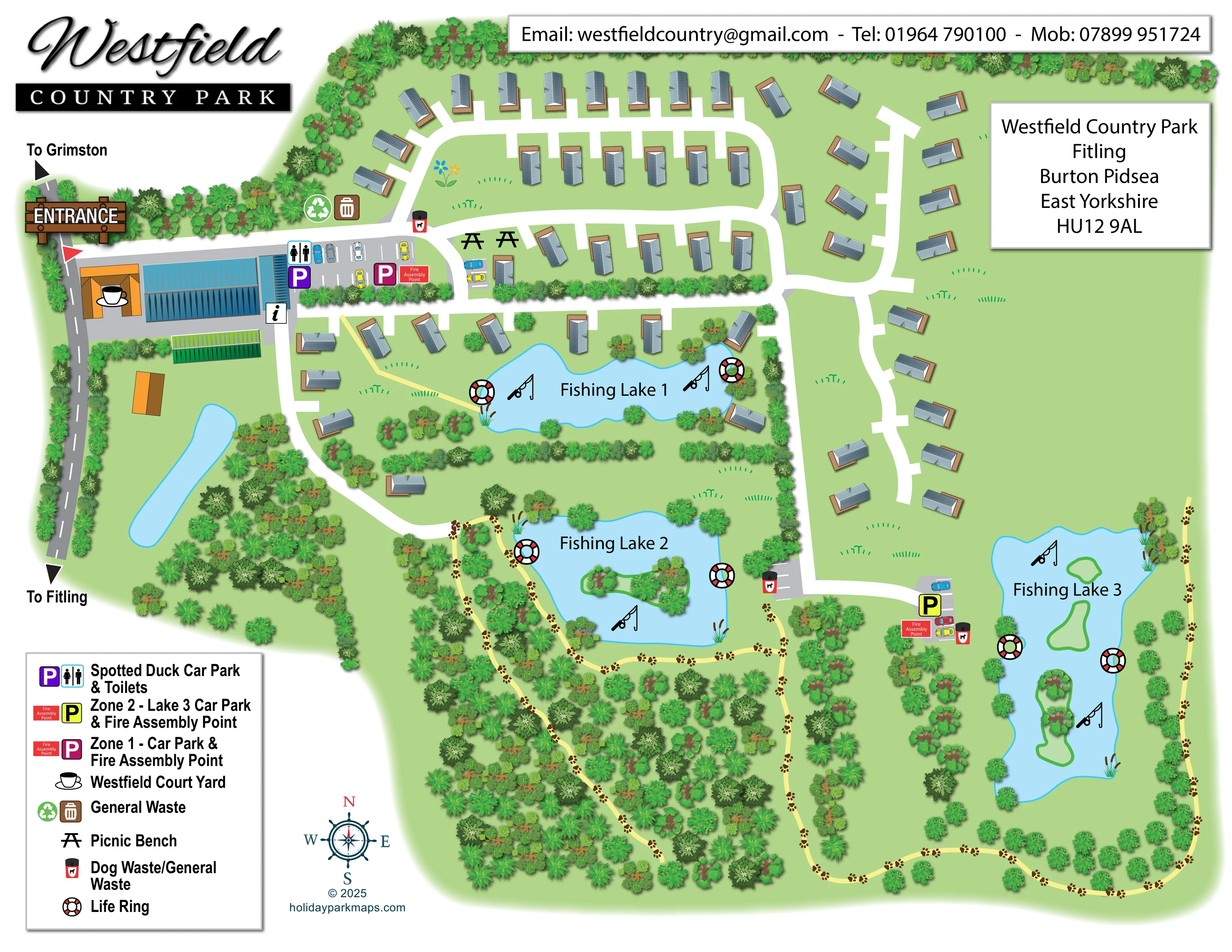
Three individually named fishing lakes form the principal landmarks. Lake 1 sits among the lodges, Lake 2 occupies the wooded centre-south, and the elongated Lake 3 lies to the east. Fishing-rod symbols reinforce their use.
ILLUSTRATED PARK MAP · P361
Westfield Country Park, Fitling, Burton Pidsea, East Yorkshire · United Kingdom
 Enlarge the map ↗
A SENSE OF THE PLACE
Westfield Country Park offers holiday lodges at Fitling in East Yorkshire. Landscaped farmland and fishing lakes form the setting, with lodges beside or close to the water.
Accommodation includes private outdoor hot tubs, with dog-friendly and log-burner options available. The map brings together the lodge areas, lakes and internal routes within the grounds.
LOOK CLOSER
Three individually named fishing lakes form the principal landmarks. Lake 1 sits among the lodges, Lake 2 occupies the wooded centre-south, and the elongated Lake 3 lies to the east. Fishing-rod symbols reinforce their use.
Lakes 2 and 3 contain green islands, some illustrated with trees. Reeds and scattered planting soften the shores of all three named lakes.
Dense woodland fills much of the southern and south-western grounds, with tree belts dividing lodge groups and edging the site. Open green spaces remain prominent between the eastern drives and lakes.
A narrow blue pond-like feature appears south of the entrance buildings beside the western boundary road; it is not labelled as a fishing lake.
A prominent timber-style entrance sign marks access from the western road, with directional arrows labelled 'To Grimston' and 'To Fitling'.
Broad white drives connect the entrance, northern lodge loops, lakeside accommodation and eastern branches, continuing to parking near Lake 3.
Pale-yellow paths weave through southern woodland, follow Lake 2 and continue around the southern and eastern grounds beside Lake 3. Repeated brown paw-print motifs distinguish much of this network.
Purple parking and male/female toilet symbols identify the entrance-side parking area next to the courtyard buildings.
Three individually named fishing lakes form the principal landmarks. Lake 1 sits among the lodges, Lake 2 occupies the wooded centre-south, and the elongated Lake 3 lies to the east. Fishing-rod symbols reinforce their use.
Lakes 2 and 3 contain green islands, some illustrated with trees. Reeds and scattered planting soften the shores of all three named lakes.
Dense woodland fills much of the southern and south-western grounds, with tree belts dividing lodge groups and edging the site. Open green spaces remain prominent between the eastern drives and lakes.
A narrow blue pond-like feature appears south of the entrance buildings beside the western boundary road; it is not labelled as a fishing lake.
A prominent timber-style entrance sign marks access from the western road, with directional arrows labelled 'To Grimston' and 'To Fitling'.
Broad white drives connect the entrance, northern lodge loops, lakeside accommodation and eastern branches, continuing to parking near Lake 3.
Pale-yellow paths weave through southern woodland, follow Lake 2 and continue around the southern and eastern grounds beside Lake 3. Repeated brown paw-print motifs distinguish much of this network.
Purple parking and male/female toilet symbols identify the entrance-side parking area next to the courtyard buildings.
Magenta identifies Zone 1 parking near the entrance; yellow identifies Zone 2 parking beside the approach to Lake 3. Illustrated cars and marked bays make the parking areas visually distinct.
Red fire assembly labels are mapped beside the Zone 1 and Zone 2 car parks.
The legend names Westfield Court Yard and associates it with a cup-and-saucer symbol placed over an orange-roofed courtyard building near the entrance.
A black italic information symbol appears beside the blue-roofed entrance building. It is not separately explained in the legend.
Two black picnic-bench symbols appear just east of the main arrival parking, beside the lodge drives.
General-waste symbols, including a recycling-style icon, appear near the entrance. Red-and-black dog waste/general waste bins are distributed at drive junctions and near the southern parking areas.
Red, white and black life-ring symbols mark locations around each of the three fishing lakes.
READING THE MAP
Three fishing lakes give this illustrated map of Westfield Country Park its structure. Set at Fitling in East Yorkshire, the park is presented as a collection of holiday lodges within green grounds, with the accommodation concentrated around the northern drives and the first lake. Further south, woodland, islands and winding paths become the dominant features.
The map brings these different parts of the site together in one landscape-format overview. A clearly marked western entrance leads past the courtyard buildings and parking before the white internal drives branch towards the lodge areas. Pale-yellow walking paths offer a contrasting route through the wooded grounds and beside the lower lakes, with paw-print motifs adding a distinctive visual cue.
Practical details sit within this landscape rather than in a separate diagram: colour-coded car parks, toilets, picnic benches, waste points, fire assembly points and lakeside life rings are all shown. Blue-grey lodge roofs, layered green tree canopies and pale-blue water provide a recognisable picture of the park, while a substantial legend and compass support orientation.
The single-page artwork places the entrance on the western edge, beside a road labelled towards Grimston and Fitling. A timber-style entrance sign introduces a compact arrival hub containing orange- and blue-roofed buildings, the Westfield Court Yard cup symbol, an information marker and parking bays. Purple parking and toilet icons identify the Spotted Duck area, while magenta marks Zone 1 parking and its fire assembly point.
From here, broad white drives spread into the accommodation areas. The northern lodges follow a rounded loop with short individual access spurs; other units sit around Fishing Lake 1 or along staggered eastern branches. Each lodge is drawn with a shaded blue-grey roof and brown deck or base outline. The units are not numbered, leaving the emphasis on the overall arrangement rather than individual accommodation identification.
Fishing Lake 1 occupies the centre of the lodge area. Lake 2 sits below it, edged by woodland and containing a planted island. Lake 3 is a long eastern water body with several green islands. Fishing-rod illustrations and large black names distinguish all three, while life-ring icons mark their shores. A smaller, unnamed water feature lies south of the entrance buildings.
Yellow paths weave through the southern woodland and continue beside the lakes and around the lower boundary. Repeated paw prints distinguish these routes from the drives. Zone 2 parking and its assembly point appear near Lake 3, with waste-bin symbols at several route junctions. The large lower-left legend, upper contact banner, address panel and nautical-style compass complete the composition. Detailed tree canopies and reeds supply texture without obscuring the main routes.
KEEP EXPLORING
Chosen for shared landscapes, accommodation or facilities.
 Explore the map ↗
United Kingdom
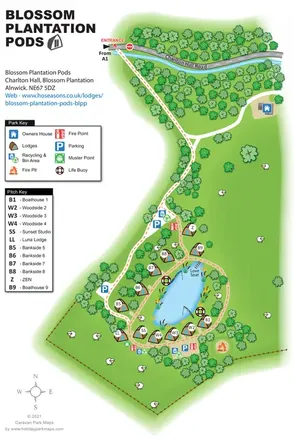
Illustrated lakeside pod map with woodland arrival routes, named lodges and a waterside circuit.
 Explore the map ↗
United Kingdom
Woodland park map with mixed pitches, bell tents, lodges and a fishing lake.
 Explore the map ↗
United Kingdom
Illustrated lakeside park plan with numbered holiday units, leisure buildings and a looping Woodland Walk.
Features may come from the sample artwork, its key or published park information. Approximate numbers describe the drawing and may cover only part of a park. They are intended to help you compare map examples. Current facilities and booking information should be checked with the park.
LET’S MAP YOUR PARK
For a map quotation, find your park and draw a rough boundary around it. The area you select helps us work out the design time and price.
Draw your park for a quote ↗Or talk to our map designers
01751 473136