
Camping Meadow
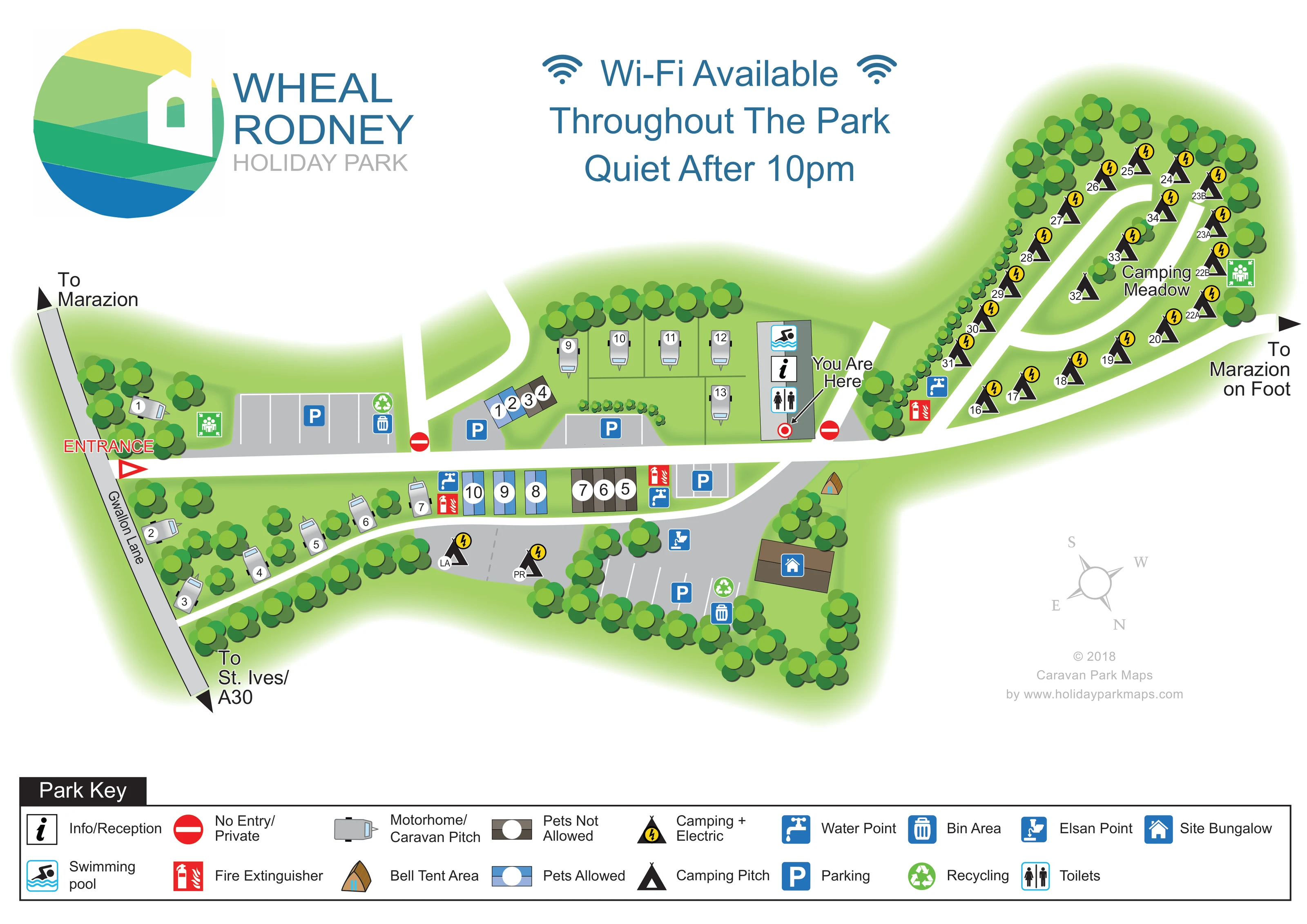
A named, elongated camping area occupies the right-hand arm of the plan.
ILLUSTRATED PARK MAP · P642
Gwallon Lane, Marazion · United Kingdom
 Enlarge the map ↗
A SENSE OF THE PLACE
Wheal Rodney Holiday Park is a family-run park at Marazion in Cornwall, close to St Michael's Mount. Self-catering accommodation sits alongside caravan, campervan and tent pitches.
A heated indoor swimming pool is a central shared facility. Lodge choices include dog-friendly options, while the map helps visitors locate the different accommodation areas within the park.
LOOK CLOSER
A named, elongated camping area occupies the right-hand arm of the plan.
Dense stylised trees enclose the meadow and lower park, separate accommodation groups and soften the road edges.
An information symbol identifies reception within the central shared-facility building, beside the 'You Are Here' marker.
A swimming symbol marks the upper end of the central facility building.
A toilet symbol appears in the central building alongside reception and the pool.
Several grey parking courts with white bay lines and blue P symbols serve the entrance, accommodation groups and lower part of the park.
Blue tap symbols identify water points near the lower accommodation row and at the approach to Camping Meadow.
An Elsan symbol is placed beside the lower parking area.
An information symbol identifies reception within the central shared-facility building, beside the 'You Are Here' marker.
A swimming symbol marks the upper end of the central facility building.
The supplied park information describes the mapped pool as heated and indoors.
A toilet symbol appears in the central building alongside reception and the pool.
Several grey parking courts with white bay lines and blue P symbols serve the entrance, accommodation groups and lower part of the park.
Blue tap symbols identify water points near the lower accommodation row and at the approach to Camping Meadow.
An Elsan symbol is placed beside the lower parking area.
Paired bin and recycling symbols appear at the entrance-side parking court and near the site bungalow.
Red extinguisher symbols mark several points beside the accommodation rows and Camping Meadow approach.
Green gathering-point pictograms appear near the entrance and at the far side of Camping Meadow, although they are not explained in the displayed key.
Yellow lightning badges distinguish electric camping pitches from plain tent-pitch symbols.
A brown building with a blue house symbol occupies the lower-right corner. The map does not identify it as visitor accommodation.
A prominent heading states 'Wi-Fi Available Throughout The Park'.
A named, elongated camping area occupies the right-hand arm of the plan.
Dense stylised trees enclose the meadow and lower park, separate accommodation groups and soften the road edges.
A red entrance label and triangular marker identify the connection from Gwallon Lane to the main white internal route.
Arrowheads at the ends of Gwallon Lane indicate Marazion in one direction and St Ives/A30 in the other.
A labelled arrow at the right-hand edge shows the onward direction 'To Marazion on Foot'.
Red no-entry symbols identify restricted branches near the entrance-side parking and central facility area.
A red ring with a leader line locates the viewer beside the reception and pool building.
READING THE MAP
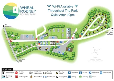
This map of Wheal Rodney Holiday Park brings together a compact touring and self-catering area with a longer, tree-lined camping meadow. Set at Marazion in Cornwall, the park is reached from Gwallon Lane, with the artwork also pointing visitors towards Marazion on foot and towards St Ives and the A30 by road.
The plan makes the different accommodation areas easy to distinguish. Grey caravan and motorhome symbols sit beside small rows of coloured self-catering units, while black tent symbols follow the meadow's branching routes. Yellow electricity badges identify many of the camping pitches, and a separate bell tent area adds another accommodation category without crowding the main layout.
Reception, the swimming pool and toilets form a clear central landmark, highlighted by a red You Are Here marker. Parking, water points, waste facilities and fire extinguishers are distributed around the plan using a consistent symbol system. A large park logo, generous white space and a full-width key give this small mixed park a visitor map that explains both its everyday facilities and the relationship between its distinct accommodation areas.
The single landscape-format artwork places Gwallon Lane along the left edge, with a red entrance marker leading onto a broad white internal route. An entrance-side parking court sits immediately inside the park. Further parking areas are positioned beside the self-catering units and in the lower section, helping visitors relate arrival and parking to their accommodation.
The main accommodation area combines several small groups rather than one uniform grid. Caravan and motorhome silhouettes line the left and lower edges and occupy a short upper-central row. The self-catering units form compact rectangular groups on either side of the main route. Their blue and brown colouring follows the pet categories explained in the key. Nearby trees and small shrubs divide these groups without obscuring the numbered markers.
At the centre, a rectangular building carries swimming, reception and toilet symbols. The You Are Here pointer terminates beside this building, making it the plan's principal orientation point. Water taps and red extinguisher symbols appear at several locations; bin and recycling symbols are paired near parking, and an Elsan point is marked in the lower area beside the site bungalow.
To the right, Camping Meadow extends into a narrow, rounded enclosure of trees. Numbered tent symbols follow its perimeter and internal white routes, mostly accompanied by yellow electric badges. A separate bell tent area is shown below the central junction. The route continues towards an arrow labelled for Marazion on foot.
The lower page is reserved for a two-row Park Key. Above the map, the park logo and large blue Wi-Fi and quiet-hours notice balance the detailed plan. A pale rotated compass completes the orientation information. The enlarged detail views show portions of this same key, not separate park sections.
KEEP EXPLORING
Chosen for shared landscapes, accommodation or facilities.
 Explore the map ↗
United Kingdom
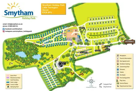
Colour-coded accommodation, woodland ponds and a Tarka Trail footpath on Smytham’s illustrated park map.
 Explore the map ↗
United States
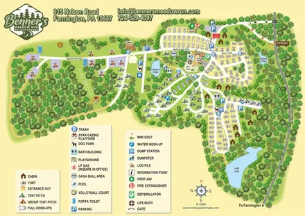
Woodland RV campground map with mixed camping, three water landmarks and a central recreation hub.
 Explore the map ↗
United Kingdom
Colour-coded campsite map with riverside pitches, bell tents, a swimming pool and fishing lake.
Features may come from the sample artwork, its key or published park information. Approximate numbers describe the drawing and may cover only part of a park. They are intended to help you compare map examples. Current facilities and booking information should be checked with the park.
TAKE A CLOSER LOOK
View the illustrated map in detail or choose a file to download. These are sample maps; contact the park for current visitor information.


LET’S MAP YOUR PARK
For a map quotation, find your park and draw a rough boundary around it. The area you select helps us work out the design time and price.
Draw your park for a quote ↗Or talk to our map designers
01751 473136
 whealrodney_large.png