
Residential areas
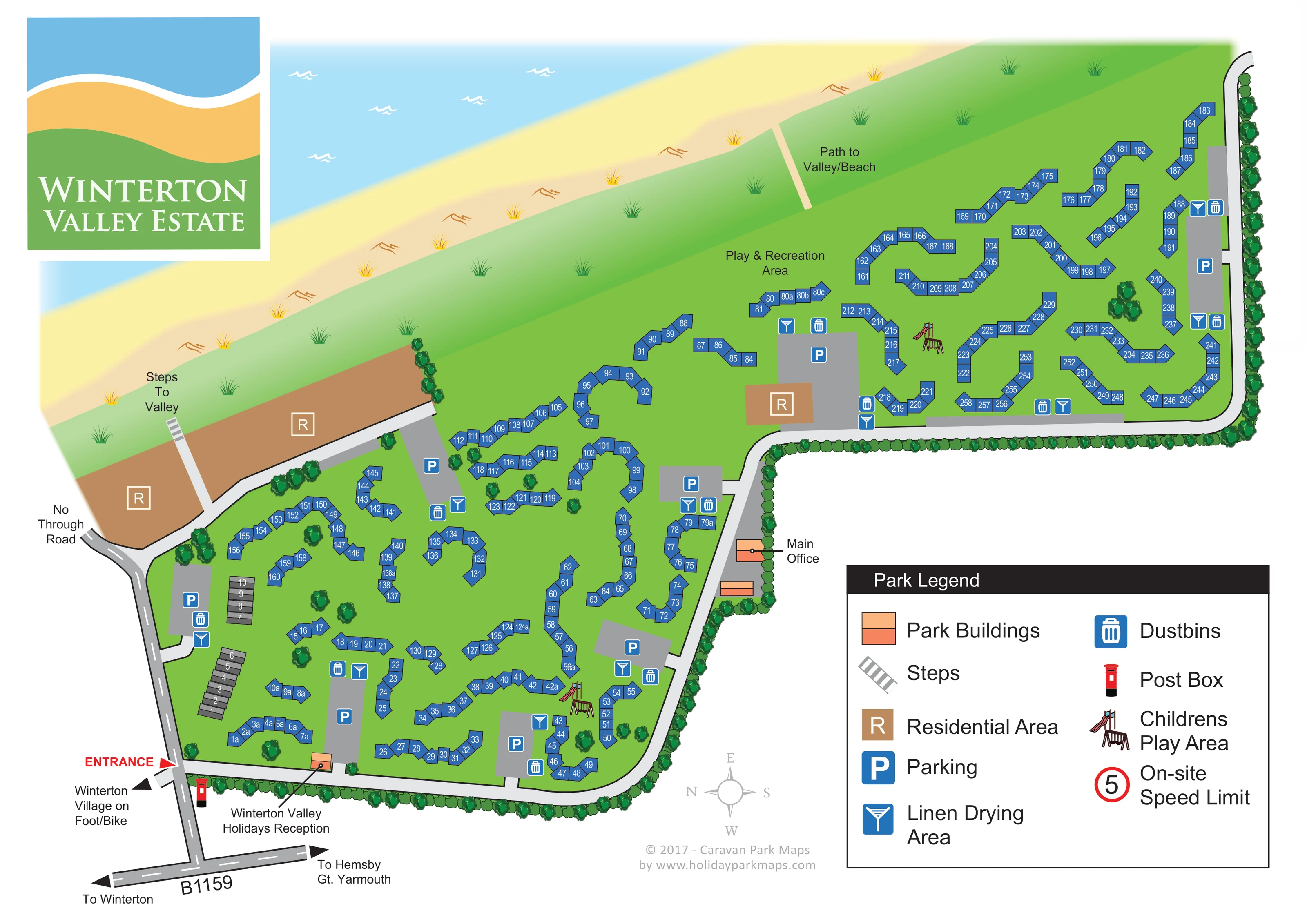
Brown areas carrying white R symbols distinguish residential land from the numbered holiday accommodation.
ILLUSTRATED PARK MAP · P650
Edward Road, Winterton-on-Sea, Norfolk · United Kingdom
 Enlarge the map ↗
A SENSE OF THE PLACE
Winterton Valley Estate is a family-owned chalet holiday retreat at Winterton-on-Sea on the Norfolk coast. The accommodation sits beside dunes and coastal landscapes close to the village.
A walking route crosses the valley and dunes to the beach without crossing a main road. Winterton Dunes National Nature Reserve adds wildlife and walking interest, with the map showing the chalet layout and access through the grounds.
LOOK CLOSER
Brown areas carrying white R symbols distinguish residential land from the numbered holiday accommodation.
Layered green valley land, sandy dune and beach bands, and pale blue sea form the coastal edge of the composition.
Continuous illustrated hedges and trees trace much of the inland perimeter, with individual trees scattered between chalet clusters.
An orange building just inside the entrance is identified by a leader line as the holiday reception.
A separate office building is labelled along the inland boundary near the central bend in the estate road.
Orange two-tone building footprints distinguish reception, the main office and another unlabelled park building from accommodation.
Grey parking courts with blue P symbols are distributed among the chalet groups and beside the internal roads.
Repeated blue drying-frame symbols mark shared linen drying points throughout the accommodation areas.
An orange building just inside the entrance is identified by a leader line as the holiday reception.
A separate office building is labelled along the inland boundary near the central bend in the estate road.
Orange two-tone building footprints distinguish reception, the main office and another unlabelled park building from accommodation.
Grey parking courts with blue P symbols are distributed among the chalet groups and beside the internal roads.
Repeated blue drying-frame symbols mark shared linen drying points throughout the accommodation areas.
Blue bin symbols identify several shared disposal points, often grouped with parking or linen drying areas.
A red post box illustration is positioned near the entrance and reception.
Two illustrated play-equipment locations appear among the chalet groups, one in each main part of the estate.
A broad green strip along the valley-facing side is labelled Play & Recreation Area.
Brown areas carrying white R symbols distinguish residential land from the numbered holiday accommodation.
Layered green valley land, sandy dune and beach bands, and pale blue sea form the coastal edge of the composition.
Continuous illustrated hedges and trees trace much of the inland perimeter, with individual trees scattered between chalet clusters.
A pale path crosses the green coastal strip towards the dunes and beach.
A stepped pedestrian connection leads through the residential side of the plan towards the valley.
The entrance is highlighted in red off the approach from the B1159, with directions towards Winterton and towards Hemsby and Great Yarmouth.
A directional arrow near the entrance identifies the route to Winterton village on foot or by bike.
The road branch beside the residential areas is explicitly labelled No Through Road.
The legend includes a red-ringed 5 symbol labelled On-site Speed Limit; no separate position for this symbol is evident on the plan.
READING THE MAP
This map of Winterton Valley Estate brings a large chalet layout together with the coastal landscape that gives the Norfolk retreat its character. The estate sits at Winterton-on-Sea, beside the valley and dunes, and the artwork places that setting prominently across the top of the page: pale blue sea, a broad sandy shore and green open land form a continuous backdrop to the accommodation.
Within the grounds, blue numbered chalet footprints follow short terraces and curved groups rather than a uniform grid. Grey parking courts, shared linen drying points and dustbin symbols help visitors orientate themselves between these clusters. Reception is clearly marked beside the entrance, while the main office is identified separately further along the internal road.
The plan also shows two children's play locations, a larger play and recreation area, steps to the valley and a path towards the beach. Road directions from the B1159 and a separate foot-and-bike connection to Winterton village give the map a useful role beyond finding an individual chalet.
The artwork uses a rotated overhead plan to fit the estate's long coastal frontage into a landscape page. East sits towards the top of the compass, with the beach and sea forming a broad diagonal edge above the accommodation. Below this, a green valley strip separates the sandy landscape from the numbered chalet groups and carries the Play & Recreation Area label.
Arrival is shown at the lower left, where a red entrance arrow leads from the B1159 approach into the estate. An orange reception building and red post box provide recognisable arrival landmarks. The internal road follows the inland boundary, bends through the centre and continues around the larger right-hand accommodation area. Grey parking courts extend from this road into the chalet groups. A separate branch beside the brown residential areas is labelled No Through Road.
Most accommodation appears as blue footprints with white numbers, arranged in short linked rows, open curves and horseshoe-like clusters. Trees occupy gaps between the buildings, and a continuous illustrated hedge defines much of the outer boundary. Repeated blue symbols identify communal parking, linen drying and dustbin points. Two small illustrations of play equipment mark children's play locations, while leader lines distinguish the main office and reception from other park buildings.
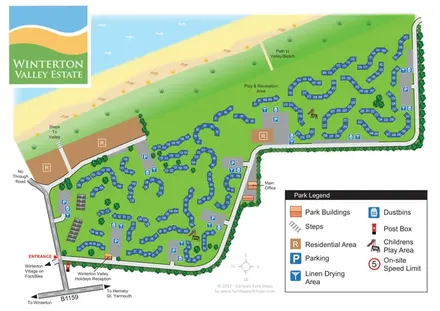
Pedestrian routes receive their own treatment: pale paths lead towards the valley and beach, grey steps cross the residential-side strip, and a labelled arrow points towards Winterton village on foot or by bike. A large two-column legend occupies the lower-right space, balanced by the coastal title panel at upper left. The accompanying detail view enlarges this same legend and nearby boundary; it is not a separate estate section.
KEEP EXPLORING
Chosen for shared landscapes, accommodation or facilities.
 Explore the map ↗
United Kingdom
Coastal park map with static-caravan rows, touring pitches, a camping field and two leisure clusters.
 Explore the map ↗
United Kingdom
Illustrated coastal holiday-home plan with dense alphanumeric plot labels, orange-roofed amenities, a numbered facility key and beach-side context.
 Explore the map ↗
United Kingdom
Coastal park plan with colour-coded pitches, named neighbourhoods and a Morecambe Bay walking route.
Features may come from the sample artwork, its key or published park information. Approximate numbers describe the drawing and may cover only part of a park. They are intended to help you compare map examples. Current facilities and booking information should be checked with the park.
TAKE A CLOSER LOOK
View the illustrated map in detail or choose a file to download. These are sample maps; contact the park for current visitor information.


LET’S MAP YOUR PARK
For a map quotation, find your park and draw a rough boundary around it. The area you select helps us work out the design time and price.
Draw your park for a quote ↗Or talk to our map designers
01751 473136