
 Explore the map ↗
United Kingdom
Adgestone Campsite
Colour-coded campsite map with riverside pitches, bell tents, a swimming pool and fishing lake.
THE HOLIDAY PARK MAP COLLECTION
Explore maps with glamping accommodation, distinctive structures and shared guest facilities.
← Explore the whole collectionCombine a country, landscape, facilities and accommodation type to find relevant examples.
Showing 1–24 of 135 · Select a map to read its story
Explore the map ↗United Kingdom
Colour-coded campsite map with riverside pitches, bell tents, a swimming pool and fishing lake.
 Explore the map ↗
United Kingdom
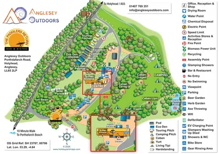
Illustrated camping and glamping map with an activity-centre inset and wildlife pond.
 Explore the map ↗
United Kingdom
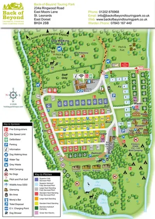
Colour-coded touring pitches, named glamping units and woodland routes at Back of Beyond Touring Park.
 Explore the map ↗
United Kingdom
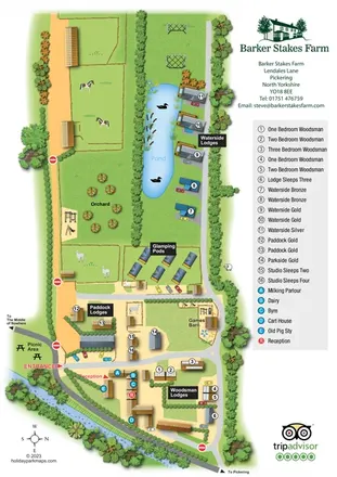
Portrait farm-stay map with pond-side lodges, glamping pods, orchard and illustrated animal paddocks.
 Explore the map ↗
United Kingdom
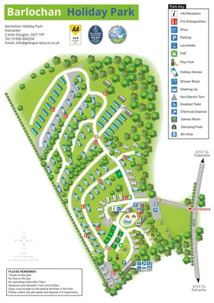
A wooded, mixed-accommodation park plan with winding lanes, a pool, camping areas and a clear facility key.
 Explore the map ↗
United Kingdom
Woodland-framed Barnsoul map with mixed accommodation, shared facilities and paw-marked walking routes.
 Explore the map ↗
United Kingdom
Coastal park plan with colour-coded pitches, named neighbourhoods and a Morecambe Bay walking route.
 Explore the map ↗
United Kingdom
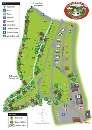
A stream-side farm campsite plan with car-free camping, caravan pitches and separate bell-tent areas.
 Explore the map ↗
United Kingdom
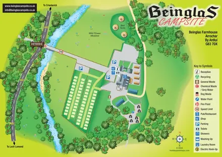
Riverside campsite map with a bridge entrance, wild flower meadow, bell tents and wooded hut paths.
 Explore the map ↗
United States
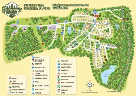
Woodland RV campground map with mixed camping, three water landmarks and a central recreation hub.
 Explore the map ↗
United Kingdom
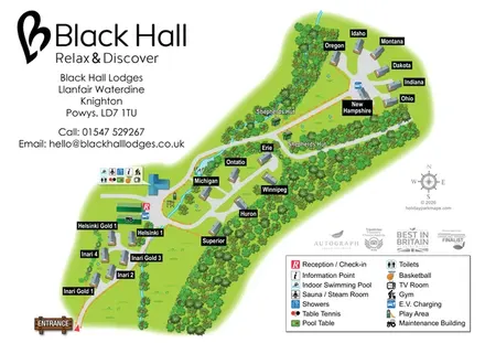
Named lodges, shepherds' huts and a shared leisure hub in a wooded countryside plan.
 Explore the map ↗
New Zealand
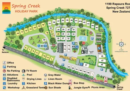
Illustrated creekside park plan with numbered pitches, mixed accommodation and a large facility legend.
 Explore the map ↗
United Kingdom
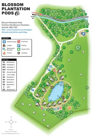
Illustrated lakeside pod map with woodland arrival routes, named lodges and a waterside circuit.
 Explore the map ↗
United Kingdom
Woodland park map with mixed pitches, bell tents, lodges and a fishing lake.
 Explore the map ↗
United Kingdom
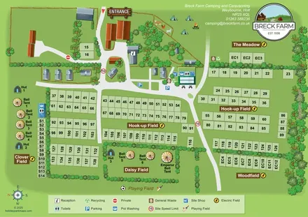
A field-based farm campsite map with numbered pitches, bell tents, huts and a wooded boundary.
 Explore the map ↗
United Kingdom
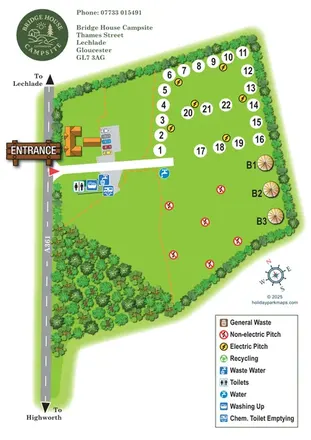
Leafy campsite map with numbered electric pitches, open camping and a prominent illustrated entrance.
 Explore the map ↗
United Kingdom
A colour-zoned coastal park map with touring areas, woodland trails, ponds and a leisure club.
 Explore the map ↗
United Kingdom
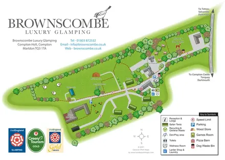
A branded rural glamping map combining named safari tents and distinctive structures with an orchard dog walk, shared amenities and farm-themed illustration.
 Explore the map ↗
United Kingdom
Riverside park map with named pitch fields, illustrated huts and a paw-print dog walk.
 Explore the map ↗
United Kingdom
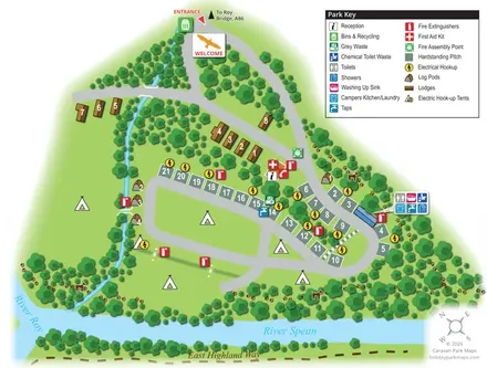
A wooded riverside map combining lodges, log pods, touring hardstandings and open camping at Bunroy Park.
 Explore the map ↗
United Kingdom
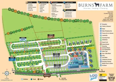
Colour-coded camping and touring sections, illustrated glamping units and a detailed amenities hub at Burns Farm.
 Explore the map ↗
United Kingdom
Colour-coded accommodation, lakeside facilities and woodland routes at Burton Constable Holiday Park & Arboretum.
 Explore the map ↗
United Kingdom
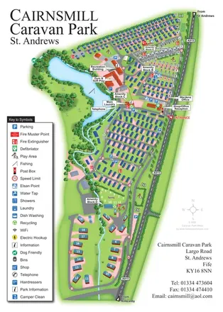
Portrait park map combining numbered caravan rows, touring and tent areas with a reservoir-side recreation hub.
 Explore the map ↗
United Kingdom
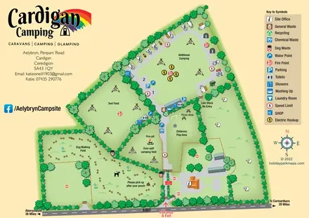
Illustrated farm-campsite map with mixed accommodation, named camping fields and a dedicated dog-walking area.
LET’S MAP YOUR PARK
For a map quotation, find your park and draw a rough boundary around it. The area you select helps us work out the design time and price.
Draw your park for a quote ↗Or talk to our map designers
01751 473136