
Tree-lined edges and planted clusters
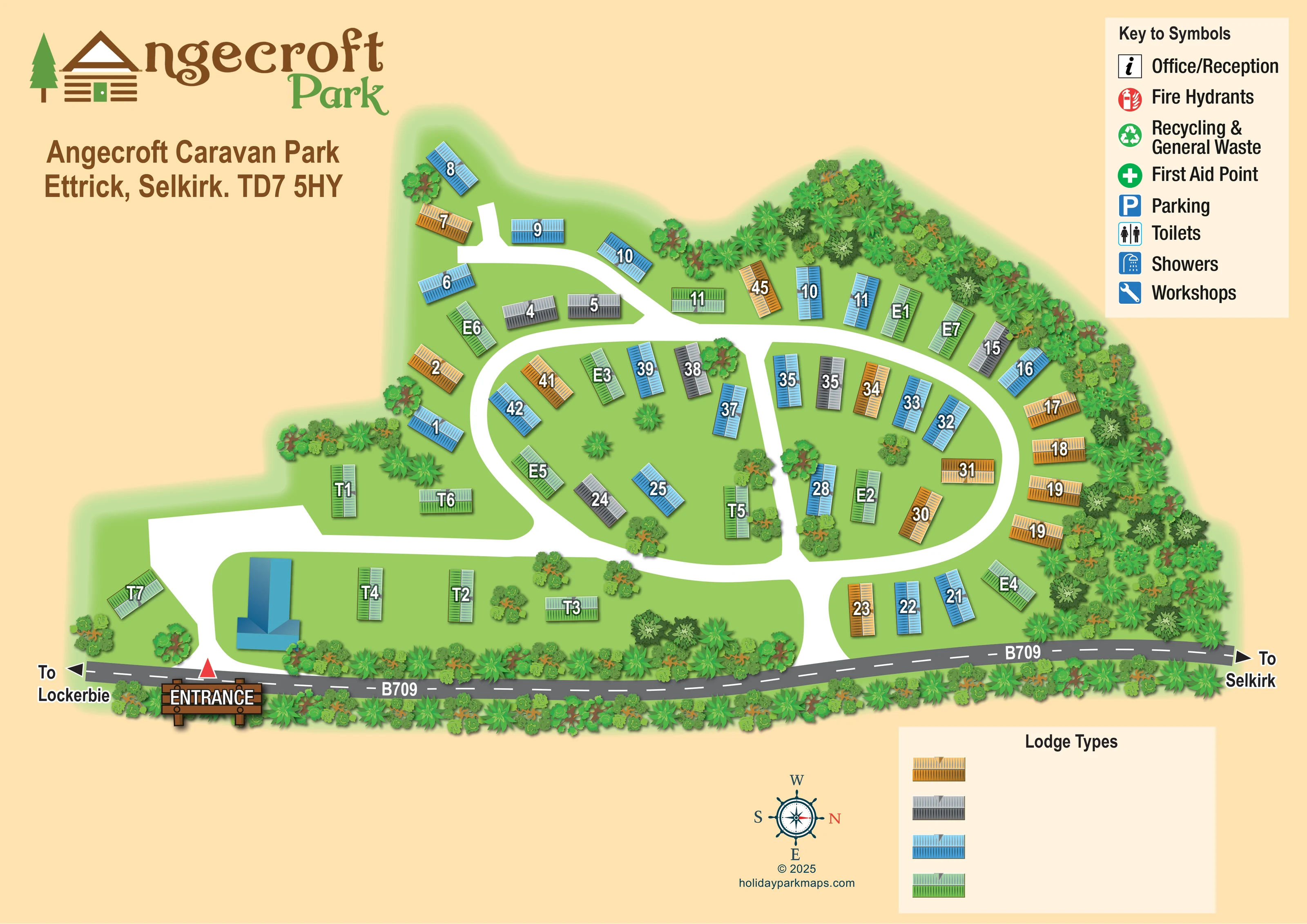
Dense illustrated trees and shrubs frame much of the perimeter, particularly the upper-right and right-hand edges, with smaller clusters between accommodation units.
ILLUSTRATED PARK MAP · P007
Ettrick Valley, Selkirk · United Kingdom
 Enlarge the map ↗
A SENSE OF THE PLACE
Angecroft Park is based at Ettrick Valley, Selkirk. The small park lies beside Tima Water in the Ettrick Valley, surrounded by the Southern Uplands. The park offers three-bedroom wooden lodges and two-bedroom caravans, each sleeping six, for weekly hire or short breaks. The operator also offers two-bedroom, six-berth caravans for sale and publishes a direct sales email.
On-site amenities include a laundry room, picnic tables, resident managers and a shop selling basic essentials. Fishing permits are available from the park.
LOOK CLOSER
Dense illustrated trees and shrubs frame much of the perimeter, particularly the upper-right and right-hand edges, with smaller clusters between accommodation units.
Bright green ground connects the accommodation groups and forms open spaces within the road loops.
An entrance label on a timber-style sign marks the access from the B709 at the lower-left side of the plan.
The B709 follows the lower edge, with arrows towards Lockerbie on the left and Selkirk on the right.
Broad white roads form connected curves and a large accommodation loop, with an upper spur, a central link and a further connection to the B709 near the lower-right side.
A larger, blue-roofed, angular building stands beside the entrance road. Its function is not labelled on the plan.
An entrance label on a timber-style sign marks the access from the B709 at the lower-left side of the plan.
The B709 follows the lower edge, with arrows towards Lockerbie on the left and Selkirk on the right.
Broad white roads form connected curves and a large accommodation loop, with an upper spur, a central link and a further connection to the B709 near the lower-right side.
Dense illustrated trees and shrubs frame much of the perimeter, particularly the upper-right and right-hand edges, with smaller clusters between accommodation units.
Bright green ground connects the accommodation groups and forms open spaces within the road loops.
A larger, blue-roofed, angular building stands beside the entrance road. Its function is not labelled on the plan.
An information symbol is defined in the key, but no matching location marker is clearly visible on the plan.
A red fire-hydrant symbol appears in the key; individual hydrant positions are not visibly marked.
A green recycling symbol represents recycling and general waste in the key, without a clearly placed counterpart on the plan.
A white cross in a green circle is included in the key, but its site position is not shown clearly.
A blue parking symbol is included in the key; no parking area is explicitly identified by that symbol on the plan.
Separate toilet and shower pictograms are listed in the key, without clearly mapped locations.
A blue spanner symbol denotes workshops in the key, but no corresponding position is clearly marked.
These amenities are described in the park information, rather than individually labelled in the artwork.
The park is described as lying beside Tima Water in the Ettrick Valley, surrounded by the Southern Uplands. Neither the watercourse nor the wider hills are illustrated here.
Park information states that fishing permits are available; this service is not labelled on the map.
READING THE MAP
This illustrated map presents Angecroft Park in the Ettrick Valley, near Selkirk, as a compact, tree-framed holiday site. Its main focus is the relationship between individual accommodation units, the curving internal roads and the B709 along the park frontage. A timber-style entrance sign and arrows towards Lockerbie and Selkirk give the plan an immediate arrival context, while large roof-mounted identifiers help visitors find their accommodation.
The artwork combines a clear overhead layout with small dimensional touches: striped pitched roofs, building shadows and layered tree canopies. Blue, orange, grey and green accommodation symbols stand out against bright grass, with a warm peach background keeping the page visually separate from the site itself. The Angecroft cabin-and-conifer logo occupies the upper left, balanced by a facility key on the right and a separate lodge-type colour panel below.
For a designer’s gallery, this is a useful example of a small holiday-park map where numbered accommodation and road legibility take priority. The surrounding planting gives the plan a rural character without adding a separate scenic panorama or obscuring the routes.
The plan is arranged around a network of broad white roads, with the main signed entrance at the lower left beside a larger blue-roofed building. From here, the road leads into the accommodation area and connects with sweeping curves through the middle and right of the site. An upper-left spur serves a smaller group of units, while a central link crosses between the upper and lower parts of the main loop. A further road connection reaches the B709 towards the lower right.
Accommodation appears on both sides of these routes: along the planted outer boundary, around the inside of the loop and in a more open group near the entrance. Roughly 45 roofed unit symbols convey the scale of the depicted park. Each has a prominent numeric or letter-prefixed identifier, with blue, orange, grey and green roofs distributed across the plan. The lower-right 'Lodge Types' panel repeats these four colours, although it does not name the categories.
Trees and shrubs form a particularly dense border along the upper-right and right-hand sides. Smaller clusters between units break up the grassed interior without overwhelming the road network. The B709 is rendered as a dark grey road with a dashed centre line, contrasting strongly with the white internal routes. Arrows identify the directions to Lockerbie and Selkirk, and the decorative compass indicates north towards the right.
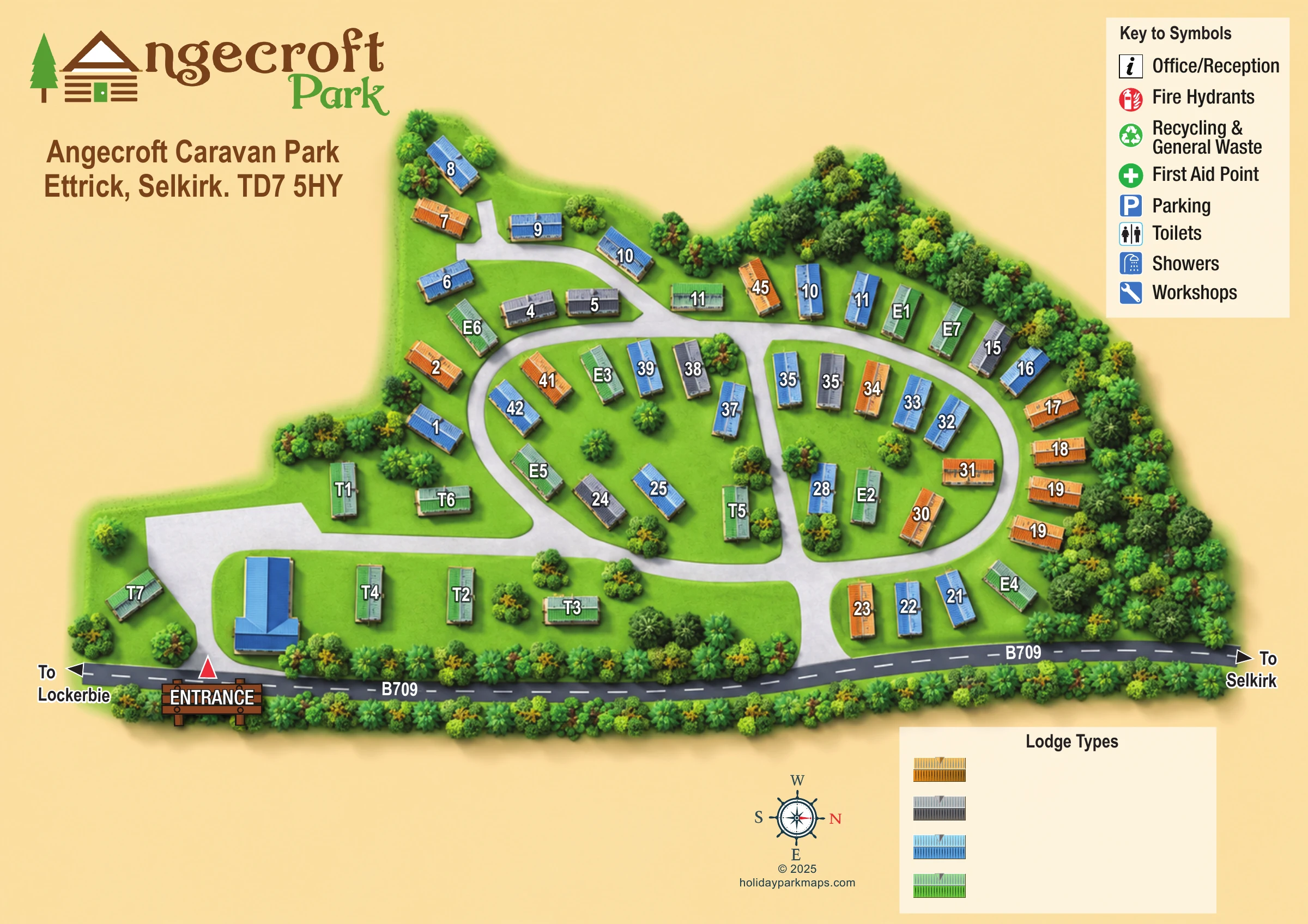
The upper-right facility key lists office/reception, fire hydrants, recycling and general waste, first aid, parking, toilets, showers and workshops. These are key entries rather than clearly placed facility markers on the plan. The enlarged detail view shows this same key and the adjacent accommodation more closely; it is not a separate park section or additional map variant.
 Enlarge this map ↗
KEEP EXPLORING
Chosen for shared landscapes, accommodation or facilities.
 Explore the map ↗
United Kingdom
Illustrated lakeside park plan with numbered holiday units, leisure buildings and a looping Woodland Walk.
 Explore the map ↗
United Kingdom
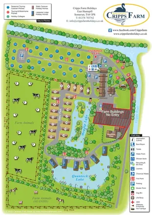
Illustrated farm holiday park plan combining riverside pitches, lakeside accommodation, animal fields and paw-print walking routes, with separate accommodation and facilities keys.
 Explore the map ↗
United Kingdom
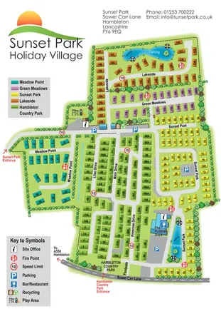
Five colour-coded park sections, two fishing lakes and linked drives on a Sunset Park-branded plan including Hambleton Country Park.
Features may come from the sample artwork, its key or published park information. Approximate numbers describe the drawing and may cover only part of a park. They are intended to help you compare map examples. Current facilities and booking information should be checked with the park.
LET’S MAP YOUR PARK
For a map quotation, find your park and draw a rough boundary around it. The area you select helps us work out the design time and price.
Draw your park for a quote ↗Or talk to our map designers
01751 473136