
Seven numbered fishing lakes
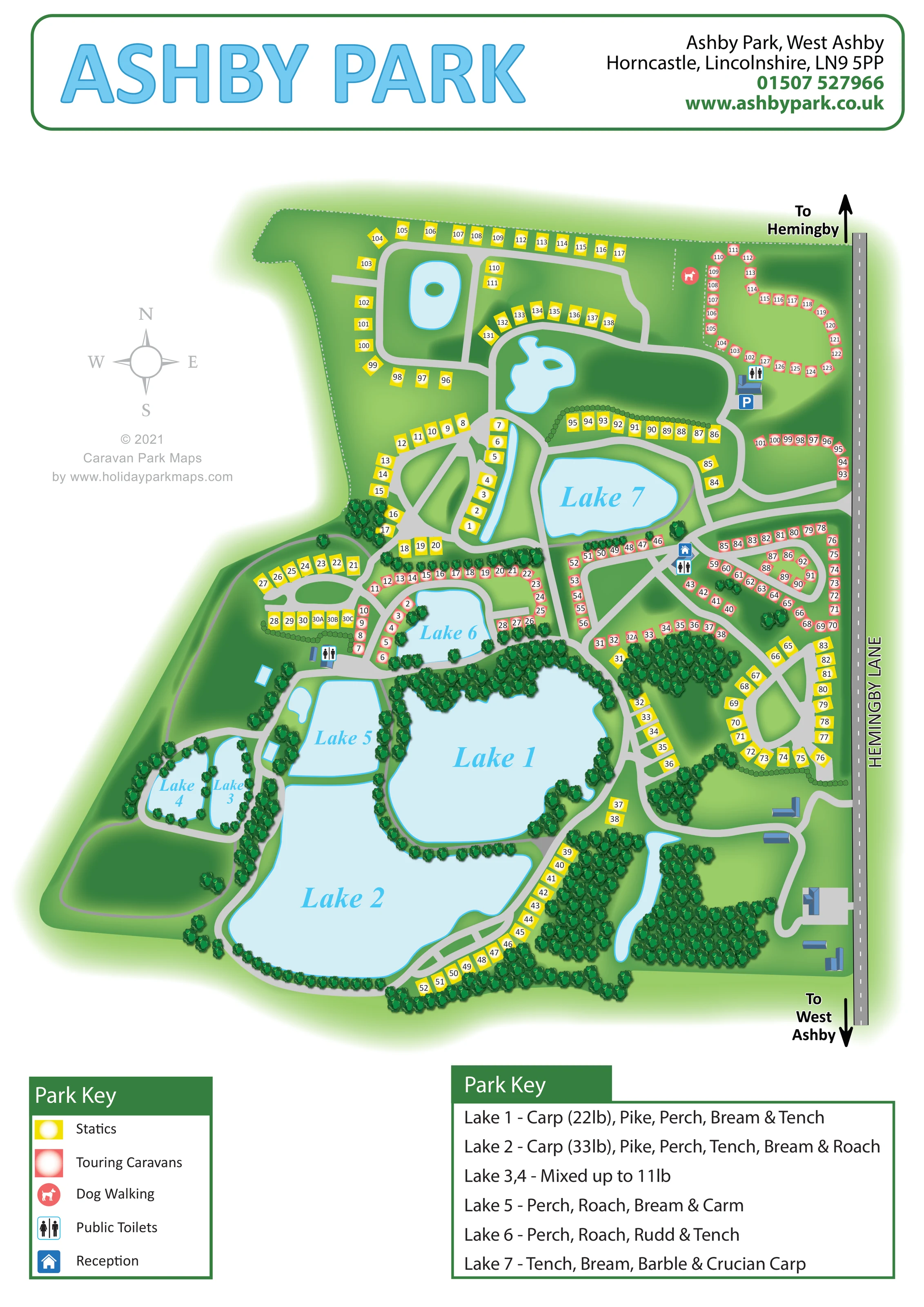
Lakes 1–7 are named on the plan and supported by a separate lake-by-lake fishing key. Lakes 1 and 2 dominate the southern half, with smaller waters to the west and north.
ILLUSTRATED PARK MAP · P396
Ashby Park, West Ashby, Horncastle, Lincolnshire · United Kingdom
 Enlarge the map ↗
A SENSE OF THE PLACE
Ashby Park is a lakeside holiday park at West Ashby near Horncastle. Former gravel workings have become fishing lakes within a wider park that combines touring and camping with holiday home ownership.
Fishing is a defining feature of the site. Heated washrooms, showers and laundry facilities support touring stays, while the surrounding Lincolnshire countryside provides opportunities for days out. Nearby leisure attractions are separate from the park's own facilities.
LOOK CLOSER
Lakes 1–7 are named on the plan and supported by a separate lake-by-lake fishing key. Lakes 1 and 2 dominate the southern half, with smaller waters to the west and north.
Small island ponds appear in the northern section, with narrow water features near the central static rows and the south-eastern woodland. Their use is not specified.
Dense illustrated trees edge Lakes 1–6, separate accommodation groups and form larger wooded pockets in the south-east.
Large grassy spaces remain between accommodation loops, around the northern ponds and west of the main lakes.
The fishing key lists species by lake, including carp, pike, perch, bream, tench, roach, rudd and crucian carp. It also prints carp weights for Lakes 1 and 2 and a mixed-fish weight note for Lakes 3 and 4; these are artwork annotations rather than current catch guarantees.
A blue house symbol identifies reception on the east-central road network, near touring groups and a toilet symbol.
Repeated toilet symbols mark facilities in the north-east, beside reception and to the west of Lake 6.
A blue P symbol marks parking beside the north-eastern toilet building. Parking is visible on the plan although it is not included in the five-entry symbol key.
Lakes 1–7 are named on the plan and supported by a separate lake-by-lake fishing key. Lakes 1 and 2 dominate the southern half, with smaller waters to the west and north.
The fishing key lists species by lake, including carp, pike, perch, bream, tench, roach, rudd and crucian carp. It also prints carp weights for Lakes 1 and 2 and a mixed-fish weight note for Lakes 3 and 4; these are artwork annotations rather than current catch guarantees.
Small island ponds appear in the northern section, with narrow water features near the central static rows and the south-eastern woodland. Their use is not specified.
A blue house symbol identifies reception on the east-central road network, near touring groups and a toilet symbol.
Repeated toilet symbols mark facilities in the north-east, beside reception and to the west of Lake 6.
A blue P symbol marks parking beside the north-eastern toilet building. Parking is visible on the plan although it is not included in the five-entry symbol key.
A coral dog symbol marks a green area beside the north-eastern touring section, close to a dotted boundary line.
Dense illustrated trees edge Lakes 1–6, separate accommodation groups and form larger wooded pockets in the south-east.
Large grassy spaces remain between accommodation loops, around the northern ponds and west of the main lakes.
Pale grey routes form interconnected loops, lakeside circuits, branches and short spurs, linking accommodation groups with buildings and the eastern roadside.
Hemingby Lane runs down the eastern edge, with directional arrows towards Hemingby at the top and West Ashby at the bottom.
A four-point compass in the left-hand white margin establishes north at the top of the page.
READING THE MAP
This illustrated map of Ashby Park places its fishing lakes at the centre of the visitor experience. Set at West Ashby near Horncastle in Lincolnshire, the park is shown as a network of curving routes, wooded water margins and numbered accommodation groups beside Hemingby Lane. Seven named lakes give the plan its structure, while yellow static caravan markers and coral touring markers make the two mapped accommodation categories easy to distinguish.
The artwork combines a practical site plan with a softer landscape illustration. Pale-blue water, layered green trees and shaded grass help visitors recognise the character of each area, while clear numbers and facility symbols support everyday navigation. Reception, public toilets, parking and a dog-walking area are marked within the plan.
A separate fishing key adds information about the different lakes without crowding their outlines. The portrait page also includes a compass, local road directions and a prominent park header. It is a useful sample for parks where accommodation is spread around substantial landscape features rather than arranged in a simple rectangular grid.
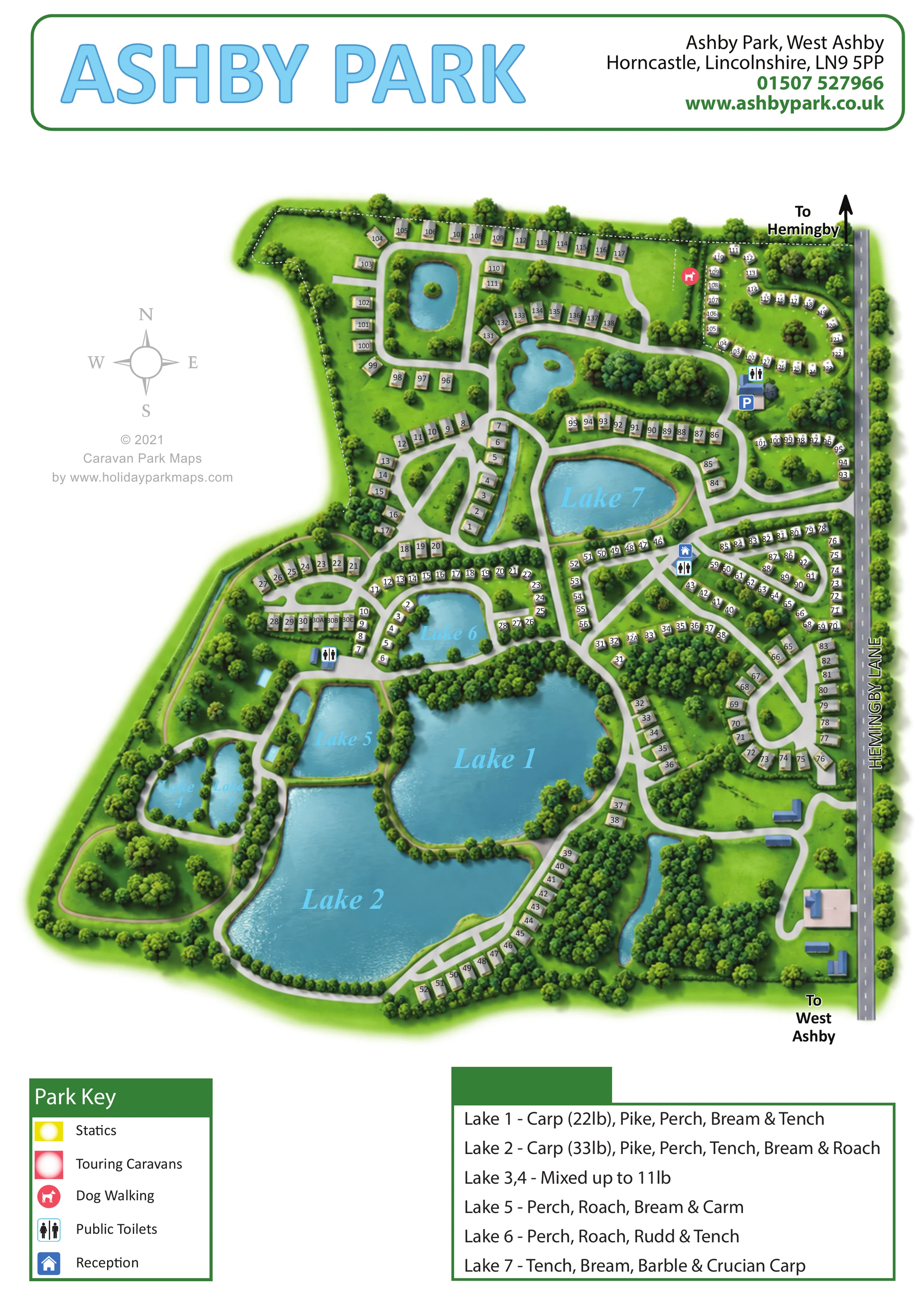
The whole-page plan follows the park's irregular footprint, with Hemingby Lane providing a straight reference along the eastern edge. Directional arrows point towards Hemingby and West Ashby, and a compass sits in the open white margin to the left. Pale-grey internal routes branch from the roadside and form a series of linked loops through the accommodation areas.
The largest water bodies, Lakes 1 and 2, occupy much of the southern half. Their irregular shorelines are fringed with illustrated trees, and yellow static markers follow parts of the eastern and southern routes. Lakes 3 and 4 sit side by side to the south-west, with Lake 5 above them. Lake 6 is surrounded by coral touring markers, while Lake 7 creates another prominent landmark farther north. Additional unlabelled ponds, including small island waters, add variety to the northern section.
Accommodation groups are drawn as numbered coloured squares rather than detailed caravan models. Yellow and coral remain easy to separate against the green ground, including where rows bend around water or follow intersecting roads. Reception is marked on the east-central network. Toilet symbols appear at several points, a parking symbol sits in the north-east, and a dog-walking symbol identifies a green area beside the northern touring loop.
Two panels complete the lower page: one explains accommodation and facility symbols, while the other gives lake-specific fishing information. A large blue title and green-bordered contact header balance the detailed plan below. The accompanying enlarged views repeat these two keys for legibility; they are details of the same artwork, not separate park sections or additional maps.
 Enlarge this map ↗
KEEP EXPLORING
Chosen for shared landscapes, accommodation or facilities.
 Explore the map ↗
United Kingdom
Illustrated caravan park plan with woodland and riverside walks, fishing pools and wildlife panels.
 Explore the map ↗
United Kingdom
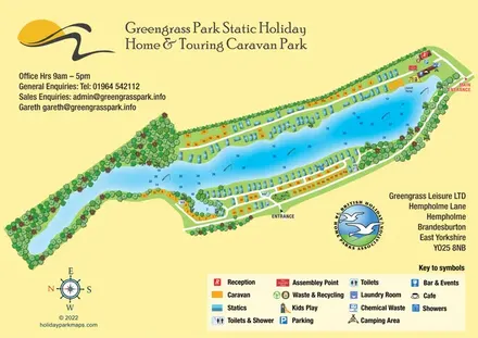
Colour-coded lakeside accommodation and illustrated facilities at Greengrass Park, East Yorkshire.
 Explore the map ↗
United Kingdom
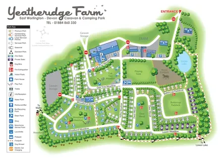
Colour-coded pitches, farm facilities and lakeside walking connections at Yeatheridge Farm, Devon.
Features may come from the sample artwork, its key or published park information. Approximate numbers describe the drawing and may cover only part of a park. They are intended to help you compare map examples. Current facilities and booking information should be checked with the park.
TAKE A CLOSER LOOK
View the illustrated map in detail or choose a file to download. These are sample maps; contact the park for current visitor information.



LET’S MAP YOUR PARK
For a map quotation, find your park and draw a rough boundary around it. The area you select helps us work out the design time and price.
Draw your park for a quote ↗Or talk to our map designers
01751 473136