
Central fishing lake
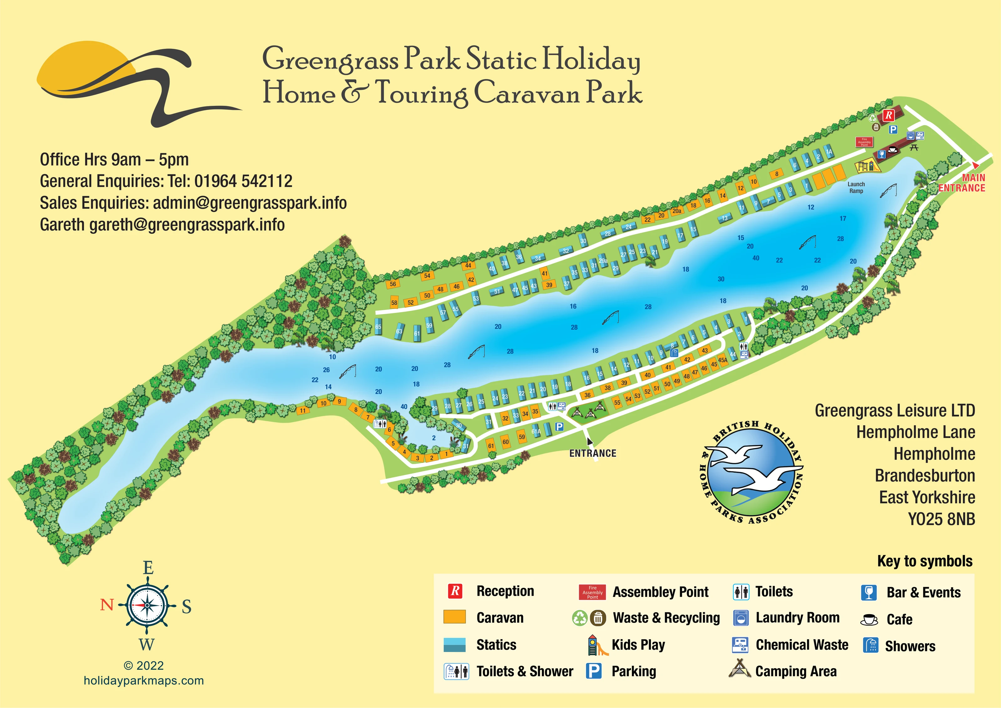
An elongated, irregular blue lake dominates the plan, with fishing-rod illustrations distributed across the water and a narrow arm extending towards the lower-left corner.
ILLUSTRATED PARK MAP · P481
Greengrass Leisure LTD, Hempholme Lane, Hempholme, Brandesburton, East Yorkshire · United Kingdom
 Enlarge the map ↗
A SENSE OF THE PLACE
Greengrass Park is based at Greengrass Leisure LTD, Hempholme Lane, Hempholme, Brandesburton, East Yorkshire. The operator describes 35 acres of countryside surrounding a 15-acre fishing lake. Static holiday homes and touring caravan pitches are offered.
Facilities include a bar and restaurant and children's outdoor play area.
LOOK CLOSER
An elongated, irregular blue lake dominates the plan, with fishing-rod illustrations distributed across the water and a narrow arm extending towards the lower-left corner.
Dense illustrated tree belts surround the narrow lake arm and parts of the opposite shore; a continuous hedge runs behind the upper accommodation row.
A red reception symbol identifies a small building near the upper-right main entrance.
Blue parking symbols appear beside reception and near the lower entrance.
A glass symbol marks the lakeside amenity building near the main entrance.
A cup symbol identifies the café at the same main-entrance amenity cluster.
A colourful play-equipment illustration sits beside the lake near the launch ramp.
The lake access point beside the main amenity cluster is explicitly labelled 'Launch Ramp'.
An elongated, irregular blue lake dominates the plan, with fishing-rod illustrations distributed across the water and a narrow arm extending towards the lower-left corner.
Dense illustrated tree belts surround the narrow lake arm and parts of the opposite shore; a continuous hedge runs behind the upper accommodation row.
A red reception symbol identifies a small building near the upper-right main entrance.
Blue parking symbols appear beside reception and near the lower entrance.
A glass symbol marks the lakeside amenity building near the main entrance.
A cup symbol identifies the café at the same main-entrance amenity cluster.
A colourful play-equipment illustration sits beside the lake near the launch ramp.
The lake access point beside the main amenity cluster is explicitly labelled 'Launch Ramp'.
Toilet, shower and combined toilet-and-shower symbols are distributed along the lower accommodation band, including its curved left-hand end.
A washing-machine symbol locates the laundry near the main entrance service cluster.
Chemical waste symbols appear near the main entrance and at service points along the lower accommodation road.
Paired bin and recycling symbols are shown beside reception.
A red fire assembly point marker sits within the main entrance amenity area.
The main entrance is labelled at the upper-right tip, with a second entrance labelled below the lower accommodation band.
White roads follow both developed banks of the lake, with a long outer connection on the right and short loops around groups of pitches.
A small picnic-table illustration appears beside the main lakeside amenity building.
The operator information describes a bar and restaurant. The artwork itself labels bar and events and a café, rather than a separate restaurant.
READING THE MAP
This illustrated map of Greengrass Park in Hempholme, near Brandesburton in East Yorkshire, is shaped around the park's long fishing lake. Rather than presenting accommodation as a regular grid, the design follows the shoreline, showing static holiday homes and caravan pitches in two contrasting colours along the developed banks. A wooded arm of the lake stretches towards the lower-left corner, giving the plan a distinctive diagonal composition.
The main entrance, reception and lakeside amenities are grouped at the opposite end. Clear symbols identify the café, bar and events building, children's play area and launch ramp, while further service points are distributed through the accommodation rows. A second entrance and a marked camping area add useful detail to the lower part of the plan.
The pale yellow background, blue water and green tree belts give the artwork a recognisable leisure-park character. Its large title, prominent entrance labels and illustrated key make this a useful sample for parks that need to explain both the shape of a waterside site and the practical relationship between pitches, facilities and arrival points.
The single-page artwork places an elongated lake diagonally across the sheet, with two accommodation bands following its irregular edges. Blue, two-tone blocks identify statics, while orange rectangles identify caravan pitches. The static rows mostly face the water; caravan pitches generally sit behind them across the white internal roads. At the lower-left end of the developed area, a curved cluster wraps around a small inlet, contrasting with the longer, straighter rows elsewhere.
Arrival is explained through a red main entrance label at the upper-right tip and a separate entrance beneath the lower bank. Reception and parking sit near the main entrance, close to the bar and events building, café, laundry, waste and recycling, chemical waste point and fire assembly point. The children's play area and labelled launch ramp occupy the adjacent lakeside space. Further toilet, shower and chemical waste symbols are positioned along the lower accommodation band. Tent illustrations mark a camping area beside the lower access road without defining individual camping pitches.
Landscape detail helps visitors read the site's structure. A continuous hedge backs the upper row, while substantial tree belts frame the narrow lake arm and sections of shoreline. Fishing-rod illustrations reinforce the lake's purpose. Numbers also appear within the water, but their meaning is not explained in the key.
The plan is supported by a large multi-column legend, a nautical compass with north pointing left, park contact and address blocks, and an association emblem. The two enlarged detail views show portions of this same legend and footer; they are not separate site plans. Together, the clear colour coding and pictorial surroundings make the long lakeside arrangement easier to understand at a glance.
KEEP EXPLORING
Chosen for shared landscapes, accommodation or facilities.
 Explore the map ↗
United Kingdom
Illustrated caravan park plan with woodland and riverside walks, fishing pools and wildlife panels.
 Explore the map ↗
United Kingdom
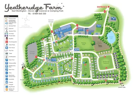
Colour-coded pitches, farm facilities and lakeside walking connections at Yeatheridge Farm, Devon.
 Explore the map ↗
United Kingdom
Ashby Park map with seven fishing lakes, colour-coded accommodation and illustrated wooded shorelines.
Features may come from the sample artwork, its key or published park information. Approximate numbers describe the drawing and may cover only part of a park. They are intended to help you compare map examples. Current facilities and booking information should be checked with the park.
LET’S MAP YOUR PARK
For a map quotation, find your park and draw a rough boundary around it. The area you select helps us work out the design time and price.
Draw your park for a quote ↗Or talk to our map designers
01751 473136