
Wildlife Meadow
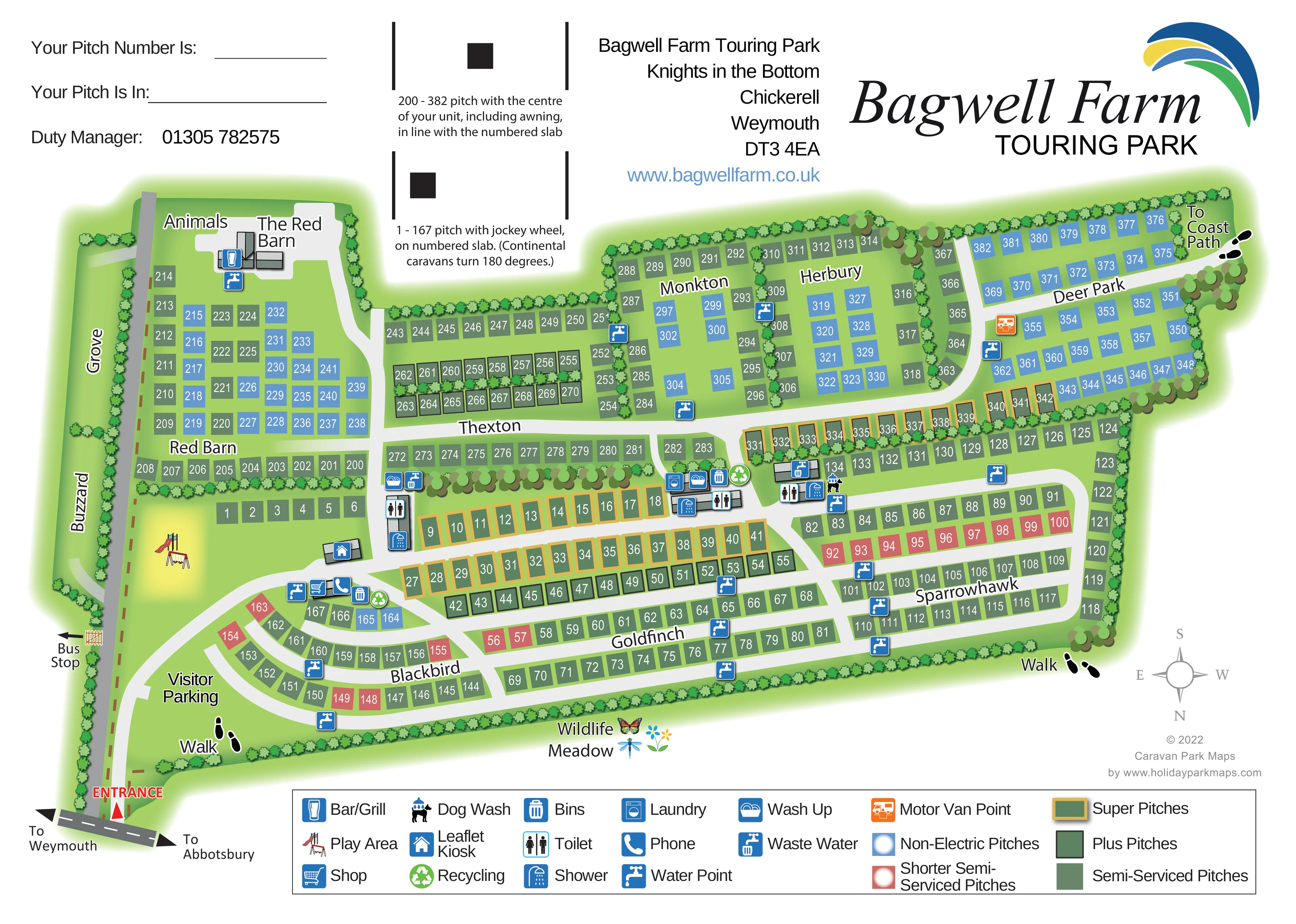
A labelled green margin along the outer pitch boundary is accented with flower, butterfly and dragonfly illustrations.
ILLUSTRATED PARK MAP · P399
Knights in the Bottom, Chickerell, Weymouth, Dorset · United Kingdom
 Enlarge the map ↗
A SENSE OF THE PLACE
Bagwell Farm Touring Park sits in countryside near Chickerell and Weymouth, close to Dorset's Jurassic Coast. Its location off the B3157 provides access to coastal excursions and walking routes, including the South West Coast Path.
A park shop, laundry and washrooms support touring holidays. The Red Barn bar and grill offers food during its operating season, with the coast and Weymouth supplying further options for days out.
LOOK CLOSER
A labelled green margin along the outer pitch boundary is accented with flower, butterfly and dragonfly illustrations.
Continuous illustrated hedges define the park perimeter and divide pitch sections; larger rounded tree groups mark corners and internal boundaries.
Two named, hedge-lined strips sit beyond the main entrance spine. No individual accommodation pitches are drawn within them.
A labelled building complex with the bar/grill symbol, reached by a spur from the internal road.
Shop symbol beside a small building near the entrance-side pitch areas.
A colourful slide-and-swings illustration in an open green space near visitor parking and the Red Barn pitch area.
Several grey-roofed service buildings along the central routes carry toilet and shower symbols.
Laundry symbol at a central service cluster, grouped with washrooms and washing-up facilities.
A labelled building complex with the bar/grill symbol, reached by a spur from the internal road.
Shop symbol beside a small building near the entrance-side pitch areas.
A colourful slide-and-swings illustration in an open green space near visitor parking and the Red Barn pitch area.
Several grey-roofed service buildings along the central routes carry toilet and shower symbols.
Laundry symbol at a central service cluster, grouped with washrooms and washing-up facilities.
Repeated washing-up symbols at the service blocks.
Water taps are distributed through the pitch areas, with waste-water symbols concentrated around service buildings.
Bin symbols occur at service clusters and near the shop; green recycling symbols mark several collection locations.
A dog-and-water symbol appears beside the service block adjoining Sparrowhawk.
An orange motorhome service symbol stands out beside the road through Deer Park.
A kiosk symbol marks a separate small building near the shop-side road junction.
A telephone symbol is mapped beside the shop building.
An area beside The Red Barn is labelled Animals; no species or visitor activity is specified.
A labelled green margin along the outer pitch boundary is accented with flower, butterfly and dragonfly illustrations.
Continuous illustrated hedges define the park perimeter and divide pitch sections; larger rounded tree groups mark corners and internal boundaries.
Two named, hedge-lined strips sit beyond the main entrance spine. No individual accommodation pitches are drawn within them.
A red entrance arrow leads from the external road onto the park spine, with visitor parking labelled beside the initial internal curve.
Opposing arrows on the short external road segment indicate Weymouth and Abbotsbury.
A bus-stop reference is shown just outside the main park spine, reached through a small illustrated gate.
Footprint symbols identify walking links at the entrance-side and far boundaries, including a labelled route towards the Coast Path beyond Deer Park.
READING THE MAP
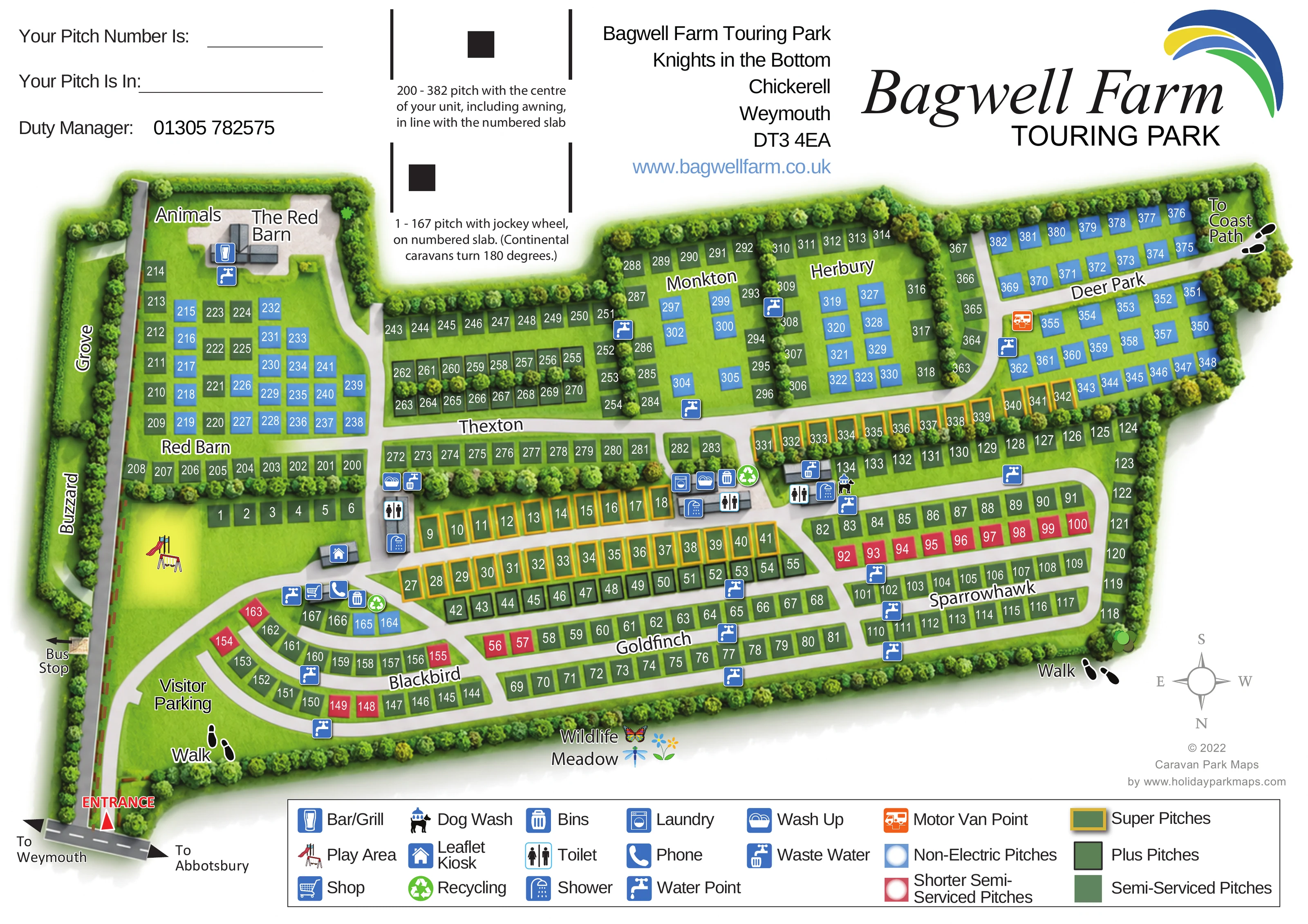
This map of Bagwell Farm Touring Park brings a substantial Dorset touring site onto one practical visitor sheet. Set near Chickerell and Weymouth, the park is presented as a sequence of hedge-lined areas, with clear internal roads linking numbered pitches, service buildings and The Red Barn bar and grill. A walking reference towards the Coast Path connects the site plan with its wider countryside setting.
The design uses a restrained overhead layout rather than filling the park with caravan illustrations. Five pitch categories are distinguished by colour and border treatment, allowing visitors to recognise their allocated pitch type as well as its number. Named sections such as Blackbird, Goldfinch, Sparrowhawk and Deer Park provide another layer of orientation.
Blue facility symbols identify everyday touring essentials, while the play area, animals label and Wildlife Meadow give the map its individual character. The prominent park branding, write-in pitch details and small positioning diagrams make this more than a decorative overview: it is a guest handout designed to support arrival, settling in and finding useful places around the park.
The single landscape-format artwork is built around an elongated site plan with a clearly marked entrance from the road signed towards Weymouth and Abbotsbury. A darker grey access spine runs along one edge of the park, with lighter internal lanes branching into the touring areas. Visitor parking and a play-equipment illustration sit near the arrival end, while a separate road spur reaches The Red Barn building and the neighbouring Animals label.
Hedgerows divide the main pitch areas into recognisable sections. Red Barn, Thexton, Monkton, Herbury and Deer Park extend along one side of the network; Blackbird curves around the entrance-side lanes, followed by the more regular rows of Goldfinch and Sparrowhawk. Grove and Buzzard are named green strips beyond the access spine, without individually drawn pitches. Across the accommodation areas, white pitch numbers sit on green, blue or coral rectangles, with gold and dark borders distinguishing additional pitch classes.
Several service blocks are represented by compact grey roof drawings and clusters of pictograms. The map locates toilets, showers, laundry, washing-up facilities and waste-water points, with water taps distributed more widely. Bins and recycling points are grouped at useful junctions. A dog wash appears by Sparrowhawk, an orange Motor Van Point marks Deer Park, and the shop, phone and leaflet kiosk occupy the entrance-side service area.
The outer landscape is expressed through continuous hedges, larger tree groups and a Wildlife Meadow label accompanied by flowers and insects. Footprint markers show walking references, including the route towards the Coast Path. A boxed key, compass, guest allocation fields and two pitch-positioning diagrams complete the sheet. The detail views enlarge this same artwork rather than introducing additional sections or variants.
 Enlarge this map ↗
KEEP EXPLORING
Chosen for shared landscapes, accommodation or facilities.
 Explore the map ↗
United Kingdom
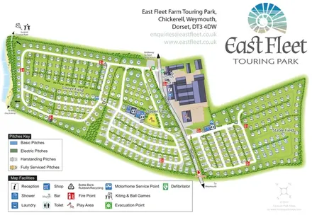
Tree-framed mixed-accommodation park map with two entrances, touring loops and a clearly illustrated social hub.
 Explore the map ↗
United Kingdom
Coastal touring-park plan with three named fields, four pitch categories and lagoon-side walking connections.
 Explore the map ↗
United Kingdom
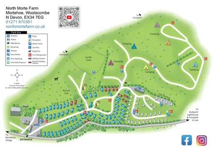
North Morte Farm map with colour-coded holiday homes, separate touring pitches and open camping fields beside coastpath connections.
Features may come from the sample artwork, its key or published park information. Approximate numbers describe the drawing and may cover only part of a park. They are intended to help you compare map examples. Current facilities and booking information should be checked with the park.
TAKE A CLOSER LOOK
View the illustrated map in detail or choose a file to download. These are sample maps; contact the park for current visitor information.

LET’S MAP YOUR PARK
For a map quotation, find your park and draw a rough boundary around it. The area you select helps us work out the design time and price.
Draw your park for a quote ↗Or talk to our map designers
01751 473136