
Tree-lined grounds
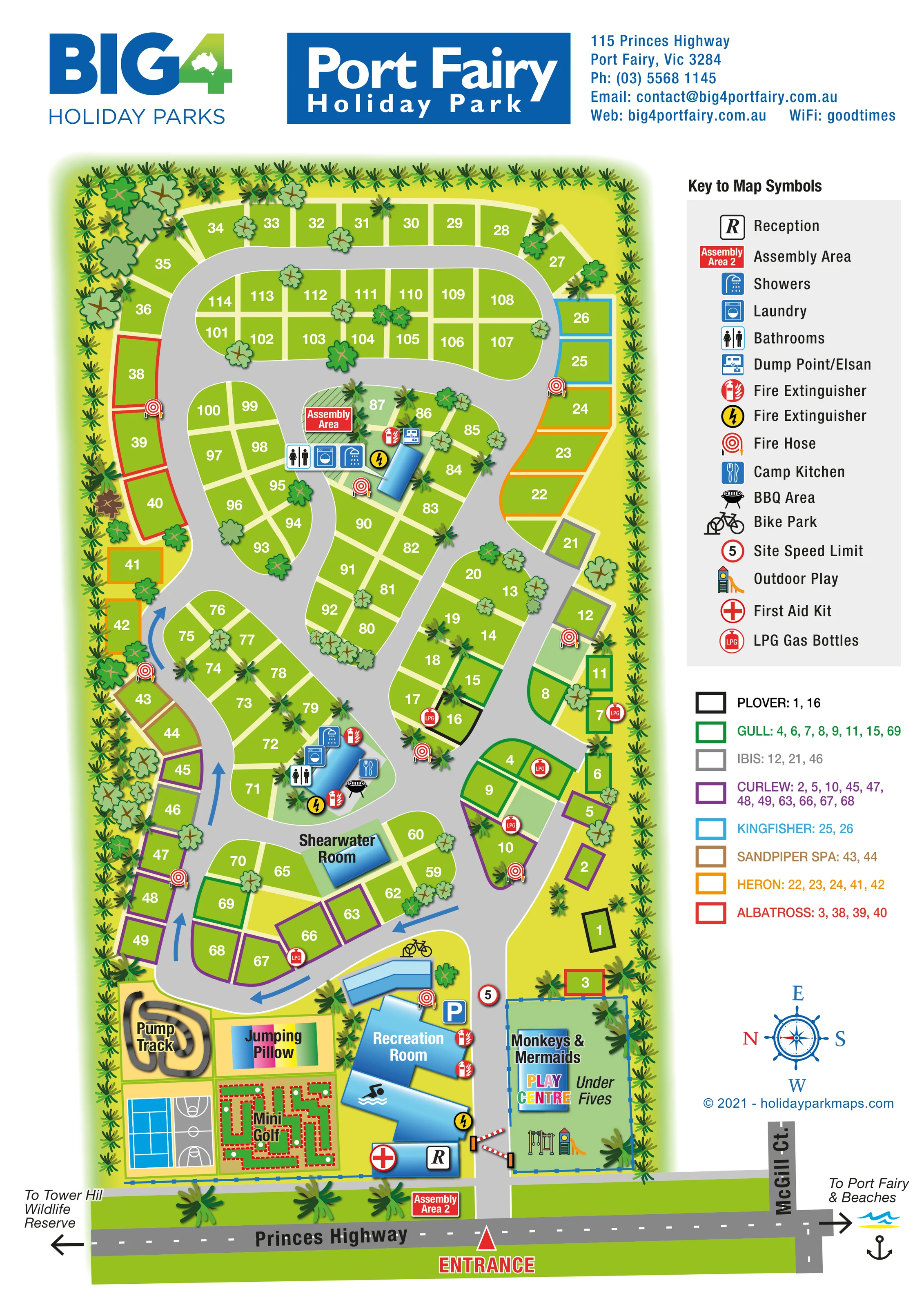
Dense stylised planting frames the park boundary, with scattered broadleaf trees and palm-like forms between pitches.
ILLUSTRATED PARK MAP · P408
115 Princes Highway, Port Fairy, Victoria · Australia
 Enlarge the map ↗
A SENSE OF THE PLACE
BIG4 Port Fairy Holiday Park offers a choice of camping sites, cabins and motel accommodation near the historic Victorian town of Port Fairy. Grassy pitches and mature trees form part of the park's setting.
Its position within walking distance of town allows visitors to combine time on site with exploring local streets and the coast. The map provides an overview of accommodation areas and the routes that connect them.
LOOK CLOSER
Dense stylised planting frames the park boundary, with scattered broadleaf trees and palm-like forms between pitches.
Marked at the front of the park beside the entrance and main recreation complex.
Large blue illustrated building within the entrance-side leisure area.
A blue pool-like element with a swimmer pictogram adjoins the recreation building.
Named play-centre building east of the entrance road, within an enclosure also labelled Under Fives.
Climbing and slide equipment shown beside the play centre.
Compact dark looping track illustrated in the front leisure area.
Bright striped rectangular jumping pillow beside the pump track.
Marked at the front of the park beside the entrance and main recreation complex.
Large blue illustrated building within the entrance-side leisure area.
A blue pool-like element with a swimmer pictogram adjoins the recreation building.
Named play-centre building east of the entrance road, within an enclosure also labelled Under Fives.
Climbing and slide equipment shown beside the play centre.
Compact dark looping track illustrated in the front leisure area.
Bright striped rectangular jumping pillow beside the pump track.
Distinctive red-bordered course drawn as a detailed grid of narrow lanes below the jumping pillow.
Adjacent blue tennis-marked and grey basketball-marked courts beside the mini golf.
Separately labelled blue building within the lower accommodation area; its specific use is not stated.
Two internal amenity clusters use grouped bathroom, shower and laundry symbols beside blue buildings.
Kitchen and barbecue symbols appear at the lower internal amenity cluster.
Marked beside the upper amenity building.
Bicycle-parking symbol beside a blue building near the front leisure complex.
Blue P symbol beside the recreation complex and entrance road.
Red-cross marker at the reception end of the front complex.
Repeated LPG markers distributed among the cabin areas.
Fire-hose and extinguisher symbols recur beside roads and facility buildings. The legend also labels a yellow lightning-style symbol as a fire extinguisher.
One assembly area is marked near the upper amenity cluster, with Assembly Area 2 beside the highway frontage.
Dense stylised planting frames the park boundary, with scattered broadleaf trees and palm-like forms between pitches.
A single prominent entrance leads from Princes Highway into a branching loop-road system. Blue arrows indicate circulation along parts of the lower western route.
Highway arrows point towards Port Fairy and beaches on one side and Tower Hill Wildlife Reserve on the other; McGill Ct. is also named at the frontage.
A circular 5 marker appears on the entrance road and is explained in the symbol key.
READING THE MAP
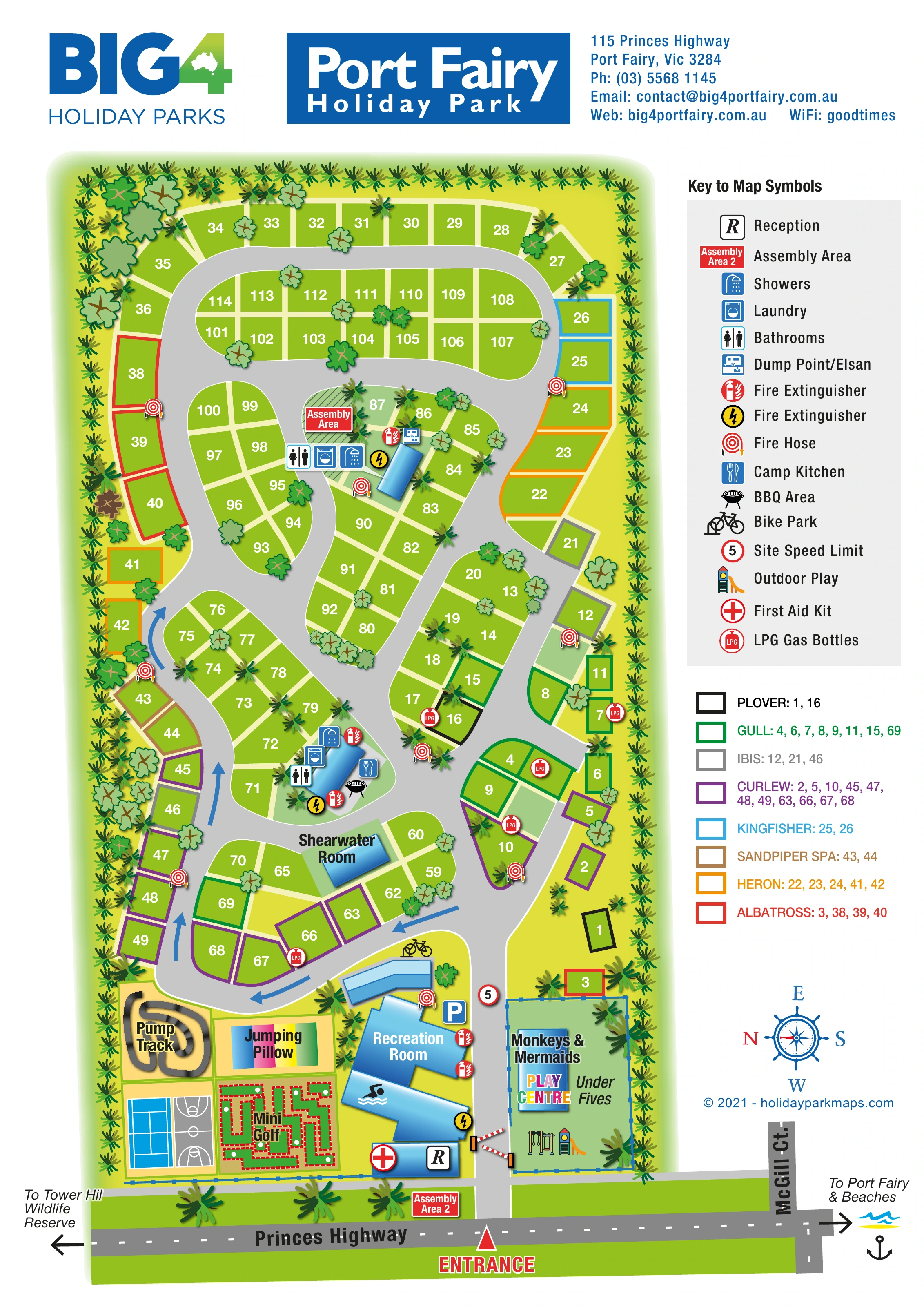
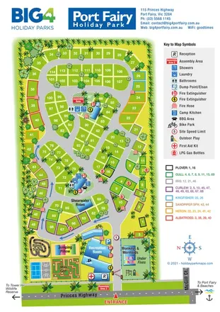
This illustrated map of BIG4 Port Fairy Holiday Park brings a busy family holiday site into one clear portrait-format plan. Set on Princes Highway in Port Fairy, Victoria, the park is shown as tree-lined accommodation areas connected by broad looping roads, with a substantial recreation zone beside the entrance. Directions along the highway point towards Port Fairy and its beaches, and towards Tower Hill Wildlife Reserve.
The artwork gives particular attention to the park’s varied leisure spaces. A pump track, jumping pillow, mini golf and sports courts are drawn individually, while the Recreation Room and Monkeys & Mermaids Play Centre receive prominent building labels. Further into the park, numbered pitches surround two amenity clusters and the separately named Shearwater Room.
Eight bird-named accommodation ranges are distinguished by coloured plot outlines, supported by a dedicated key. Together with the service-symbol legend, this creates a map that helps guests locate both their accommodation and the facilities they are likely to use during their stay.
The plan places Princes Highway across the bottom of the page, with a clearly labelled entrance leading between the main recreation complex and the children’s play-centre enclosure. Reception is marked at the front of the blue building group, alongside a first-aid symbol. A parking marker and bicycle-parking symbol sit nearby. The compass indicates that north lies towards the left, allowing the elongated park to fit the portrait page without losing its roadside context.
The lower leisure area contains some of the artwork’s most individual illustrations. The pump track is a compact dark loop, the jumping pillow uses bright vertical stripes, and the mini-golf course is drawn with red-bordered lanes. Adjacent courts carry tennis and basketball markings. A swimmer pictogram identifies the pool element beside the Recreation Room, while outdoor play equipment appears within the area labelled Monkeys & Mermaids and Under Fives.
Beyond this frontage, broad grey roads branch into rounded loops around numbered green pitches. Colour-bordered plots identify the Plover, Gull, Ibis, Curlew, Kingfisher, Sandpiper Spa, Heron and Albatross accommodation ranges. Trees punctuate the pitch groups and form a dense illustrated boundary. Two internal amenity clusters show bathrooms, showers and laundries; the lower cluster also carries camp-kitchen and barbecue symbols, while the upper cluster includes a dump-point marker and a nearby assembly area.
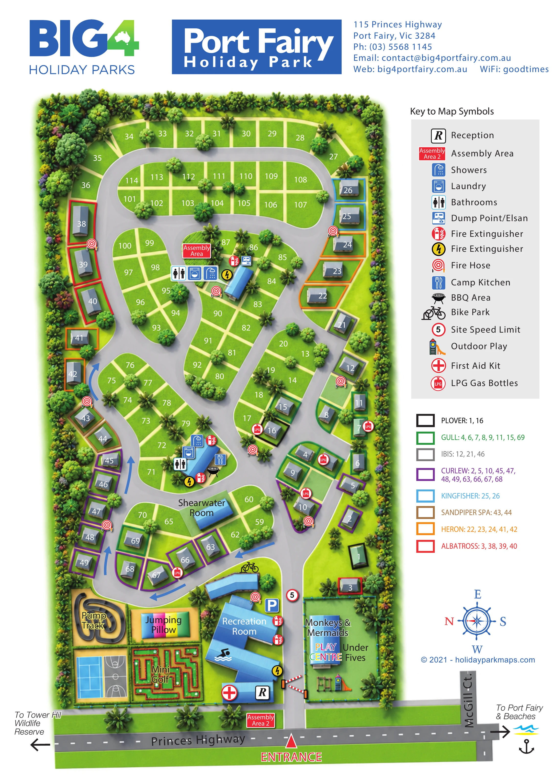
The right-hand column separates the facility-symbol legend from the accommodation colour key. Repeated fire-equipment and LPG symbols provide further reference points across the plan. Highway arrows, the McGill Ct. label and a second assembly-area marker complete the frontage. The enlarged legend view presents detail from this same artwork, rather than a separate map variant.
 Enlarge this map ↗
KEEP EXPLORING
Chosen for shared landscapes, accommodation or facilities.
 Explore the map ↗
United Kingdom
A colour-zoned coastal park map with touring areas, woodland trails, ponds and a leisure club.
 Explore the map ↗
United Kingdom
Colour-coded accommodation, central leisure facilities and coastal paths on an illustrated headland park map.
 Explore the map ↗
United States
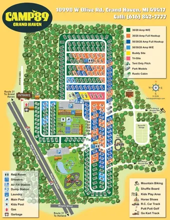
Colour-coded RV pitches, woodland borders and two activity hubs at Camp '89 Grand Haven.
Features may come from the sample artwork, its key or published park information. Approximate numbers describe the drawing and may cover only part of a park. They are intended to help you compare map examples. Current facilities and booking information should be checked with the park.
TAKE A CLOSER LOOK
View the illustrated map in detail or choose a file to download. These are sample maps; contact the park for current visitor information.


LET’S MAP YOUR PARK
For a map quotation, find your park and draw a rough boundary around it. The area you select helps us work out the design time and price.
Draw your park for a quote ↗Or talk to our map designers
01751 473136
 hpmaustraliab_large.png