
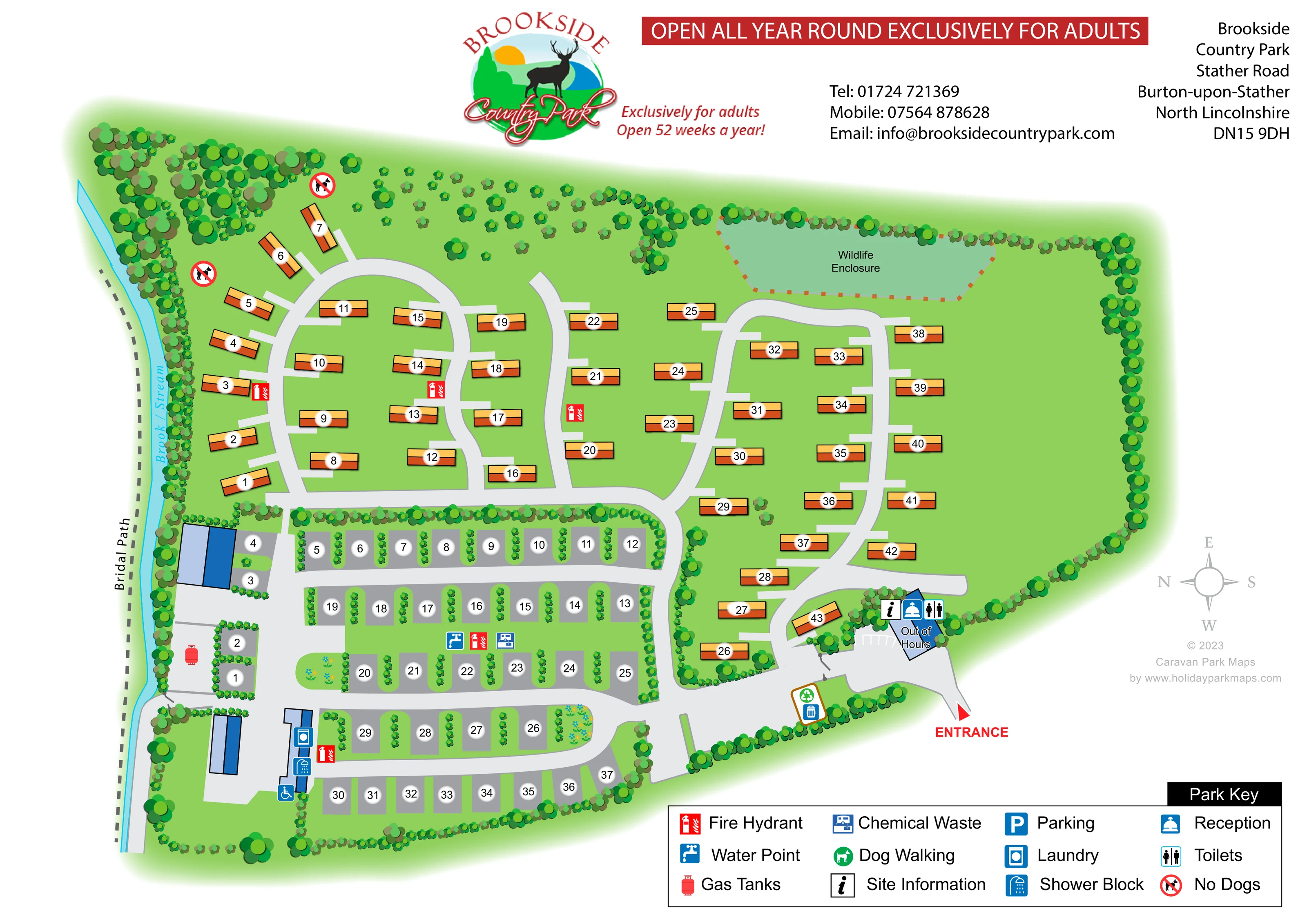
Wildlife enclosure
A labelled muted-green enclosure with an orange dashed boundary sits along the upper edge of the park.
ILLUSTRATED PARK MAP · P041
Stather Road, Burton-upon-Stather, Scunthorpe, North Lincolnshire · United Kingdom
 Enlarge the map ↗
A SENSE OF THE PLACE
Brookside Country Park offers adults-only touring and holiday home ownership at Burton-upon-Stather in North Lincolnshire. The River Trent and Lincolnshire Edge woodland provide the surrounding landscape.
Seasonal touring pitches are available, and a dedicated Pooch Park offers space for dogs. The map shows the arrangement of the touring and privately owned holiday home areas within the grounds.
LOOK CLOSER
A labelled muted-green enclosure with an orange dashed boundary sits along the upper edge of the park.
A narrow cyan watercourse follows the western boundary beside a belt of trees.
Dense trees occupy the upper-left corner, while tree belts frame the perimeter and hedges separate many touring pitches.
A reception symbol marks the blue-roofed building beside the entrance.
An information symbol appears alongside reception at the arrival point.
The entrance-side building carries an 'Out of Hours' label.
A toilet symbol is shown at the entrance-side reception building.
A shower symbol identifies the elongated service building beside the lower touring rows.
A reception symbol marks the blue-roofed building beside the entrance.
An information symbol appears alongside reception at the arrival point.
The entrance-side building carries an 'Out of Hours' label.
A toilet symbol is shown at the entrance-side reception building.
A shower symbol identifies the elongated service building beside the lower touring rows.
The laundry symbol appears on the same lower touring-area service building as the shower symbol.
A wheelchair symbol is placed at the lower end of the touring-area service building; the key does not define its precise meaning.
Blue tap symbols mark water points within the touring area and beside its service building.
A chemical-waste symbol is shown beside the central touring pitches, near a water point.
Repeated red symbols identify fire-hydrant locations across the holiday-home and touring areas.
A red gas-tank symbol appears on the western side of the touring area.
Bin and recycling symbols occupy a small outlined area just inside the entrance.
Parking is included in the Park Key, but no matching parking symbol is clearly positioned on the plan.
A dog-walking symbol appears in the key without a clearly identifiable matching location on the plan.
Two red prohibition symbols appear around the wooded upper-left area; they do not establish a park-wide pet policy.
A labelled muted-green enclosure with an orange dashed boundary sits along the upper edge of the park.
A narrow cyan watercourse follows the western boundary beside a belt of trees.
A dashed route follows the outside of the western watercourse and is labelled 'Bridal Path' on the artwork.
Dense trees occupy the upper-left corner, while tree belts frame the perimeter and hedges separate many touring pitches.
A red arrow and ENTRANCE label identify arrival at the lower-right edge.
Pale-grey curving roads link reception, the branching holiday-home area and the more regular touring rows.
READING THE MAP
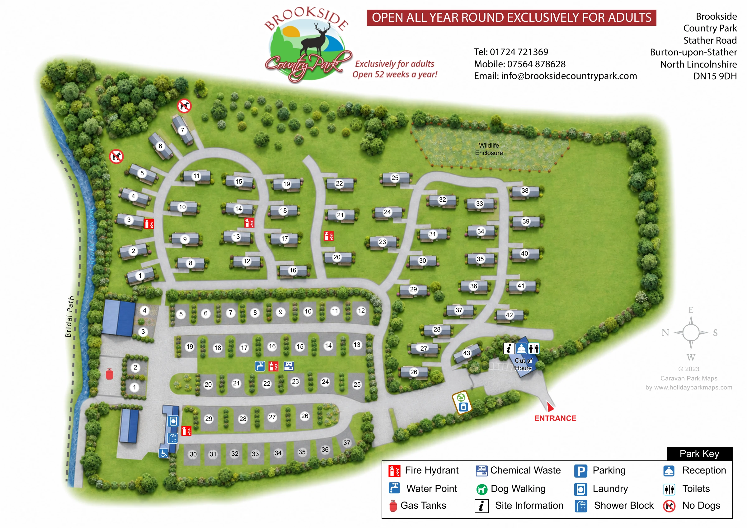
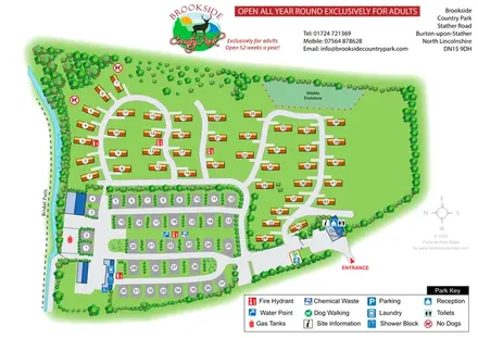
This illustrated map of Brookside Country Park brings together two different accommodation layouts within a green, tree-lined setting at Burton-upon-Stather in North Lincolnshire. Orange holiday-home symbols follow gently curving roads across the upper and right-hand parts of the plan, while grey touring pitches form more regular rows in the lower-left area. The contrast makes the two sections easy to recognise without introducing separate inset maps.
Landscape features give the drawing its character. A narrow brook follows the western boundary beside a dashed path, dense trees fill the upper-left corner, and a labelled wildlife enclosure sits along the upper edge. Hedges divide many touring pitches and help explain the site's internal structure.
Visitors arrive at the lower-right entrance, where reception and information symbols establish a clear starting point. Numbered accommodation, service pictograms and a boxed Park Key then support navigation around the grounds. The park's deer logo, red adults-only banner and contact block complete a single-page design that combines practical orientation with a recognisable country-park identity.
The artwork is a single landscape-format plan, drawn from above with simplified buildings and planting. Its principal organising feature is the division between holiday homes on green plots and touring pitches on grey pads. The holiday-home roads curve through the upper half and down the right side, with short pale spurs leading towards individual units. The touring section uses straighter lanes and closely spaced rows, interrupted by hedges, small planted areas and blue-roofed service buildings.
The entrance is marked by a red arrow at the lower right. Immediately inside, the reception building carries information, reception and toilet symbols, together with an 'Out of Hours' label. A separate outlined waste and recycling point sits nearby. Further into the touring area, the map places water and chemical-waste symbols beside the pitches. Laundry and shower symbols mark a service building near the lower boundary, where a wheelchair symbol is also shown. Red fire-hydrant symbols are distributed through both accommodation areas, and a gas-tank symbol appears towards the western side.
Along the left edge, the cyan brook is bordered by trees, with a dashed path beyond it. The upper-left woodland is denser than the planting elsewhere and includes two No Dogs markers. A muted-green wildlife enclosure, labelled directly on the plan, has a dashed orange boundary along the upper edge.
White circular number badges remain prominent against both accommodation colours. The twelve-entry Park Key sits below the right-hand side of the site; it also lists parking and dog walking, although their matching locations are not clearly marked. A compass shows north pointing left. Above the plan, the park logo, red opening banner, address and contact details provide the page's branded header.
 Enlarge this map ↗
KEEP EXPLORING
Chosen for shared landscapes, accommodation or facilities.
 Explore the map ↗
United Kingdom
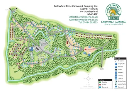
Woodland park plan with Roman-named sections, colour-coded pitches and clearly marked arrival facilities.
 Explore the map ↗
United Kingdom
A woodland estate park map combining caravan loops, touring pitches, riverside paths and Bruce’s Cave landmarks.
 Explore the map ↗
United Kingdom
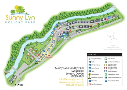
A river-led site plan with colour-coded pitches, central facilities and local walking directions.
Features may come from the sample artwork, its key or published park information. Approximate numbers describe the drawing and may cover only part of a park. They are intended to help you compare map examples. Current facilities and booking information should be checked with the park.
TAKE A CLOSER LOOK
View the illustrated map in detail or choose a file to download. These are sample maps; contact the park for current visitor information.


LET’S MAP YOUR PARK
For a map quotation, find your park and draw a rough boundary around it. The area you select helps us work out the design time and price.
Draw your park for a quote ↗Or talk to our map designers
01751 473136