
Riverside setting
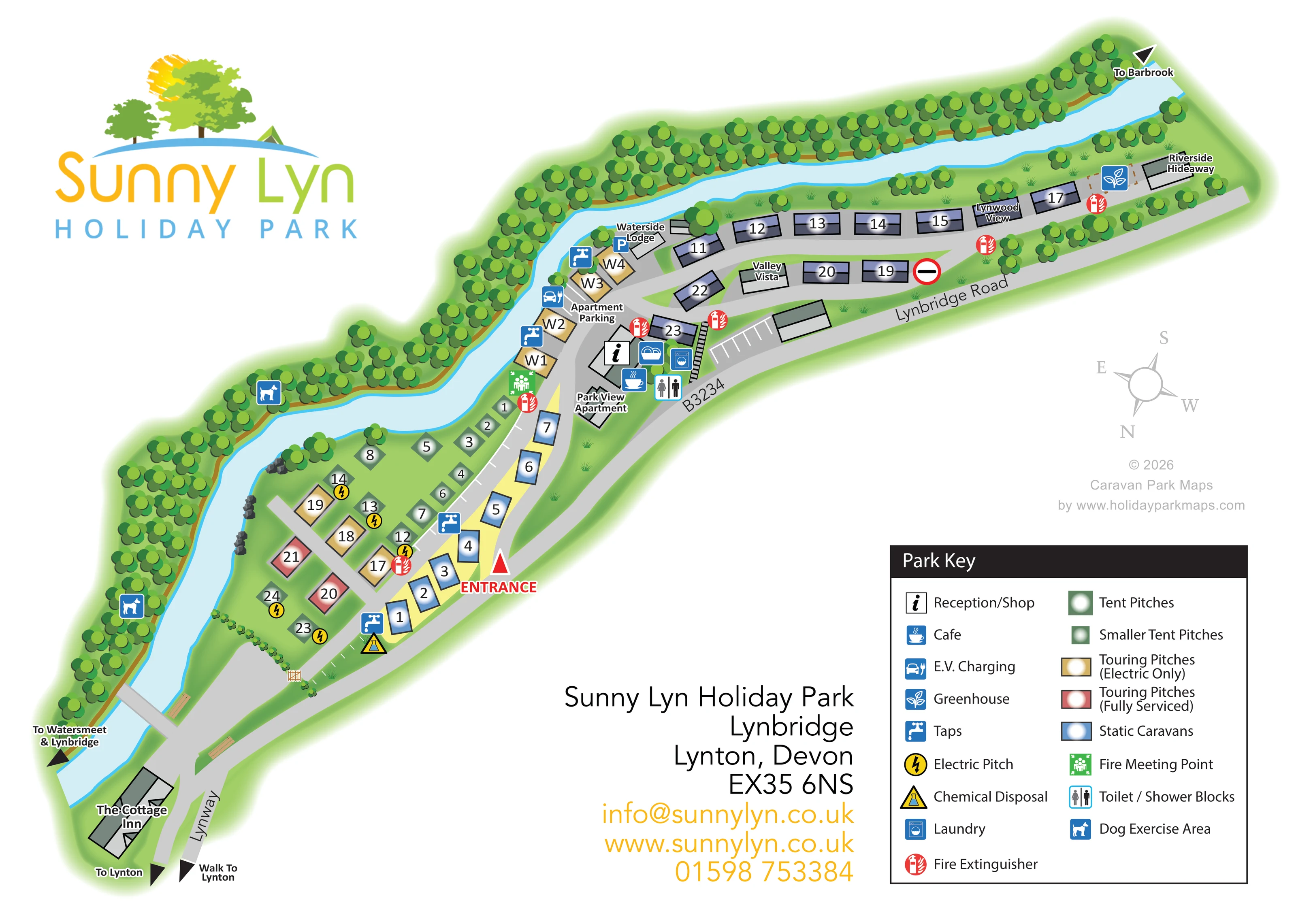
A broad, pale-blue river curves through the full composition and separates the accommodation from a wooded bank.
ILLUSTRATED PARK MAP · P317
Sunny Lyn Holiday Park, Lynbridge, Lynton, Devon · United Kingdom
 Enlarge the map ↗
A SENSE OF THE PLACE
Sunny Lyn is set beside the West Lyn River in a wooded Exmoor valley near Lynton and Lynmouth. Lodges, apartments, holiday caravans, touring and camping offer different ways to enjoy the location.
The park welcomes dogs and provides a shop, breakfast cafe and heated showers. Its riverside layout is a distinctive feature, with the map helping visitors locate accommodation and facilities within the valley.
LOOK CLOSER
A broad, pale-blue river curves through the full composition and separates the accommodation from a wooded bank.
Dense overlapping tree symbols follow the outside riverbank, with smaller groups around the accommodation.
An information symbol marks reception/shop within the central building cluster.
A blue cup symbol locates the café beside the reception and service buildings.
The toilet/shower symbol is placed at the central facilities cluster.
A washing-machine symbol identifies laundry facilities in the central cluster.
An EV charging symbol appears beside the riverside touring pitches near the apartment parking area.
Repeated blue tap symbols mark water points in the lower pitch area and around the central riverside pitches.
An information symbol marks reception/shop within the central building cluster.
A blue cup symbol locates the café beside the reception and service buildings.
The toilet/shower symbol is placed at the central facilities cluster.
A washing-machine symbol identifies laundry facilities in the central cluster.
An EV charging symbol appears beside the riverside touring pitches near the apartment parking area.
Repeated blue tap symbols mark water points in the lower pitch area and around the central riverside pitches.
Yellow lightning symbols distinguish selected electric pitches among the green camping markers.
A yellow triangular disposal symbol appears near the lower end of the numbered static-caravan row.
Red extinguisher symbols are distributed along the accommodation routes. A green fire meeting-point symbol appears beside the river near the central approach.
Two dog symbols identify stretches of the wooded bank across the river from the accommodation.
A blue plant symbol marks a greenhouse near Riverside Hideaway at the far end of the upper accommodation ribbon.
Apartment Parking is labelled near Waterside Lodge, with a blue parking symbol nearby and white parking bays drawn beside the central buildings.
A broad, pale-blue river curves through the full composition and separates the accommodation from a wooded bank.
Dense overlapping tree symbols follow the outside riverbank, with smaller groups around the accommodation.
A red arrow and ENTRANCE label highlight the approach beside the lower static-caravan row.
The plan labels the road running alongside the park as Lynbridge Road and B3234, with Lynway at the lower end.
A bridge crosses the river near the lower end of the plan, linking towards the narrow route drawn along the opposite wooded bank.
Black arrows identify routes towards Barbrook, Watersmeet and Lynbridge, Lynton, and a separately labelled walk to Lynton.
The Cottage Inn is shown as a local landmark near the lower river crossing, rather than identified as a park-operated facility.
Published park information identifies the setting as a wooded Exmoor valley beside the West Lyn River.
READING THE MAP
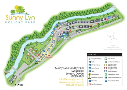
Sunny Lyn Holiday Park’s map follows the shape of its riverside setting at Lynbridge, near Lynton in Devon. A pale-blue river winds diagonally across the artwork, with wooded banks on one side and accommodation, pitches and access roads arranged along the other. This gives the plan a distinctive outline and makes the valley landscape part of the visitor’s orientation.
The map brings together static caravans, tent pitches, touring pitches and individually named accommodation. Colour coding separates electric-only touring pitches from fully serviced pitches, while two green marker sizes distinguish the camping options. Reception, the café, laundry and toilet/shower facilities form a clear central cluster, supported by symbols for water points, EV charging and other practical facilities.
A large Sunny Lyn logo, generous white space and a substantial Park Key give the page a clear hierarchy. Directions towards Lynton, Barbrook, Watersmeet and Lynbridge extend the map beyond the park boundary, making this a useful example of an illustrated site plan that combines arrival information, accommodation finding and local landscape context.
The plan is arranged as a long diagonal strip, widening at the lower end into a mixed camping and touring area. The river curves around this broader section before running beside the upper accommodation rows. Dense groups of green tree canopies trace the opposite bank, while smaller trees and grass details soften the spaces between buildings and roads.
At the lower end, numbered tent pitches sit alongside gold electric-only touring markers and red fully serviced touring markers. Selected camping pitches carry yellow electrical symbols. A short row of blue static-caravan markers follows the entrance-side lane. The entrance itself is picked out with a bold red arrow and label, and nearby symbols identify a water point and chemical disposal.
The central building cluster brings reception/shop, café, laundry and toilet/shower facilities together. Apartment parking, EV charging and additional taps appear around the adjoining riverside pitches. Park View Apartment and Waterside Lodge are named here, while Valley Vista, Lynwood View and Riverside Hideaway provide further landmarks along the upper section. Grey-roofed caravans line the internal route, and a greenhouse symbol appears near its far end.
Beyond the accommodation, the map includes a lower river crossing, The Cottage Inn, a wooded-bank route and dog exercise symbols. Lynway, Lynbridge Road and the B3234 are labelled, with arrows towards surrounding destinations and a separate walking direction to Lynton. A compass aids orientation without imposing a north-up layout.
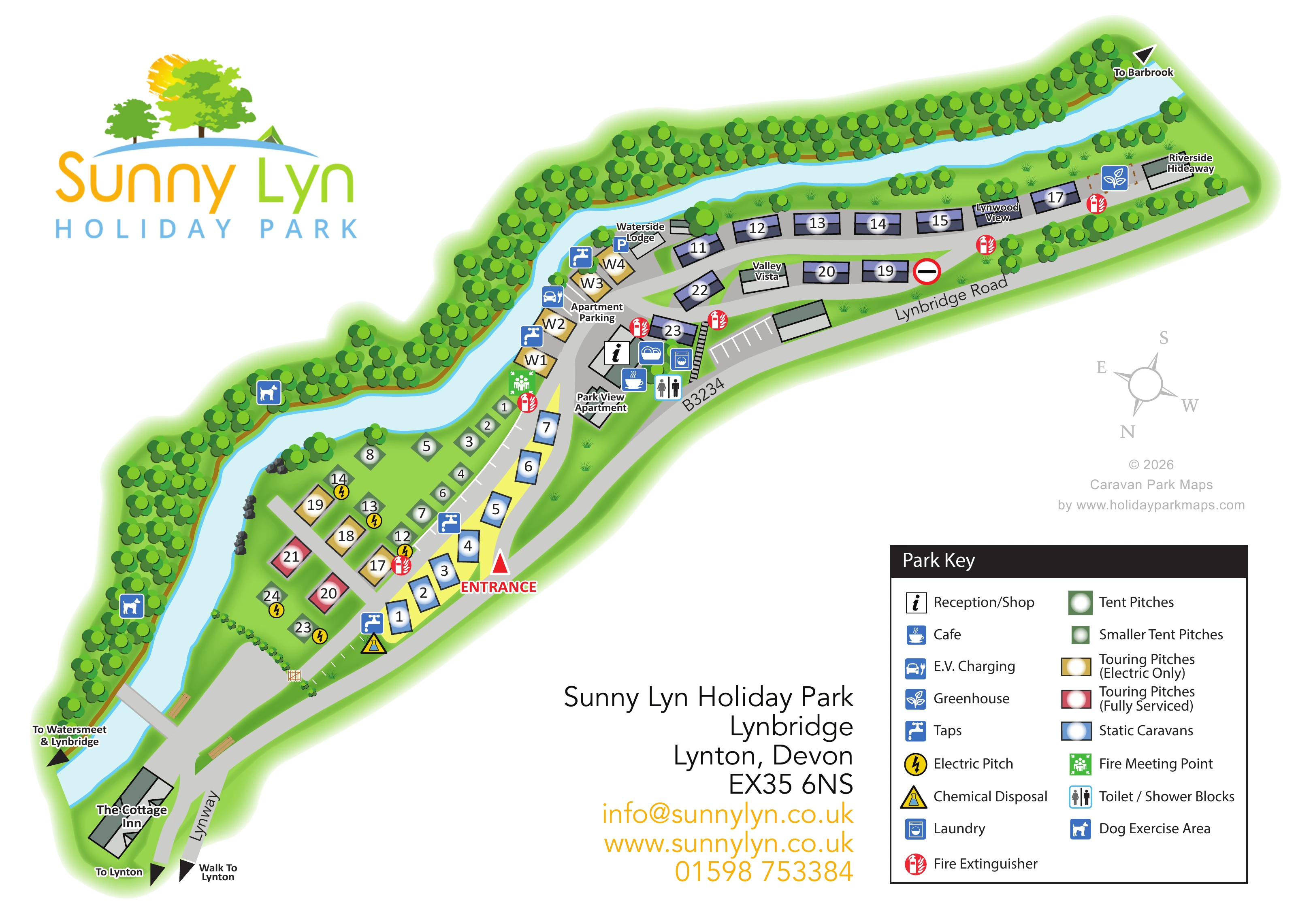
The single-page composition is completed by a large logo, contact block and two-column key. The enlarged detail view shows that same key more closely; it is not a separate map or additional accommodation area.
KEEP EXPLORING
Chosen for shared landscapes, accommodation or facilities.
 Explore the map ↗
United Kingdom
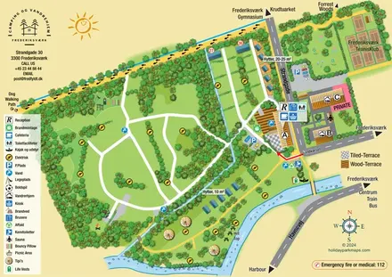
A woodland estate park map combining caravan loops, touring pitches, riverside paths and Bruce’s Cave landmarks.
 Explore the map ↗
Denmark
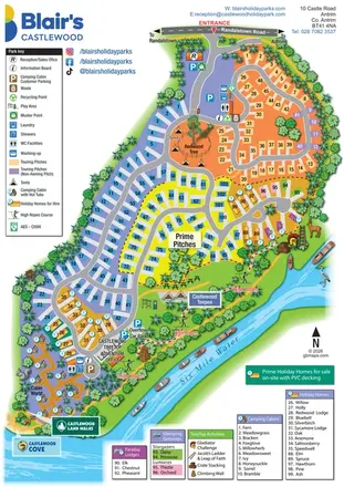
Illustrated canal-side campsite and hostel map with cabins, tipis, walking routes and town connections.
 Explore the map ↗
United Kingdom
A colourful riverside park map combining touring pitches, holiday accommodation and treetop adventures.
Features may come from the sample artwork, its key or published park information. Approximate numbers describe the drawing and may cover only part of a park. They are intended to help you compare map examples. Current facilities and booking information should be checked with the park.
TAKE A CLOSER LOOK
View the illustrated map in detail or choose a file to download. These are sample maps; contact the park for current visitor information.


LET’S MAP YOUR PARK
For a map quotation, find your park and draw a rough boundary around it. The area you select helps us work out the design time and price.
Draw your park for a quote ↗Or talk to our map designers
01751 473136
 sunnylyn_large.png