
Tree-lined boundaries and internal planting
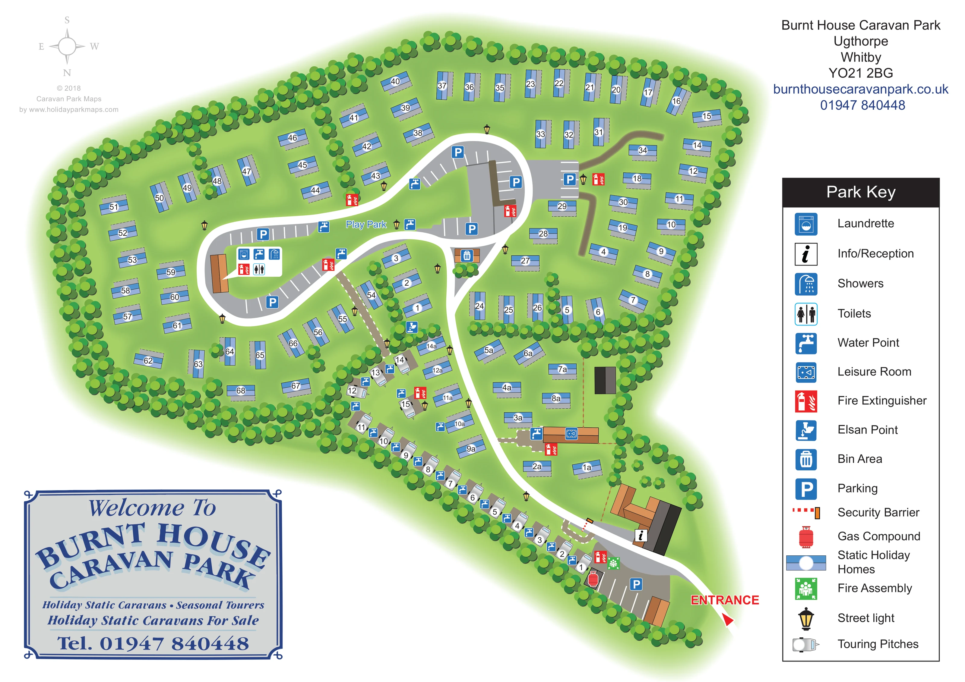
Dense bands of stylised trees enclose the irregular site and divide several accommodation groups.
ILLUSTRATED PARK MAP · P425
Burnt House Caravan Park, Ugthorpe, Whitby · United Kingdom
 Enlarge the map ↗
A SENSE OF THE PLACE
Burnt House Caravan Park at Ugthorpe offers holiday home ownership and a small seasonal touring area near the North York Moors. The family-run park also provides access to the Yorkshire coast.
Seasonal pitches include hardstanding for an awning and parking. A central children's play area serves families, and nearby moorland walks are part of the park's appeal. Dogs are welcomed under the park's lead rules.
LOOK CLOSER
Dense bands of stylised trees enclose the irregular site and divide several accommodation groups.
Green ground surrounds the units, with a larger open central space labelled Play Park.
A labelled grassy space between the central road loops; no detailed play equipment is illustrated.
An information symbol marks the large brown-and-charcoal building beside the entrance road.
Shown in the service cluster beside the left-hand central road loop.
Shower and toilet symbols share the central service cluster with the laundrette.
Repeated blue tap symbols appear around the central roads and along the touring section.
A pool-table-style pictogram identifies the long orange-brown building in the smaller entrance-side accommodation area.
A labelled grassy space between the central road loops; no detailed play equipment is illustrated.
An information symbol marks the large brown-and-charcoal building beside the entrance road.
Shown in the service cluster beside the left-hand central road loop.
Shower and toilet symbols share the central service cluster with the laundrette.
Repeated blue tap symbols appear around the central roads and along the touring section.
A pool-table-style pictogram identifies the long orange-brown building in the smaller entrance-side accommodation area.
A blue disposal-point symbol is positioned near the upper end of the touring row.
A bin symbol marks a small brown building at the central road junction.
Grey areas with white bay markings and blue P symbols are distributed around the central loops and near the entrance.
A red dashed barrier line and orange marker cross the access road beside reception.
A red gas-cylinder symbol appears in a small dark enclosure beside the entrance parking area.
Red extinguisher symbols are repeated near service buildings, parking and accommodation sections.
A green assembly symbol is shown beside the entrance-side touring pitches and parking.
Small black-and-yellow lantern symbols follow the main roads and central accommodation areas.
Dense bands of stylised trees enclose the irregular site and divide several accommodation groups.
Green ground surrounds the units, with a larger open central space labelled Play Park.
A bold red ENTRANCE label and arrow identify arrival at the lower-right tip of the site.
A broad curving access road leads into two adjoining loops with parking bays around their edges.
Short brown tracks and pale dashed route markings supplement the main road network; their exact functions are not labelled.
READING THE MAP
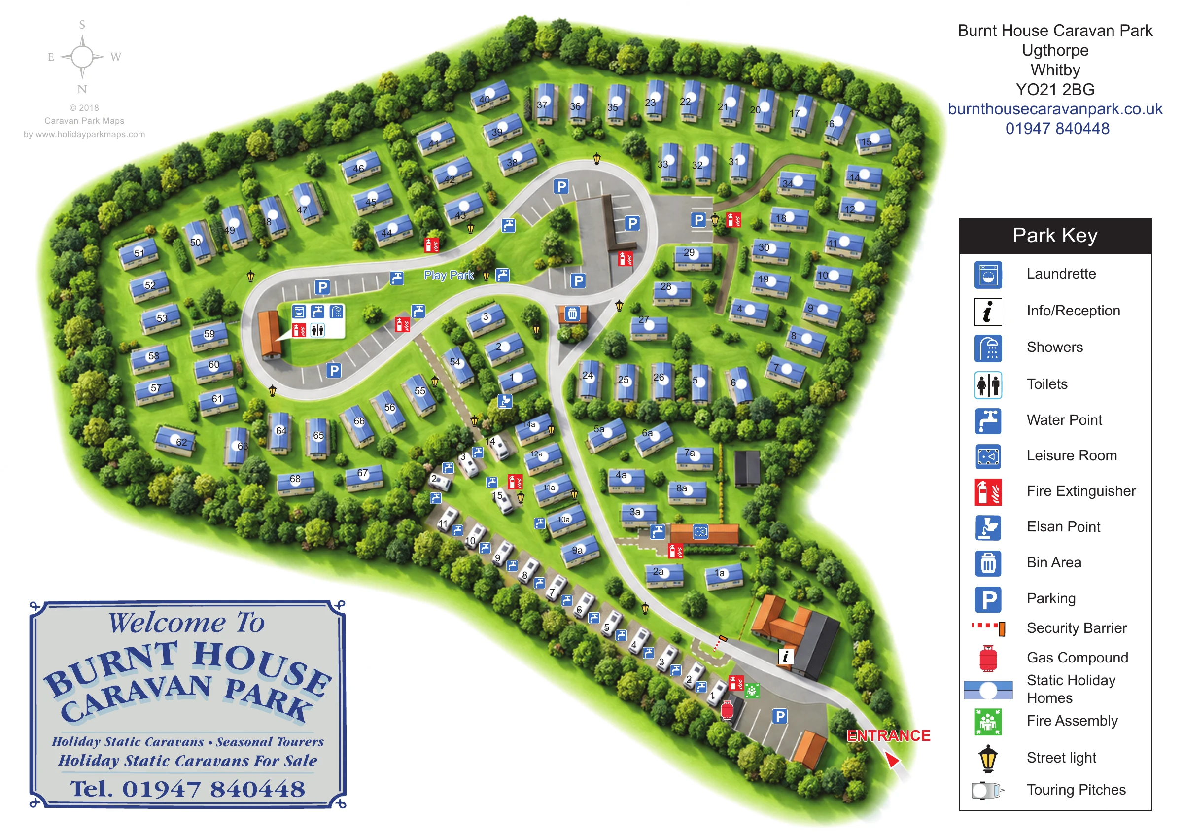
This illustrated map of Burnt House Caravan Park in Ugthorpe, near Whitby, brings together a tree-lined holiday-home site and a smaller seasonal touring area. Its distinctive shape is easy to recognise: a broad main accommodation area narrows into an entrance approach, with reception, parking and touring pitches arranged along that approach.
Blue static-home symbols stand out against soft green grass, while white caravan illustrations distinguish the touring row. Within the main park, two curving road loops frame parking areas and a labelled Play Park. Service symbols identify the laundrette, showers, toilets, water points and other practical destinations without crowding the accommodation layout.
The composition also gives the park a clear visual identity. A traditional blue welcome panel anchors the lower-left corner, while the title, contact details and tall Park Key occupy the right-hand side. Dense illustrated trees define the site boundary and separate groups of homes. For a rural caravan park near the North York Moors and Yorkshire coast, the design balances a green setting with the everyday information visitors need to find their way around.
The plan begins at the lower-right entrance, marked by a red arrow and bold label. A grey road passes an entrance parking area, a gas-compound symbol and a green fire-assembly marker before reaching the reception building and security barrier. From here, the road curves through the narrower part of the site towards two adjoining loops in the main accommodation area. White bay markings make the parking spaces particularly clear around these loops.
Static holiday homes are shown as blue rectangular units with white number badges. They form loose rows around the tree-lined perimeter and smaller groups within the park, including a separate section beside the approach road. White touring-caravan symbols follow the opposite boundary of this narrower section, accompanied by repeated water-point icons. The distinction between these two accommodation types is reinforced in the key.
The central Play Park is named directly on the grass between the roads. Beside the left-hand loop, a compact symbol cluster identifies the laundrette, showers and toilets. A leisure-room pictogram marks a long brown-roofed building nearer the entrance, while an Elsan point, bin area, fire extinguishers and street lights provide further practical landmarks.
Rounded, layered tree canopies enclose the site and screen internal groups. Brown secondary routes and pale dashed markings add detail without competing with the main roads. The page also includes a compass with north towards the bottom, a large ornamental welcome sign and a right-hand legend. The accompanying detail view enlarges part of this same plan and key; it is not a separate site section or additional accommodation area.
 Enlarge this map ↗
KEEP EXPLORING
Chosen for shared landscapes, accommodation or facilities.
 Explore the map ↗
United Kingdom
Woodland-framed Barnsoul map with mixed accommodation, shared facilities and paw-marked walking routes.
 Explore the map ↗
United Kingdom
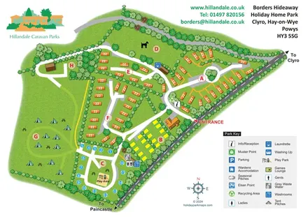
Illustrated Borders Hideaway map with leafy accommodation zones, camping field and a play-area loop.
 Explore the map ↗
United Kingdom
A wooded, streamside park map with a linked farm, café, touring and cottage area.
Features may come from the sample artwork, its key or published park information. Approximate numbers describe the drawing and may cover only part of a park. They are intended to help you compare map examples. Current facilities and booking information should be checked with the park.
TAKE A CLOSER LOOK
View the illustrated map in detail or choose a file to download. These are sample maps; contact the park for current visitor information.


LET’S MAP YOUR PARK
For a map quotation, find your park and draw a rough boundary around it. The area you select helps us work out the design time and price.
Draw your park for a quote ↗Or talk to our map designers
01751 473136