
Woodland and tree belts
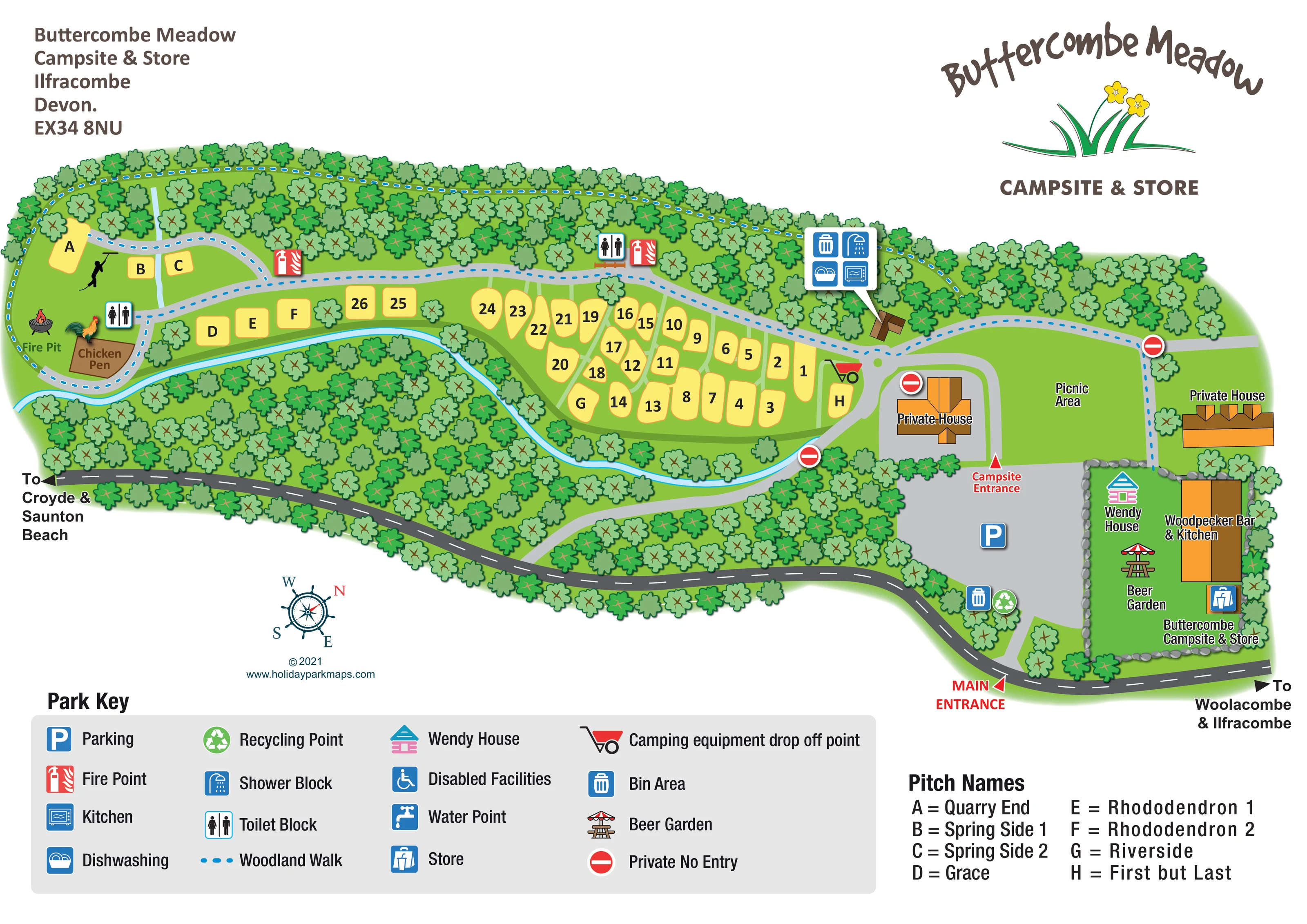
Dense illustrated trees enclose the camping meadow and separate it from the roadside and entrance grounds.
ILLUSTRATED PARK MAP · P428
Ilfracombe, Devon · United Kingdom
 Enlarge the map ↗
A SENSE OF THE PLACE
Buttercombe Meadow is a family-run campsite beside the River Caen near Ilfracombe in North Devon. Woodland and meadows give the site a natural riverside setting.
The matched camping listing describes hot showers, toilets, a communal firepit and a nearby bar and kitchen. The map shows how the camping areas and shared facilities are arranged within the grounds.
LOOK CLOSER
Dense illustrated trees enclose the camping meadow and separate it from the roadside and entrance grounds.
A narrow blue watercourse follows the southern edge of the camping pitches before curving towards the entrance side. It is not named on the artwork.
A blue dotted route follows the northern woodland boundary, loops around the western camping area and connects towards the eastern grounds.
Separate red arrow labels distinguish the roadside main entrance from the campsite entrance beside the parking area.
A large grey parking area sits inside the main entrance, between the camping grounds and the bar, store and beer garden.
A wheelbarrow symbol marks an equipment drop-off point near the eastern end of the pitch area.
Toilet symbols appear at the western camping area and along the northern side of the central meadow.
A grouped callout identifies showers, kitchen, dishwashing and a bin area at a small building on the north-eastern side of the camping grounds.
Dense illustrated trees enclose the camping meadow and separate it from the roadside and entrance grounds.
A narrow blue watercourse follows the southern edge of the camping pitches before curving towards the entrance side. It is not named on the artwork.
A blue dotted route follows the northern woodland boundary, loops around the western camping area and connects towards the eastern grounds.
Separate red arrow labels distinguish the roadside main entrance from the campsite entrance beside the parking area.
A large grey parking area sits inside the main entrance, between the camping grounds and the bar, store and beer garden.
A wheelbarrow symbol marks an equipment drop-off point near the eastern end of the pitch area.
Toilet symbols appear at the western camping area and along the northern side of the central meadow.
A grouped callout identifies showers, kitchen, dishwashing and a bin area at a small building on the north-eastern side of the camping grounds.
Red fire-point symbols are positioned beside the woodland route at the western and central camping areas.
Bins are indicated at the shared-service building and near the entrance parking area; recycling is marked beside the latter.
A labelled fire-pit illustration occupies the far western end beside the chicken pen.
A brown enclosure with chicken illustrations is labelled near the western toilet point.
A broad green space east of the pitches is labelled as the picnic area.
An orange-roofed building stands in the eastern entrance-side cluster beside the beer garden and store.
A labelled parasol-and-table symbol identifies the beer garden within the stone-edged eastern enclosure.
A blue shopping-bag symbol marks the store beside the bar and kitchen building.
A brightly coloured playhouse symbol is labelled within the beer-garden enclosure.
Two private houses are labelled, with red no-entry symbols distinguishing private access from visitor routes.
Road-end arrows point towards Woolacombe and Ilfracombe to the right, and Croyde and Saunton Beach to the left.
A wheelchair symbol is included in the key, but no corresponding location is clearly identifiable on the plan.
A water-point symbol appears in the key without a clearly identifiable mapped position.
READING THE MAP
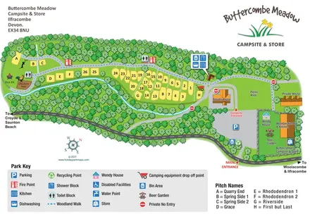
This illustrated map of Buttercombe Meadow Campsite & Store presents a small, woodland-framed campsite near Ilfracombe in North Devon. A narrow river curves beside the camping meadow, while dense belts of trees give the plan its distinctive elongated shape. Rather than drawing tents on every plot, the design uses clear yellow pitch shapes with bold numbers and letters, keeping the accommodation easy to find against the green landscape.
The map brings together two different visitor experiences: the quieter camping grounds to the west and the entrance-side gathering places to the east. Parking, the store, Woodpecker Bar & Kitchen, beer garden and Wendy house form a recognisable arrival cluster. Further into the campsite, toilets, shared washing and kitchen facilities, a fire pit and a chicken pen provide useful landmarks.
A blue dotted woodland walk, prominent entrance arrows and a separate list of named pitches add practical detail without overwhelming the illustration. The result is a characterful example of campsite mapping that combines everyday wayfinding with a strong sense of place.
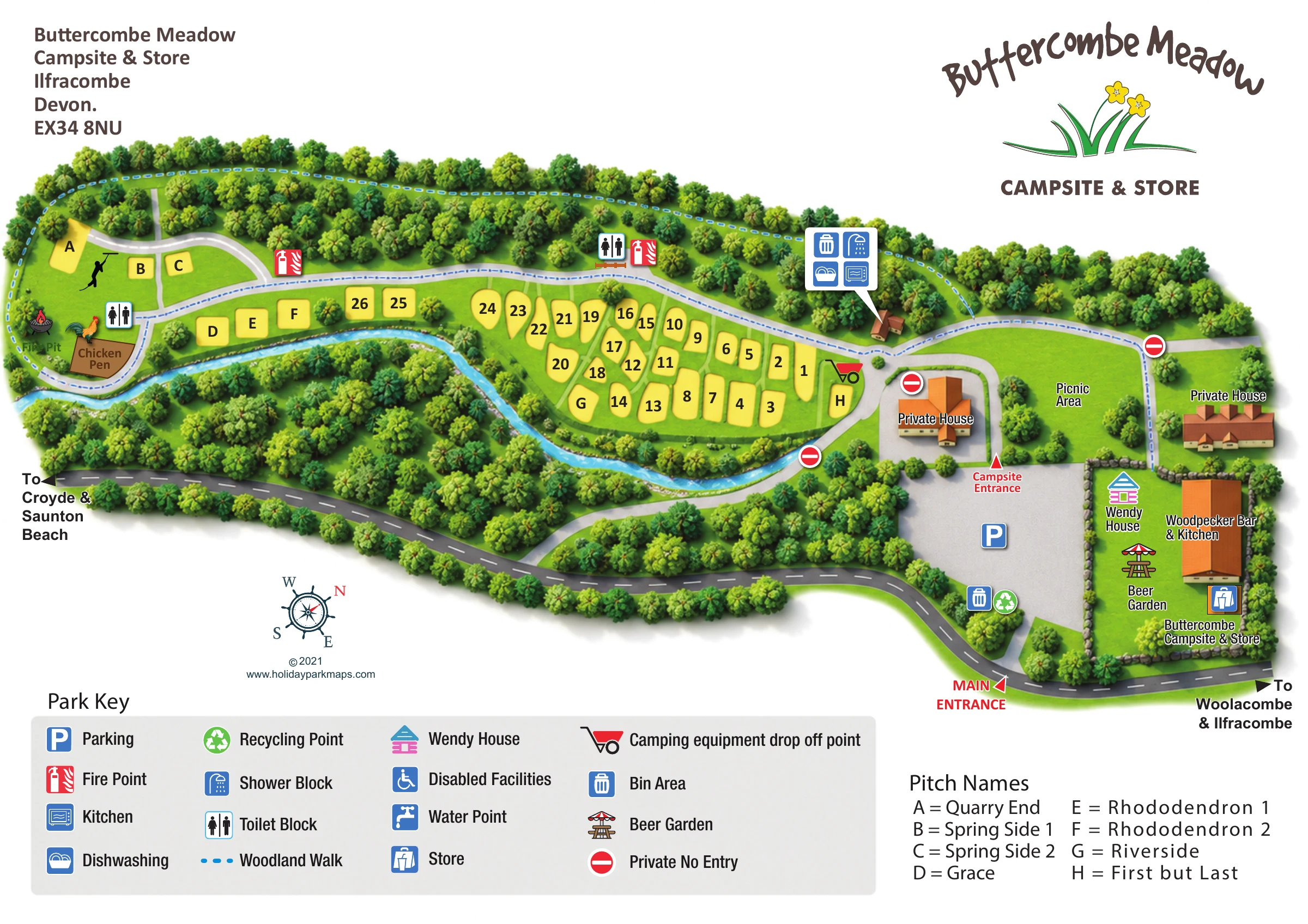
The single landscape plan arranges Buttercombe Meadow as a long green strip between woodland and a curving roadside. Camping pitches fill the western and central grounds, with the river tracing their southern edge. The yellow plots vary in shape and sit in loose rows or small clusters, divided by green strips and scattered trees. Lettered pitches have a dedicated name panel, including Quarry End, Spring Side, Rhododendron and Riverside, alongside the numbered camping area.
Arrival is shown in two stages. A red main-entrance arrow points from the roadside into a broad grey parking area, while a second arrow identifies the campsite entrance beyond it. An equipment drop-off symbol sits near the eastern pitches. Nearby private houses and red no-entry markers help distinguish visitor space from private access.
The eastern grounds contain a labelled picnic area and a stone-edged enclosure for the beer garden, Wendy house, store and Woodpecker Bar & Kitchen. Across the campsite, toilet and fire-point symbols provide local reference points. A small building near the north-eastern woodland edge has a grouped callout for showers, kitchen, dishwashing and bins. At the opposite end, a fire pit and chicken pen create especially memorable landmarks.
The blue dotted woodland walk follows the upper tree belt and loops around the western area. Road arrows give directions towards Woolacombe, Ilfracombe, Croyde and Saunton Beach. A large lower-page key explains the pictograms, with the pitch-name list beside it. The accompanying detail views enlarge these same information panels rather than showing separate map variants.
 Enlarge this map ↗
KEEP EXPLORING
Chosen for shared landscapes, accommodation or facilities.
 Explore the map ↗
United Kingdom
Illustrated coastal campsite plan with named fields, electric pitch colours, beach routes and the Afon Hen.
 Explore the map ↗
United Kingdom
Woodland camping, lodges, lakes and colour-coded bike trails at Avon Tyrrell Outdoor Centre.
 Explore the map ↗
United Kingdom
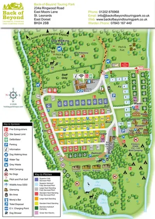
Colour-coded touring pitches, named glamping units and woodland routes at Back of Beyond Touring Park.
Features may come from the sample artwork, its key or published park information. Approximate numbers describe the drawing and may cover only part of a park. They are intended to help you compare map examples. Current facilities and booking information should be checked with the park.
TAKE A CLOSER LOOK
View the illustrated map in detail or choose a file to download. These are sample maps; contact the park for current visitor information.


LET’S MAP YOUR PARK
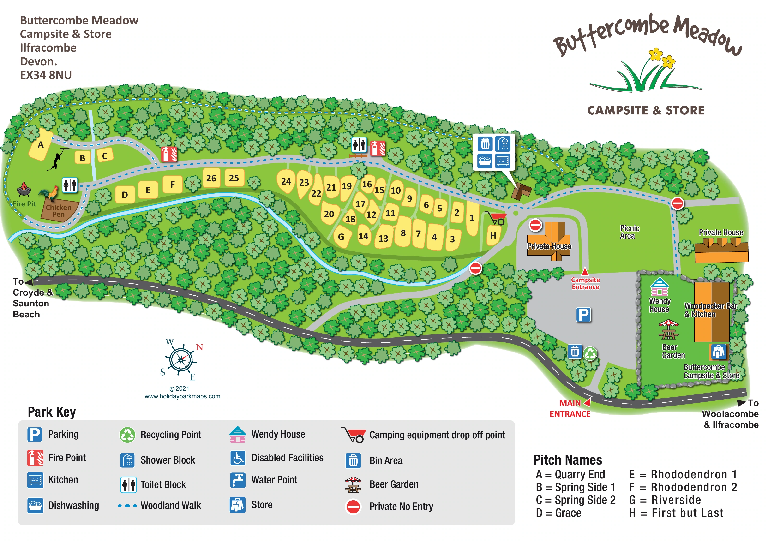
For a map quotation, find your park and draw a rough boundary around it. The area you select helps us work out the design time and price.
Draw your park for a quote ↗Or talk to our map designers
01751 473136
 buttercombemeadow_large.png