
Afon Twrch
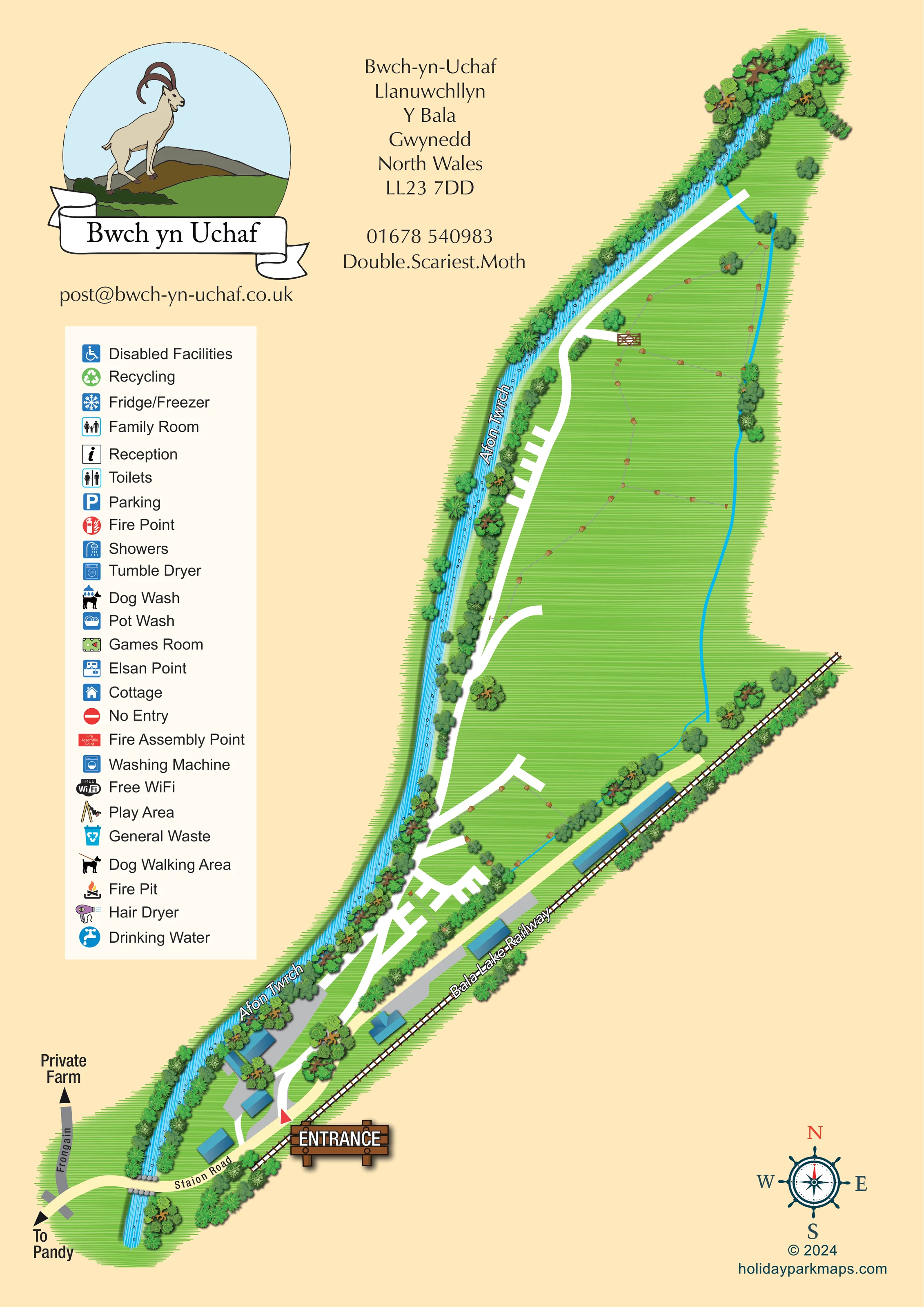
Named blue river running along the western side of the site, illustrated with water streaks, stones and dense bankside vegetation.
ILLUSTRATED PARK MAP · P053
Bwch-yn-Uchaf, Llanuwchllyn, Y Bala, Gwynedd, North Wales · United Kingdom
 Enlarge the map ↗
A SENSE OF THE PLACE
Bwch yn Uchaf provides camping, touring and bed-and-breakfast accommodation at Llanuwchllyn near Bala. Part of the camping area is a Camping and Caravanning Club certificated site beside the Bala Lake Railway.
Electric pitches and hardstanding options support touring stays, with a toilet block serving the camping areas. The location places visitors within the landscapes of Eryri and close to Bala's lake and railway attractions.
LOOK CLOSER
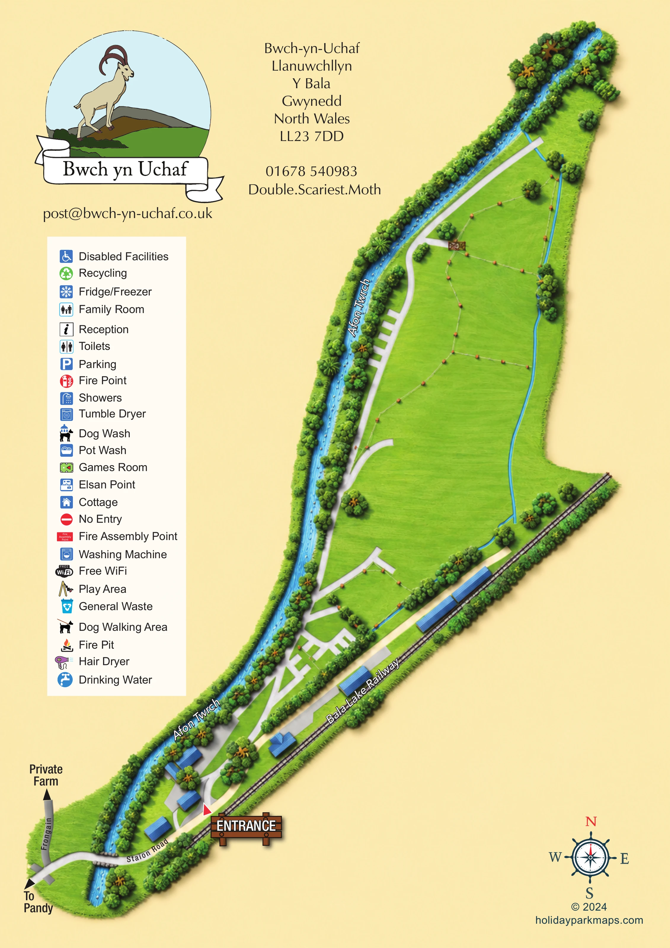
Named blue river running along the western side of the site, illustrated with water streaks, stones and dense bankside vegetation.
Long green areas occupy the centre and north of the site. Fine grey fence lines, brown posts and a wooden gate distinguish some internal divisions.
Layered trees and shrubs frame the river and railway edges. A narrower unlabelled blue watercourse runs down the eastern side and branches near the railway.
Labelled railway follows the south-eastern boundary, with sleepers, rails and several adjacent blue-roofed buildings.
A large timber-style entrance sign and red triangular marker identify the southern arrival point.
Station Road crosses the river at the foot of the plan. An arrow points towards Pandy, while a separate grey lane is labelled Frongain and Private Farm.
A white spine follows the riverside and branches into short spurs and a denser network near the southern buildings.
Blue-roofed buildings sit beside grey surfaced areas near the entrance and along the railway. Their individual functions are not labelled on the plan.
Named blue river running along the western side of the site, illustrated with water streaks, stones and dense bankside vegetation.
Labelled railway follows the south-eastern boundary, with sleepers, rails and several adjacent blue-roofed buildings.
A large timber-style entrance sign and red triangular marker identify the southern arrival point.
Station Road crosses the river at the foot of the plan. An arrow points towards Pandy, while a separate grey lane is labelled Frongain and Private Farm.
A white spine follows the riverside and branches into short spurs and a denser network near the southern buildings.
Long green areas occupy the centre and north of the site. Fine grey fence lines, brown posts and a wooden gate distinguish some internal divisions.
Layered trees and shrubs frame the river and railway edges. A narrower unlabelled blue watercourse runs down the eastern side and branches near the railway.
Blue-roofed buildings sit beside grey surfaced areas near the entrance and along the railway. Their individual functions are not labelled on the plan.
Reception and parking appear in the legend, without clearly corresponding symbols placed on the site plan.
The key includes toilets, showers, disabled facilities, a family room and a hair dryer; it does not establish their positions.
Washing machine, tumble dryer, fridge/freezer and pot wash are listed in the key.
Drinking water, Elsan point, recycling and general waste symbols are provided in the legend.
Games room, play area, fire pit and free Wi-Fi appear as legend entries, not located amenities.
Dog wash and dog walking area are represented in the legend without a marked location.
A cottage symbol appears in the legend; no building is explicitly assigned that symbol.
Fire point, fire assembly point and no entry symbols are included in the key but are not visibly positioned on the plan.
READING THE MAP
This illustrated map of Bwch yn Uchaf presents a distinctive camping and touring setting at Llanuwchllyn near Bala in North Wales. Rather than organising the artwork around rows of holiday homes, the design follows the shape of the grounds: a long sweep of green space beside Afon Twrch, with the Bala Lake Railway forming another prominent boundary.
Arrival is introduced at the foot of the page, where Station Road crosses the river and a timber-style entrance sign marks the turn into the site. White internal routes then lead through the southern building cluster and onwards into the open grass areas. Trees, hedges, fence lines and a small gate give structure to the landscape without filling it with pitch numbers.
The portrait page pairs this site illustration with a large goat-and-mountain logo, address details and a tall facility key. Blue roofs, bright water and layered green vegetation create clear visual distinctions between buildings, routes and natural features. It is a useful sample for rural campsites whose geography and arrival sequence matter more than an individually numbered accommodation plan.
The plan stretches diagonally across a cream portrait page, from Station Road at the lower left to the wooded northern end at the upper right. Afon Twrch follows the western edge throughout, illustrated as a bright blue ribbon with streaked water and small stones. Dense trees and shrubs separate much of the river from the internal access route. Along the lower eastern edge, the Bala Lake Railway is drawn with rails and sleepers, accompanied by several elongated blue-roofed buildings.
At the southern end, Station Road crosses the river and passes the entrance. A separate grey lane points towards a private farm, while another arrow indicates the direction of Pandy. Inside the site, white routes curve between blue-roofed buildings and grey surfaced areas before branching into the grass grounds. The lower area has a relatively intricate set of spurs; further north, the main route becomes simpler and follows the river. Fence lines with brown posts divide some areas, and a wooden gate marks one branch. A thinner blue watercourse runs along the opposite side of the northern grounds.
The left-hand key covers reception, parking, washrooms, family and disabled facilities, laundry, fridge/freezer, pot wash, drinking water, waste disposal and recycling. It also includes games, play, dog facilities, a fire pit, cottage, Wi-Fi and safety symbols. These entries are shown in the key rather than as clearly located markers within the plan.
The artwork is a single site map, with no inset or separate walking-map variant. Its large logo, contact block, decorative compass and timber entrance sign give the page a distinctive campsite identity while leaving the elongated landscape easy to follow.
 Enlarge this map ↗
KEEP EXPLORING
Chosen for shared landscapes, accommodation or facilities.
 Explore the map ↗
United Kingdom
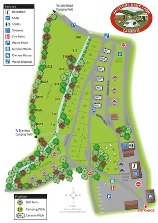
A stream-side farm campsite plan with car-free camping, caravan pitches and separate bell-tent areas.
 Explore the map ↗
United Kingdom
Woodland park map with mixed pitches, bell tents, lodges and a fishing lake.
 Explore the map ↗
United Kingdom
Woodland holiday homes, named camping fields and farm buildings on a colour-coded Nether Wasdale park map.
Features may come from the sample artwork, its key or published park information. Approximate numbers describe the drawing and may cover only part of a park. They are intended to help you compare map examples. Current facilities and booking information should be checked with the park.
LET’S MAP YOUR PARK
For a map quotation, find your park and draw a rough boundary around it. The area you select helps us work out the design time and price.
Draw your park for a quote ↗Or talk to our map designers
01751 473136