
River boundary
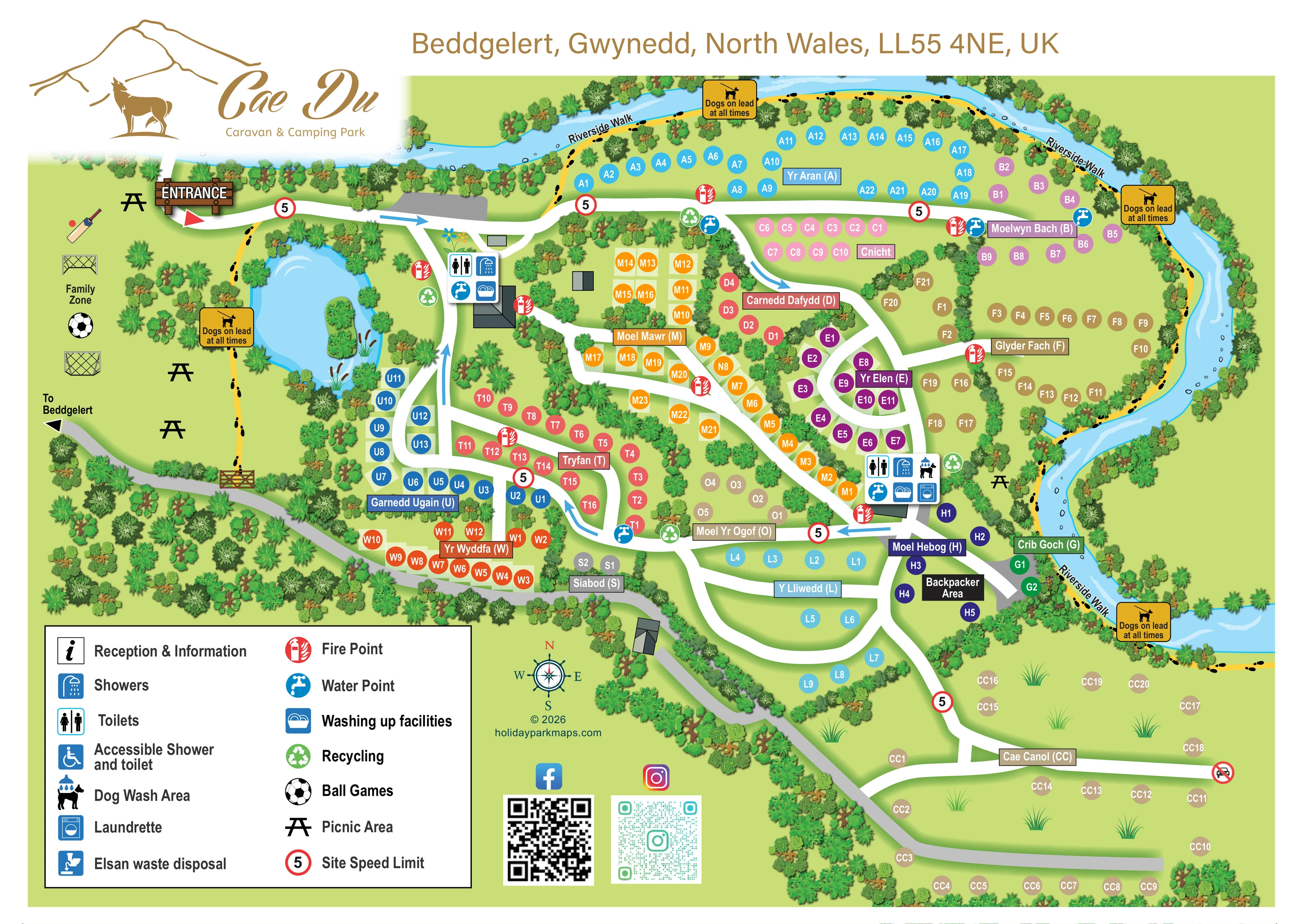
A broad illustrated river follows the northern and eastern edges, with ripples, small stones and densely planted banks.
ILLUSTRATED PARK MAP · P054
Beddgelert, Gwynedd, North Wales · United Kingdom
 Enlarge the map ↗
A SENSE OF THE PLACE
Cae Du Caravan and Camping Park is set in the Eryri landscape near Beddgelert. Grass, hard-ground and hardstanding pitches offer a choice of camping arrangements, including electric and water-service options.
A riverside walk and picnic areas help guests enjoy the valley setting. Heated toilets, showers, laundry and dishwashing facilities support stays, while a communal room and sheltered cooking area provide cover in wet weather.
LOOK CLOSER
A broad illustrated river follows the northern and eastern edges, with ripples, small stones and densely planted banks.
A rounded pond near the entrance is illustrated with a small planted island, reeds and surrounding trees.
Dense tree and shrub belts define the perimeter, separate pitch groups and frame the pond and routes.
A yellow route with black footprint marks follows the river around the top and right of the plan.
A prominent timber-style ENTRANCE sign and red triangular marker identify arrival at the upper-left corner.
Broad white roads branch and loop between pitch sections, with blue directional arrows on selected stretches.
A grey route along the western and southern side is labelled with a left-pointing arrow towards Beddgelert.
The open western recreation area is labelled Family Zone and illustrated with football goals, a football and cricket equipment.
A broad illustrated river follows the northern and eastern edges, with ripples, small stones and densely planted banks.
A yellow route with black footprint marks follows the river around the top and right of the plan.
A rounded pond near the entrance is illustrated with a small planted island, reeds and surrounding trees.
Dense tree and shrub belts define the perimeter, separate pitch groups and frame the pond and routes.
A prominent timber-style ENTRANCE sign and red triangular marker identify arrival at the upper-left corner.
Broad white roads branch and loop between pitch sections, with blue directional arrows on selected stretches.
A grey route along the western and southern side is labelled with a left-pointing arrow towards Beddgelert.
The open western recreation area is labelled Family Zone and illustrated with football goals, a football and cricket equipment.
Picnic-table symbols appear in the Family Zone and beside the eastern riverside.
Two building-side icon panels identify toilets and showers: one near the pond and another towards the centre-right.
Dishwashing symbols appear in both main facility panels.
A washing-machine symbol identifies laundry facilities at the centre-right amenity building.
A dog-under-shower symbol is included in the centre-right amenity panel.
Blue tap symbols are distributed beside roads and pitch sections, as well as within the amenity panels.
Green recycling symbols identify several collection points near facilities and road junctions.
Repeated red fire-point symbols are placed throughout the pitch areas and beside amenity buildings.
Listed in the key, but a corresponding location is not clearly identifiable on the plan.
An accessible shower and toilet symbol is explained in the key; its position is not clearly marked in the visible facility panels.
Named and illustrated in the legend without a clearly identifiable mapped position.
The artwork includes repeated red-ringed 5 speed-limit symbols, yellow dogs-on-lead notices and a crossed-out car symbol at the eastern end of the Cae Canol road.
Published park information describes a communal room and sheltered cooking area; neither is separately labelled on this map.
READING THE MAP
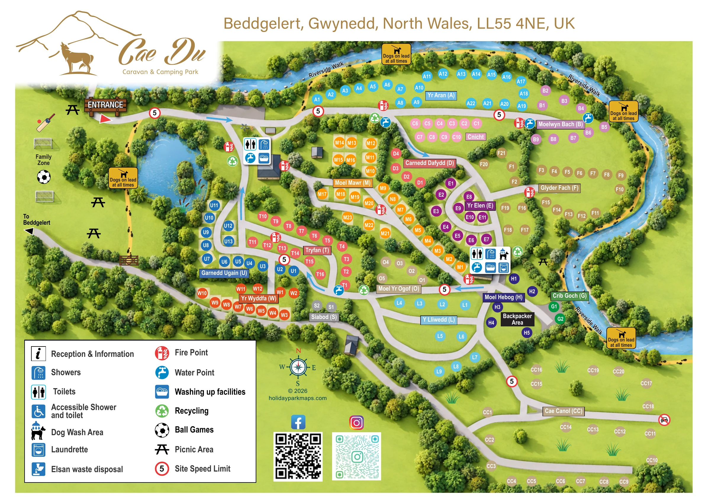
This illustrated map of Cae Du Caravan & Camping Park places its riverside setting at the centre of the visitor experience. Located near Beddgelert in Gwynedd, North Wales, the park is presented as a series of colourful pitch sections enclosed by trees, with a river sweeping around the northern and eastern boundaries. A yellow, footprint-marked Riverside Walk follows the water, while a pond and an open Family Zone give the entrance side of the plan a distinct character.
Rather than drawing individual caravans or tents, the design uses coloured pitch markers and Welsh mountain names to organise the accommodation areas. Broad white roads connect the sections, and grouped service icons identify the main amenity buildings. A labelled backpacker area and the more open Cae Canol field add useful distinctions within the wider layout.
The sample demonstrates how a touring and camping park can communicate a substantial pitch network without losing its landscape identity. Its mountain-and-dog branding, recreation illustrations and large symbol key combine practical arrival information with a recognisable sense of place.
The plan begins at a timber-style entrance sign in the upper-left corner. From here, a broad white road runs towards the central pitch areas, with blue arrows marking selected directions through the network. The western side is deliberately more open: a Family Zone contains ball-game illustrations and picnic-table symbols, while a tree-fringed pond separates this recreation space from the main accommodation sections. A grey route on the outer edge points towards Beddgelert.
Across the centre, coloured circular markers identify individual pitches within mountain-named groups. Names such as Yr Aran, Tryfan, Yr Wyddfa and Glyder Fach appear in rectangular labels matched to their section colours. Some pitches have pale rectangular bases, but the key does not define these as particular accommodation or surface types. Interconnected road loops and planted divisions create a series of smaller, recognisable neighbourhoods rather than one undifferentiated field.
Two enlarged amenity panels sit beside simple roof-shaped buildings. Both show toilets, showers, water and washing-up facilities; the centre-right panel also identifies a dog wash and laundrette. Separate fire-point, water and recycling symbols recur around the roads. Picnic symbols appear beside the river as well as in the Family Zone.
The yellow Riverside Walk traces the top and right-hand boundaries, accompanied by footprint marks and illustrated notices. Near the southern river bend, the map labels a backpacker area. Below this, Cae Canol is shown as a more spacious field with scattered pitch markers and grass tufts. A two-column legend, compass and social-media QR codes complete the single-page composition.
 Enlarge this map ↗
KEEP EXPLORING
Chosen for shared landscapes, accommodation or facilities.
 Explore the map ↗
United Kingdom
Woodland camping, lodges, lakes and colour-coded bike trails at Avon Tyrrell Outdoor Centre.
 Explore the map ↗
United Kingdom
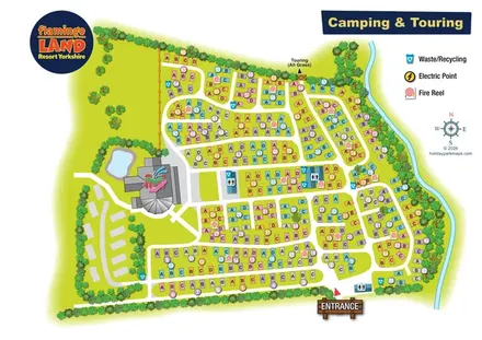
Colour-coded camping and touring plan with lettered pitches, numbered groups and illustrated landscape boundaries.
 Explore the map ↗
United Kingdom
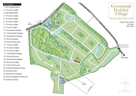
Numbered lodge and cottage areas, golf, ponds and shared facilities on a landscaped Goosnargh site plan.
Features may come from the sample artwork, its key or published park information. Approximate numbers describe the drawing and may cover only part of a park. They are intended to help you compare map examples. Current facilities and booking information should be checked with the park.
LET’S MAP YOUR PARK
For a map quotation, find your park and draw a rough boundary around it. The area you select helps us work out the design time and price.
Draw your park for a quote ↗Or talk to our map designers
01751 473136